The best waterfall hikes and walks around Setesdal Vesthei - Ryfylkeheiane landskapsvernområde
4.3
(1331)
5,755
hikers
8
hikes
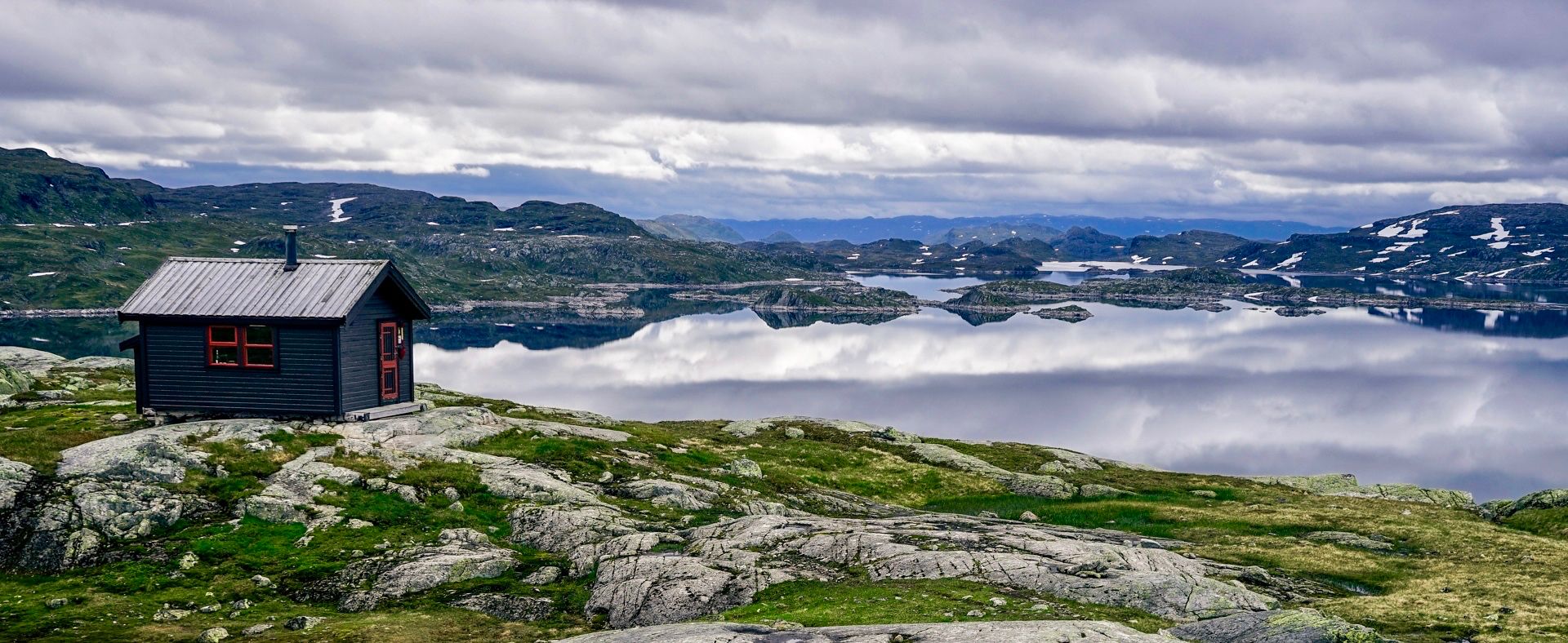
Waterfall hiking trails around Setesdal Vesthei - Ryfylkeheiane landskapsvernområde traverse a diverse landscape, ranging from undulating highlands with birch forests and numerous small lakes to rugged terrain with rocky outcrops and glaciated bedrock. This extensive protected area features dramatic western sections that plunge into narrow gorges and fjords, alongside higher altitudes with smooth, glaciated rock formations and moraine ridges. The region's geology is primarily granite, contributing to vast heather moorlands and a landscape shaped by ancient ice and meltwater.
Best…
Last updated: October 26, 2026
5.0
(6)
34
hikers
5.49km
01:40
170m
170m
Easy hike. Easily walkable paths.
4
hikers
17.9km
05:15
590m
310m
Hard hike. Very good fitness required. Easily walkable paths.

5.0
(1)
7
hikers
4.88km
01:23
100m
100m
Easy hike. Easily walkable paths.
3.3
(21)
66
hikers
Moderate hike. Good fitness required. Easily walkable paths.
4.7
(7)
23
hikers
Easy hike. Easily walkable paths.
Get access to more routes and recommendations from other explorers.
Already have an account?
Our route recommendations are based on thousands of hikes, rides, and runs completed by other people on komoot.
Start today with a free account
Your next adventure awaits.
Popular around Setesdal Vesthei - Ryfylkeheiane landskapsvernområde
Other adventures around Setesdal Vesthei - Ryfylkeheiane landskapsvernområde

Tips from the Community

Two identical bridges one after the other over the river Otra. In the middle is a small mini-island.
0
0

Gaukhei is a historic self‑service mountain cabin run by DNT Sør located deep in the Setesdal Vesthei wilderness at about 843 m above sea level, and it is considered the oldest tourist hut in the region, with origins dating back to 1898 and 46 sleeping places.
1
0

Otra Bridge is a cool wooden swing bridge that crosses the River Otra. It's pretty skinny, so single file only and watch out for other users, but it's a fun crossing with great views on both sides.
0
0


Very beautiful path along the river. You pass several rapids and have a great view of the mountains of Setesdal.
0
0
Old pedestrian suspension bridge, on the other side from the road there is a small pine forest.
0
0

A path leads to the river bank with a view of the rapids.
1
0

East side gets more traffic than west side, but not excessively either. Further south the other way around
0
0
Frequently Asked Questions
How many waterfall hiking trails are available in Setesdal Vesthei - Ryfylkeheiane landskapsvernområde?
There are currently 6 dedicated waterfall hiking trails listed in Setesdal Vesthei - Ryfylkeheiane landskapsvernområde. These routes offer a variety of experiences, from easy strolls to more challenging treks through the region's diverse landscape.
Are there easy waterfall hikes suitable for families or beginners?
Yes, the region offers several easy waterfall hikes perfect for families or those new to hiking. For instance, the Goplestigjilå – Røyduskaret loop from Ljosland is an easy 4.9 km path winding through birch forests and past small tarns. Another accessible option is the Brunin – Kvitefossliæ loop from Bortelid, which is 5.4 km long and offers varied highland terrain views.
What kind of scenery can I expect on waterfall hikes in this area?
Waterfall hikes in Setesdal Vesthei - Ryfylkeheiane landskapsvernområde showcase the region's unique geology, characterized by glaciated bedrock, vast heather moorlands, and birch forests. You'll encounter numerous small lakes, dramatic river valleys, and in the western parts, landscapes that plunge into narrow gorges and fjords. The trails often lead through areas shaped by ancient ice and meltwater, offering a truly wild and diverse experience.
Are there any moderate or challenging waterfall trails for experienced hikers?
Yes, for those seeking a more moderate challenge, the Hagafoss Rapids – View of the Otra River loop from Flateland Camping is a great option. This 8.7 km trail leads through river valleys and past impressive rapids, typically taking around 2 hours and 14 minutes to complete. While most listed waterfall trails are easy, the broader region also offers more difficult routes for experienced hikers.
What do other hikers say about the waterfall trails in Setesdal Vesthei - Ryfylkeheiane landskapsvernområde?
The waterfall trails in Setesdal Vesthei - Ryfylkeheiane landskapsvernområde are highly rated by the komoot community, with an average score of 4.5 stars from over 1000 reviews. Hikers often praise the varied terrain, the pristine wilderness experience, and the well-maintained paths that lead to stunning natural features.
Are there any circular waterfall walks available?
Yes, many of the waterfall trails in the region are designed as circular routes, allowing you to start and end at the same point. Examples include the Brunin – Kvitefossliæ loop from Bortelid and the Goplestigjilå – Røyduskaret loop from Ljosland, both offering convenient round trips to enjoy the waterfalls and surrounding nature.
What other natural attractions can I explore near the waterfall trails?
Beyond the waterfalls, the region is rich in natural monuments and beautiful lakes. You can explore highlights such as the Stavbrokka Pass or enjoy views from the Rest Area Near Støylskardnuten. The area is also dotted with numerous lakes, including the Island Chain in Setesdal Vesthei Ryfylkeheiane Landscape Protection Area, offering serene spots to relax or extend your adventure.
What is the best time of year to hike to waterfalls in this region?
The best time for waterfall hikes is typically during late spring and early summer (May to July) when snowmelt contributes to powerful water flows, making the waterfalls particularly impressive. The weather is also generally milder and more stable during these months, though snowfields can persist on higher peaks well into summer.
Are there any cultural landmarks or points of interest along the waterfall routes?
While the primary focus is on natural beauty, some routes may pass by cultural elements. For example, the Traditional Cabin – Hylestad Suspension Bridge loop from Valle kyrkje offers a glimpse into traditional structures and crosses the historic Hylestad Suspension Bridge, connecting you with the region's heritage.
What should I wear or bring for a waterfall hike in Setesdal Vesthei - Ryfylkeheiane landskapsvernområde?
Given the varied terrain and potential for changing weather, it's advisable to wear sturdy, waterproof hiking boots and dress in layers. Bring rain gear, even on sunny days, as mountain weather can be unpredictable. A backpack with water, snacks, a map, and a compass or GPS device is also recommended, especially for longer routes.
Is public transport available to access the starting points of waterfall trails?
Access to trailheads in Setesdal Vesthei - Ryfylkeheiane landskapsvernområde often requires private transport due to its remote nature as Norway's second-largest protected area. While some larger villages might have limited bus services, reaching specific trail starting points like those for the Brunin – Kvitefossliæ loop from Bortelid or Goplestigjilå – Røyduskaret loop from Ljosland typically involves driving.
Are there places to eat or get refreshments near the waterfall hiking areas?
While many waterfall trails are in pristine wilderness, some routes may pass near small villages or camping sites where refreshments can be found. For example, the Hylestad Suspension Bridge – Nordibø Landhandel Café loop from Valle kyrkje specifically mentions a café, indicating that some amenities are available in certain areas. It's always a good idea to check local services before you go, especially in more remote sections.
Most popular routes around Setesdal Vesthei - Ryfylkeheiane landskapsvernområde
Most popular attractions around Setesdal Vesthei - Ryfylkeheiane landskapsvernområde

Get inspired with the komoot mobile app


Explore more
Browse the best Hikes in other regions.
