The best walks and hikes around Storvatnet
4.5
(33)
175
hikers
8
hikes
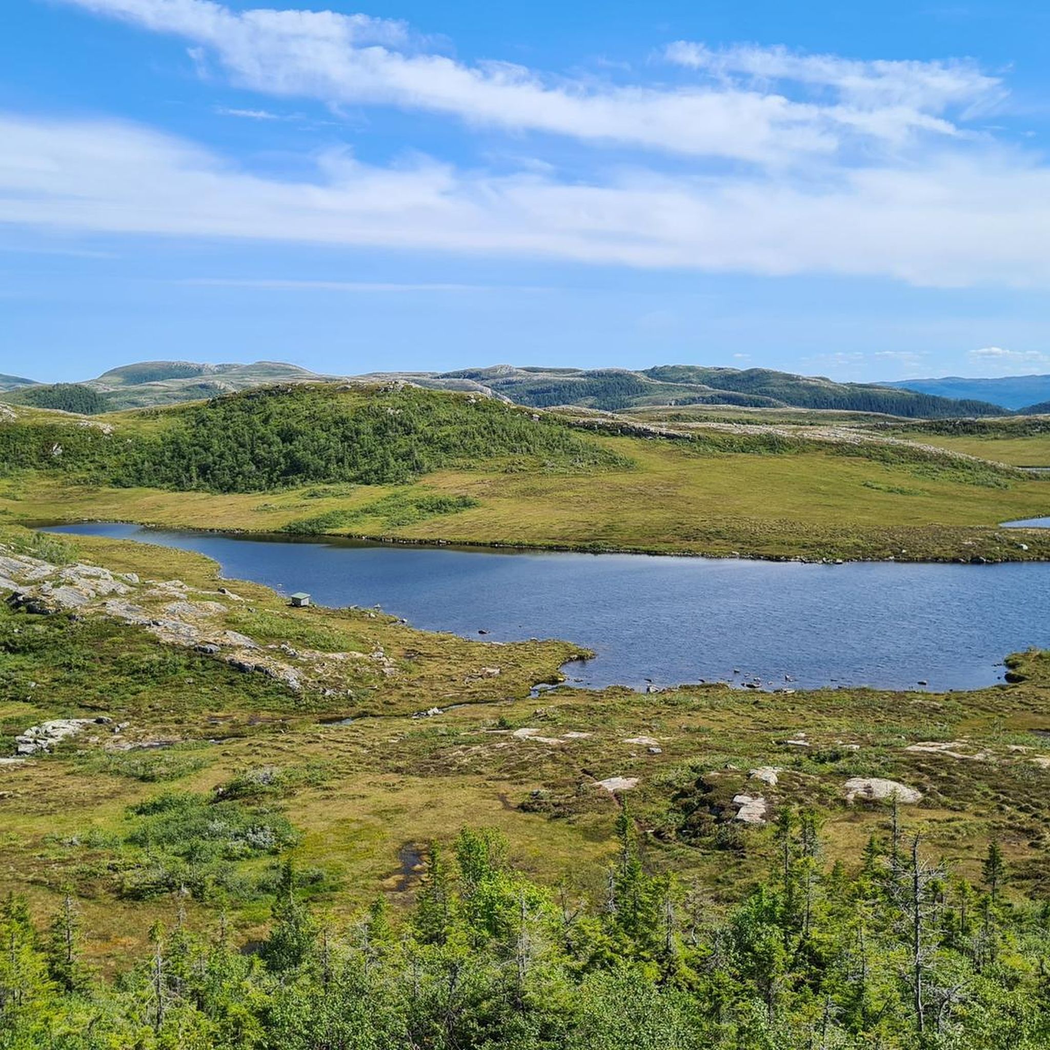
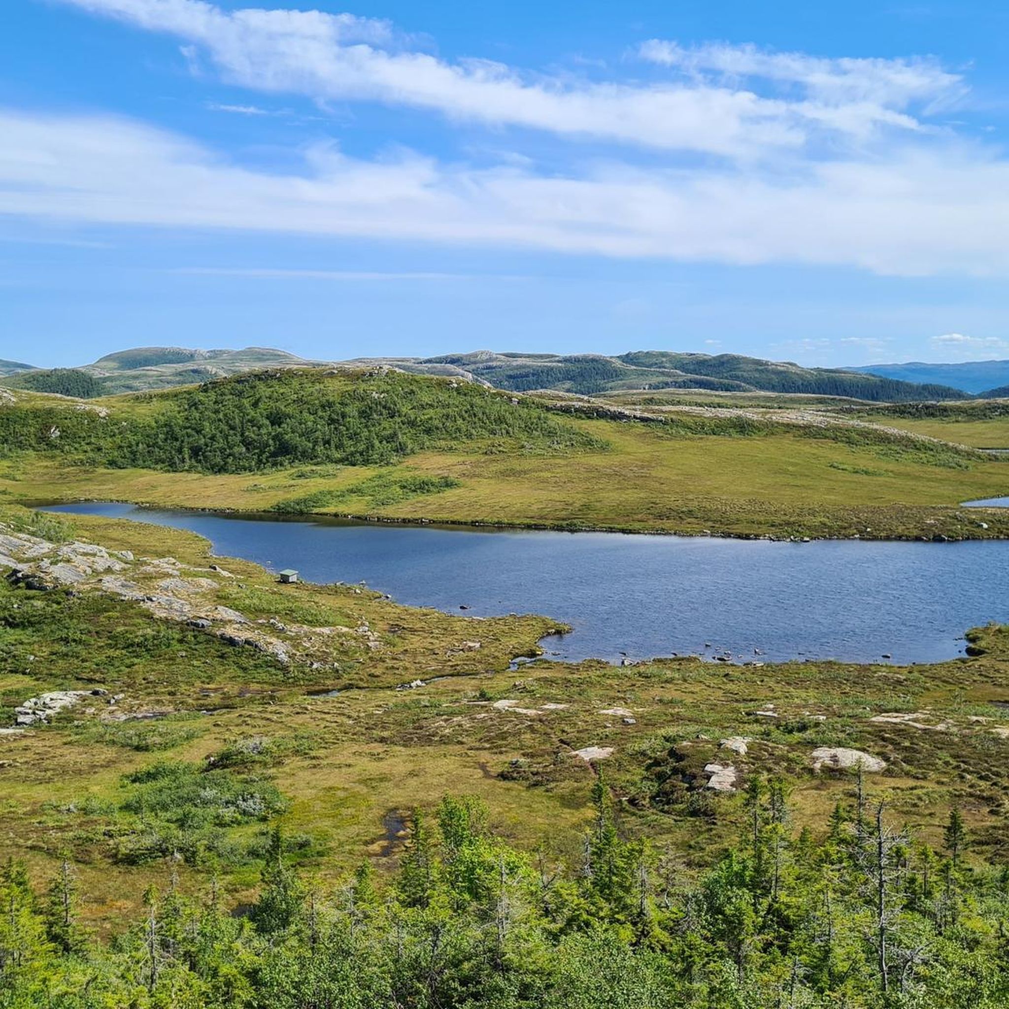
Hiking around Storvatnet in Nord-Trøndelag features a landscape characterized by a lake surrounded by varied terrain. The region offers routes with significant elevation changes, leading to summits and panoramic viewpoints. Hikers can expect a mix of forest paths and open areas, providing diverse natural experiences.
Best hiking trails around Storvatnet
- The most popular hiking route is Vanvikan Harbor – Maritåsen loop from Utistubekken mikrokraftverk, a 5.9 miles (9.5 km) trail that takes 3 hours 16 minutes to complete. This…
Last updated: June 26, 2026
4.7
(3)
7
hikers
6.39km
01:58
230m
230m
Easy hike. Great for any fitness level. Easily-accessible paths. Suitable for all skill levels.
4.0
(1)
3
hikers
2.71km
00:57
150m
140m
Easy hike. Great for any fitness level. Easily-accessible paths. Suitable for all skill levels.

Sign up for free
4.8
(5)
73
hikers
9.59km
03:18
520m
520m
Moderate hike. Good fitness required. Easily-accessible paths. Suitable for all skill levels.
4.3
(18)
58
hikers
12.3km
04:07
550m
550m
Moderate hike. Good fitness required. Mostly accessible paths. Sure-footedness required.
4.0
(1)
8
hikers
14.5km
04:20
460m
460m
Moderate hike. Good fitness required. Easily-accessible paths. Suitable for all skill levels.
Get access to more routes and recommendations from other explorers.
Sign up for free
Already have an account?
Our route recommendations are based on thousands of hikes, rides, and runs completed by other people on komoot.
Start today with a free account
Your next adventure awaits.
Login or Signup
Popular around Storvatnet
Tips from the Community

You can find your wood for in the Fosenkoia Cabin around here! It is a 25 minute walk back to the cabin.
0
0


There are tables and benches and a little space for a tent. Great view!
2
0

A good starting point for a hike up the Aksnes lumps. From Trondheim you can take the bus that goes here via the ferry.
0
0
Frequently Asked Questions
What kind of terrain can I expect when hiking around Storvatnet in Nord-Trøndelag?
Hiking around Storvatnet in Nord-Trøndelag offers a diverse landscape. You'll find a mix of beautiful lake views, varied forest paths, and open areas. Many routes feature significant elevation changes, leading to summits and panoramic viewpoints, providing a rich natural experience.
Are there any easy or family-friendly hiking options near Storvatnet?
Yes, the area around Storvatnet in Nord-Trøndelag includes options suitable for various ability levels. While many routes involve elevation, there are 2 easy tours available. For a moderate, yet rewarding experience, consider the Vanvikan Harbor – Maritåsen loop from Utistubekken mikrokraftverk, which offers views towards the harbor and Maritåsen.
What are some popular longer hikes around Storvatnet that offer a challenge?
For those seeking a more challenging experience, the Panoramic View – Storhaugen Summit loop from Utistubekken mikrokraftverk is a difficult 11.7-mile (18.8 km) trail that leads through mountainous terrain to a summit, typically taking about 5 hours 30 minutes to complete.
Can I find circular hiking routes around Storvatnet?
Yes, many of the trails around Storvatnet are designed as loops, allowing you to start and end at the same point. For example, the Fosenkoia Cabin – UntaFuring Cabin loop from Utistubekken mikrokraftverk is a moderate 7.6-mile (12.2 km) path that connects two cabins, traversing varied forest and open terrain.
What do other hikers say about the trails in Storvatnet?
The routes in Storvatnet are highly rated by the komoot community, with an average score of 4.4 stars from over 27 reviews. Hikers often praise the diverse terrain, from lake views and forest paths to rewarding summit ascents, and the variety of options for different ability levels.
Are there any specific viewpoints or landmarks to look out for on the trails?
While specific named landmarks are not detailed in the guide data for this Storvatnet, many routes are designed to offer panoramic views, especially those leading to summits. For instance, the Panoramic View – Storhaugen Summit loop from Utistubekken mikrokraftverk (a moderate 14.5 km version) is known for its scenic vistas.
What is the best time of year to go hiking around Storvatnet?
While the guide doesn't specify a 'best' time, generally, the warmer months from late spring to early autumn (May to September) offer the most favorable conditions for hiking in Norway, with longer daylight hours and less snow. However, the specific conditions can vary greatly depending on the elevation and local weather patterns.
Is there parking available near the trailheads for Storvatnet hikes?
Many of the listed routes, such as the Hundmollia – Øverråa loop from Øyan, start from locations like 'Utistubekken mikrokraftverk' or 'Øyan', which typically indicate common access points where parking might be available. It's always advisable to check local signage or specific route details for confirmed parking facilities.
Are dogs allowed on the hiking trails around Storvatnet?
While the guide data doesn't explicitly state dog-friendly policies for this specific Storvatnet, generally, dogs are welcome on hiking trails in Norway, often on a leash, especially during certain times of the year to protect wildlife. It's always best to check local regulations or specific trail information before heading out with your dog.
What kind of wildlife might I encounter around Storvatnet?
The broader Storvatnet regions in Norway are known for rich animal and bird life. Depending on the specific location, you might spot deer, roe deer, fox, mink, otter, and various bird species like white-tailed eagles, whooper swans, divers, and grebes. The diverse landscapes of forest and open areas provide habitats for many creatures.
Are there any historical or cultural points of interest near Storvatnet?
While the guide focuses on the natural hiking experience, other Storvatnet locations in Norway, such as the one on Averøy, are near historical hiking trails in the Kvernes cultural area, offering insights into 4000 years of history. For the Storvatnet in Nord-Trøndelag, the focus is more on the natural beauty and varied terrain.
Can I swim in Storvatnet?
The possibility of swimming in Storvatnet depends on its specific designation. For example, the Storvatnet on Averøy is a drinking water reservoir, meaning swimming is prohibited there. However, other Storvatnets, like the one in Innerdalen, are known for their pristine, drinkable waters. It's important to check local regulations for the specific Storvatnet you plan to visit.
Most popular routes around Storvatnet

Get inspired with the komoot mobile app


Explore more
Browse the best Hikes in other regions.
