The best running trails around Strynevatnet
79
runners
7
runs
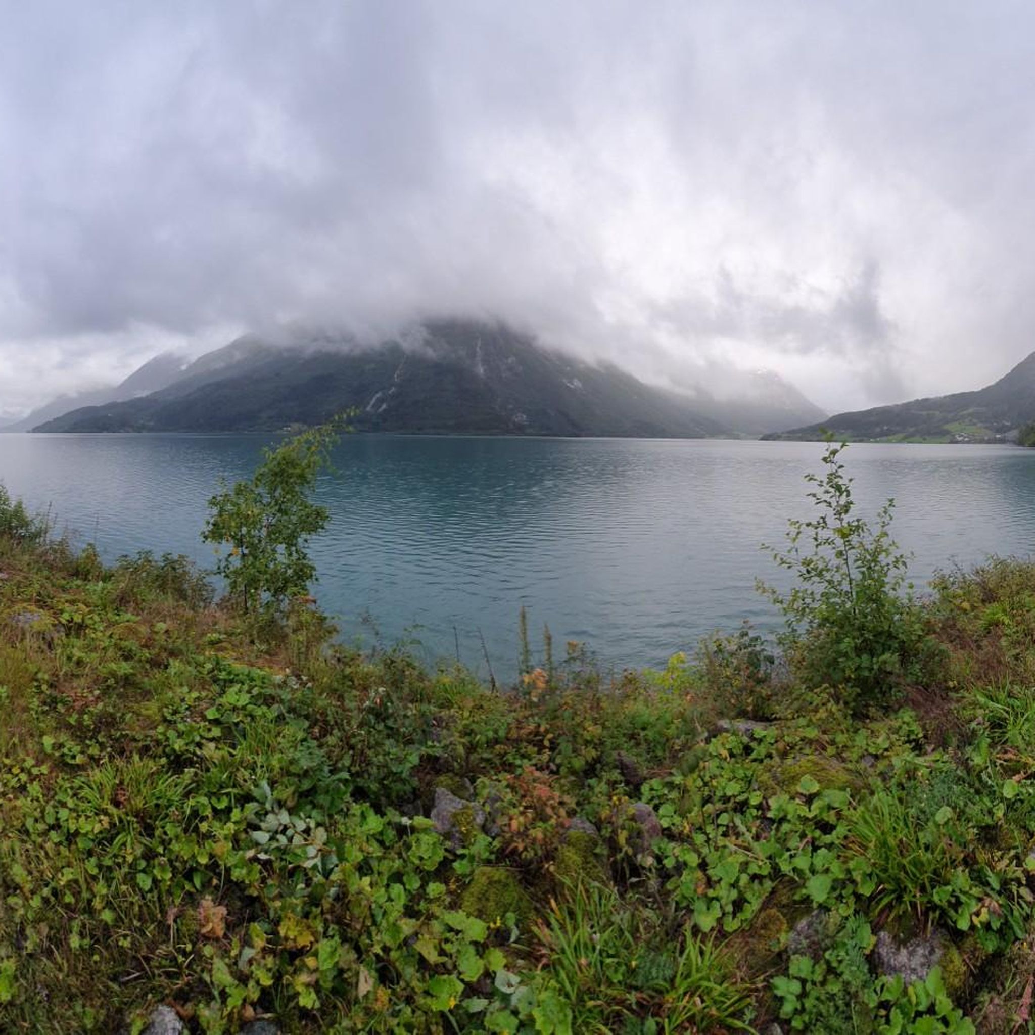
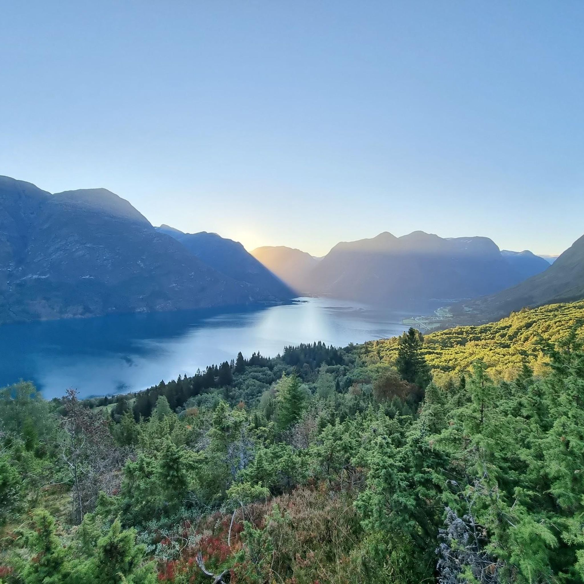
Jogging routes around Strynevatnet are set amidst majestic mountains, deep valleys, and emerald-green glacial lakes. The region features varied terrain, from accessible lakeside paths to more challenging mountain trails. Forest roads and paths provide options for different running preferences, often leading through remnants of deciduous forest. The landscape is characterized by its pure, often turquoise, glacial water and the presence of towering peaks and dramatic waterfalls.
Best jogging routes around Strynevatnet
- The most popular jogging route is Storekvilet – Legdeskog…
Last updated: July 10, 2026
5
runners
6.45km
01:15
380m
370m
Hard run. Very good fitness required. Sure-footedness, sturdy shoes and alpine experience required.
5
runners
4.73km
00:39
120m
120m
Hard run. Good fitness required. Sure-footedness, sturdy shoes and alpine experience required.

Sign up for free
34
runners
15.7km
04:09
1,770m
1,770m
Hard run. Very good fitness required. Sure-footedness, sturdy shoes and alpine experience required.
8
runners
8.50km
01:23
430m
430m
Hard run. Very good fitness required. Sure-footedness, sturdy shoes and alpine experience required.
10
runners
12.2km
02:52
1,190m
1,190m
Hard run. Very good fitness required. Sure-footedness, sturdy shoes and alpine experience required.
Get access to more routes and recommendations from other explorers.
Sign up for free
Already have an account?
Our route recommendations are based on thousands of hikes, rides, and runs completed by other people on komoot.
Start today with a free account
Your next adventure awaits.
Login or Signup
Tips from the Community


Frequently Asked Questions
What natural features or landmarks can I expect to see while running around Strynevatnet?
The Strynevatnet area is renowned for its stunning natural beauty. You'll encounter the emerald-green glacial lake itself, surrounded by majestic mountains and deep valleys. Many routes offer views of dramatic waterfalls, such as the Marså waterfall, and you'll often run through remnants of deciduous forest. The region's proximity to glaciers, like those of Jostedalsbreen, also contributes to the awe-inspiring backdrop.
Are there parking facilities available near the running trails?
Yes, parking is generally available near the starting points of many running trails around Strynevatnet. For instance, routes like Storekvilet – Legdeskog loop from Hjelle and Storekvilet loop from Hjelle typically have parking options in or near Hjelle. Similarly, routes starting from Loen kyrkje, such as Skåla loop from Loen kyrkje, usually have accessible parking.
When is the best time of year to go running in Strynevatnet?
The best time for running in Strynevatnet is typically during the warmer months, from late spring to early autumn (May to September), when the trails are clear of snow and the weather is milder. This period offers lush landscapes, full waterfalls, and comfortable temperatures for outdoor activities. However, the region's beauty can be enjoyed year-round, with winter offering a different, serene experience for those prepared for colder conditions.
Are there family-friendly running paths suitable for all ages?
While many routes in the area are quite challenging, there are options for less strenuous runs. The region offers accessible paths and forest roads that can be suitable for families. For instance, lakeside jogs along Strynevatnet provide a more gentle terrain. Always check the difficulty and elevation gain of a specific route to ensure it matches your family's fitness level.
Can I bring my dog on the running trails around Strynevatnet?
Generally, dogs are welcome on many trails in Norway, provided they are kept on a leash, especially during certain times of the year to protect wildlife (e.g., nesting birds, grazing animals). It's always best to check local regulations or specific trail signage before heading out with your dog. Ensure you clean up after your pet to maintain the pristine natural environment.
Are there any easy or beginner-friendly running routes?
Yes, while many routes around Strynevatnet are rated as difficult, there is at least one easy route available. The area features accessible lakeside paths and forest roads that are suitable for beginners or those looking for a less strenuous run. These paths often provide a serene experience along the emerald-green glacial lake without significant elevation gain.
Which running routes offer the best scenic viewpoints?
Many routes around Strynevatnet boast incredible views. For panoramic vistas over Nordfjord and Breheimen National Park, more challenging ascents like the Skåla loop from Loen kyrkje or Vesleskåla loop from Loen kyrkje are highly recommended. Even routes with moderate elevation, such as Storekvilet loop from Hjelle, offer beautiful perspectives of the surrounding landscape and the glacial lake.
Are there many circular running routes available?
Yes, the Strynevatnet area offers a good selection of circular running routes, which are popular for their convenience. Examples include the Storekvilet – Legdeskog loop from Hjelle, the Storekvilet loop from Hjelle, and the Skåla loop from Loen kyrkje. These loops allow you to experience varied terrain and return to your starting point without retracing your steps.
What is the typical terrain like on the running trails?
The terrain around Strynevatnet is quite varied. You'll find accessible paths and forest roads, particularly closer to the lake, which are often smoother. As you venture higher, routes can become more challenging, featuring mountainous terrain with significant elevation gain. Expect a mix of paved surfaces, gravel paths, and natural trails, often leading through forests or open mountain landscapes.
Are there places to eat or stay near the running routes?
Yes, the region offers amenities for visitors. Mindresunde, idyllically situated by Strynevatnet, provides peace and tranquility and serves as a base for many walks. Stryn center, a short drive away, offers a wider range of amenities including shops, cafes, and restaurants. You'll find various accommodation options, from hotels to guesthouses, in these areas.
How many running routes are available in the Strynevatnet area?
Komoot lists several running routes around Strynevatnet, with a total of 7 routes detailed in this guide. These range in difficulty from easy to difficult, offering options for various fitness levels and preferences.
What is the longest running route mentioned in this guide?
The longest running route detailed in this guide is the Skåla loop from Loen kyrkje. This challenging trail spans 9.7 miles (15.6 km) and typically takes around 4 hours and 9 minutes to complete, leading through mountainous terrain.

Get inspired with the komoot mobile app


Explore more
Browse the best Running Trails & Routes in other regions.
