The best walks and hikes around Soumaintrain
4.5
(21)
85
hikers
14
hikes
Hiking around Soumaintrain offers access to a network of trails through the gentle, rolling landscapes of the Yonne department. The region is characterized by its rural setting, featuring agricultural fields, small woodlands, and waterways such as the Burgundy Canal. Elevation changes are generally modest, making many paths accessible for various fitness levels. The terrain primarily consists of well-maintained paths and country roads, suitable for walking.
Best hiking trails around Soumaintrain
- The most popular hiking route is Burgundy canal lock –…
Last updated: July 5, 2026
5.0
(2)
17
hikers
13.0km
03:27
130m
130m
Moderate hike. Good fitness required. Easily-accessible paths. Suitable for all skill levels.
5.0
(5)
8
hikers
12.4km
03:12
80m
80m
Moderate hike. Good fitness required. Easily-accessible paths. Suitable for all skill levels.

Sign up for free
4.3
(3)
11
hikers
5.08km
01:20
40m
30m
Easy hike. Great for any fitness level. Easily-accessible paths. Suitable for all skill levels.
5
hikers
6.17km
01:39
70m
70m
Easy hike. Great for any fitness level. Easily-accessible paths. Suitable for all skill levels.
5.0
(1)
5
hikers
Moderate hike. Good fitness required. Easily-accessible paths. Suitable for all skill levels.
Get access to more routes and recommendations from other explorers.
Sign up for free
Already have an account?
Our route recommendations are based on thousands of hikes, rides, and runs completed by other people on komoot.
Start today with a free account
Your next adventure awaits.
Login or Signup


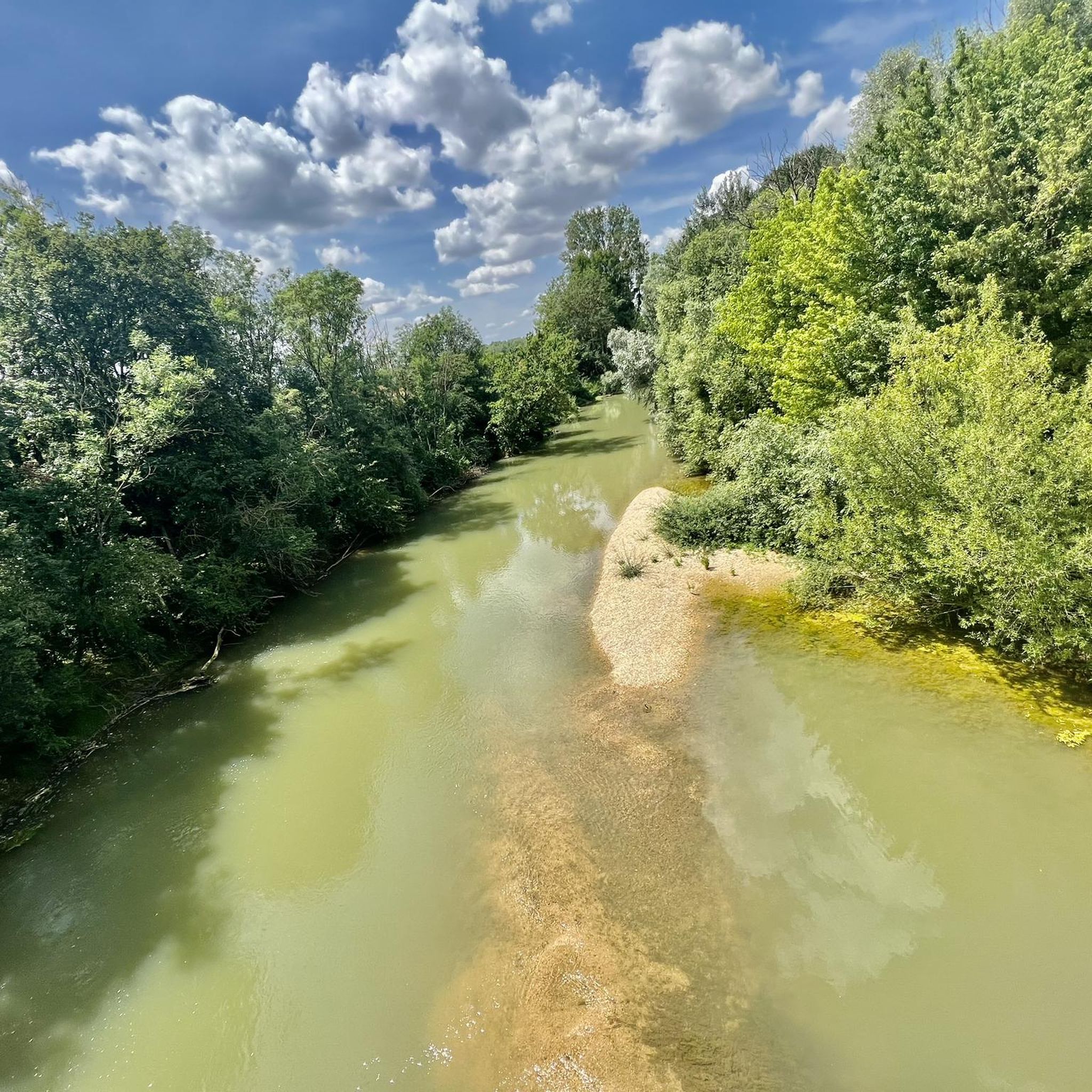

Tips from the Community


Located between the forest massifs of Chaourçois and the Othe forest, Ervy-le-Châtel has many charms. The village takes its name from the local lord who ruled this stronghold until the 9th century: the Ervy family. The Armance flows at the foot of the town. There is also a feudal mound nearby. These are probably the ruins of the original castle.
0
0
In the very heart of the municipal forest of Marolles-sous-Lignières, the path to the pond takes you close to the Marolles pond. This artificial body of water is created from the Madeleine stream.
1
0
You cross the Park woods in a long straight line under a magnificent forest cover. The road begins at the Popin field and ends at the gates of the town of Ervy-le-Châtel.
0
0


Saint Florentin is a pleasant little town that has been very well restored. The two fun and informative anecdotes to take away from the city are as follows: during the Revolution, Saint-Florentin was one of the most dynamic places of Theophilanthropy, a religion which succeeded the cult of reason and the supreme being between 1798 and 1801. During the convention, the anticlerical republicans renamed Saint-Florentin and called it Mont-Armance between 8 Germinal of Year Two (March 28, 1794) and 6 Ventôse of Year Three (February 24, 1795). The city is located on the edge of the Armance and the Burgundy Canal, but also the N77. Some ingenious minds wanted to take inspiration from the legendary American route 66 in the hope of attracting tourists, and now call it route 77.
2
0
Frequently Asked Questions
How many hiking trails are available around Soumaintrain?
There are over 8 hiking trails documented around Soumaintrain, offering a variety of options through the region's gentle landscapes.
Are there easy hiking trails suitable for beginners in Soumaintrain?
Yes, Soumaintrain offers 3 easy hiking trails. A good option for beginners is the Saint-Florentin loop from Saint-Florentin, which is 3.2 miles (5.1 km) long and takes about 1 hour 19 minutes to complete.
What is the typical difficulty and distance of hikes in Soumaintrain?
The majority of hikes in Soumaintrain are classified as easy or moderate. Distances vary, with moderate routes like the Burgundy canal lock – Saint-Florentin loop from Saint-Florentin covering about 8.1 miles (13.0 km), while easier options are shorter.
Are there any circular walks around Soumaintrain?
Yes, many of the trails around Soumaintrain are circular. For example, the Rest area – Marolles Pond loop from Flogny-la-Chapelle is a moderate 7.8 miles (12.6 km) loop that takes you through rural landscapes and past Marolles Pond.
What kind of terrain can I expect on the hiking trails?
The terrain around Soumaintrain primarily consists of well-maintained paths and country roads. You'll encounter gentle, rolling landscapes, agricultural fields, small woodlands, and canal-side paths, with modest elevation changes.
Are the hiking trails in Soumaintrain suitable for families?
Given the gentle terrain and the presence of easy routes, many trails are suitable for families. The Saint-Florentin loop from Saint-Florentin is a shorter, easy option that families might enjoy.
What do other hikers say about the trails in Soumaintrain?
The trails in Soumaintrain are highly rated by the komoot community, with an average score of 4.5 stars from over 19 reviews. Hikers often praise the peaceful rural landscapes and the well-maintained paths along the Burgundy Canal.
Are there any interesting landmarks or places to explore near the hiking routes?
Yes, the region offers several points of interest. You can explore the town of Saint-Florentin, or visit Ervy-le-Châtel with its unique Circular Market Hall and historical sites. The village of Percey also features a canal, lock, and château.
Is there parking available near the trailheads in Soumaintrain?
While specific parking details for every trailhead are not provided, routes often start from towns or villages like Saint-Florentin or Flogny-la-Chapelle, where public parking is generally available. It's advisable to check local maps for designated parking areas before your hike.
What is the best season for hiking in Soumaintrain?
The gentle nature of the trails makes them enjoyable across multiple seasons. Spring and autumn offer pleasant temperatures and beautiful scenery with blooming flora or changing leaves. Summer is also suitable, though it's wise to start early to avoid the midday heat. Winter hikes are possible, but some paths might be muddy.
Are there any cafes or places to eat near the hiking paths?
Many routes either start or pass through villages and towns such as Saint-Florentin or Flogny-la-Chapelle, where you can typically find local cafes, bakeries, or restaurants to refuel before or after your hike.
Are there any trails that offer viewpoints or scenic overlooks?
While the region is characterized by gentle rolling hills rather than dramatic mountain vistas, trails often provide scenic views over agricultural plains, small woodlands, and along the Burgundy Canal, offering picturesque rural landscapes. The Neuvy-Sautour Courcelles loop from Neuvy-Sautour offers views of the local countryside.
Most popular routes around Soumaintrain
Most popular attractions around Soumaintrain

Get inspired with the komoot mobile app


Explore more
Browse the best Hikes in other regions.
