The best mountain hikes around Giaglione
5.0
(4)
35
hikers
5
hikes
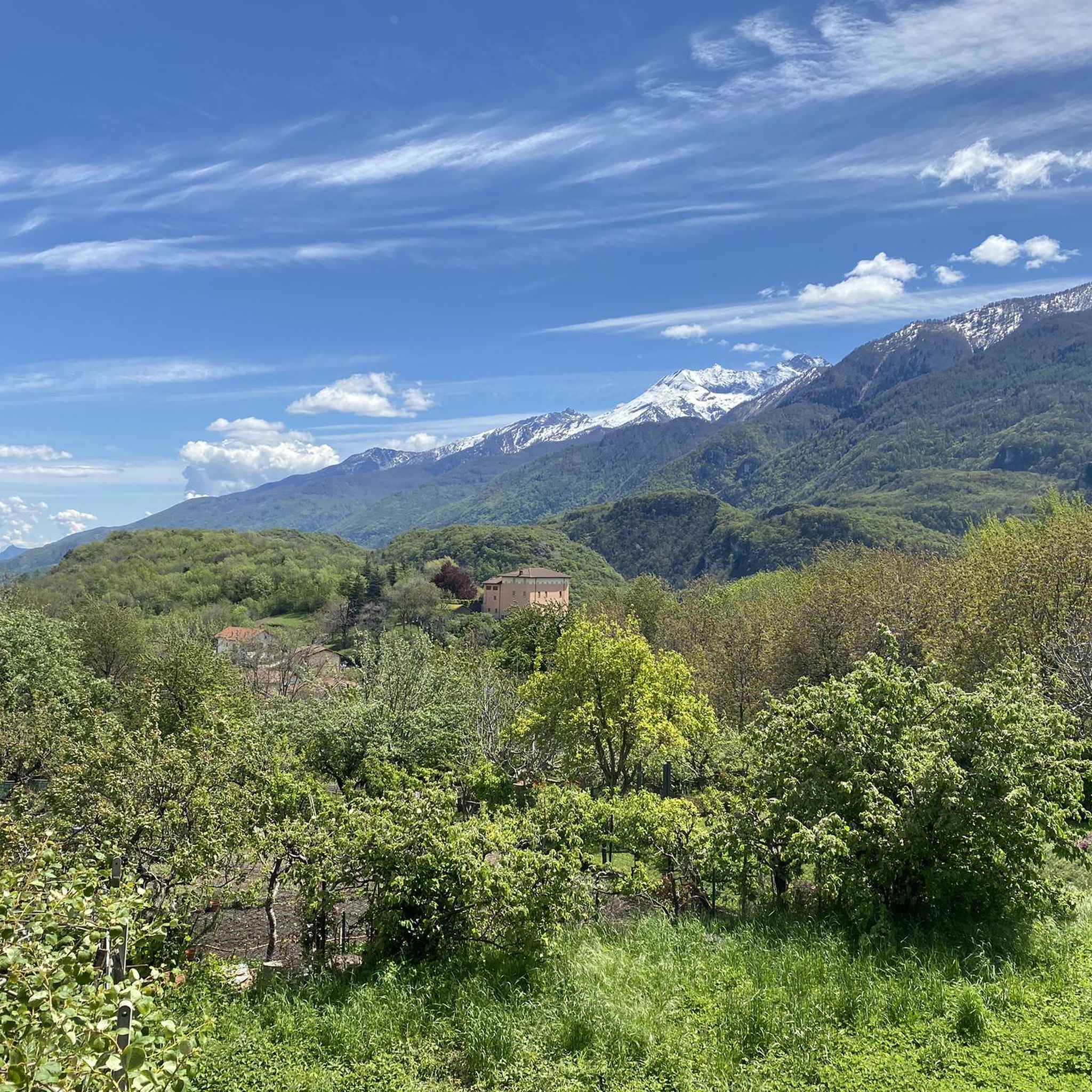
Mountaineering around Giaglione is set within the dramatic alpine landscape of the Piedmontese Alps, characterized by high peaks and expansive open spaces. The region is situated in the Susa Valley, offering views of prominent peaks like Rocciamelone and featuring protected areas such as the Orsiera-Rocciavrè and Gran Bosco di Salbertrand natural parks. The Massif d'Ambin and Colle del Moncenisio further define the terrain, providing diverse mountaineering opportunities.
Best mountaineering routes around Giaglione
- The most popular mountaineering route is Rifugio Ca'…
Last updated: July 10, 2026
8
hikers
3.17km
01:56
270m
270m
Hard mountaineering route. Great for any fitness level. Sure-footedness, sturdy shoes and alpine experience required.
5.0
(1)
8
hikers
Hard mountaineering route. Very good fitness required. Mostly accessible paths. Sure-footedness required.

Sign up for free
7
hikers
4.38km
03:14
620m
610m
Hard mountaineering route. Good fitness required. Sure-footedness, sturdy shoes and alpine experience required.
5.0
(2)
6
hikers
15.1km
07:23
1,120m
1,120m
Hard mountaineering route. Very good fitness required. Sure-footedness, sturdy shoes and alpine experience required.
3
hikers
15.8km
07:19
1,330m
1,330m
Hard mountaineering route. Very good fitness required. Mostly accessible paths. Sure-footedness required.
Our route recommendations are based on thousands of hikes, rides, and runs completed by other people on komoot.
Start today with a free account
Your next adventure awaits.
Login or Signup

Tips from the Community

Lake Savine is a unique sight; we saw it covered in snow at the end of September! If you're heading towards Colle Clapier or the bivouac of the same name, we recommend crampons (especially for the descent, which can be icy in some places). In winter, you may also need snowshoes.
0
0

This refuge is managed and open only during the summer months. It's possible to stop for a break when climbing to the summit of Rocciamelone. It's located approximately halfway between La Riposa and Rocciamelone.
0
0

in case of snow be careful not to lose the path
0
0
landing place for beginners, or a useful support point to break the climb in 2
0
0

Colle Clapier, located in the Cottian Alps, is a historic Alpine pass that connects Italy and France. At 2,491 meters above sea level, it offers breathtaking views and a route full of history, considered by some scholars to be one of the possible passages crossed by Hannibal during his famous crossing of the Alps.
0
0

Nice tour to the Lake starting from Le Verney
0
0

Very comfortable, dormitory and room for 2 with 140 bed
0
0

Perfect family trip to train the legs for the children too... once over the top this fantastic mountain lake emerges
0
0
Frequently Asked Questions
What kind of terrain can I expect on mountaineering routes around Giaglione?
The mountaineering routes around Giaglione are set within the dramatic alpine landscape of the Piedmontese Alps. You'll encounter high peaks, expansive open spaces, and the diverse terrain of the Susa Valley. The region features protected areas like the Orsiera-Rocciavrè and Gran Bosco di Salbertrand natural parks, offering a mix of rugged mountain paths and forested sections. Expect breathtaking 'top of the world' panoramas and challenging ascents.
Are there any family-friendly mountaineering routes in Giaglione?
While many mountaineering routes in Giaglione are rated as difficult, the region does offer options for varying experience levels. For families looking for a less strenuous but still engaging experience, consider exploring parts of the natural parks or looking for routes with lower elevation gain. Always check the specific route details for difficulty and duration to ensure it's suitable for all family members.
What are the best times of year for mountaineering in Giaglione?
The best time for mountaineering in Giaglione is typically during the warmer months, from late spring through early autumn (roughly June to September), when trails are generally free of snow and weather conditions are more stable. During winter, the Italian Alps transform, offering opportunities for ski mountaineering, but this requires specialized equipment and experience. Always check current weather and trail conditions before heading out.
Are there any circular mountaineering routes available?
Yes, there are several circular mountaineering routes around Giaglione. For example, you could explore the Rifugio Ca' d'Asti – Rocciamelone (3,538 m) loop from Rocciamelone, which is a challenging ascent to the summit. Another option is the Petit Mont Cenis Refuge – Lac de Savine loop from Ancien Fort de Pattacreuse, which explores the historic Mont Cenis region. These loops offer a varied experience without retracing your steps.
What kind of landmarks or natural features can I see along the routes?
Mountaineering routes in Giaglione offer stunning natural features and historical landmarks. You can admire prominent peaks like Rocciamelone, which stands at 3,537 meters, or explore areas around the historic Colle del Moncenisio. The region is also home to protected areas such as the Orsiera-Rocciavrè and Gran Bosco di Salbertrand natural parks. Along some routes, you might encounter mountain huts like Assietta Refuge or Petit Mont Cenis Refuge, and even historical sites such as Fort Gran Serin.
Are there any Via Ferrata routes in the Giaglione area?
Yes, the broader region around Giaglione offers Via Ferrata routes for those seeking a blend of hiking and climbing. An example is the Via Ferrata des Cascades loop from Novalesa, which provides a challenging experience equipped with fixed cables and ladders. These routes require specific equipment and experience.
What do other mountaineers say about the routes in Giaglione?
The mountaineering routes in Giaglione are highly regarded by the komoot community, with an average rating of 5.0 stars from 5 reviews. Over 80 mountaineers have used komoot to explore the varied terrain, often praising the challenging ascents, extensive alpine views, and the sense of adventure offered by the high peaks of the Piedmontese Alps.
Are there options for multi-day mountaineering expeditions?
Yes, the region around Giaglione is well-suited for multi-day mountaineering expeditions, especially within the Massif d'Ambin, which offers cross-border itineraries. The presence of mountain huts like Levi Molinari Hut and Daniele Arlaud Mountain Hut provides essential support for longer treks, offering places for rest and shelter along the way.
How can I access the mountaineering routes using public transport?
Giaglione is located within the Susa Valley, which has some public transport infrastructure. While direct access to all trailheads by public transport might be limited, you can often reach nearby towns or villages by bus or train, and then arrange for local transport or a taxi to the starting points of the routes. It's advisable to research specific public transport options for your chosen trailhead in advance.
Where can I find parking for the trailheads?
Parking availability varies by trailhead. For popular routes, there are often designated parking areas near the starting points, though these can fill up quickly during peak season. For example, routes exploring the Mont Cenis region, such as the Refuge du Petit Mont Cenis – Signal of Petit Mont Cenis loop from Refuge du Petit Mont Cenis, may have parking near the refuges or historical sites. Always check local signage and regulations for parking.
Are dogs allowed on the mountaineering trails in Giaglione?
Many trails in the Piedmontese Alps and natural parks around Giaglione are dog-friendly, but regulations can vary, especially within protected areas like the Orsiera-Rocciavrè and Gran Bosco di Salbertrand natural parks. It's always best to keep dogs on a leash, especially in areas with wildlife or livestock, and to check specific park rules or route descriptions for any restrictions before you go.
What is the typical duration and elevation gain for these mountaineering routes?
The mountaineering routes around Giaglione vary significantly in duration and elevation gain. For instance, the Col de Bramanette (2855 m) loop from Le Cernay is a difficult route that typically takes over 7 hours to complete, involving substantial elevation gain. Shorter, less intense options are also available, but most mountaineering routes in this region are designed for experienced individuals and involve considerable physical effort and altitude changes.
Most popular routes around Giaglione
Most popular attractions around Giaglione

Get inspired with the komoot mobile app


Explore more
Browse the best Mountain Hikes & Routes in other regions.
