The best MTB trails in San Juan De Pastocalle
88
riders
6
rides
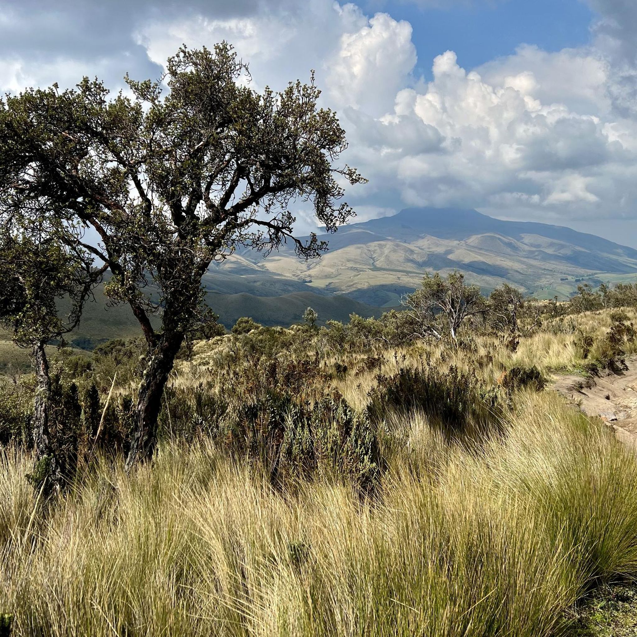
Mountain bike trails in San Juan De Pastocalle offer diverse terrain within Ecuador's Cotopaxi province, characterized by high Andean landscapes. The region's elevation, often exceeding 10,000 feet (3,000 meters), provides varied environments ranging from high-altitude páramo to cloud forests and dry valleys. Mountain bikers can expect challenging conditions including volcanic ash, petrified lava, boulders, and sand, especially near Cotopaxi National Park and the Illinizas Ecological Reserve. This area is known for its dramatic Andean highlands.
Best mountain bike trails in…
Last updated: October 30, 2026
13
riders
11.4km
01:09
310m
310m
Moderate mountain bike ride. Good fitness required.
17
riders
17.1km
01:32
400m
400m
Moderate mountain bike ride. Good fitness required.

8
riders
63.8km
05:36
1,080m
1,080m
Hard mountain bike ride. Very good fitness required. Advanced riding skills necessary.
7
riders
Moderate mountain bike ride. Good fitness required.
10
riders
19.6km
01:51
400m
400m
Moderate mountain bike ride. Good fitness required.
Our route recommendations are based on thousands of hikes, rides, and runs completed by other people on komoot.
Start today with a free account
Your next adventure awaits.
Popular around San Juan De Pastocalle
Tips from the Community

take it easy, some of the ramps are broken. no signage, so you won't know it until you fall
0
0

It's an excellent viewpoint, both for Limpiopungo Lagoon and for Rumiñahui and Cotopaxi Volcano. Because of the cold, you'll need to wear a coat.
0
0

A beautiful circular path leads around the lagoon and great animal sightings are possible.
0
0


Beginning of a section to reach the shelter where you leave everything on the bike! 🚲
0
0

You can camp at the lodge and enjoy the breakfast buffet at the lodge. A welcome opportunity to warm up after the cold nights. It is only possible to warm up in very few places in the Andes.
0
0

Hidden behind a few hills, this lagoon reminds our guide of Scotland. You can easily fill up your drinking bottle in the clear water and have a wonderful rest. What you should not do is camp here. It's forbidden in the national park anyway and the indigenous people make sure that it's followed.
1
0
The only information on site is a small sign near the grassy parking lot named Pucara Salitre. nothing else. To the untrained eye it was easy to see that this location was chosen for its strategic value. Most of the exposed site is built high on the hill to enjoy the views all around. A small building is lower with less view and has a partly built modern roof. We thought the whole building might be modern, an example of what the buildings might have looked like on the less surviving buildings on the hill, but photos online show this building as an Incan construction and as a defensive structure. Unfortunately, the ruins of the modern roof detract from the site and do little to preserve the ruins themselves. There are clearly two levels on the hill, one a defensive wall around the structure and the second a wall that contained many smaller buildings. Today it seems clear that there were entrances to the north and south, although no lintels or doors remain, only openings in the remaining low walls that are there. Source: https://notyouraverageamerican.com/inca-ruins-cotopaxi-national-park/ The best way is to walk the few meters from the street. It's not really a lot to watch... but the view...
0
0
Frequently Asked Questions
How many mountain bike trails are available in San Juan De Pastocalle?
There are 9 mountain bike trails available in the San Juan De Pastocalle area. These routes offer a mix of moderate and difficult options, catering to experienced riders.
What kind of terrain can I expect on mountain bike trails in San Juan De Pastocalle?
Mountain bike trails in San Juan De Pastocalle feature diverse high-altitude Andean terrain. You can expect challenging conditions including volcanic ash, petrified lava, boulders, and sand, especially near Cotopaxi National Park. The landscapes transition from high-altitude páramo to cloud forests and dry valleys, often with significant climbs and descents.
Are there any family-friendly mountain bike trails in the San Juan De Pastocalle area?
The mountain bike trails in San Juan De Pastocalle are generally rated as moderate to difficult, often involving significant elevation changes and challenging terrain. While there are no routes specifically listed as 'easy' in the guide, families with experienced teenage riders might find some of the moderate trails manageable. Always check the specific route details for suitability.
Can I bring my dog on the mountain bike trails in San Juan De Pastocalle?
While specific regulations for dogs on trails directly in San Juan De Pastocalle are not detailed, many of the routes are in or near Cotopaxi National Park. National parks often have strict rules regarding pets to protect wildlife. It's advisable to check the current regulations for Cotopaxi National Park or any specific trail before bringing your dog.
What are the typical durations of mountain bike trails in San Juan De Pastocalle?
Trail durations vary depending on the route's length and difficulty. For example, the Limpiopungo Lagoon – Pucara Salitre Ruins loop from Boliche is a difficult 40.5-mile (65.2 km) trail that typically takes around 5 hours 44 minutes. A shorter, moderate option like The Flight of the Guarro loop from Boliche (15.2 miles / 24.5 km) can be completed in about 1 hour 24 minutes.
Are there any circular mountain bike routes available?
Yes, many of the mountain bike routes in San Juan De Pastocalle are circular. Examples include the Limpiopungo Lagoon – La Pradera Grassland loop from Boliche, a difficult 30.0-mile (48.3 km) path, and the Manantiales Alto – Limpiopungo Lagoon loop from Boliche, a moderate 19.3-mile (31.1 km) trail.
What are some scenic viewpoints or natural attractions I can see while mountain biking?
The region offers breathtaking Andean landscapes. While mountain biking, you can expect views of iconic volcanoes like Cotopaxi and Illiniza South. Notable attractions nearby include the Iliniza Norte Summit, Corazón Summit, and the View of Illiniza Sur and Illiniza Norte. The Quebrada El Rosario (Rosario Gorge) and Cascada de Cunuyacu waterfall are also part of the local geography.
Is there parking available for mountain bikers near the trails?
Many of the trails start from Boliche, which is a common access point for Cotopaxi National Park. Parking facilities are typically available at national park entrances or designated visitor areas. It's advisable to check specific parking options for your chosen trailhead, especially when entering protected areas like Cotopaxi National Park.
How can I get to the mountain bike trailheads using public transport?
San Juan De Pastocalle is a rural parish, and while specific public transport details to trailheads like Boliche are not provided, the broader Cotopaxi province is accessible. You may need to use a combination of inter-city buses to Latacunga or nearby towns, followed by local transport or taxis to reach specific starting points within the national park or surrounding areas.
Are there any cafes or restaurants near the mountain bike trails in San Juan De Pastocalle?
San Juan De Pastocalle is a rural area, but as a hub for ecotourism, there are likely local eateries and small shops. Within Cotopaxi National Park, facilities might be limited to visitor centers. For more options, you might need to venture into the main town of Latacunga. It's recommended to carry sufficient water and snacks for your ride.
What is the best time of year for mountain biking in San Juan De Pastocalle?
The Andean region experiences varied weather. Generally, the drier months (typically June to September and December to February) are preferred for mountain biking, offering clearer skies and less muddy conditions. However, weather can change rapidly at high altitudes, so always be prepared for different conditions regardless of the season.
Are there any permits or fees required for mountain biking, especially in Cotopaxi National Park?
Yes, if your mountain bike route takes you into Cotopaxi National Park, you will likely need to pay an entrance fee. There might also be specific regulations or permits required for certain activities within the park. It's crucial to check the official Cotopaxi National Park website for the most current information on fees and permits before your visit. You can find more general information about the park at globalnationalparks.com.
What do other mountain bikers say about the trails in San Juan De Pastocalle?
The mountain bike routes in San Juan De Pastocalle are highly rated by the komoot community, with an average score of 4.8 stars from over 4 reviews. Reviewers often praise the challenging and varied terrain, the stunning high-altitude Andean landscapes, and the expansive views of volcanoes and páramo.
Most popular routes in San Juan De Pastocalle
Most popular attractions in San Juan De Pastocalle

Get inspired with the komoot mobile app


Explore more
Browse the best MTB trails in other regions.
