The best walks and hikes in Bay Of Fires Conservation Area
4.8
(10)
108
hikers
9
hikes
Hiking in Bay Of Fires Conservation Area is characterized by its pristine white-sand beaches, crystal-clear turquoise waters, and dramatic granite headlands adorned with vibrant orange lichen. The region offers a diverse landscape, including coastal paths, heathlands, and rocky bluffs, providing varied terrain for exploration. These natural features create a visually striking environment for hikers. The area's trails range from easy strolls along the shoreline to more challenging treks through varied ecosystems.
Best hiking trails in Bay Of Fires Conservation Area
…Last updated: July 13, 2026
24
hikers
3.76km
00:58
10m
10m
Easy hike. Great for any fitness level. Easily-accessible paths. Suitable for all skill levels.
4.7
(3)
15
hikers
12.2km
03:11
80m
80m
Moderate hike. Good fitness required. Easily-accessible paths. Suitable for all skill levels.

Sign up for free
5.0
(1)
8
hikers
12.2km
03:29
170m
170m
Hard hike. Good fitness required. Sure-footedness, sturdy shoes and alpine experience required.
4.0
(2)
7
hikers
Moderate hike. Good fitness required. Easily-accessible paths. Suitable for all skill levels.
16
hikers
4.78km
01:15
30m
30m
Easy hike. Great for any fitness level. Easily-accessible paths. Suitable for all skill levels.
Get access to more routes and recommendations from other explorers.
Sign up for free
Already have an account?
Our route recommendations are based on thousands of hikes, rides, and runs completed by other people on komoot.
Start today with a free account
Your next adventure awaits.
Login or Signup
Popular around Bay Of Fires Conservation Area
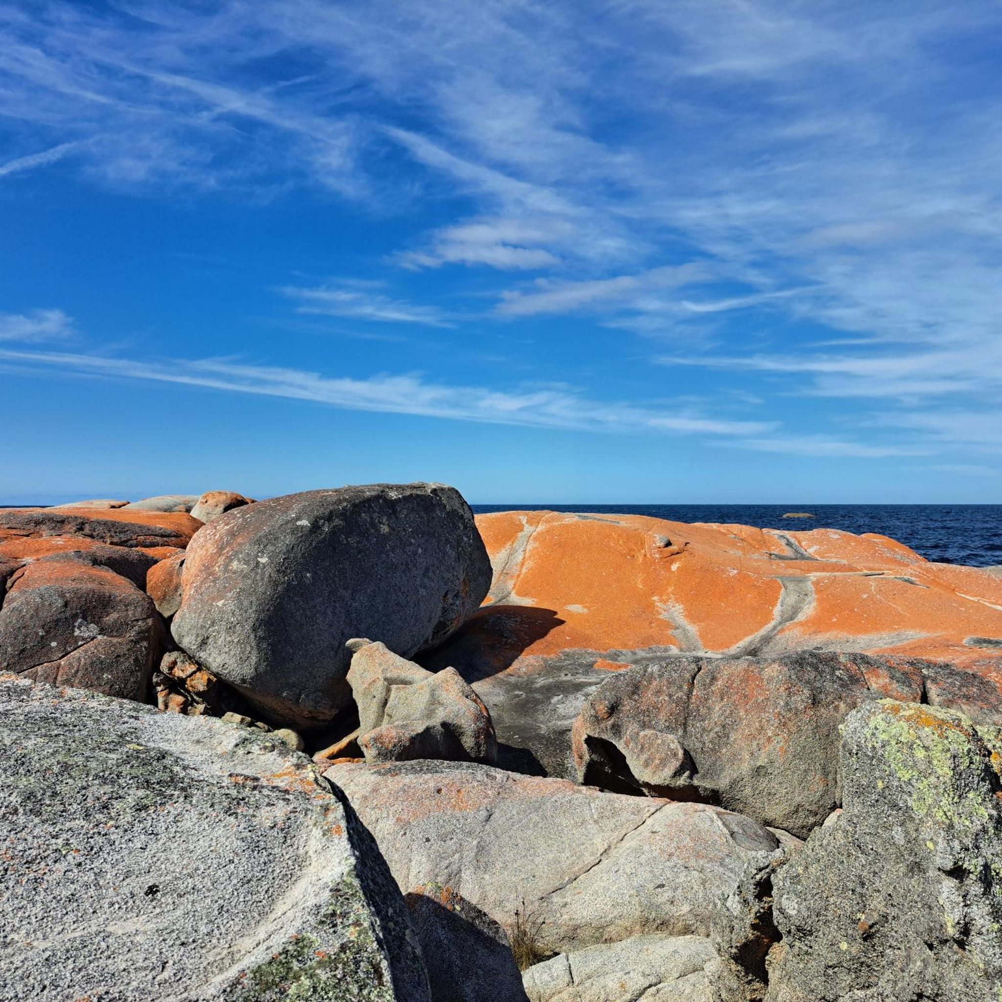
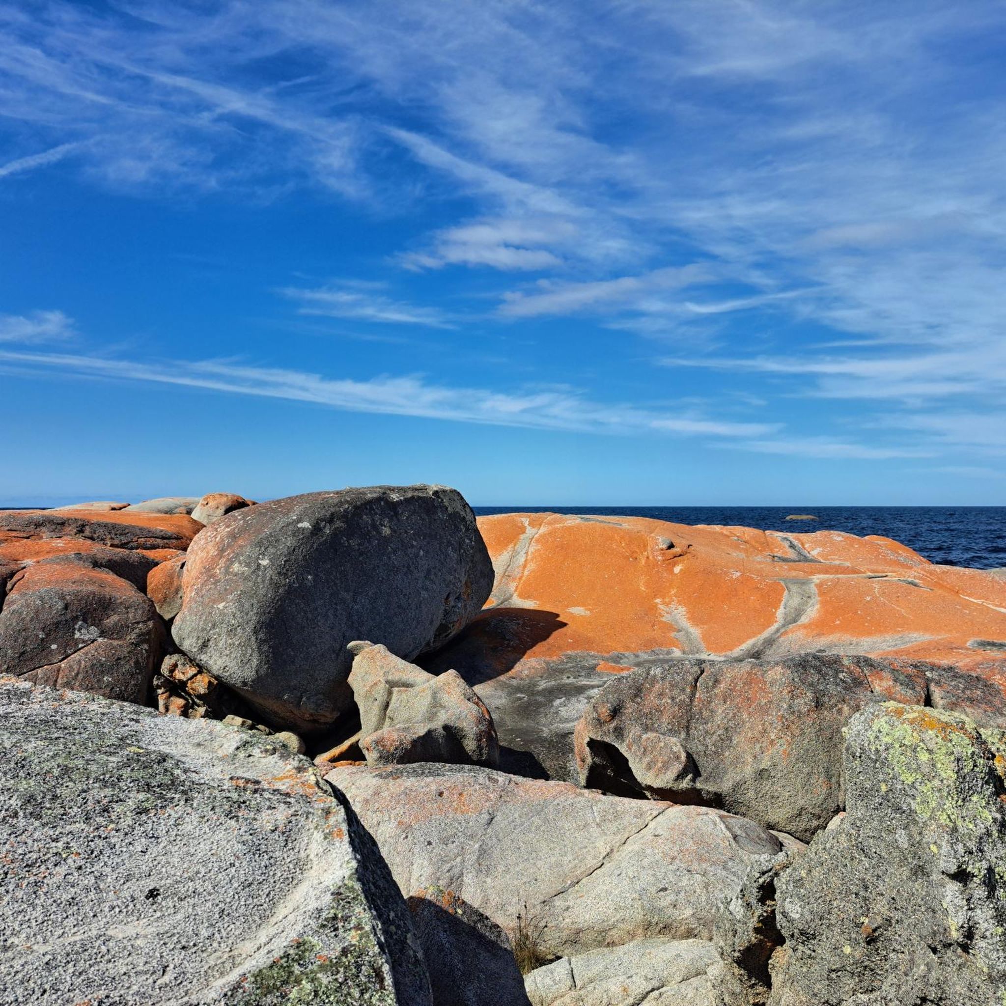
Tips from the Community

Rocks coloured by lichen to an amazing orange
0
0

5 minute return path off the hiking trail to Skeleton Bay Lookout. you may spot a whale if you're lucky 🐳
0
0
Frequently Asked Questions
How many hiking trails are available in the Bay of Fires Conservation Area?
There are 9 hiking routes in the Bay of Fires Conservation Area, offering a range of experiences from easy coastal strolls to more challenging treks.
What kind of terrain can I expect on hikes in the Bay of Fires?
Hikes in the Bay of Fires Conservation Area primarily feature pristine white-sand beaches, dramatic granite headlands adorned with vibrant orange lichen, and coastal paths. You'll also encounter heathlands, rocky bluffs, and lagoons, providing a diverse and visually striking environment.
Are there any easy, family-friendly walks in the Bay of Fires?
Yes, there are several easy options suitable for families. A great choice is the Binalong Bay Beach – Bay of Fires loop from Binalong Bay, an easy 3.8 km trail that offers direct access to the iconic white-sand beaches and orange lichen-covered boulders. Another easy option is the East Coast Whale Trail Lookout loop from Binalong Bay.
What are some notable natural features or landmarks to look out for while hiking?
The most distinctive features are the granite boulders encrusted with bright orange lichen, which create a striking contrast against the white sand and azure water. You'll also find secluded white-sand beaches, clear turquoise waters, and diverse ecosystems including heathlands. Specific lookouts like Skeleton Bay Lookout offer scenic views and opportunities to spot whales during migration.
Are there any circular walks in the Bay of Fires Conservation Area?
Yes, many of the trails are designed as loops. For example, the easy Binalong Bay Beach – Bay of Fires loop from Binalong Bay and the moderate Binalong Bay Beach – Skeleton Bay Lookout loop from Binalong Bay are popular circular routes.
What is the best time of year to hike in the Bay of Fires?
The Bay of Fires is beautiful year-round, but spring (September to November) and autumn (March to May) generally offer the most pleasant hiking conditions with mild temperatures and less extreme weather. Spring also brings native orchids into bloom. Summer can be warm, ideal for swimming, while winter offers crisp air and fewer crowds.
Are dogs allowed on the hiking trails in the Bay of Fires Conservation Area?
The Bay of Fires Conservation Area has specific regulations regarding pets to protect its natural environment and wildlife. It's best to check the official Parks Tasmania website for the most current information on where dogs are permitted. You can find details at parks.tas.gov.au.
Where can I park when visiting the Bay of Fires Conservation Area for hiking?
Parking is generally available at key access points along the Bay of Fires coastline, particularly around Binalong Bay and The Gardens. Specific parking areas are usually signposted near trailheads and popular beach access points.
What do other hikers enjoy most about hiking in the Bay of Fires Conservation Area?
The area is highly rated by the komoot community, with an average score of 4.8 stars. Reviewers often praise the stunning contrast of the white-sand beaches, turquoise waters, and the vibrant orange lichen-covered granite boulders. The diverse coastal scenery and the feeling of seclusion are also frequently highlighted.
Are there any challenging multi-day hiking options in the region?
While many trails are day hikes, the broader region offers more immersive experiences. The 'Bay of Fires Lodge Walk' is a guided multi-day hike that includes exclusive eco-lodge accommodation. For a challenging day hike, consider the Skeleton Bay Lookout – Dora's Bay loop from Binalong Bay, which covers varied coastal terrain.
Are there cafes or places to eat near the hiking trails?
Binalong Bay, located at the southern end of the Bay of Fires, offers a few options for cafes and dining. The nearby town of St Helens also provides a wider range of services, including restaurants and pubs, which are a short drive from many of the trailheads.
Do I need any permits or have to pay fees to hike in the Bay of Fires Conservation Area?
Generally, day walks within the Bay of Fires Conservation Area do not require specific permits or fees. However, for certain guided multi-day walks or specific areas within the broader national park system (like Mount William National Park to the north), permits may be required. It's always advisable to check the official Parks Tasmania website for the most up-to-date information on fees and permits: parks.tas.gov.au.
Most popular routes in Bay Of Fires Conservation Area

Get inspired with the komoot mobile app


Explore more
Browse the best Hikes in other regions.
