The best running trails around Dryden
5.0
(1)
33
runners
4
runs
Jogging around Dryden, Ontario, offers access to a diverse landscape characterized by the Boreal Forest and numerous freshwater lakes, including Wabigoon, Thunder, and Eagle Lake. The region features an extensive network of trails, totaling over 25 kilometers, that cater to various preferences and fitness levels. These routes often follow the Wabigoon River, wind through wetlands, or traverse Boreal forest, providing varied terrain for running. The trail systems connect urban areas with natural features, offering both accessible paths and more rugged…
Last updated: July 4, 2026
13
runners
10.9km
01:23
180m
180m
Moderate run. Good fitness required. Mostly accessible paths. Some sure footedness required.
8
runners
22.4km
02:19
80m
80m
Hard run. Very good fitness required. Mostly paved surfaces. Suitable for all skill levels.

Sign up for free
5.0
(1)
3
runners
9.38km
01:12
240m
230m
Moderate run. Good fitness required. Mostly paved surfaces. Suitable for all skill levels.
3
runners
6.24km
00:50
170m
170m
Moderate run. Good fitness required. Mostly paved surfaces. Suitable for all skill levels.
2
runners
Moderate run. Good fitness required. Mostly paved surfaces. Suitable for all skill levels.
Our route recommendations are based on thousands of hikes, rides, and runs completed by other people on komoot.
Start today with a free account
Your next adventure awaits.
Login or Signup
Popular around Dryden

Tips from the Community

Hartung–Boothroyd Observatory was begun in the 1930s and completed at last in 1974. It is primarily used to teach ungraduate courses at Cornell and sits at the summit of Mount Pleasant.
1
0

Mount Pleasant is a 1,751-foot mountain with Hartung–Boothroyd Observatory at its peak. Hartung–Boothroyd Observatory is run by Cornell University and is used for upper-level astronomy classes.
0
0

Summit of Mt. Pleasant Rd. Wikipedia page: https://en.wikipedia.org/wiki/Hartung%E2%80%93Boothroyd_Observatory
1
1
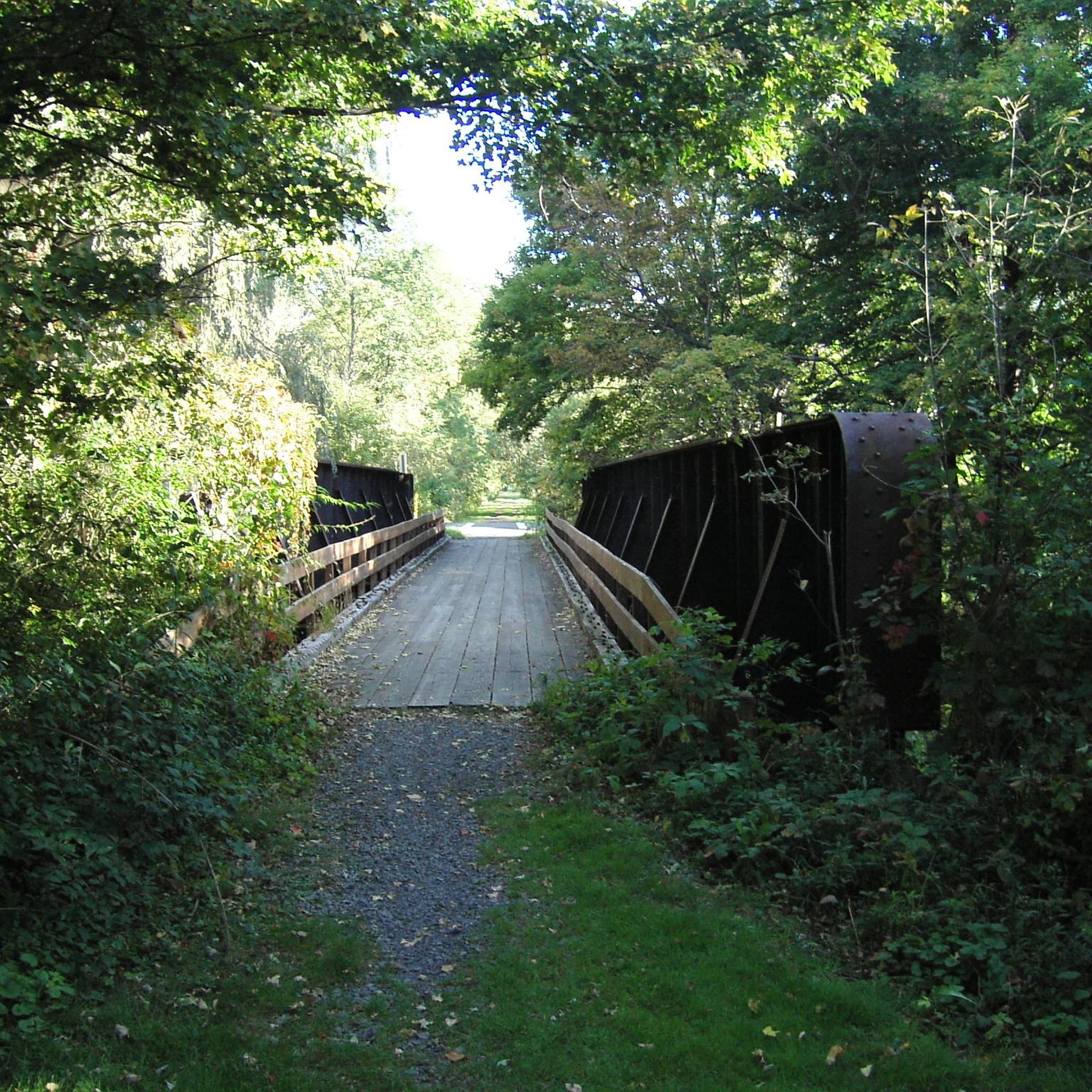
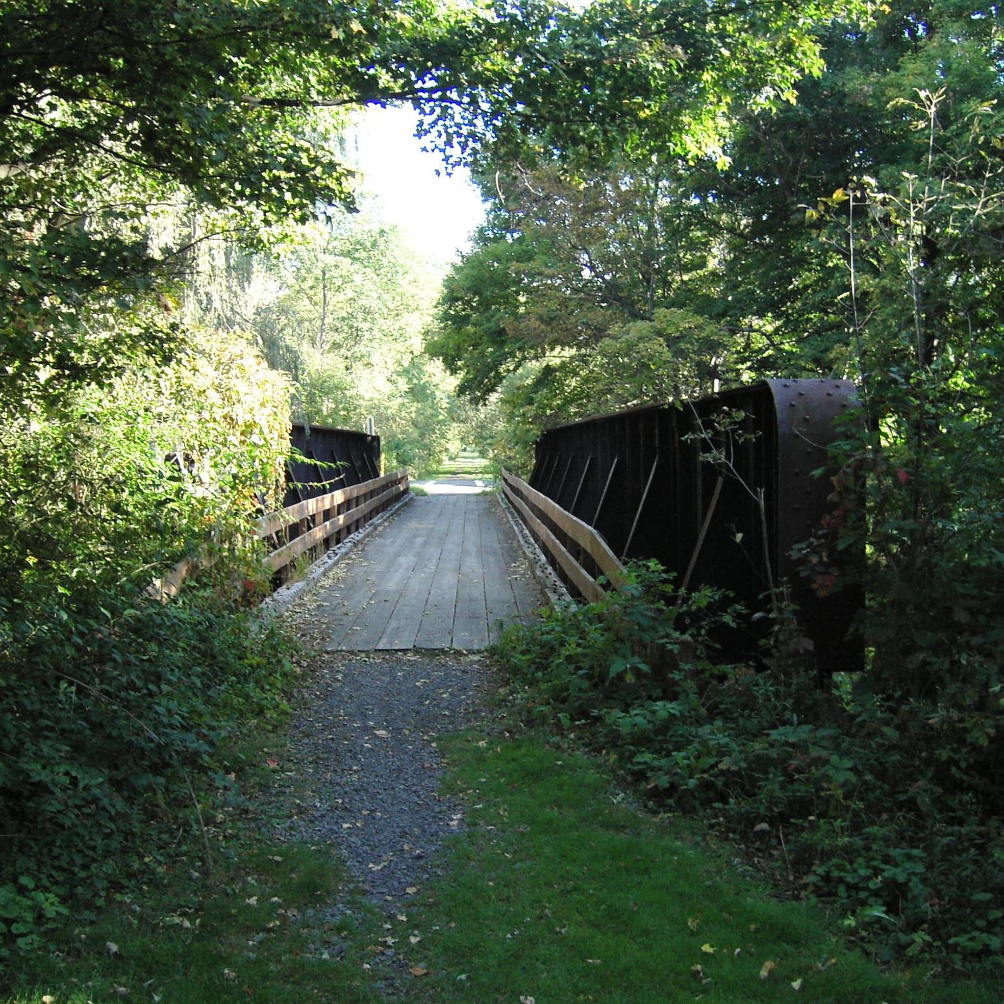
Mix of large and small hard packed gravel surface. Former Lehigh Valley railroad bed. Good views of Dryden Lake and marsh habitats. Expect runners, dog walkers, etc. Some maps show trail extending to north - however north of Ferguson St in Dryden is a grass trail. Maintained by the Town of Dryden: http://dryden.ny.us/departments/planning-department/dryden-trails/jim-schug-trail/
0
0
Frequently Asked Questions
What types of running routes can I find in Dryden, NY?
Dryden offers a diverse range of running routes, from multi-use rail trails to more rugged forest paths. You can enjoy relatively flat and accessible trails like the Dryden Rail Trail and Jim Schug Trail, or explore winding paths along Fall Creek in areas like Campbell Meadows and Genung Nature Preserve. For those seeking more challenging terrain, state forests such as Hammond Hill State Forest provide expansive and rugged options.
Are there any easy or beginner-friendly jogging routes in Dryden?
Yes, Dryden has several accessible options perfect for beginners or those looking for an easy run. The James Kennedy State Forest loop from Virgil Transfer Station is a moderate 6.2 km route, offering a pleasant experience. Additionally, the Jim Schug Trail, part of the Dryden Rail Trail, is known for its flat and easy surface, ideal for a smooth run.
Where can I find scenic running trails with viewpoints in Dryden?
Many routes in Dryden offer picturesque views, especially those along Fall Creek, such as the trails in Campbell Meadows and Genung Nature Preserve. The Monkey Run Preserve also presents scenic views and beautiful foliage. For a run through varied natural surroundings, consider the Star Stanton Hill loop from Roy H. Park Nature Preserve, a moderate 7.3 km path.
Are there any circular jogging routes available in Dryden?
Yes, several circular routes are popular among local runners. For a moderate run, try the Star Stanton Hill loop from Hammond Hill State Forest, which is 10.9 km. If you're looking for a longer, more challenging option, the Star Stanton Hill – Hammond Hill State Forest loop from Hammond Hill State Forest covers 17.5 km through forested areas.
What are some natural features or landmarks I might see while running in Dryden?
Dryden's routes often pass through diverse natural settings. Along the Dryden Rail Trail, you can observe wildlife and even active beaver dams in the Cornell Botanic Gardens Purvis Road Wetlands Natural Area. Dryden Lake Park offers scenic views of its 0.75-mile lake. Other preserves like Sapsucker Woods Sanctuary provide serene backdrops with forests, ponds, and abundant wildlife.
Are the jogging routes in Dryden suitable for families?
Many of Dryden's trails are family-friendly, especially the flatter, multi-use paths. The Jim Schug Trail, for instance, is flat and easy, making it suitable for all ages. Dryden Lake Park also offers a pleasant environment with amenities like restrooms and picnic shelters, ideal for a family outing combined with a run.
Can I bring my dog on the running trails in Dryden?
While specific regulations vary by preserve and trail, many multi-use trails and state forests in Dryden are generally dog-friendly, provided your dog is leashed. Always check local signage or park websites for the most current rules regarding pets on specific trails to ensure a pleasant experience for everyone.
Are there options for longer, more challenging runs in Dryden?
Absolutely. For experienced runners seeking a challenge, the Star Stanton Hill – Hammond Hill State Forest loop from Hammond Hill State Forest is a difficult 17.5 km trail that takes about 2 hours 15 minutes to complete. Hammond Hill State Forest itself offers 8 trails spanning 5.6 miles through rugged terrain.
What do other runners enjoy most about jogging in Dryden?
The running routes in Dryden are highly rated by the komoot community, with an average score of 5.0 stars. Runners often praise the diverse terrain, from accessible rail trails to challenging forest paths, and the opportunity to experience the region's beautiful natural landscapes, including Boreal forests and scenic wetlands.
Are there any running routes accessible by public transport in Dryden?
While many trails in Dryden are best accessed by car, the Dryden Rail Trail connects the villages of Dryden and Freeville, and the hamlets of Etna and Varna, which may offer some public transport access points. For specific public transport options to trailheads, it's recommended to check local transit schedules for routes serving these areas.
Where can I find parking for the jogging routes in Dryden?
Many popular trailheads and parks in Dryden, such as Dryden Lake Park and access points for the Dryden Rail Trail, offer designated parking areas. For routes within state forests like Hammond Hill State Forest, parking is typically available at trail entrances. Always look for official parking lots to ensure proper access and avoid issues.
Most popular routes around Dryden

Get inspired with the komoot mobile app


Explore more
Browse the best Running Trails & Routes in other regions.
