The best walks and hikes in Windermere Lake Provincial Park
4.9
(7)
59
hikers
4
hikes
Hiking in Windermere Lake Provincial Park offers diverse landscapes within British Columbia's East Kootenay region. The park is centered around the 13-kilometer Windermere Lake, known for its shallow waters and sandy beaches. To the west, the Purcell Mountain Range rises, while the Rocky Mountains form the eastern backdrop. The area features native grassland, riparian habitats, lush forests, and meadows, providing varied terrain for exploration.
Best hiking trails in Windermere Lake Provincial Park
- The most popular hiking route is Columbia Wetland Viewpoint via Tatley Slough Lookout trail — Windermere, BC, a 2.3 miles (3.6 km) trail that takes 58 minutes to complete. This easy path leads through open forest to a viewpoint overlooking Tatley Slough and the Columbia Wetlands.
- Another top favourite among local hikers is Swansea Peak Summit – View from Swansea Summit loop from Windermere Creek Bed & Breakfast Cabins, a difficult 8.0 miles (12.9 km) path. This challenging route offers significant elevation gain and panoramic vistas from the summit of Mount Swansea.
- Local hikers also love the Windermere Lake loop via Windermere Lake — Invermere, an 11.3 miles (18.2 km) trail leading through varied terrain around the lake, often completed in about 4 hours 59 minutes.
- Hiking in Windermere Lake Provincial Park is defined by tranquil lake shores, diverse forest paths, and mountain backdrops. The network offers options for different ability levels, from gentle strolls to challenging mountain ascents.
- The routes in Windermere Lake Provincial Park are highly rated by the komoot community with an average score of 4.9 stars from 6 reviews. More than 50 hikers have used komoot to explore Windermere Lake Provincial Park's varied terrain.
Last updated: July 12, 2026
4.7
(3)
16
hikers
Easy hike. Great for any fitness level. Easily-accessible paths. Suitable for all skill levels.
5.0
(2)
30
hikers
5.79km
02:19
310m
310m
Moderate hike. Good fitness required. Mostly accessible paths. Sure-footedness required.

Sign up for free
5.0
(2)
12
hikers
Hard hike. Very good fitness required. Mostly accessible paths. Sure-footedness required.
18.2km
04:59
280m
280m
Moderate hike. Good fitness required. Easily-accessible paths. Suitable for all skill levels.
3
hikers
4.33km
01:09
40m
40m
Easy hike. Great for any fitness level. Easily-accessible paths. Suitable for all skill levels.
Our route recommendations are based on thousands of hikes, rides, and runs completed by other people on komoot.
Start today with a free account
Your next adventure awaits.
Login or Signup
Popular around Windermere Lake Provincial Park
Tips from the Community

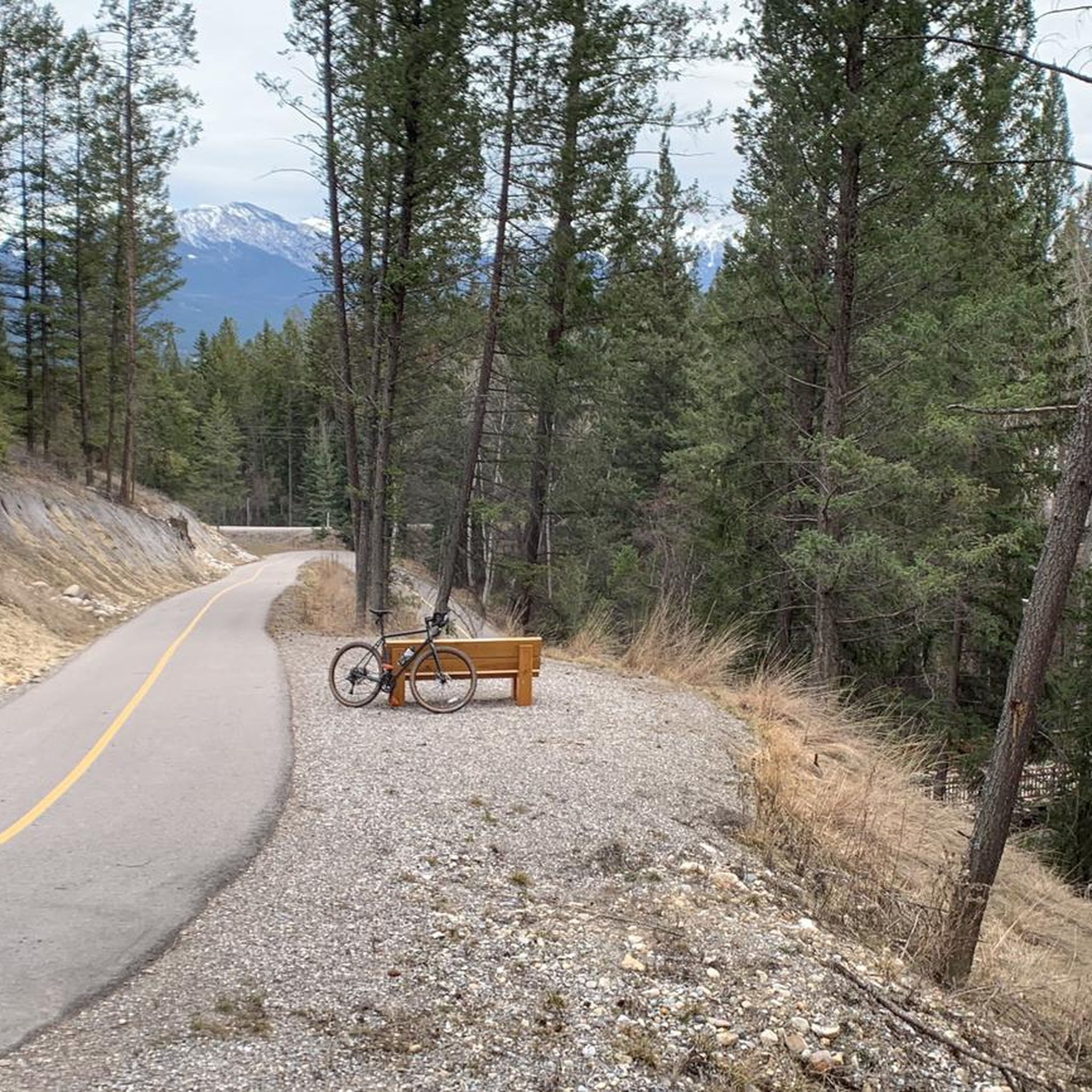
The Markin-MacPhail Westside Legacy Trail is a 25 kilometer multi-use trail linking the towns of Invemere and Fairmont. The trail is dotted with a number of picnic area, viewpoint, benches, and information kiosks making it a great place for the family to get out and enjoy the scenery.
0
0
Nestled in British Columbia’s East Kootenay region along the Columbia River system, Windermere Lake is a tranquil 13-kilometre lake celebrated for its warm shallow waters, wide sandy beaches, and relaxed atmosphere. Shoreline trails wind through forest and meadow, perfect for a peaceful hike or relaxing picnic.
0
0

This short and gentle trail winds through open forest to a small viewpoint overlooking Tatley Slough and the Columbia Wetlands. It’s a good choice for an easy walk, quick run, or snowshoe in winter.
0
0
At the end of the trail, this lookout offers a wide view over the Columbia Wetlands — one of the largest intact wetland systems in North America. From the bench at the top, you can take in the winding channels of the Columbia River and the surrounding mountain ranges. It’s a quiet, scenic spot to rest, watch for birds, and enjoy the scale of the valley below.
0
0
This easy out-and-back trail leads to a viewpoint overlooking the expansive Columbia Wetlands — one of North America’s largest intact wetlands. Along the route you’ll pass forested sections and open ridge spots where you can pause and watch for birds, wildlife and sweeping valley views.
0
0

Bench with a view, overlooking Windermere and the Lake. The Markin-MacPhail Westside Legacy Trail can get quite steep at times, so a nice rest with a view may be very welcome.
1
0
Frequently Asked Questions
What kind of terrain can I expect on hiking trails in Windermere Lake Provincial Park?
The park offers a diverse range of terrain, from tranquil shoreline paths along Windermere Lake to trails winding through native grasslands, lush forests, and meadows. You'll find gentle, flat sections as well as more challenging ascents, particularly on routes leading to higher viewpoints.
Are there any easy, family-friendly hiking options in Windermere Lake Provincial Park?
Yes, there are several easy options suitable for families. The Columbia Wetland Viewpoint via Tatley Slough Lookout trail is an easy 2.3-mile (3.6 km) path through open forest, leading to a scenic viewpoint. Another gentle option is the Kinsmen Beach loop from James Chabot Provincial Park, which is also considered easy.
Are dogs allowed on the hiking trails in Windermere Lake Provincial Park?
Windermere Lake Provincial Park is generally dog-friendly, but it's always recommended to keep your dog on a leash to protect wildlife and ensure a pleasant experience for all visitors. Please remember to pack out any waste.
What are some notable natural features or viewpoints I can see while hiking?
Hikers can enjoy stunning views of Windermere Lake, the Purcell Mountains to the west, and the Rocky Mountains to the east. The Columbia Wetland Viewpoint offers a glimpse of Tatley Slough and the expansive Columbia Wetlands. For panoramic vistas, the challenging Swansea Peak Summit loop provides rewarding views from Mount Swansea.
Are there any circular hiking routes in the park?
Yes, the Windermere Lake loop via Windermere Lake — Invermere is a notable circular route, covering 11.3 miles (18.2 km) around the lake. For a more challenging loop with significant elevation gain, consider the Swansea Peak Summit loop.
When is the best time of year to go hiking in Windermere Lake Provincial Park?
The best time for hiking is typically from late spring through early fall (May to October) when the weather is mild and trails are clear of snow. Summer offers warm, shallow lake waters for swimming after a hike. While winter hiking is possible, be prepared for snow and ice conditions.
Is there parking available at the trailheads?
Access to Windermere Lake Provincial Park is generally undeveloped and often unmarked from Westside Road. Parking availability can vary by trailhead, with some areas offering designated spots and others requiring roadside parking. It's advisable to check specific route details for parking information.
What kind of wildlife might I encounter while hiking?
The park is home to diverse wildlife, including large populations of white-tail deer, mule deer, and elk, especially during winter. Birdwatching is also popular due to the varied habitats. Always maintain a respectful distance and do not feed any animals.
What do other hikers enjoy most about hiking in Windermere Lake Provincial Park?
The area is highly rated by the komoot community, with an average score of 4.9 stars. Reviewers often praise the tranquil lake shores, diverse forest paths, and the stunning mountain backdrops provided by the Purcell and Rocky Mountains. The variety of trails catering to different ability levels is also frequently highlighted.
Are there any challenging trails for experienced hikers?
Yes, for experienced hikers seeking a challenge, the Swansea Peak Summit – View from Swansea Summit loop is a difficult 8.0-mile (12.9 km) path with significant elevation gain, offering rewarding panoramic views from the summit of Mount Swansea.
How long do hikes in Windermere Lake Provincial Park typically take?
Hike durations vary significantly depending on the route and your pace. An easy trail like the Columbia Wetland Viewpoint via Tatley Slough Lookout trail might take less than an hour, while the 11.3-mile (18.2 km) Windermere Lake loop can take around 5 hours. More challenging routes like the Swansea Peak Summit loop can take over 5 hours.
Are there any fees or permits required for hiking in the park?
Generally, there are no specific fees or permits required for day hiking within Windermere Lake Provincial Park itself. However, it's always a good idea to check the latest regulations from BC Parks before your visit, especially for any specific activities or areas.
Most popular routes in Windermere Lake Provincial Park

Get inspired with the komoot mobile app


Explore more
Browse the best Hikes in other regions.
