The best cycling routes around Alcollarín
5.0
(2)
22
riders
7
rides
Touring cycling routes around Alcollarín are set within the province of Cáceres, Extremadura, Spain, characterized by its serene landscapes. The region's most prominent feature is the Alcollarín Reservoir, which offers open landscapes and views. Surrounding the reservoir are extensive *dehesa* areas, an agroforestry system of scattered oak trees and pastures. The terrain is generally easy, making it suitable for various cycling abilities.
Best touring cycling routes around Alcollarín
- The most popular touring cycling route is Ruecas River in Palazuelo –…
Last updated: June 30, 2026
4
riders
39.7km
02:38
610m
610m
Hard bike ride. Very good fitness required. Mostly paved surfaces. Suitable for all skill levels.
4
riders
45.2km
03:50
480m
480m
Hard bike ride. Very good fitness required. Mostly paved surfaces. Suitable for all skill levels.

Sign up for free
5.0
(2)
2
riders
15.4km
01:00
40m
40m
Easy bike ride. Great for any fitness level. Mostly paved surfaces. Suitable for all skill levels.
2
riders
28.8km
02:33
470m
470m
Hard bike ride. Very good fitness required. Mostly paved surfaces. Suitable for all skill levels.
3
riders
39.9km
03:38
660m
660m
Hard bike ride. Very good fitness required. Mostly paved surfaces. Suitable for all skill levels.
Get access to more routes and recommendations from other explorers.
Sign up for free
Already have an account?
Our route recommendations are based on thousands of hikes, rides, and runs completed by other people on komoot.
Start today with a free account
Your next adventure awaits.
Login or Signup
Popular around Alcollarín

Tips from the Community

Market Hall. Building constructed in 1959, recently renovated; unique architecture with brick facade and gabled roof.
2
0
In the 16th century, it was the seat of the estate of Martín de Chaves, founder of the Chaves mayorazgo. Subsequently, it passed to the Vargas Carvajal family, who held the office of courier of the Indies and, later, the title of counts of Castillejo. The estate included the Viña de Aceituno. In 1594, it was part of the Tierra de Trujillo in the province of Trujillo. Since 1834, it was integrated into the Judicial Party of Logrosán
17
0
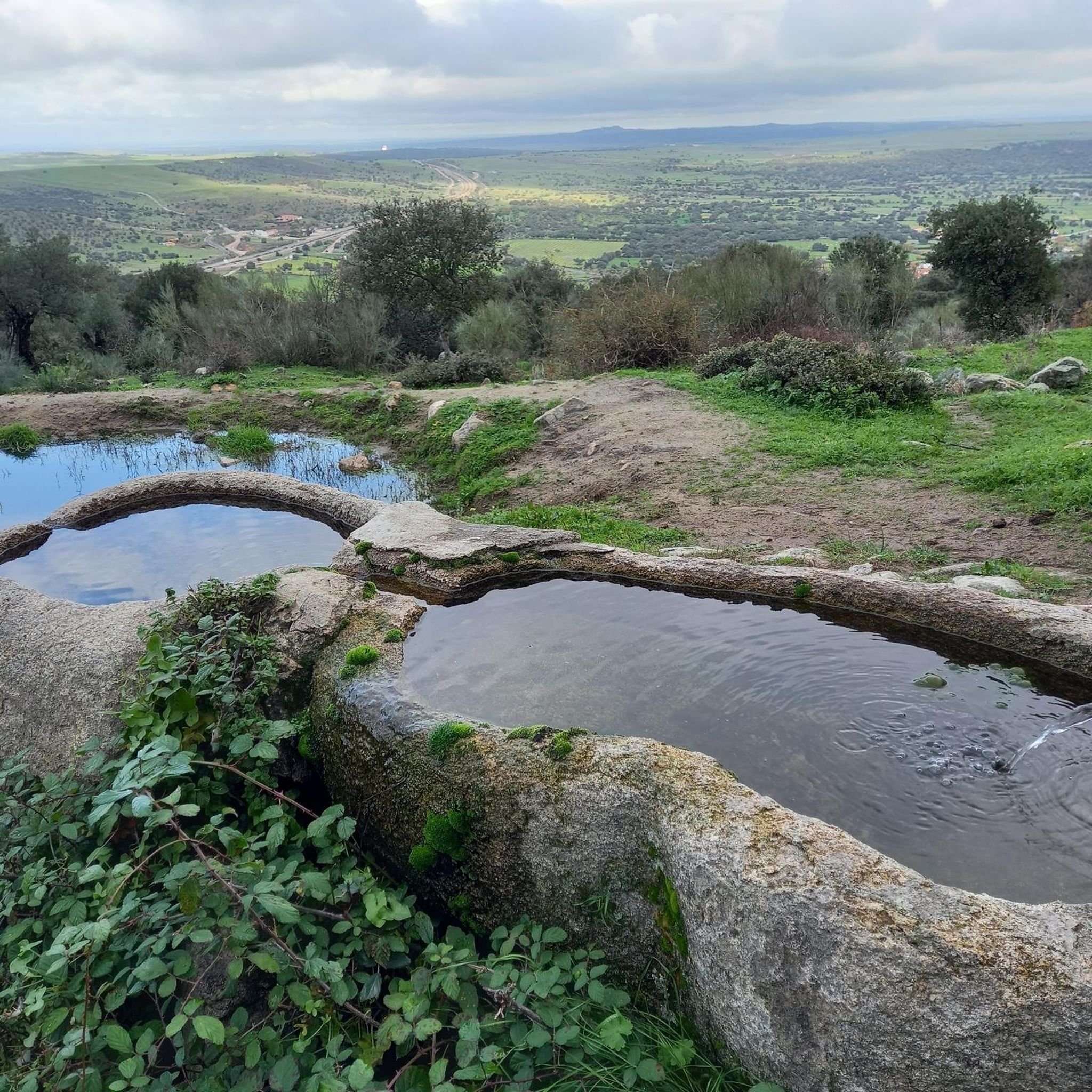
Conquista de la Sierra's location between the Sierras de Madernalo (also known as Sierras de Conquista and Garciaz) offers a beautiful natural environment. Take the opportunity to explore the surroundings and enjoy nature.
15
0
Zorita is a Spanish town and municipality, in the province of Cáceres, autonomous community of Extremadura. It belongs to the judicial district of Logrosán and the Zona Centro community. Zorita sits on a flat terrain with some alterations such as Monte de la Peña or Monte de la Cabeza del Águila. It is worth noting the steep slopes in an important part of the municipal area, which are sometimes greater than 20%. The evolution followed by the population of Zorita is very similar to that of other Extremaduran municipalities. Although its growth was gradual until the middle of the century, from that date onwards the general movement was towards decline. Emigration has hit this town so hard that it has managed, in just over 10 years, to reduce its numbers by half. If in 1950 Zorita had 6,482 inhabitants, in 1970 this figure was 3,627. Currently, the population tends to stabilize, trying to overcome the significant decline of those years. Heritage: St. Paul Parish Church. Hermitage of Fuente Santa and Temple from the 17th century. The Pareños of Malillo.
16
0

Ferdinand the Catholic died here
1
0
Frequently Asked Questions
How many touring cycling routes are available around Alcollarín?
There are 6 touring cycling routes around Alcollarín listed on komoot. These routes offer a mix of easy, moderate, and difficult options, catering to various skill levels.
What is the general terrain like for touring cycling in Alcollarín?
The terrain around Alcollarín is generally described as easy, making it suitable for touring cyclists who prefer less strenuous routes. You'll primarily encounter open landscapes, especially around the Alcollarín Reservoir, and extensive dehesa areas with scattered oak trees and pastures.
Are there any circular touring cycling routes in Alcollarín?
Yes, many of the touring cycling routes in Alcollarín are circular. For example, the Madrigalejo Market loop from Madrigalejo is an easy 15.4 km (9.5 miles) route, and the more challenging Risco de San Gregorio loop from Santa Cruz de la Sierra covers 39.9 km (24.8 miles) with significant elevation gain.
What kind of natural features or landmarks can I expect to see along the touring cycling routes?
The most prominent natural feature is the Alcollarín Reservoir, offering beautiful landscapes and sunsets. You can also find a Birdwatching viewpoint and areas with Stork nests. The routes often traverse dehesa landscapes, which are traditional Mediterranean agroforestry systems. You might also encounter sections of the Vía Verde Vegas del Guadiana or the Natural Trail Greenway of the Vegas del Guadiana.
What is the best time of year to go touring cycling in Alcollarín?
While specific weather data isn't provided, Extremadura generally experiences hot summers. For comfortable touring cycling, spring (March to May) and autumn (September to November) are typically ideal, offering milder temperatures and pleasant conditions to enjoy the open landscapes and birdlife.
Are there any family-friendly touring cycling routes in Alcollarín?
Yes, the generally easy terrain around the Alcollarín Reservoir makes it suitable for families. The Madrigalejo Market loop from Madrigalejo is an easy 15.4 km (9.5 miles) route with minimal elevation gain, making it a good option for families or beginners.
What are the options for more challenging touring cycling routes?
For those seeking a challenge, Alcollarín offers several difficult routes. The Risco de San Gregorio loop from Santa Cruz de la Sierra is a difficult 39.9 km (24.8 miles) path with significant elevation gain. Another demanding option is the Herguijuela – Conquista de la Sierra loop from Conquista de la Sierra, which covers 39.6 km (24.6 miles) with over 600 meters of ascent.
What do other touring cyclists say about the routes in Alcollarín?
The touring cycling routes around Alcollarín are highly rated by the komoot community, with an average score of 5.0 stars from a few reviews. Cyclists often appreciate the serene landscapes, the views of the Alcollarín Reservoir, and the opportunities for birdwatching.
Is Alcollarín a good destination for birdwatching while cycling?
Absolutely. The Alcollarín Reservoir is a significant attraction for birdwatchers, with numerous species present, including various ducks, Gull-billed Terns, Collared Pratincoles, and Common Cranes in winter. The Ruecas River in Palazuelo – Birdwatching viewpoint loop from Madrigalejo is specifically highlighted for its birdwatching opportunities.
Are there any long-distance touring cycling routes available?
Yes, for longer rides, consider the Ruecas River in Palazuelo – Birdwatching viewpoint loop from Madrigalejo. This moderate route spans 75.6 km (47.0 miles) and takes approximately 4 hours and 27 minutes to complete, offering extensive views and birdwatching opportunities.
Can I find routes that pass through towns or settlements?
Yes, some routes connect to or pass near local settlements. For instance, the Zorita loop from Zorita starts and ends in the settlement of Zorita, allowing you to explore local charm.
Most popular routes around Alcollarín
Most popular attractions around Alcollarín

Get inspired with the komoot mobile app


Explore more
Browse the best Cycling routes in other regions.
