The best gravel rides around Salir De Matos
4.8
(5)
15
riders
3
rides
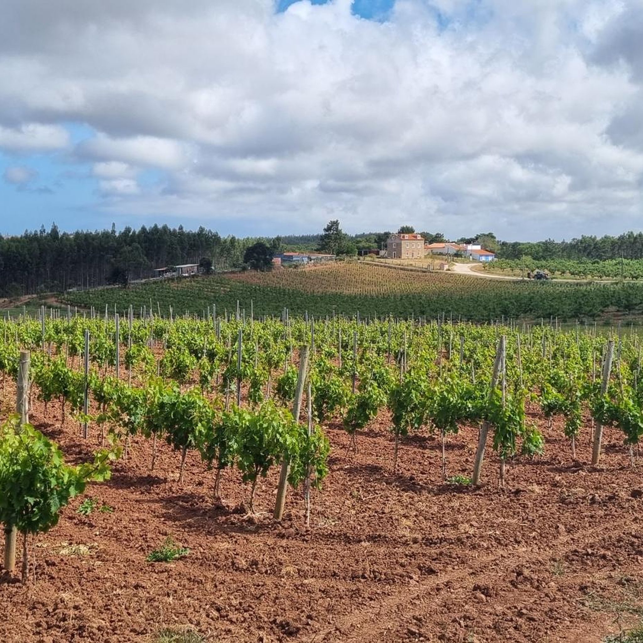
Gravel biking around Salir De Matos offers diverse terrain, from undulating hills to coastal paths, making it a compelling destination for outdoor activities. The region features a mix of paved roads winding through woodlands, orchards, and vineyards, alongside dedicated gravel paths. Cyclists can explore rural areas and enjoy scenic landscapes, including views of the Atlantic coast and the Óbidos Lagoon. This varied environment provides engaging climbs and descents suitable for gravel biking.
Best gravel bike trails around Salir De Matos
…Last updated: July 25, 2026
4.5
(4)
10
riders
45.0km
02:32
420m
420m
Moderate gravel ride. Good fitness required. Mostly paved surfaces. Suitable for all skill levels.
2
riders
31.7km
01:54
270m
270m
Moderate gravel ride. Good fitness required. Mostly paved surfaces. Suitable for all skill levels.

Sign up for free
2
riders
27.8km
01:32
260m
260m
Moderate gravel ride. Good fitness required. Mostly paved surfaces. Suitable for all skill levels.
5.0
(1)
1
riders
10.1km
00:42
200m
200m
Moderate gravel ride. Good fitness required. Mostly paved surfaces. Suitable for all skill levels.
Our route recommendations are based on thousands of hikes, rides, and runs completed by other people on komoot.
Start today with a free account
Your next adventure awaits.
Login or Signup
Tips from the Community

Poorly maintained, some sections dangerous because of landslides due to the water and rain. If you like to bike in dense vegetation and get your face smacked, this is for you. If else, take the road nearby
0
0

An entrance in the city wall, with some tile panels that I loved seeing.
6
0
Beautiful photos. Thank you 🙏
6
1

The Porta da Vila is the city's main gate. It consists of two low, staggered gates to prevent a direct cavalry charge, as was often the case with Gothic Portuguese castles. Between the gates is a small balcony that served as a prayer room, with beautiful blue and white tiles (azulejos) from 1740 depicting the Passion of Christ. Street performers often play there because of the acoustics.
5
0

Turn boldly here and cross the sign area.
0
0

The Óbidos Lagoon is the largest coastal lagoon system on the Portuguese coast. It has a total area of approximately 6.9 km2 and an average depth of two metres, with elevations ranging from half a metre to five metres. It extends upstream essentially through two channels, to the west by the Braço do Bom Sucesso, and to the east by the Braço da Barrosa. It shares a land border with the municipality of Caldas da Rainha to the north (parishes of Foz do Arelho and Nadadouro) and with the municipality of Óbidos to the south (parishes of Vau and Santa Maria). To the south is the Poça do Vau and to the west it is connected to the Poça das Ferrarias. It has a maximum length of 6 km and a width that varies between 1 and 1.5 km, with a preferential NW-SW orientation.
0
0

It is best to visit in the winter months, when you have air in the narrow streets
1
0

A beautiful place that I would not want to miss
4
1
Frequently Asked Questions
How many gravel bike trails are available around Salir de Matos?
There are several gravel biking routes around Salir de Matos, with komoot featuring at least 4 distinct trails. These routes offer varied terrain and scenic views, primarily around the Óbidos Lagoon and nearby areas.
What kind of terrain can I expect on gravel bike trails around Salir de Matos?
The terrain around Salir de Matos is quite diverse, featuring undulating hills that provide engaging climbs and descents. You'll encounter a mix of mostly paved roads winding through woodlands, orchards, and vineyards, as well as dedicated gravel paths. Many routes offer scenic coastal views and paths around the picturesque Óbidos Lagoon.
What is the difficulty level of gravel biking routes in Salir de Matos?
Most gravel biking routes in Salir de Matos are considered moderate in difficulty. They are suitable for riders with some experience, offering a good balance of challenge and enjoyment without being overly strenuous. For example, the Lagoa de Óbidos Gravel Trail is a moderate 45 km route.
Are there any interesting landmarks or natural features to see along the gravel bike trails?
Yes, the region is rich in natural beauty and historical sites. Many routes pass by or offer views of the Óbidos Lagoon. You can also explore the historic town of Óbidos, with its impressive Town Gate and Óbidos Castle. The Salir do Porto Dune, Portugal's tallest sand dune, offers panoramic views of São Martinho do Porto Bay.
What do other gravel bikers enjoy the most about gravel biking in Salir de Matos?
The komoot community highly rates the gravel biking experience in Salir de Matos, with an average score of 4.7 stars. Riders often praise the varied terrain, the beautiful coastal and lagoon views, and the opportunity to explore charming rural areas and historical sites like Óbidos.
Are there any circular gravel bike routes in the area?
Yes, several routes are designed as loops, making them convenient for starting and ending at the same point. For instance, the Óbidos Lagoon loop from Caldas da Rainha and the Óbidos – Town Gate loop from Caldas da Rainha are popular circular options.
What is the best time of year for gravel biking in Salir de Matos?
The region generally enjoys a mild climate, making it suitable for gravel biking for much of the year. Spring and autumn offer pleasant temperatures and lush landscapes, ideal for longer rides. Even winter can be enjoyable, though some paths might be wetter. Summer can be warm, so early morning or late afternoon rides are recommended.
Are there family-friendly gravel biking options in Salir de Matos?
While many routes are moderate, the varied terrain means there are sections suitable for families, especially around the flatter parts of the Óbidos Lagoon. The 'Caminhos da Rainha' network, with its marked pedestrian and cycling paths, often includes easier sections that families can enjoy. Always check the route details for elevation and surface type to ensure it matches your family's skill level.
Is Salir de Matos suitable for dog-friendly gravel biking?
Many natural trails and rural roads in the Salir de Matos area are generally dog-friendly, provided your dog is well-behaved and on a leash where necessary. Always be mindful of local regulations, livestock, and other trail users. Ensure you carry enough water for both yourself and your dog, especially on longer rides.
Can I access gravel bike trails in Salir de Matos using public transport?
Salir de Matos is near Caldas da Rainha, which has public transport connections. While direct access to trailheads might require a short ride from public transport stops, many routes, like those starting from Caldas da Rainha, are accessible if you're willing to cycle a short distance to the main gravel paths. Consider checking local bus schedules for connections to smaller towns near trail starting points.
Are there any routes that combine gravel biking with historical exploration?
Absolutely. The region is perfect for combining cycling with cultural discovery. The Óbidos Lagoon – Óbidos – Town Gate loop is a prime example, leading you through the historic area near Óbidos, allowing you to experience the medieval charm of the town while enjoying a gravel ride.
What are the typical distances and durations for gravel rides in this area?
Gravel rides in Salir de Matos vary in length and duration. You can find routes ranging from shorter 19.5 km rides, like the Chafariz das Cinco Bicas loop, which takes around 1 hour 27 minutes, to longer trails such as the Lagoa de Óbidos Gravel Trail, which is 45 km and typically takes over 3 hours to complete.
Most popular attractions around Salir De Matos

Get inspired with the komoot mobile app


Explore more
Browse the best Gravel rides in other regions.
