The best walks and hikes around Almagreira
4.9
(14)
56
hikers
5
hikes
Hiking around Almagreira offers diverse opportunities to explore a region characterized by its wild, untouched beauty and dramatic coastal scenery. The landscape features extensive sandy stretches framed by striking ochre and sandy cliffs, creating natural nooks and small caves. Inland, the terrain includes mixed environments suitable for various outdoor activities, with scenic coastal paths providing panoramic ocean views. These Almagreira hiking routes showcase distinct rock formations and expansive natural environments.
Best hiking trails around Almagreira
- The most popular hiking route…
Last updated: July 11, 2026
4.5
(8)
31
hikers
Moderate hike. Good fitness required. Mostly accessible paths. Sure-footedness required.
5.0
(1)
8
hikers
12.0km
03:48
410m
410m
Moderate hike. Good fitness required. Mostly accessible paths. Sure-footedness required.

Sign up for free
5.0
(1)
8
hikers
10.8km
02:56
150m
150m
Moderate hike. Good fitness required. Easily-accessible paths. Suitable for all skill levels.
5.0
(4)
7
hikers
7.16km
02:11
210m
220m
Moderate hike. Good fitness required. Mostly accessible paths. Sure-footedness required.
2
hikers
Moderate hike. Good fitness required. Easily-accessible paths. Suitable for all skill levels.
Our route recommendations are based on thousands of hikes, rides, and runs completed by other people on komoot.
Start today with a free account
Your next adventure awaits.
Login or Signup



Tips from the Community

The Chapel of Our Lady of the Star is sheltered by an impressive grotto, which rises like a stone mantle over the temple. Once a simple cavity, it grew until it took on its current form. Inside, a staircase leads to the deepest grotto. And, at the top, a small viewpoint guards the image of Our Lady of the Star facing the sea, recalling the legend that says she guided a fisherman back home.
2
0
The Poio Valley stands as a well-kept secret of the mountains, preserved for centuries by its rugged, steep, wild, and inaccessible geography. Only shepherds and adventurers used to know these paths. Perhaps that is why a rare fauna found refuge here. It is one of the largest fluviokarstic canyons in Portugal, a valley patiently sculpted by water, which left monumental slopes and a breathtaking landscape. To the south lies Poio Velho; to the north, the more famous Poio Novo, two chapters of the same magnificent landscape.
2
0
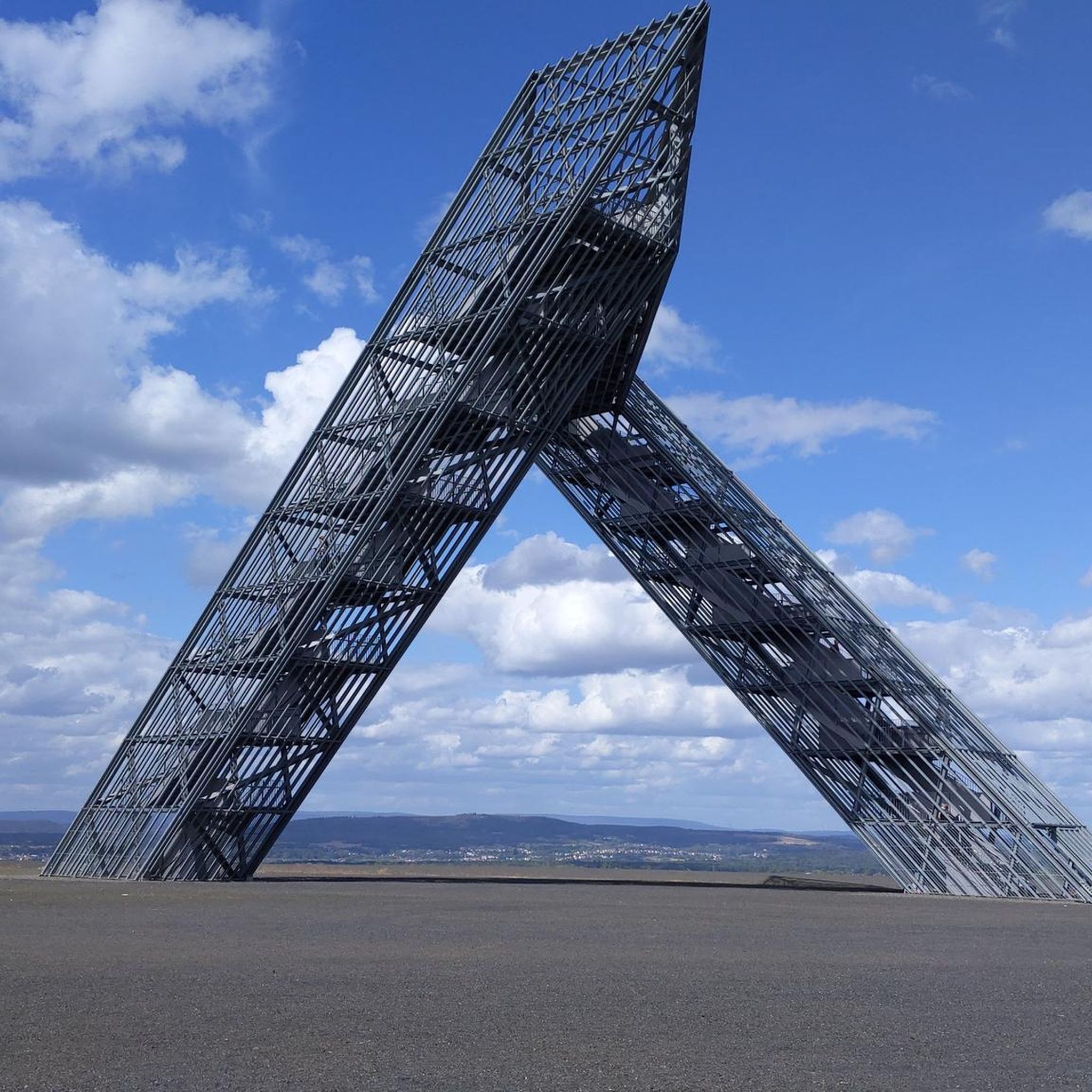
The Sicó Landmark, standing at an altitude of 553 meters, emerges amidst an almost lunar landscape, where the karst fields carve the ground into unexpected shapes. Up there, the views stretch endlessly, and the atmosphere invites you to linger a little longer. And to liven up the arrival at the summit, there's a panoramic swing and a photogenic sign that make the moment a little more special.
1
1

Easy to find, directly by the trail. Great spot to rest and take in the surroundings.
1
2
Incredible view by the side of the radio / cell towers. Wooden Sicó sign. And large concrete modern menhir.
0
1

Excellent view from a height for many kilometers
0
0

it is better to start the tour down in poios, so the highlight is at the end
2
0
Frequently Asked Questions
How many hiking trails are available in Almagreira?
There are 5 hiking routes detailed in this guide for Almagreira, all offering a moderate challenge. These trails explore both the dramatic coastal scenery and the varied inland terrain.
What kind of terrain can I expect on the hiking trails in Almagreira?
Hiking in Almagreira features a mix of environments. You'll encounter dramatic coastal scenery with striking ochre and sandy cliffs, as well as inland areas with varied terrain. Some routes, like the Nossa Senhora da Estrela – Poios Canyon loop, offer canyon views, while others lead through rural landscapes and historical sites.
Are there any circular hiking routes in Almagreira?
Yes, all the routes featured in this guide are circular loops. For example, you can explore the Miradouro de Sicó – Sicó — tower + sign loop or the Anta do Alto da Carrasqueira loop, both designed to bring you back to your starting point.
What are the typical difficulty levels for hiking in Almagreira?
The routes in this guide for Almagreira are primarily of moderate difficulty. They are suitable for hikers with a reasonable level of fitness and offer a rewarding challenge without being overly strenuous.
What natural attractions or landmarks can I see along the hiking trails?
Along the trails, you can discover several interesting points. The Nossa Senhora da Estrela – Poios Canyon loop takes you past the impressive Poios Canyon. Other nearby attractions include the historic Pombal Castle and the serene Monastery of Our Lady of Seiça.
What is the best time of year to go hiking in Almagreira?
Almagreira, particularly the coastal areas, can be enjoyed year-round. Spring and autumn offer pleasant temperatures for hiking, avoiding the peak heat of summer. The dramatic cliffs and expansive sandy shores are beautiful in all seasons, with spectacular sunsets over the Atlantic.
Are the hiking trails in Almagreira suitable for families?
While all routes in this guide are rated as moderate, families with older children who are accustomed to hiking may find them enjoyable. The varied terrain and scenic views offer a good adventure. For younger children, some sections might be challenging due to distance and elevation changes.
Can I bring my dog on the hiking trails in Almagreira?
Many trails in natural areas are generally dog-friendly, but it's always advisable to keep dogs on a leash, especially in areas with wildlife or near cliffs. Be mindful of local regulations and ensure your dog is comfortable with the moderate distances and varied terrain.
How long do the hikes in Almagreira typically take?
The hiking routes in Almagreira vary in length and duration. For instance, the Nossa Senhora da Estrela – Poios Canyon loop is about 5.7 miles (9.3 km) and takes around 2 hours 43 minutes, while the Miradouro de Sicó – Sicó — tower + sign loop is 7.5 miles (12.0 km) and typically takes longer.
What do other hikers say about the trails in Almagreira?
The hiking routes in Almagreira are highly regarded by the komoot community, holding an average rating of 4.9 stars from over 10 reviews. Hikers often praise the dramatic coastal scenery, the unique rock formations, and the well-maintained paths that offer panoramic ocean views.
Are there any shorter or easier hiking options for beginners in Almagreira?
All the routes listed in this guide are classified as moderate. While there are no 'easy' rated trails in this selection, the shortest route, the Nossa Senhora da Estrela – Poios Canyon loop from Monte do Meio, is 7.1 km (4.4 miles) and might be a good starting point for those looking for a slightly less demanding option within the moderate category.
Is public transport available to access the trailheads in Almagreira?
Access to trailheads in Almagreira often relies on local transport options. While specific public transport links to every trailhead may vary, it's generally recommended to check local bus schedules or consider driving, as many of these scenic routes are in more secluded natural areas.
Most popular routes around Almagreira
Most popular attractions around Almagreira

Get inspired with the komoot mobile app


Explore more
Browse the best Hikes in other regions.
