The best gravel rides around Blèves
3.7
(3)
43
riders
2
rides
Gravel biking around Blèves offers routes through the serene rural landscapes of France's Pays de la Loire region, near the Parc Naturel Régional du Perche. The terrain features rolling hills, dense forests, and accessible paths, including sections of the Voie Verte de La Mêle-sur-Sarthe à Alençon. This area provides varied conditions for gravel cyclists, from flat greenways to more challenging ascents. The average altitude of 145 meters ensures generally manageable gradients across the region.
Best gravel bike trails around Blèves
…Last updated: July 11, 2026
7
riders
54.3km
04:22
990m
990m
Hard gravel ride. Very good fitness required. Mostly paved surfaces. Suitable for all skill levels.
9
riders
63.8km
04:35
960m
950m
Hard gravel ride. Very good fitness required. Mostly paved surfaces. Suitable for all skill levels.

Sign up for free
5.0
(1)
16
riders
Moderate gravel ride. Good fitness required. Mostly paved surfaces. Suitable for all skill levels.
3.0
(1)
5
riders
23.3km
01:39
250m
250m
Moderate gravel ride. Good fitness required. Mostly paved surfaces. Suitable for all skill levels.
3.0
(1)
5
riders
33.1km
02:14
350m
350m
Moderate gravel ride. Good fitness required. Mostly paved surfaces. Suitable for all skill levels.
Our route recommendations are based on thousands of hikes, rides, and runs completed by other people on komoot.
Start today with a free account
Your next adventure awaits.
Login or Signup



Tips from the Community

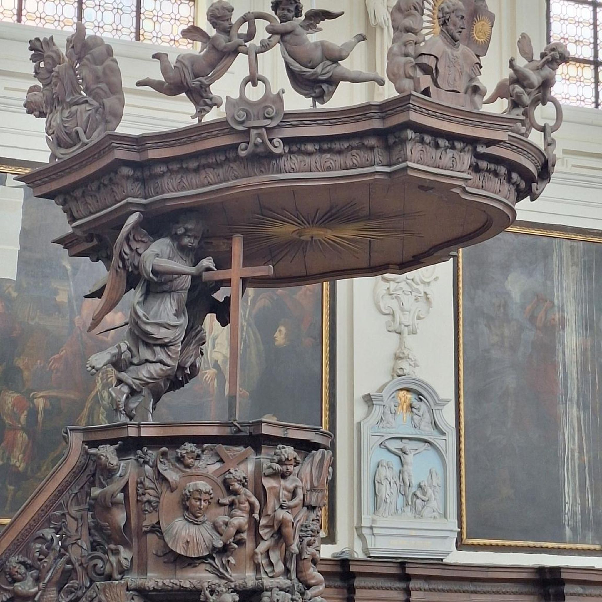
This magnificent church in Neuchâtel is dedicated to the patronage of "Saint-ETIENNE". He is one of the first seven deacons of the early Jerusalem community and, according to the biblical accounts in the "New Testament", the first martyr (witness by blood) of early Christianity. The church commemorates his death on the second day of Christmas, December 26th. As the Acts of the Apostles reports: When Stephen loudly proclaimed his vision of the open sky "But he, full of the Holy Spirit, looked up to heaven and saw the glory of God, and Jesus standing at the right hand of God" (Chapter 7, Verse 55), the people were so outraged that they drove him out of the city and stoned him.
0
0

The place that gives its name to the surrounding forest. An abbey founded in 1145 by monks from the Abbey of Citeaux in search of silence and isolation. Now, only a ruined section remains, visible through the foliage from the road. Note that these ruins are located on the grounds of the oldest summer camp still in operation in France.
0
0
On this beautiful forest road, a giant sequoia planted over 100 years ago marked the boundary between the communes of Ancinnes and St Rigomer-des-Bois. Although already imposing, it will take another thousand years before it reaches the size of its American counterparts, particularly those in California.
0
0

small, gentle climb coming from Allieres Beauvoir
0
0

Area including all the necessary shelter in case of rain (tables, WC, water and a
0
0

Good for a little break
0
0
Fresh climb to the north of Sarthe
0
0
Meeting points for walks to Perseigne
0
0
Frequently Asked Questions
What is the typical terrain like for gravel biking around Blèves?
Gravel biking around Blèves features a mix of rolling hills, dense forests, and dedicated greenways. The average altitude is around 145 meters, ensuring generally manageable gradients. You'll find varied conditions, from flat, stable gravel surfaces like the Voie Verte de La Mêle-sur-Sarthe à Alençon to more challenging ascents, particularly in areas like the Parc Naturel Régional du Perche.
Are there any notable landmarks or natural features to see while gravel biking near Blèves?
Yes, the Blèves area is rich in points of interest. You can explore the historic village of La Perrière, known for its charming architecture. For panoramic views, the Perseigne Viewpoint offers magnificent vistas of the Sarthe and Orne landscapes. You might also pass by the serene Mêlois Country Lake, perfect for a break.
Where can I find parking for gravel bike trails in the Blèves area?
While specific trailheads for parking aren't detailed for every route, areas like the Mêlois Country Lake offer convenient parking facilities. For routes starting from specific towns, such as Neufchâtel-en-Saosnois or Saint-Longis, you can typically find public parking within the village centers.
Is public transport available for cyclists with bikes in Blèves?
Blèves is a small commune, and direct public transport options specifically designed for cyclists with bikes may be limited. It's generally recommended to travel by car to reach the starting points of the gravel bike trails in the region. For detailed information on regional transport, it's best to consult local transport authorities.
What is the best time of year for gravel biking around Blèves?
The Pays de la Loire region, including Blèves, generally offers pleasant conditions for gravel biking from spring through early autumn. Spring brings blooming landscapes, while autumn provides cooler temperatures and beautiful foliage. Summer can be warm but is often enjoyable, especially on shaded routes like the Voie Verte. Always check local weather forecasts before heading out.
Are there any family-friendly gravel bike routes near Blèves?
Yes, for families, the Voie Verte de La Mêle-sur-Sarthe à Alençon is an excellent choice. This path, built on an old railway line, offers a flat, stable gravel surface and ample shade, making it ideal for relaxed and enjoyable rides away from motorized traffic. Routes like the Château de Bellerive – Saosnois Greenway loop from Aillières-Beauvoir are also moderate and could be suitable for families looking for a shorter ride.
Can I bring my dog on the gravel bike trails in the Blèves area?
Many natural areas and public paths in France, including gravel trails, are generally dog-friendly, especially if dogs are kept on a leash. However, specific rules can vary, particularly within protected areas like the Parc Naturel Régional du Perche. It's always advisable to check local signage or park regulations for the specific trail you plan to ride to ensure your dog is welcome.
Are there cafes or restaurants near the gravel bike routes in Blèves?
Blèves itself is a small village, so amenities might be limited. However, you'll find cafes, restaurants, and other services in larger nearby towns that serve as starting points for some routes, such as Neufchâtel-en-Saosnois, Saint-Longis, or Mamers. The Mêlois Country Lake also features picnic tables, ideal for a packed lunch.
What do other gravel bikers enjoy the most about gravel biking in Blèves?
The area is highly rated by the komoot community, with an average score of 4.0 stars. Reviewers often praise the serene rural landscapes, the variety of terrain from greenways to rolling hills, and the opportunity to explore charming villages and natural parks. The panoramic views from spots like the Perseigne Viewpoint are frequently highlighted as a major draw.
Are there any long-distance gravel routes or loops available?
Yes, the region offers several longer loop routes. For instance, the Perseigne Viewpoint – Vallée d'Enfer loop from Neufchâtel-en-Saosnois is a challenging 40.7-mile (65.5 km) ride, while the Saosnois Greenway – Perseigne Belvedere loop from Mamers covers 43.4 km (27 miles) and offers significant elevation gain. These routes provide extensive exploration of the Perche Regional Natural Park.
What kind of elevation gain can I expect on gravel bike trails near Blèves?
The elevation gain varies significantly depending on the route. While the average altitude of the region is around 145 meters, some routes, particularly those venturing into the Parc Naturel Régional du Perche, can be quite demanding. For example, the Perseigne Belvedere – Vallée d'Enfer loop from Saint-Longis involves nearly 960 meters of ascent, offering challenging climbs and descents.
Are there any specific permits required for gravel biking in the Blèves region?
Generally, no specific permits are required for cycling on public roads, greenways, or designated trails in the Blèves area or within the Parc Naturel Régional du Perche. However, always respect private property and any local regulations or signage you may encounter, especially if venturing off marked paths.
Most popular attractions around Blèves

Get inspired with the komoot mobile app


Explore more
Browse the best Gravel rides in other regions.
