The best running trails in Carroll County
52
runners
7
runs
Jogging routes in Carroll County, Maryland, traverse a landscape characterized by rolling hills, dense woodlands, and scenic waterways. The terrain offers varied experiences, from gentle paths alongside streams to routes with moderate elevation changes. Runners can explore diverse natural features, including forests, meadows, and the banks of rivers like the Patapsco. This blend of natural elements provides a picturesque and engaging environment for outdoor running.
Best jogging routes in Carroll County
- The most popular jogging route is Granite City Greenway loop from Mount Airy, a 4.3 miles (6.9 km) trail that takes 43 minutes to complete, offering a pleasant run through local scenery.
- Another top favourite among local runners is Mount Airy Historic District loop from Mount Airy, a moderate 4.8 miles (7.8 km) path. This route winds through historic areas and offers views of the surrounding countryside.
- Local runners also love the Granite City Greenway loop from Mount Airy Church, a 3.0 miles (4.9 km) trail leading through open fields and residential areas, often completed in about 30 minutes.
- Jogging in Carroll County is defined by rolling hills, woodlands, and waterways, with routes available for various ability levels.
- The guide includes highly-rated routes that showcase the best of the region's landscape. More than 30 runners have used komoot to explore Carroll County's varied terrain.
Last updated: July 9, 2026
11
runners
6.95km
00:43
20m
20m
The Granite City Greenway offers a delightful escape for joggers, winding along the serene Ararat River and Lovills Creek. This paved, wide path transitions smoothly from urban settings to natural woodlands and open fields, providing a varied and pleasant backdrop for your run. You'll pass through several city parks, like Riverside Park, and might even spot kayakers or anglers enjoying the water, making for a scenic and engaging experience.
This 4.3-mile (6.9 km) jogging route is rated moderate, with a gentle 63 feet (19 metres) of elevation gain, typically taking around 42 minutes. Its flat and accessible terrain makes it an excellent choice for beginners or anyone looking for a relaxed outing. Parking is readily available at the various city parks connected by the greenway, offering convenient access points for your visit.
Beyond its natural beauty, the Granite City Greenway is notable for its unique public art installations, with brightly decorated manhole covers adding a whimsical touch. The trail's name itself pays homage to Mount Airy's nickname, reflecting its history with the world's largest open-face granite quarry. It's a family-friendly and dog-friendly option, perfect for enjoying the outdoors in Mount Airy, NC.
8
runners
36.8km
04:15
470m
470m
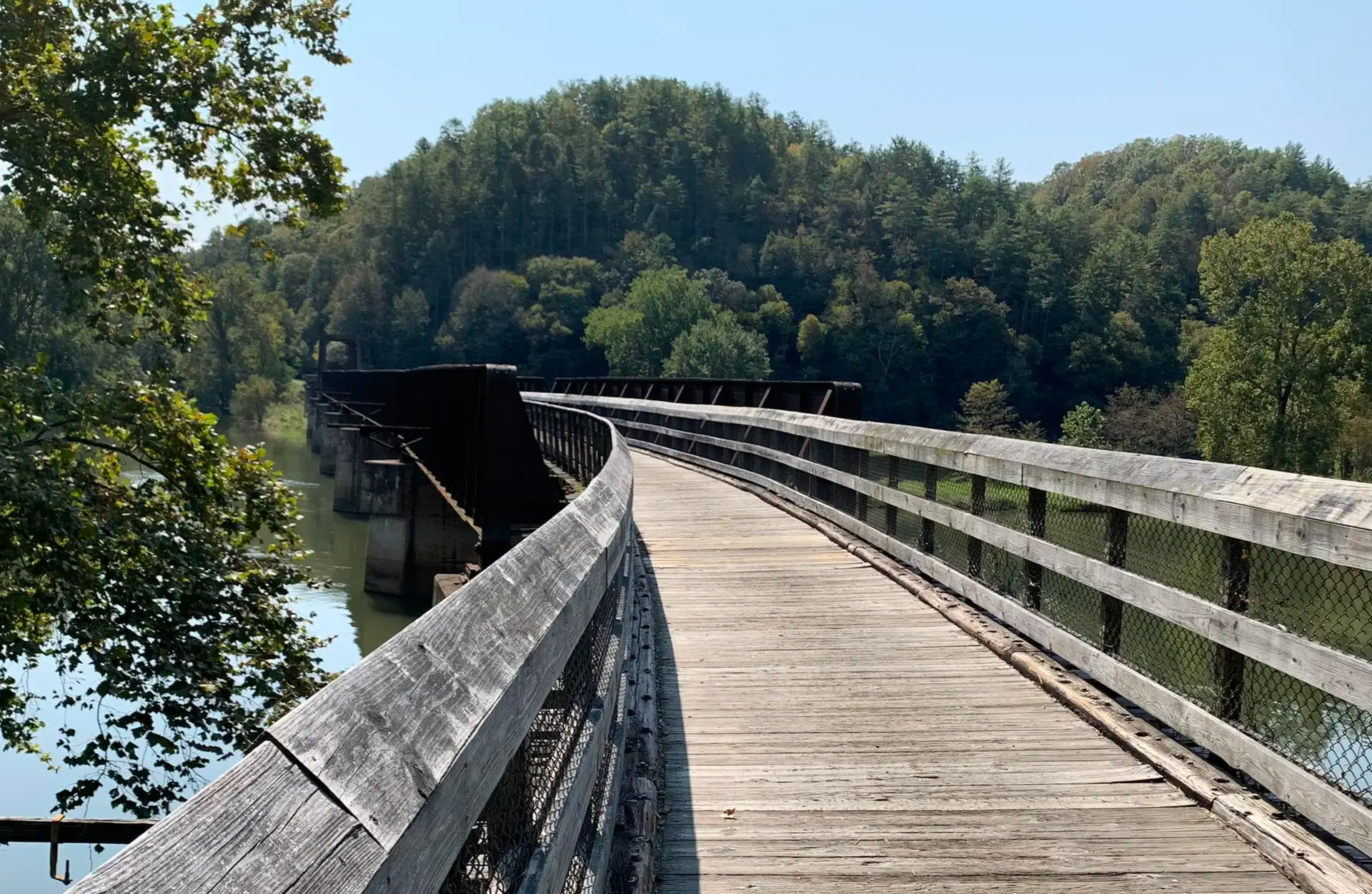
This challenging jogging route on the New River Trail State Park offers a unique blend of history and natural beauty, following a 'rails-to-trails' path. You'll experience consistent riverine views as the trail parallels the ancient New River, often shaded by a lush tree canopy. The highlight is crossing the historic Big Reed Trestle, one of many impressive structures that define this scenic journey.
To tackle this 22.9-mile (36.8 km) difficult route, which includes 1544 feet (471 metres) of elevation gain and takes about 4 hours and 14 minutes, plan to start early. While the path is mostly crushed stone and gently graded, the distance makes it a significant undertaking. Parking is available at various access points along the New River Trail, but remember that the nearby Bertha Cave (likely 'Star Cave') is not open for independent access.
The New River Trail is notable for its origins as an abandoned railroad corridor, providing a flat, smooth path ideal for sustained running. This historical aspect, combined with the constant presence of one of the world's oldest rivers, creates a distinctive experience. The area also features high mountain walls and steep slopes descending to the river, adding to the dramatic scenery.

Sign up for free
7
runners
5.36km
00:33
10m
10m
The Granite City Greenway loop from Chile Rojo offers a delightful and accessible jogging experience, tracing the tranquil Ararat River and Lovills Creek. You'll move through a pleasant mix of natural woodlands, open fields, and urban sections, with unique painted manhole covers adding local artistic flair. The route is predominantly paved, wide, and remarkably flat, making it an ideal choice for a relaxed outing.
This moderate 3.3-mile (5.4 km) loop, with a minimal 34 feet (10 metres) of elevation gain, can be completed in about 33 minutes. The greenway is easily accessible from multiple points, all offering parking, and features amenities like restrooms and picnic tables. Consider starting your jog from Chile Rojo for convenient access to this well-maintained path.
Beyond just jogging, the Granite City Greenway is a significant community asset, providing direct access to the Ararat River for activities like fishing or kayaking. It connects several local parks and even borders schools, serving as an outdoor learning resource. The smooth, wide surface also makes it ADA accessible, welcoming a diverse range of users.
6
runners
19.3km
02:00
110m
110m
Hard run. Very good fitness required. Mostly paved surfaces. Suitable for all skill levels.
3
runners
7.79km
00:49
50m
50m
The Mount Airy Historic District loop offers a pleasant jogging experience, blending natural scenery with a touch of local history. You'll traverse sections of the Mount Airy Rails to Trails, enjoying a mix of paved and gravel surfaces that wind through peaceful wooded areas. Keep an eye out for the charming wooden boardwalk and the old railroad tracks that hint at the town's past, providing a unique backdrop to your 4.8-mile (7.8 km) run, which features a gentle 173 feet (53 metres) of elevation gain.
This moderate route is easily accessible, with parking available in Mount Airy. The trail connects directly to Watkins Park, where you'll find convenient amenities like restrooms and drinking fountains. For a post-jog treat or a quick bite, the eastern section of the trail near Main Street offers easy access to local shops and restaurants, making it a great option for a quick 48-minute outing.
What makes this route particularly interesting is its connection to the town's rich heritage, following a former B&O railroad line that dates back to 1838. The trail provides a unique perspective on the quaint railroad town, running near the historic 1882 brick Baltimore and Ohio Railroad station. It's a great way to combine a moderate jog with a glimpse into Mount Airy's past.
5
runners
13.2km
01:36
60m
60m
Moderate run. Good fitness required. Mostly paved surfaces. Suitable for all skill levels.
2
runners
9.49km
00:59
60m
60m
Moderate run. Good fitness required. Mostly paved surfaces. Suitable for all skill levels.
Our route recommendations are based on thousands of hikes, rides, and runs completed by other people on komoot.
Start today with a free account
Your next adventure awaits.
Login or Signup


Other adventures in Carroll County

Tips from the Community

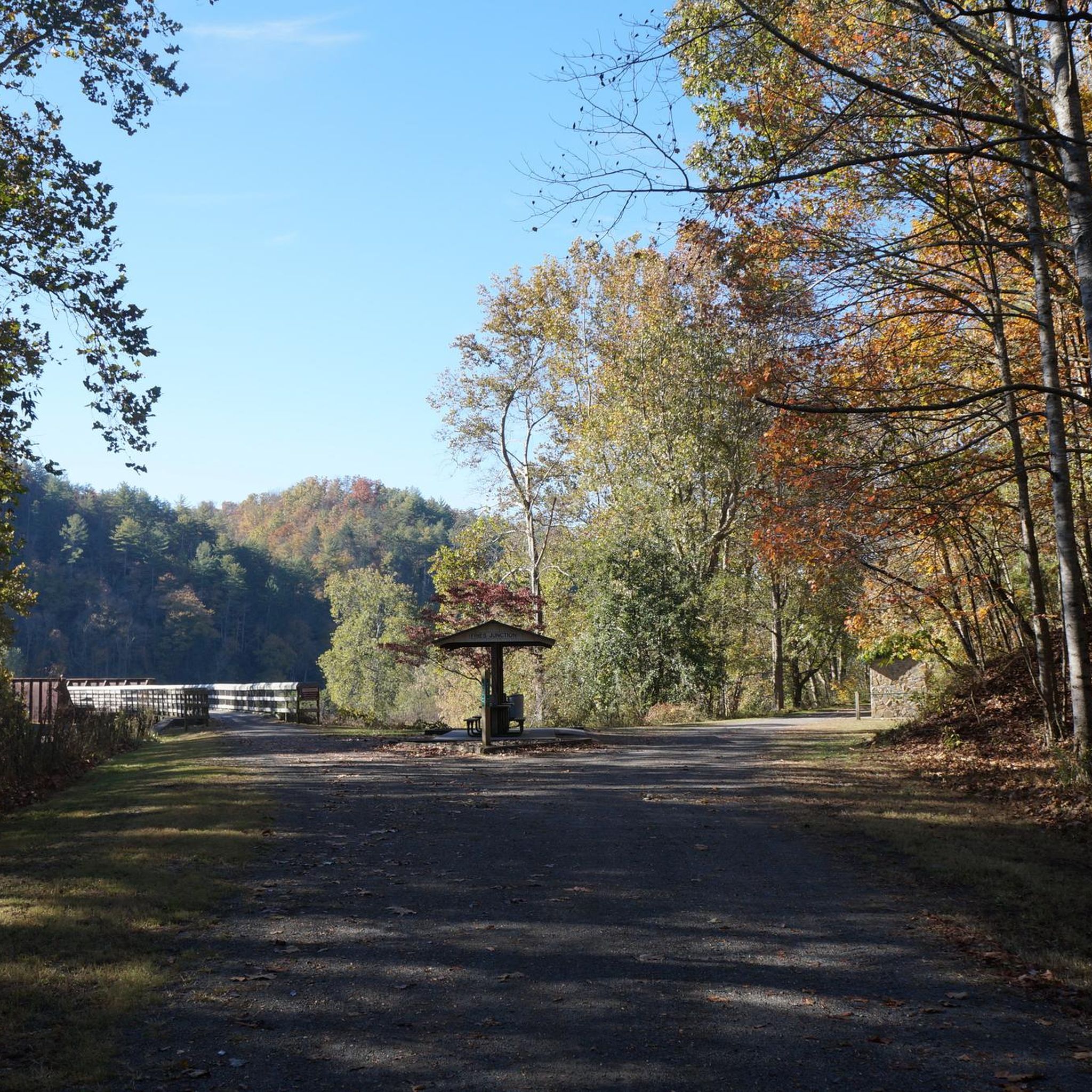
The New River Trail State Park Cliff View Access area offers a picnic shelter, parking, and has a potable water source.
0
0
While the entire 57-mile length of the New River Trail is technically all state park land, this section of the trail offers a bit of forest for exploring as well as public river access in conjunction with the Virginia Department of Conservation Recreation. Baker Island, a small forested island in the river, can be accessed from this area if you brave a river crossing.
0
0
With views of distant mountains to the south and the serene waters of the New River beneath you, this wooden bridge can be a good spot to stop and soak up some of the beauty of the trail.
0
0
The Whistle Stop Inn is a small, one-unit, nightly rental that is just steps away from New River Trail. The building was originally used as the city of Allisonia's train station in the late 1800's. It sleeps 2 to 4 people and can be reserved through New River Retreat's website.
0
0
This small waterfall is located at mile marker 47 along the New River Trail as it runs alongside Chestnut Creek.
0
0

The Granite City Greenway is an eight-mile-long paved trail that offers a scenic route around Mount Airy. It connects several parks, including Riverside Park, Tharrington Park, and HB Rowe Environmental Park. Along the way, visitors can enjoy the natural beauty of the Ararat River and Lovills Creek. The greenway is popular for walking, running, biking, and even kayaking, thanks to convenient access points to the water.
0
0
This district boasts a collection of beautifully preserved buildings that primarily date back to the late 19th and early 20th centuries. Visitors can stroll along brick-lined streets, admiring the exquisite examples of Late Victorian and Bungalow/American Craftsman architecture. Many of the buildings once served as bustling commercial establishments, and their characterful facades retain a sense of old-world charm. Today, these historic structures house a variety of shops, restaurants, and cultural venues, creating a vibrant and inviting atmosphere.
0
0

Chestnut Creek Falls is a small but beautiful waterfall on Chestnut Creek and can be seen from the New River Trail.
0
0
Frequently Asked Questions
What kind of terrain can I expect on running routes in Carroll County?
Carroll County offers a diverse landscape for runners, characterized by rolling hills, lush fields, and dense forests. You'll find paths winding through serene woodlands and open meadows, with terrain generally consisting of rolling hills rather than steep mountains. This provides good workouts without overly challenging ascents, making trails accessible for a wide range of fitness levels.
Are there any running routes that feature waterways or lakes?
Yes, Carroll County is rich in waterways, offering scenic running opportunities alongside peaceful streams and rivers like Deer Creek and the Patapsco River. Lakes such as Lake Freeman, Lake Hashawha, and the 300-acre lake at Piney Run Park also provide beautiful waterside running experiences. The Patapsco River, in particular, is known for its cascading waterfalls and rugged sections.
How many jogging routes are available in Carroll County?
Komoot features a selection of 5 jogging routes in Carroll County, ranging from easy to difficult. These routes are designed to showcase the best of the region's landscape, with over 30 runners having already explored them using komoot.
Are there any family-friendly running trails in the area?
While specific routes are not designated as 'family-friendly' in the guide data, many parks in Carroll County offer multi-use trails suitable for various ages. For example, the Granite City Greenway loop from Mount Airy Church is an easy 3.0-mile (4.9 km) trail that leads through open fields and residential areas, which could be a good option for families.
Where can I find a challenging running route in Carroll County?
For a more challenging experience, consider the Big Reed Trestle – New River Trail State Park loop from Star Cave. This difficult route spans 36.8 km (22.9 miles) with significant elevation changes, offering a rewarding run for experienced joggers.
Are there any loop running trails in Carroll County?
Yes, several routes in Carroll County are designed as loops, providing convenient starting and ending points. A popular moderate option is the Mount Airy Historic District loop from Mount Airy, which is 4.8 miles (7.8 km) long and winds through historic areas.
What kind of natural features can I see while running in Carroll County?
Runners in Carroll County can enjoy diverse natural habitats, including woodlands, meadows, and wetlands. Locations like the Hashawha Environmental Center encompass a variety of these environments, providing an immersive natural experience. You'll also encounter rolling hills, dense forests, and scenic waterways throughout the county.
Are there any specific parks or centers known for their running trails?
Absolutely. Piney Run Park is a popular spot with over 5 miles of trails surrounding a 300-acre lake. The Hashawha Environmental Center & Bear Branch Nature Center, spanning 320 acres, also offers over 5 miles of multi-use trails, including an accessible one circling a lake and pond. Other notable parks include Freedom Park and Gillis Falls, both offering several miles of trails.
What are some interesting landmarks or attractions near the running routes?
While running, you might encounter various points of interest. For example, the Patapsco Valley State Park (McKeldin Area) offers scenic views, including the Liberty Dam Overlook. You can also explore historical sites like Puckett Cabin or natural highlights such as Chestnut Creek Falls. The Union Mills Homestead also provides a blend of history and nature with its landscaped gardens.
Is there public transport access to running trails in Carroll County?
While specific public transport routes to individual trailheads are not detailed in the guide, Carroll County does have some public transportation options. For detailed information on local public transport services and accessibility to parks and trails, it's best to consult the official county resources. You can find more information on local government services at carrollcountymd.gov.
Where can I find information about parking for running trails?
Many of Carroll County's parks and environmental centers, such as Piney Run Park, Hashawha Environmental Center, and various smaller parks, typically offer dedicated parking facilities for visitors. For specific parking details at a particular location, it's advisable to check the park's official website or local government resources, such as those found at carrollcountytourism.org.
Are there any less crowded running trails or hidden gems in Carroll County?
For a quieter experience, the Morgan Run Environmental Area provides a serene location with trails that are also used for equestrian activities, suggesting a potentially less crowded environment. Exploring the trails at Hashawha Environmental Center, particularly those near Westminster, can also offer longer runs in a rustic and peaceful setting away from more bustling areas.
What is the best time of year to go jogging in Carroll County?
Carroll County's diverse natural features make it suitable for jogging across multiple seasons. Spring and fall offer pleasant temperatures and vibrant scenery with blooming flowers or colorful foliage. Summer mornings or evenings can be ideal to avoid the heat, while winter jogging is possible, though some trails might require appropriate gear for colder conditions.
Most popular routes in Carroll County
Most popular attractions in Carroll County

Get inspired with the komoot mobile app


Didn’t find what you were looking for?
Check out more Running Trails & Routes throughout Carroll County below and find the perfect route in your destination.
Explore more
Browse the best Running Trails & Routes in other regions.
