The best walks and hikes in Bodega Ridge Provincial Park
5.0
(1)
21
hikers
6
hikes
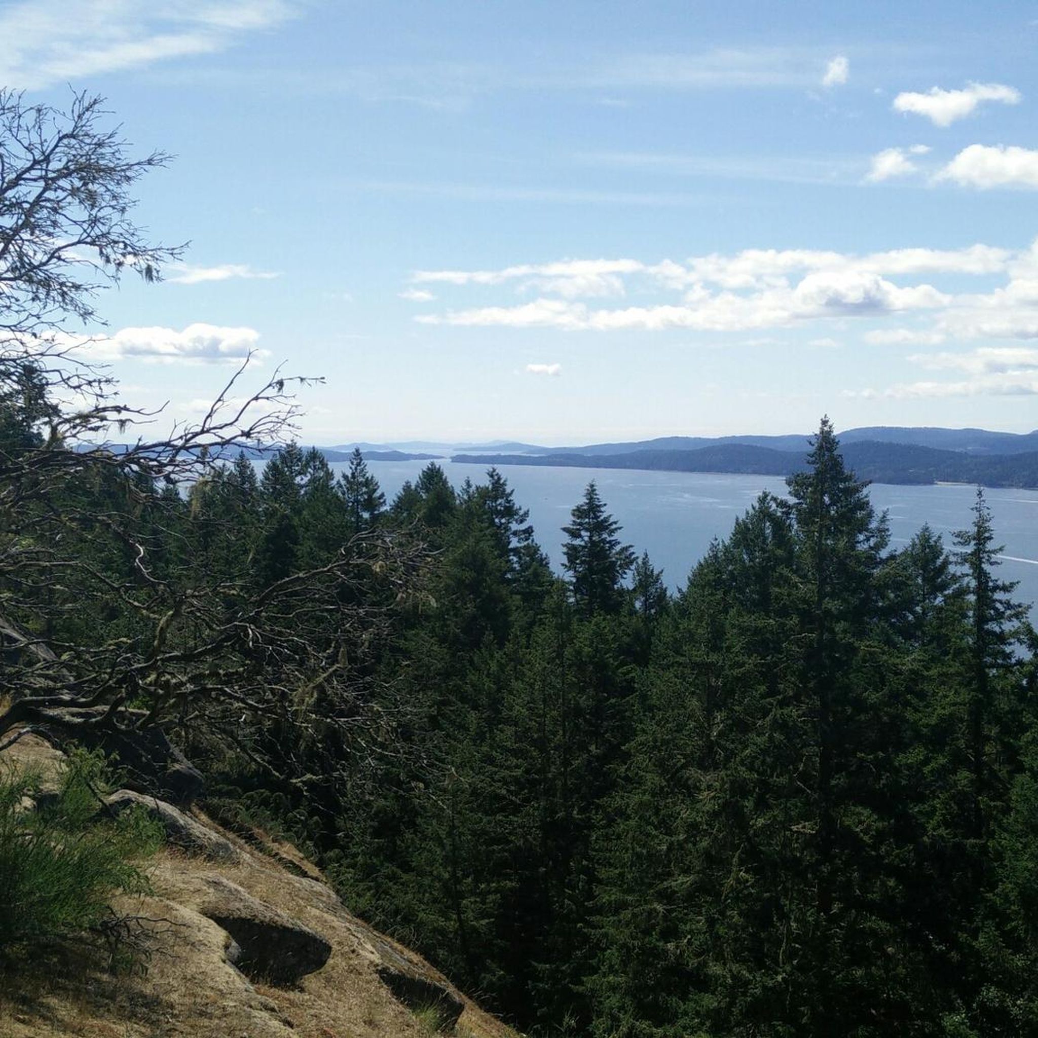
Hiking trails in Bodega Ridge Provincial Park are characterized by a prominent 4-kilometer ridge that rises 328 meters above sea level, offering panoramic views of the Trincomali Channel and surrounding islands. The park features diverse ecosystems, including dense forests of Douglas fir and Western red cedar, as well as unique plant communities like arbutus and Garry Oak trees. Coastal sections reveal dramatic cliffs and sandstone formations along the water's edge. This varied terrain provides a range of hiking experiences.
Best…
Last updated: October 4, 2026
5.0
(1)
7
hikers
7.96km
02:17
190m
190m
Moderate hike. Good fitness required. Easily-accessible paths. Suitable for all skill levels.
6
hikers
2.91km
00:49
60m
60m
Easy hike. Great for any fitness level. Easily-accessible paths. Suitable for all skill levels.

3
hikers
Easy hike. Great for any fitness level. Easily-accessible paths. Suitable for all skill levels.
1
hikers
7.89km
02:18
220m
220m
Moderate hike. Good fitness required. Easily-accessible paths. Suitable for all skill levels.
1.92km
00:33
40m
40m
Easy hike. Great for any fitness level. Easily-accessible paths. Suitable for all skill levels.
Our route recommendations are based on thousands of hikes, rides, and runs completed by other people on komoot.
Start today with a free account
Your next adventure awaits.
Popular around Bodega Ridge Provincial Park

Tips from the Community

Salt Spring Island is the largest and most populous of the Southern Gulf Islands, with forested hills, farmland, lakes, and long stretches of shoreline. It has been part of the traditional territory of the Saanich, Cowichan, and Chemainus First Nations for at least 5,000 years and, in 1859, became the first Gulf Island settled by non-First Nations people. Today, it’s known for its extensive network of trails and parks, along with a thriving arts scene centred around the village of Ganges.
0
0
The north end of the Channel Ridge trail system is reached from several access points on the island, with numbered junction signs throughout the entire 15 kilometres of trails to help with orientation. The rolling paths wind through arbutus groves and pine, opening up at many points to beautiful views over St. Mary Lake to the east and Stuart Channel and Vancouver Island to the west. It's a moderately challenging network overall, with noticeably more climbing than the gentler south end. Since there are many intersections that loop through the area, it's a good idea to have your downloaded komoot GPS route along with CRD's trail map (https://www.crd.ca/media/file/channel-ridge-web-map) to keep you on track.
0
0
Channel Ridge South Trail is a lovely, relatively easy stroll through the forest, filled with Douglas firs, cedars, and lush West Coast vegetation. As you walk along this well-kept trail, there are two viewpoints overlooking St. Mary Lake. Though the first might be overgrown, the second spot, with a short spur trail, offers beautiful elevated views across the water. The gentle elevation changes and peaceful surroundings make this a relaxing hike with some of the best inland views on Salt Spring Island.
0
0
This is a great spot to see lovely views of St. Mary Lake, the largest freshwater lake on Salt Spring Island, surrounded by lush forests and fields. If you're lucky enough to visit on a clear day, the forested hills rising beyond the lake are a beautiful backdrop, making this an ideal place for a break before continuing on the trail.
0
0
This trailhead offers easy access to the Channel Ridge trails and includes a small parking area. From here, well-signposted forest trails meander through mixed woodlands, leading to scenic viewpoints that overlook St. Mary Lake and the nearby hills. It’s the perfect starting point for one of the most popular walks on Salt Spring Island.
0
0

Set along the eastern side of Galiano Island, Bodega Ridge Provincial Park protects a rugged stretch of coastal bluff, Douglas fir forest and rocky ridgeline overlooking the Salish Sea. The park is best known for its elevated viewpoints across the Gulf Islands, with sections of exposed rock and Garry oak ecosystem rare within British Columbia. Bald eagles are commonly seen soaring along the ridge, especially on windy days.
0
0
A small dirt parking area at the end of Cottage Way provides access to the Bodega Ridge Trail on Galiano Island. The final stretch of road includes narrow switchbacks and limited roadside space, so it can feel tight for larger vehicles. There are no washrooms or facilities at the trailhead.
0
0
Climbing through coastal Douglas fir forest and rocky bluffs, the Bodega Ridge Trail leads to sweeping views across the Salish Sea and the surrounding Gulf Islands. The trail steadily gains elevation along the ridge, with exposed sections opening onto dramatic coastal viewpoints that feel surprisingly remote for such a short hike. Expect roots, uneven rocks and steeper sections along the climb, particularly in wet conditions.
0
0
Frequently Asked Questions
How many hiking trails are available in Bodega Ridge Provincial Park?
Bodega Ridge Provincial Park offers a selection of hiking routes, with at least four distinct trails available for exploration. These routes cater to various preferences, primarily focusing on easy to moderate difficulty levels.
What kind of views can I expect while hiking in Bodega Ridge Provincial Park?
Hikers are treated to spectacular panoramic views from the park's prominent ridge, which ascends 328 meters above sea level. These vistas include the Trincomali Channel, Wallace Island Marine Park, Saltspring Island, the mountains of Vancouver Island, and the Strait of Georgia. The trails also offer diverse scenery, winding through dense forests and along dramatic coastal sections with unique sandstone formations.
Are there any longer or more challenging hikes in the park?
While many trails are considered easy, the park does offer options for those seeking a longer experience. For example, the View from Mount Erskine loop from Harrison Avenue Park Reserve is a moderate 13.7 km (8.5 miles) hike that takes approximately 4 hours and 13 minutes to complete, featuring significant elevation changes.
What is the terrain like on the trails in Bodega Ridge Provincial Park?
The trails traverse varied terrain, from dense forests of Douglas fir and Western red cedar to unique plant communities like arbutus and Garry Oak trees. You'll encounter sections of old paths and logging roads, as well as dramatic cliffs and sandstone formations along the water's edge. While generally well-maintained, some sections involve elevation changes, loose rocks, and roots, so sturdy hiking boots are recommended.
Can I bring my dog on the trails in Bodega Ridge Provincial Park?
Bodega Ridge Provincial Park is generally dog-friendly, allowing leashed dogs on its trails. However, always check for specific signage or park regulations upon arrival, as rules can sometimes vary or be updated.
Are there any family-friendly hiking options in Bodega Ridge Provincial Park?
Yes, the park offers several easy trails suitable for families. Routes like the Pebble Beach loop from Spune’luxutth, at 3.0 km (1.9 miles), provide an accessible way to explore the coastal areas and enjoy the natural beauty without significant difficulty.
What kind of wildlife can I expect to see while hiking?
Bodega Ridge is a renowned birding site, particularly known for its birds of prey. You might spot endangered peregrine falcons, bald eagles, and turkey vultures utilizing the high cliffs for nesting and hunting. The foreshore areas also protect various marine life, including rockfish, lingcod, and sea perches.
Are there any circular routes available for hikers?
Yes, many of the trails in Bodega Ridge Provincial Park are designed as loops, offering a varied experience without retracing your steps. Examples include the Pebble Beach Recreation Site loop from Galiano Island and the Lighthouse Bay – Parry Lagoon loop from Dionisio Point Provincial Park.
What should I wear or bring for a hike in Bodega Ridge Provincial Park?
Given the varied terrain, including uneven ground, rocks, and roots, wearing sturdy hiking boots is highly recommended. Trekking poles can also be beneficial for stability, especially on sections with elevation changes. Dressing in layers is advisable to adapt to changing weather conditions.
Is there parking available at Bodega Ridge Provincial Park?
Yes, parking is available at Bodega Ridge Provincial Park. Specific parking areas are typically located near trailheads, providing convenient access for hikers.
What do other hikers enjoy most about Bodega Ridge Provincial Park?
Hikers frequently praise the park's breathtaking panoramic views from the ridge, the diverse forest and coastal scenery, and the opportunity for wildlife spotting, especially birds of prey. The well-maintained trails and the generally peaceful, uncrowded experience are also highly valued.
Most popular routes in Bodega Ridge Provincial Park

Get inspired with the komoot mobile app


Explore more
Browse the best Hikes in other regions.
