The 7 Most Amazing Peaks around Drummanmore
Best mountain peaks around Drummanmore are found within County Down, Northern Ireland, in close proximity to the Mourne Mountains. This region is characterized by its rugged granite peaks and diverse landscapes, designated an Area of Outstanding Natural Beauty. The Mourne Mountains offer numerous impressive peaks, each with distinctive features for outdoor enthusiasts. The area provides a range of experiences, from challenging hikes to scenic routes.
Best mountain peaks around Drummanmore
- The most popular mountain peaks is Eagle Mountain, a…
Last updated: June 29, 2026
Barnavave Summit
Highlight • Summit
Translated by Google •
Tip by

Slievemartin Summit & View of Carlingford Lough
Highlight • Summit
From here you can see Rostrevor, Warrenpoint and across to Carlingford and O'Meath in the …
Tip by

Sign up now to discover places like this
Get recommendations on the best single tracks, peaks, & plenty of other exciting outdoor places.
Sign up for free
Slievemeen Summit
Highlight • Summit
A great walk for kids as it's relatively close …
Tip by
Eagle Mountain
Highlight • Viewpoint
Tip by

Slievemeen
Highlight • Trail
The new path is great for running/hiking along the top.
Tip by
Sign up for free to discover even more peaks around Drummanmore.
Sign up for free
Already have an account?
Start today with a free account
Your next adventure awaits.
Login or Signup



Tips from the Community


Wikipedia (Cooley Mountains, 2024-07-28): https://en.m.wikipedia.org/wiki/Cooley_Mountains "... Barnavave (350m). This latter name comes from Bearna Mhéabha (Maeve's Gap), and refers to the legendary Queen Medb (Maeve), whose army is said to have dug a pass through the mountain. ..."
1
0

Standing at 472m from sea level Slievemeen offers incredible views down over the village of Killowen and over Carlingford Lough. The new path is great for running/hiking along the top.
0
0
Not the biggest in the mournes at only 472m but well worth the climb as the views from Slievemeen are incredible! A great walk for kids as it's relatively close to the car park and has a nice summit to take a picnic on.
0
0
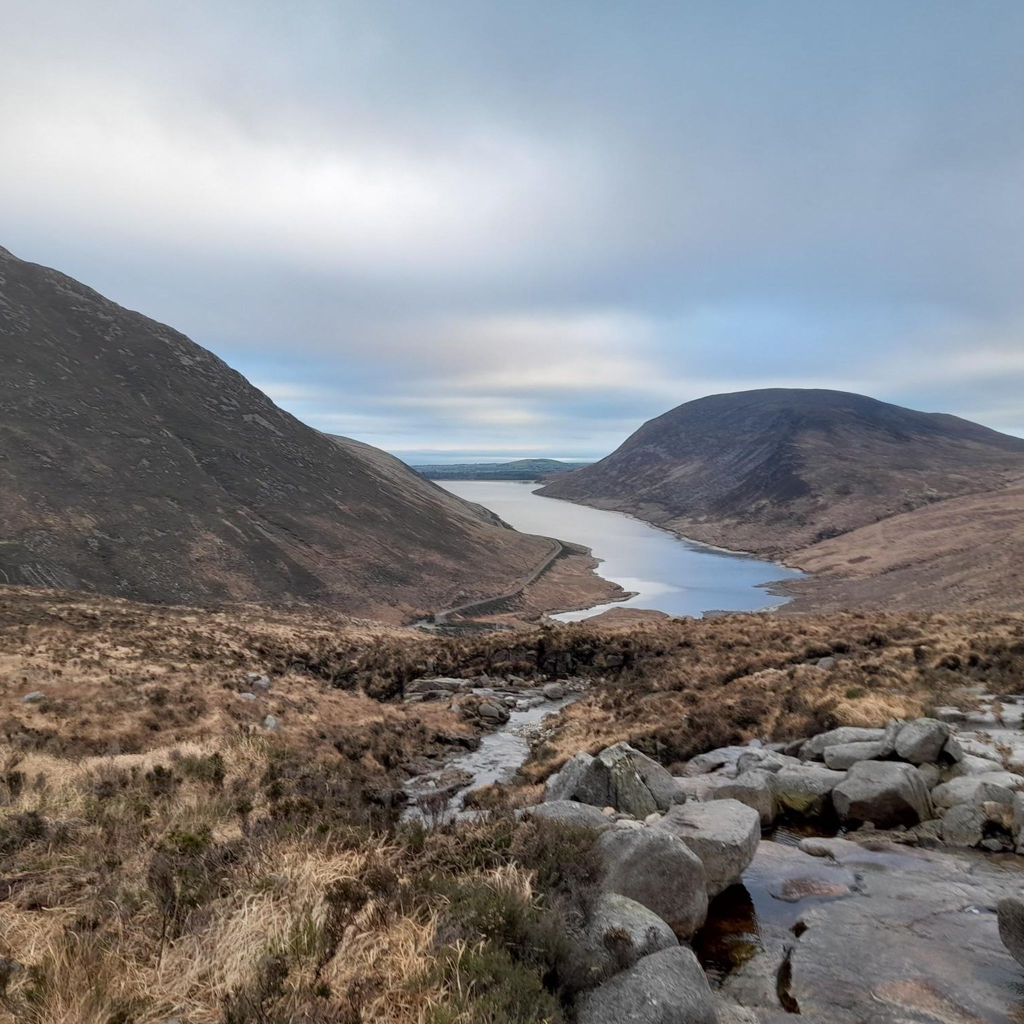
One of the best viewpoints over Rostrevor village and Carlingford Lough
1
0

Slievemartin stands at 485m and is situated in the Kilbroney Forest Park, in the southern Mournes mountain range of Northern Ireland. It's a truly magical place and a popular spot for hikers, so magical that it was the inspirarion for C.S. Lewis’s wonderful world of Narnia! From the top of the peak, you can enjoy vast views over the stunning Rostrevor Forest and glacial fjord of Carlingford Lough.
2
0
At 485m above the village of Rostrevor this is the highest point of Slieve Martin. From here you can see Rostrevor, Warrenpoint and across to Carlingford and O'Meath in the South. Cairns in ancient times functioned as landmarks to aid navigation, long before GPS. An early version of komoot! The climb up here is steep but the views are incredible so take a camera. Even if it's calm at the lower levels, the wind can be really strong up at the cairn so be prepared for that.
2
0

Didn't have the best of hiking days when I went up Barnavave but it was still a great outing if you take in Slieve Foy too.
3
0
Frequently Asked Questions
What are the most prominent mountain peaks in the Mourne Mountains near Drummanmore?
The Mourne Mountains, an Area of Outstanding Natural Beauty near Drummanmore, feature several prominent peaks. These include Slieve Donard, the highest in Ulster, known for its panoramic views and the iconic Mourne Wall. Other notable peaks are Slieve Bearnagh with its distinctive rocky tors, Slieve Commedagh, Slieve Binnian with its twin summits, and Slieve Meelbeg and Slieve Meelmore, often part of multi-peak challenges.
Are there family-friendly mountain peaks or walks around Drummanmore?
Yes, there are several family-friendly options. Slievemeen Summit is a great choice, offering incredible views and being relatively close to parking, making it suitable for a picnic. Another excellent option is Wee Binnian, which has a slow and steady incline, perfect for kids or elderly people, and provides great views of Slieve Binnian and Silent Valley Reservoir.
Which mountain peaks offer the best views near Drummanmore?
For unparalleled panoramic views, Slieve Donard is highly recommended, offering vistas of the entire mountain range, the countryside, and the Irish Sea. Closer to Drummanmore, Eagle Mountain provides fantastic views all around the Mournes. Barnavave Summit also boasts beautiful 360-degree views of Carlingford, the Mourne Mountains, and the Irish Sea.
What kind of challenging mountain climbs can I find near Drummanmore?
For a challenging climb, Slieve Donard is the highest peak and offers a demanding ascent with significant rewards. Eagle Mountain is also known for being a challenging climb, requiring good fitness. Slieve Bearnagh's final ascent can be steep and may involve some scrambling, making it another good option for experienced hikers.
What natural features are unique to the mountain peaks in the Mourne Mountains?
The Mourne Mountains are characterized by their rugged granite peaks and distinctive tors, such as those found on Slieve Bearnagh and Slieve Binnian. A remarkable feature is the iconic Mourne Wall, a dry-stone wall that crosses fifteen summits, including Slieve Donard and Slieve Bearnagh, adding a historical and engineering marvel to the natural landscape.
What outdoor activities are available near the mountain peaks around Drummanmore?
Beyond hiking, the area around Drummanmore offers a variety of outdoor activities. You can explore MTB trails, with options like the Carlingford — Cooley Mountains loop or various routes around Kilbroney Caravan Park. There are also numerous cycling routes, including the Carlingford Lough Greenway and The Head Road Route, catering to different difficulty levels.
Are there easy hiking trails near Drummanmore's mountain peaks?
Yes, for easier hikes, you can find several options. The easy hikes guide includes routes like the Wee Binnian trail, which is a gentle incline. Other easy routes include walks around Silent Valley Reservoir and the Cloughmore Stone loop, offering scenic beauty without extreme difficulty.
What is the best time to visit the mountain peaks near Drummanmore?
The Mourne Mountains are beautiful year-round, but for hiking, late spring to early autumn (May to October) generally offers the most favorable weather conditions with longer daylight hours and milder temperatures. However, clear days in any season can provide spectacular views. Always check local weather forecasts before heading out, as conditions can change rapidly in the mountains.
What historical or cultural significance do the mountain peaks near Drummanmore hold?
The Mourne Mountains are rich in history and legend. The name of Barnavave Summit, for instance, is linked to the legendary Queen Medb, whose army is said to have dug a pass through the mountain. The entire range is also believed to have inspired C.S. Lewis's 'Chronicles of Narnia,' adding a literary connection to its natural beauty.
Can I find circular mountain walks around Drummanmore?
Many of the hiking routes in the Mourne Mountains are designed as circular walks, allowing you to experience diverse scenery without retracing your steps. For example, the Glen River path leading up Slieve Commedagh often forms part of circular routes. When planning your hike, look for trails that specify a loop or circuit to enjoy a full circular experience.
What should I know about parking and public transport for hiking in the Mourne Mountains?
While specific parking details vary by trailhead, many popular starting points for Mourne Mountain hikes have designated car parks. Public transport options to the immediate trailheads can be limited, so driving is often the most convenient way to access many areas. It's advisable to research specific access points for your chosen peak or trail in advance to confirm parking availability and any public transport connections.
Most popular attractions around Drummanmore

Get inspired with the komoot mobile app


Explore more
See even more amazing summits around Drummanmore with these guides:
