The 6 Most Amazing Peaks around Chicopee
Best mountain peaks around Chicopee MA include elevated areas within the city and more prominent summits in nearby ranges. Chicopee Mountain, an elevated area, reaches approximately 250 meters (820 feet) above sea level. The city's highest point is found on Old Lyman Road, at about 88 meters (288 feet). For outdoor recreation, Chicopee Memorial State Park offers trails with varied terrain.
Best mountain peaks around Chicopee
- The most popular mountain peaks is Mount Holyoke Summit and Viewpoint, a summit…
Last updated: September 30, 2026
Deadtop
Highlight • Summit
Tip by

Mount Holyoke Summit and Viewpoint
Highlight • Summit
Tip by

Sign up now to discover places like this
Get recommendations on the best single tracks, peaks, & plenty of other exciting outdoor places.
Bare Mountain
Highlight • Summit
Tip by
Mount Tom State Reservation
Highlight • Natural Monument
Tip by

Mount Hitchcock
Highlight • Summit
Tip by
Sign up for free to discover even more peaks around Chicopee.
Already have an account?
Start today with a free account
Your next adventure awaits.

Tips from the Community

Mount Holyoke is a 935 foot mountain near the town of Northampton, Massachusetts. Cycling up Mount Holyoke, Massachusetts, is a rewarding, but challenging experience. The auto road is open to cyclists in the spring, summer, and early fall, and great views of the Pioneer Valley and the Connecticut River as you climb. At the top, there are overlooks with benches, and several picnic tables with panoramic views for you to rest and relax at before beginning your descent. There are also bathrooms as well as the historic Summit House, which used to be a hotel.
0
0
Bare Mountain stands at 1,014 feet above sea level and is part of the greater Metacomet Ridge and the Holyoke Range. This steep mountain is popular with students from the many elite colleges in the nearby towns. From the summit you get great views of the surrounding valleys to the north and south, views to Mount Norwottuck and the eastern peaks of the Holyoke Range, and of the campuses of the University of Massachusetts Amherst and Hampshire College. Bare Mountain also is home to a bunker that was used as the command center for U.S. forces during the Cuban Missile Crisis.
0
0
Mount Hitchcock stands at 1,002 feet and was named for Edward Hitchcock, a professor of geology at Amherst College in the 1800s. Mount Hitchcock is the most remote peak in the Holyoke Range because it is farthest from a road. To the west of the summit is Seven Sisters and Mount Holyoke and to the east is Bare Mountain, which is higher than Hitchcock by eight feet.
0
0

Wide views, open skies and soaring birds – Mount Tom overlooks the Pioneer Valley. The reservation is a wonderful place to hike, fish and bike, as well as cross-country ski and ice skate in the winter. You'll find picnic areas, a playground, restrooms and grills.
0
0

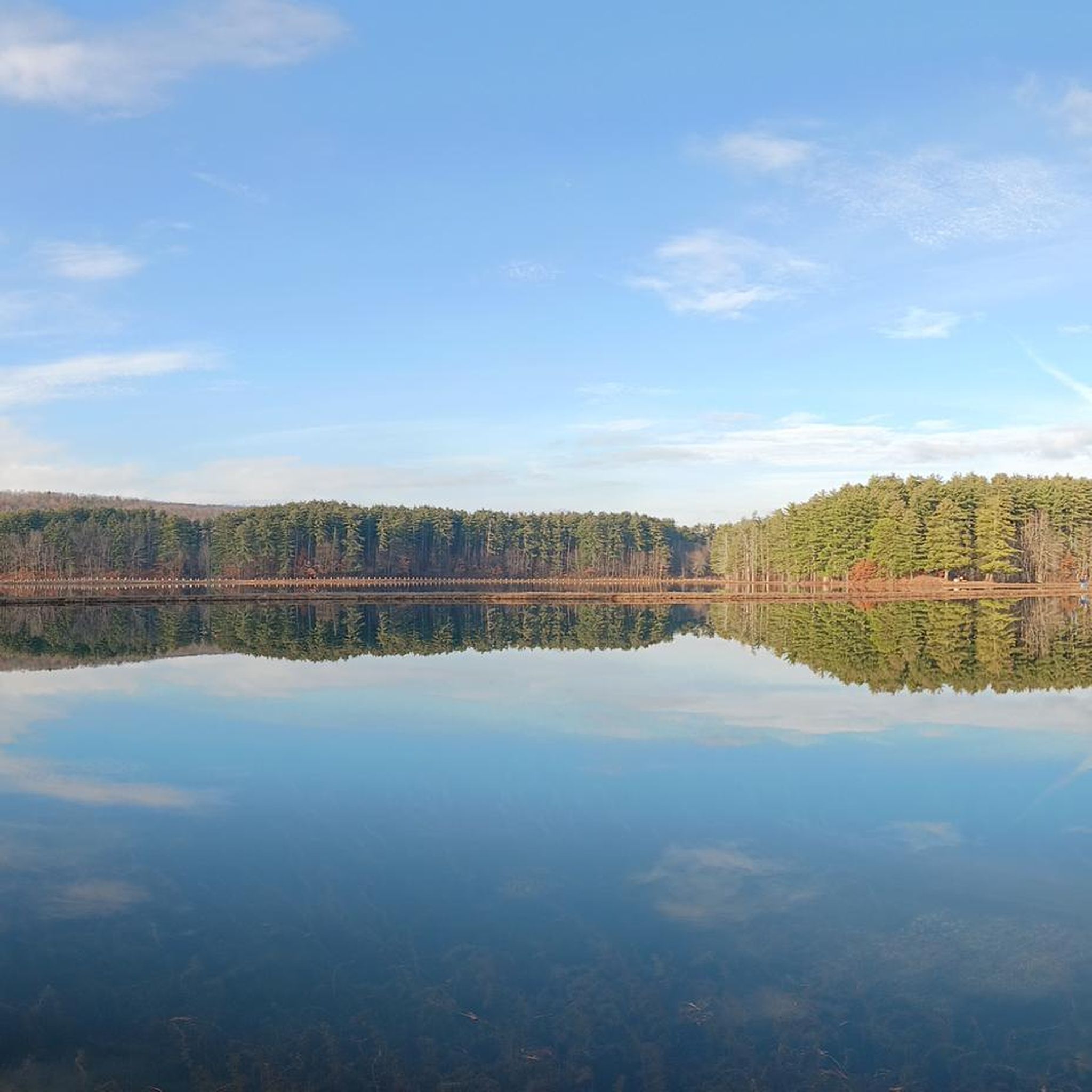
Here you are standing on the westernmost peak of the Holyoke Range: Mount Holyoke. The approximately 285 meter high mountain is located in the Connecticut River Valley in western Massachusetts and is the namesake of nearby Mount Holyoke College. Enjoy the picturesque views from here. But don't forget to pay a visit to the historic summit house.
1
0


Frequently Asked Questions
What are some prominent mountain peaks or elevated areas near Chicopee?
While Chicopee itself features elevated areas like Chicopee Mountain (approximately 250 meters or 820 feet above sea level) and the city's highest point on Old Lyman Road (about 88 meters or 288 feet), more prominent peaks are found in nearby ranges. Notable summits include Mount Holyoke Summit and Viewpoint, Deadtop, and Mount Tom, all offering significant elevation and views.
Are there any historical sites or unique features on the peaks around Chicopee?
Yes, several peaks offer historical interest. At the open summit of Mount Nonotuck, you can find the ruins of the Eyrie House, a hotel built in 1861. Mount Holyoke Summit and Viewpoint also features a historic summit house. Additionally, Bare Mountain is home to a bunker that served as a command center during the Cuban Missile Crisis.
What kind of views can I expect from the mountain peaks in the Chicopee area?
The peaks around Chicopee offer diverse and scenic views. From Mount Holyoke Summit and Viewpoint, you can enjoy picturesque views of the Pioneer Valley and the Connecticut River. Deadtop provides fantastic views of Easthampton, the Connecticut River Valley, and the entire Mount Tom Range. Mount Tom offers dramatic views across its range and of the Connecticut River Valley. Mount Nonotuck is known for its fantastic views of "the Oxbow," a dramatic bend in the Connecticut River.
Are there family-friendly hiking options among the peaks near Chicopee?
While some of the higher peaks involve intermediate trails, Chicopee Memorial State Park offers a 2.3-mile paved loop trail that is suitable for families and provides a tranquil setting with varied terrain. For easy hikes in the broader area, you can explore options like the Chicopee Paved Trail or the Ashley Reservoir Trail, which are listed in the Easy hikes around Chicopee guide.
Can I bring my dog to the mountain trails around Chicopee?
Many outdoor areas in Massachusetts are dog-friendly, but it's always best to check specific park regulations. For example, Mount Tom State Reservation, which includes Mount Tom, generally allows dogs on trails, often requiring them to be on a leash. Always ensure your dog is leashed and you clean up after them to maintain trail etiquette.
What are some easy or beginner-friendly hikes in the Chicopee area?
For easy and beginner-friendly hikes, consider the trails within Chicopee Memorial State Park. The 2.3-mile paved loop trail is a great option. Other easy routes in the vicinity include the Chicopee Paved Trail and the Dufresne Loop Trail. You can find more details on these and other accessible paths in the Easy hikes around Chicopee guide.
What is the best time of year to visit the mountain peaks near Chicopee?
The best time to visit the mountain peaks near Chicopee is generally during the spring, summer, and especially the fall. Fall foliage in the Pioneer Valley is spectacular, offering vibrant colors. The auto road to Mount Holyoke Summit and Viewpoint is open to cyclists during spring, summer, and early fall, making these seasons ideal for exploring.
Are there cycling opportunities on or near these peaks?
Yes, there are cycling opportunities. The auto road to Mount Holyoke Summit and Viewpoint is open to cyclists in the spring, summer, and early fall, offering great views as you climb. Additionally, Chicopee Memorial State Park features a 2.3-mile paved loop trail suitable for biking. For more extensive cycling, explore routes in the Cycling around Chicopee guide or the Road Cycling Routes around Chicopee guide.
What other outdoor activities can I do near the mountain peaks around Chicopee?
Beyond hiking and cycling, the area around Chicopee offers various outdoor activities. You can find numerous routes for touring bicycles and road cycling, such as the Connecticut River Walk and Bikeway, or longer loops like the Northampton nature loop. For more ideas, check out the Cycling around Chicopee guide and the Easy hikes around Chicopee guide.
Where can I find trails for hiking near Chicopee's elevated areas?
You can find trails for hiking within Chicopee Memorial State Park, which offers wooded trails with varied terrain. For more challenging hikes with significant elevation, explore the trails leading to peaks like Mount Tom, which is accessible via trails including a section of the 110-mile Metacomet-Monadnock Trail. The Easy hikes around Chicopee guide also lists several local hiking options.
Are there any hidden gem trails or less-known viewpoints in the Chicopee area?
While the major peaks like Mount Tom and Mount Holyoke are popular, exploring the lesser-known sections of the Mount Tom Range or Holyoke Range can reveal quieter spots. For instance, the views from Deadtop are highly regarded by the komoot community for their beauty across the Connecticut River Valley and Mount Tom Range.
What are the highest points within the city limits of Chicopee?
Within the city limits of Chicopee, the highest elevation point is found on Old Lyman Road in the Fairview section, reaching approximately 288 feet (88 meters). Chicopee Mountain, while not a towering peak, is a significant named elevation directly associated with the city, reaching about 820 feet (250 meters) above sea level.
Most popular attractions around Chicopee

Get inspired with the komoot mobile app


Explore more
See even more amazing summits around Chicopee with these guides:
