The 6 Most Amazing Peaks around Alcoentre
Best mountain peaks around Alcoentre are characterized by elevated terrain and scenic viewpoints rather than towering mountains. The region offers numerous hiking and cycling trails that traverse varied landscapes, providing opportunities for outdoor activities. These elevated areas, often referred to as hills or 'cabeços', offer moderate elevation gains and pleasant walks. Visitors can explore serene landscapes and accessible trails, enjoying the natural environment.
Best mountain peaks around Alcoentre
- The most popular mountain peaks is Serra de Montejunto Watchtower, a…
Last updated: July 1, 2026
Serra de Montejunto Watchtower
Highlight • Viewpoint
Translated by Google •
Tip by

Top of the eastern side of Montejunto mountain.
Highlight • Summit
A part of the trail that passes through this point is a bit technical with some loose rock, it …
Tip by

Sign up now to discover places like this
Get recommendations on the best single tracks, peaks, & plenty of other exciting outdoor places.
Sign up for free
Cabeço da Silheira
Highlight • Summit
Translated by Google •
Tip by
Summit of Monte Redondo
Highlight • Summit
Whether it …
Translated by Google •
Tip by
Cabeço Pardal
Highlight • Viewpoint
Translated by Google •
Tip by
Sign up for free to discover even more peaks around Alcoentre.
Sign up for free
Already have an account?
Start today with a free account
Your next adventure awaits.
Login or Signup

Tips from the Community

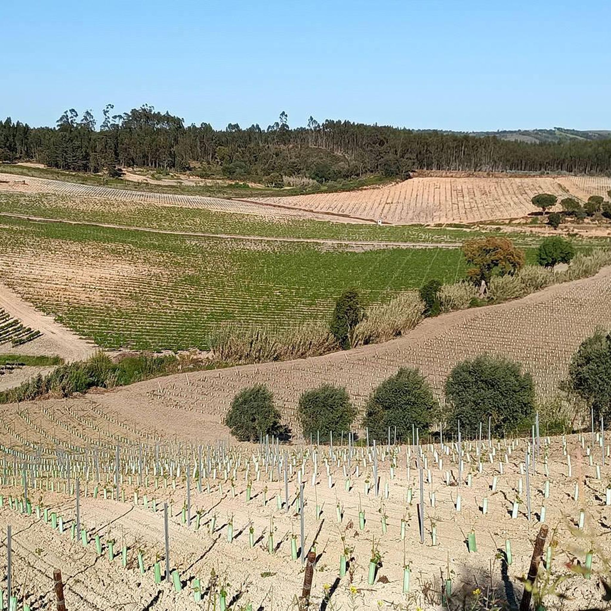
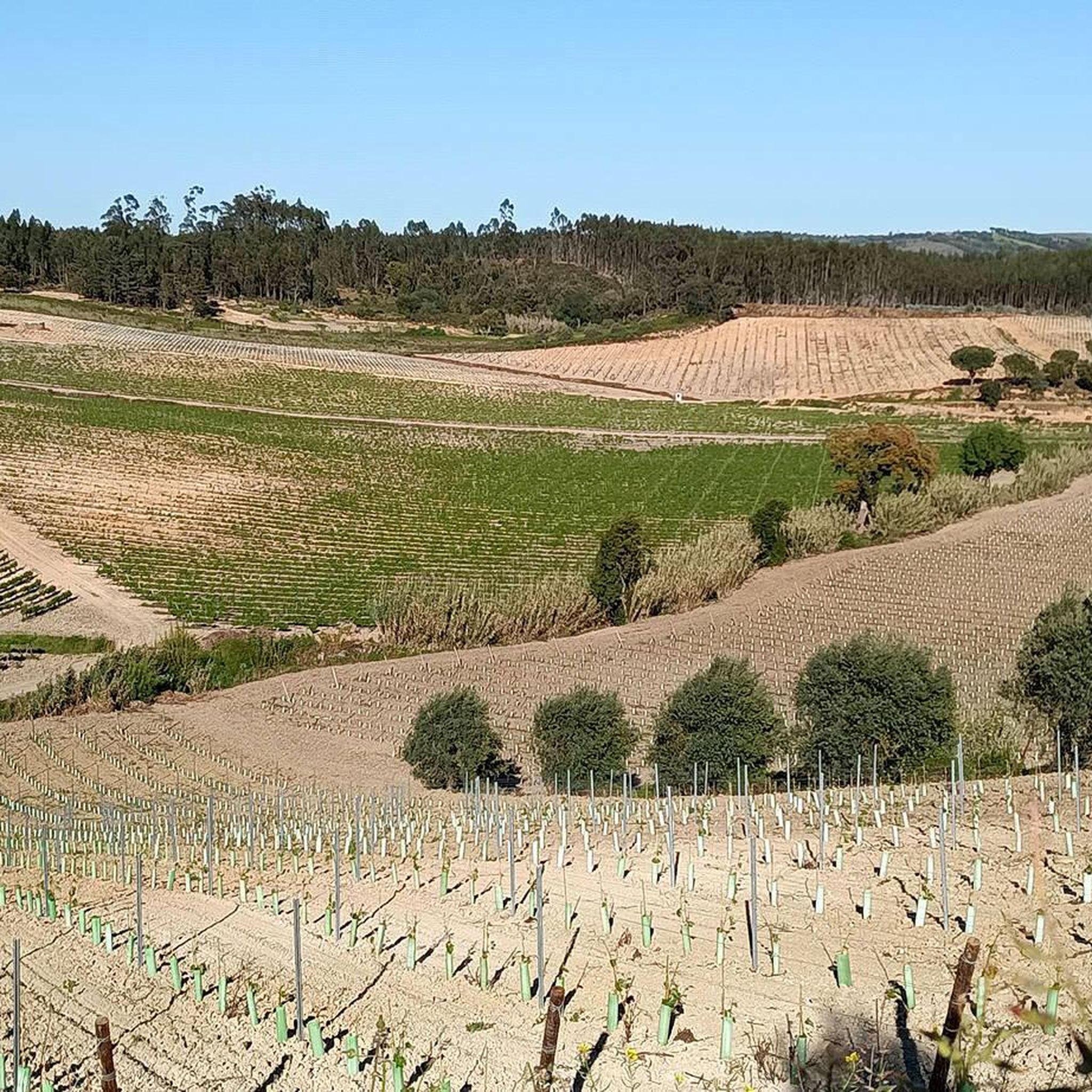
Monte Redondo is a limestone elevation with an altitude of around 212 metres. It is located near the town of Ota, and is distinguished by its rounded shape. Whether it is due to the various trails that allow you to observe the surrounding landscape, including the Ota plain and the Tagus River, or due to its proximity to the Chã Alta dam, Monte Redondo is a point of interest for hikers, gravel bikers and nature lovers in general.
1
0
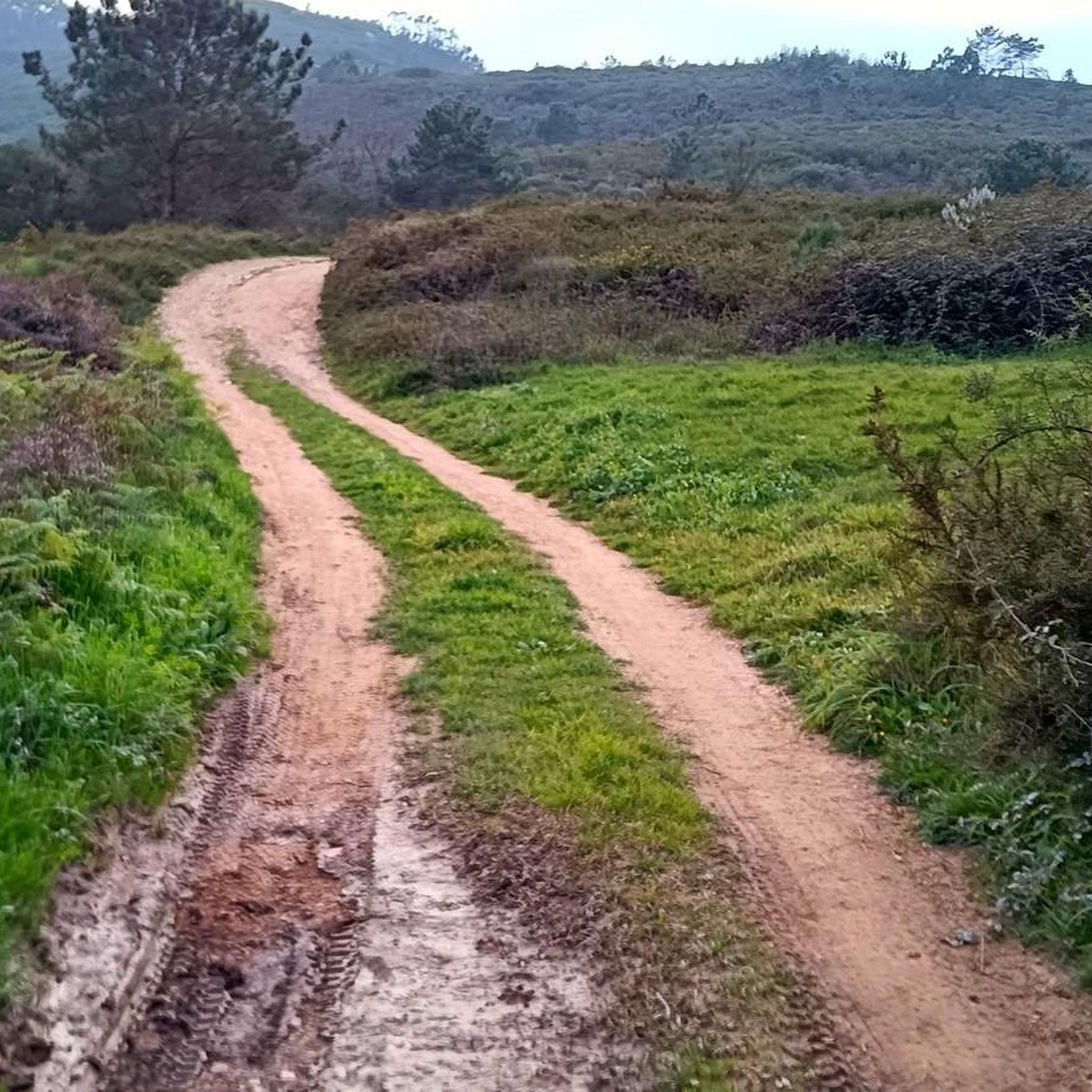
Locally, these small hills are called "cabeços". Cabeço da Silheira is one of the highest in the region, reaching 200m in altitude. It is therefore natural that it was chosen as the site for the installation of water tanks that supply the region's public water supply network. You can reach Cabeço da Silheira via a small asphalt road (very steep) or via one or two existing trails. If you choose to go along the trails, we recommend a mountain bike.
1
0

Point where you can observe the region in Serra de Ota. The route is also frequented by mountain bikers, and can be covered without any major difficulties on foot.
0
0
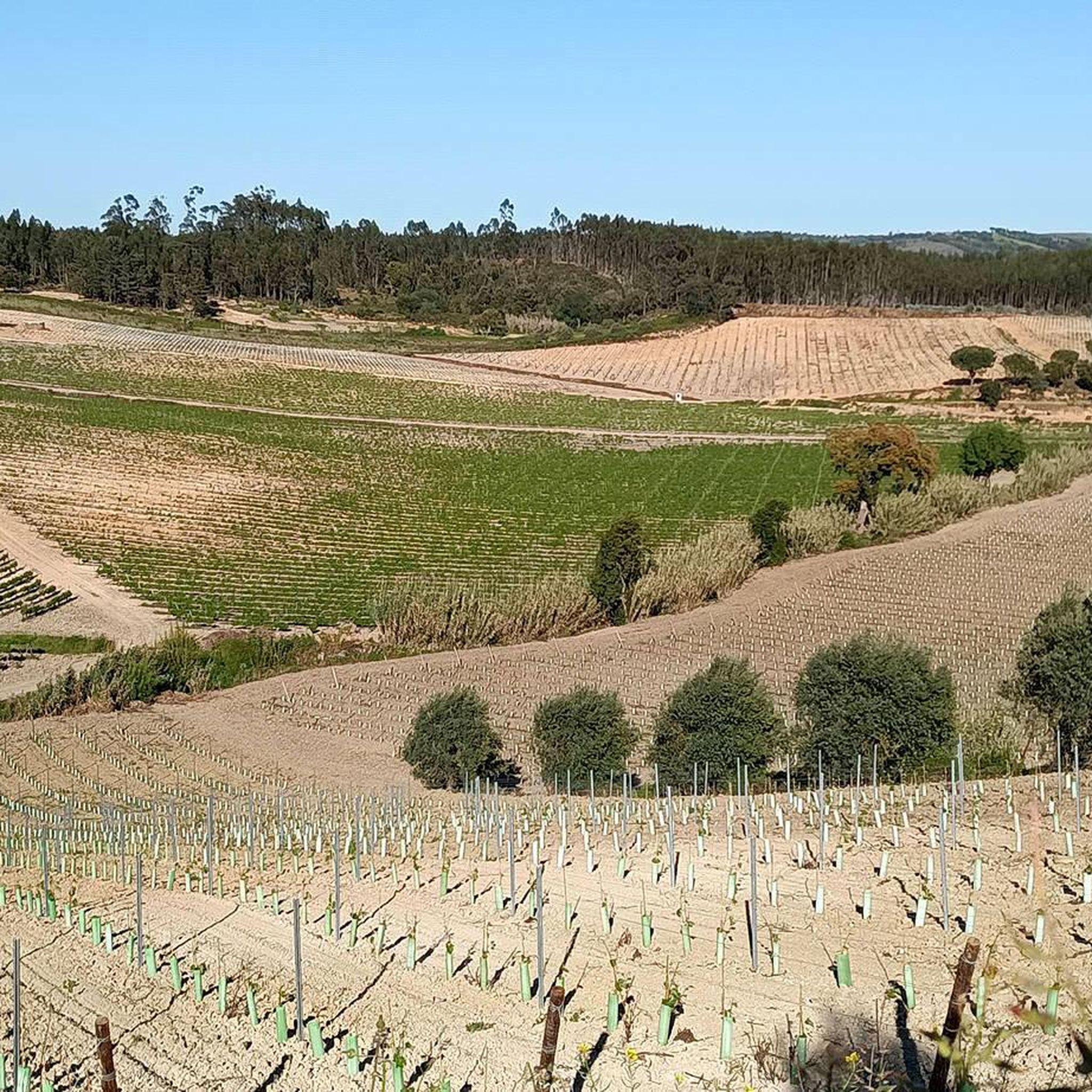
The Serra de Montejunto Forest Watch Station can be accessed via a pastoral trail from the picnic park. It offers a beautiful panorama of the region north of the Serra.
3
0
Usually this is a windy place, but the view is superb. A part of the trail that passes through this point is a bit technical with some loose rock, it may not be very recommended for gravel bikes with thin tires.
2
0
Frequently Asked Questions
What are some popular elevated points or 'peaks' to explore around Alcoentre?
The region around Alcoentre offers several elevated points and viewpoints. Notable spots include the Serra de Montejunto Watchtower, which provides a beautiful panorama, and the Top of the eastern side of Montejunto mountain., known for its superb views. Another significant point is Cabeço da Silheira, one of the highest points in the region at 200 meters.
What kind of views can I expect from the elevated points near Alcoentre?
From the elevated points around Alcoentre, you can expect scenic views of the surrounding landscapes. For instance, the Serra de Montejunto Watchtower offers a beautiful panorama of the region north of the Serra. From the Top of the eastern side of Montejunto mountain., the views are described as superb, though it can be windy. Summit of Monte Redondo provides views of the Ota plain and the Tagus River.
Are there hiking trails suitable for families around Alcoentre's elevated areas?
While specific 'family-friendly' categorizations aren't always explicit, the elevated areas around Alcoentre are generally characterized by pleasant walks and moderate elevation gains, making many trails suitable for families. For example, the Serra de Montejunto Watchtower is accessible via a pastoral trail from a picnic park, suggesting a more relaxed approach. Always check individual route details for specific difficulty and terrain to ensure it suits your family's needs.
What are the typical elevations and difficulties of the trails around Alcoentre?
The 'peaks' around Alcoentre are generally elevated hills or 'cabeços' rather than towering mountains, offering moderate elevation gains. For instance, Cabeço da Silheira reaches 200 meters, and Summit of Monte Redondo is around 212 meters. Trails can range from accessible pastoral paths to more technical sections with loose rock, such as parts of the trail near the Top of the eastern side of Montejunto mountain.. Some routes, like the one to Cabeço da Silheira, can be steep.
Can I bring my dog on the trails near Alcoentre's peaks?
The region around Alcoentre is generally welcoming to outdoor activities, and many trails are suitable for dogs. However, it's always advisable to check local regulations or specific trail information before heading out. Ensure your dog is on a leash and that you carry waste bags to maintain the natural environment.
What is the best time of year to visit the elevated areas around Alcoentre?
The best time to visit the elevated areas around Alcoentre for hiking and outdoor activities is typically during spring (March to May) and autumn (September to November). During these seasons, the weather is usually milder and more pleasant, avoiding the intense heat of summer and the potentially wetter, cooler conditions of winter. This allows for comfortable exploration of the trails and enjoyment of the scenic views.
Are there any specific natural features to look out for when exploring the region?
Beyond the elevated viewpoints, the region around Alcoentre is characterized by varied landscapes, including areas with abundant trees and serene surroundings. While not explicitly mentioned in the highlights, the broader area offers pleasant natural environments for exploration. For those interested in water features, Lagoa de Alcoentre, an artificial lake, is a popular spot for picnics and cycling, featuring a bridge with a Romanesque arch.
What outdoor activities, besides hiking, can I do near these elevated points?
The region around Alcoentre is excellent for cycling. You can find various cycling routes, including MTB trails and road cycling options. For mountain biking, consider routes like the 'Moinho de Avis – Chapel of Saint George loop from Abrigada' or the 'Chapel of Saint George – Meia Encosta Trail loop from Abrigada' which are part of the MTB Trails around Alcoentre guide. For road cycling, routes like the 'Alenquer Wine Museum – Alenquer loop from Abrigada' are available in the Road Cycling Routes around Alcoentre guide.
Where can I find more detailed hiking and cycling routes in the Alcoentre area?
Komoot offers several guides for outdoor activities in the Alcoentre area. For mountain biking, you can explore the MTB Trails around Alcoentre guide. If you prefer general cycling, check out the Cycling around Alcoentre guide. For road cycling enthusiasts, the Road Cycling Routes around Alcoentre guide provides specific routes.
Are there any amenities like cafes or restaurants near the hiking trails?
While the guide focuses on the peaks themselves, the region around Alcoentre and nearby towns will offer amenities. For specific recommendations on cafes or restaurants near trailheads, it's best to check local listings or maps for the towns closest to your chosen starting point, such as Alcoentre itself or areas around Serra de Montejunto.
What makes the <a href="https://www.komoot.com/highlight/6301182" target="_blank" rel="noopener">Serra de Montejunto Watchtower</a> a popular spot?
The Serra de Montejunto Watchtower is popular because it offers a beautiful panorama of the region north of the Serra. It's also easily accessible via a pastoral trail from a picnic park, making it a convenient and rewarding destination for visitors seeking scenic views.
What should I know about visiting the <a href="https://www.komoot.com/highlight/2234103" target="_blank" rel="noopener">Top of the eastern side of Montejunto mountain.</a>?
When visiting the Top of the eastern side of Montejunto mountain., be prepared for potentially windy conditions, although the views are superb. Parts of the trail leading to this point can be technical with some loose rock, so appropriate footwear is recommended. It might not be ideal for gravel bikes with thin tires due to the terrain.
What is the significance of <a href="https://www.komoot.com/highlight/7165019" target="_blank" rel="noopener">Cabeço da Silheira</a>?
Cabeço da Silheira is significant as one of the highest 'cabeços' (small hills) in the region, reaching 200 meters in altitude. Its elevation made it a strategic location for installing water tanks that supply the local public water network. You can reach it via a steep asphalt road or existing trails, with mountain biking recommended for the trails.
Most popular attractions around Alcoentre

Get inspired with the komoot mobile app


Explore more
See even more amazing summits around Alcoentre with these guides:
