The 4 Most Amazing Peaks around Bad Wimsbach-Neydharting
Best mountain peaks around Bad Wimsbach-Neydharting are found in a forest and water-rich landscape within the Salzkammergut region. The area offers varied hikes and elevated views rather than traditional towering peaks. Visitors can explore natural features and cultural trails that provide scenic paths and unique experiences. The region is characterized by lighter terrain, ideal for leisurely to moderately challenging hikes.
Best mountain peaks around Bad Wimsbach-Neydharting
- The most popular mountain peaks is Krailberg Summit Cross (504 m), a summit…
Last updated: July 9, 2026
Krailberg Summit Cross (504 m)
Highlight • Summit
Translated by Google •
Tip by

Krailberg Summit and Survey Point
Highlight • Summit
Translated by Google •
Tip by

Sign up now to discover places like this
Get recommendations on the best single tracks, peaks, & plenty of other exciting outdoor places.
Sign up for free
Krailberg Summit (504 m) – Highest Point of Wels-Land District
Highlight • Summit
Translated by Google •
Tip by
Himmelreich Summit
Highlight • Summit
Translated by Google •
Tip by

Panoramic View from Römerberg with Summit Marker
Highlight • Viewpoint
Translated by Google •
Tip by
Start today with a free account
Your next adventure awaits.
Login or Signup
Popular around Bad Wimsbach-Neydharting
Tips from the Community

The shortcut I took is only recommended if you want to pick a few blackberries along the way! And if you're wearing pants that are resistant to thorns 😅
0
0

Halfway point of the Krailbergrunde, good rest stop
1
0

The highest point in the Wels-Land district is on the Steindlberg at 513m. That's 9m higher than the famous Krailberg.
1
0

The actual summit/surveying point is about 100m north of the summit cross and is recognizable by a marker stone
0
0
Coming from the south (vineyard), enter the forest, then turn left (do not go around the forest to the southwest, it will be difficult there), from the north (staffel) there are 2 steeper paths leading up, we used the left one around the outside, at the top it is then comfortably flat in the forest to the summit cross
0
0
Coming from the south (vineyard), enter the forest, then turn left (do not go around the forest to the southwest, it will be difficult there), from the north (staffel) there are 2 steeper paths leading up, we used the left one around the outside, at the top it is then comfortably flat in the forest to the summit cross
1
0
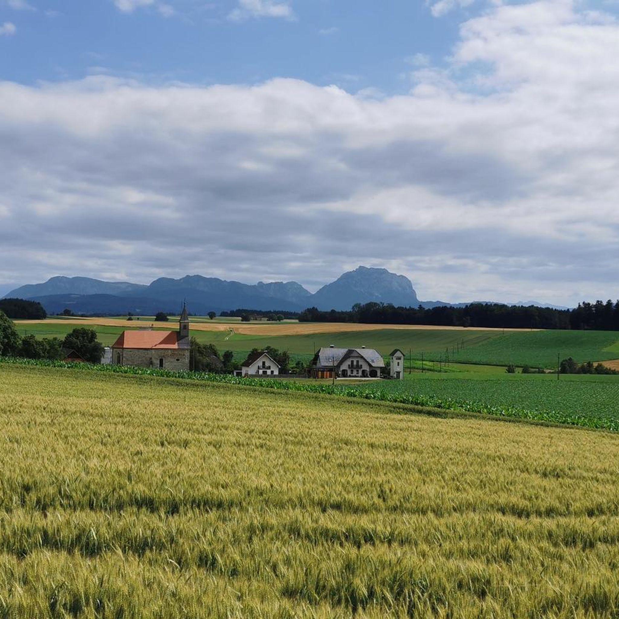
The vantage point on the Römerberg offers a wonderful view of the Alpine panorama with Schwanenstadt in the foreground. The panorama stone helps to identify the peaks.
1
0

Krailberg is the highest point in the Wels-Land district with a height of 504 meters. It lies on the border of the communities of Bachmanning, Neukirchen and Pennewang. There is a summit cross on the Krailberg that was built in 2011. Krailberg is a popular destination for hikers who can enjoy beautiful hiking trails through picturesque forests. There are several routes to reach the summit, starting from various villages in the area. Some of the most recommended are: Hike from Bachmanning: This is a 9.5 km long hiking trail that starts from the Bachmanning town hall and passes the St. Leonhard Chapel and the Bachmanning Castle before reaching the summit of Krailberg. Hike from Neukirchen: This is a 7.5 km long circular route that starts from the Neukirchen multi-purpose hall and follows a forest road to the summit of the Krailberg. Hike from Pennewang: This is a 6.5 km long circular route that starts from the Pennewang church and crosses the fields and forests to the summit of the Krailberg.
2
3
Frequently Asked Questions
What kind of elevated experiences can I expect around Bad Wimsbach-Neydharting?
The region of Bad Wimsbach-Neydharting is characterized by lighter terrain, offering varied hikes and elevated views rather than traditional towering mountain peaks. You'll find scenic paths, unique natural features like the Neydharting Moor, and cultural trails that provide enjoyable outdoor experiences.
What are some of the most notable elevated points or summits in the area?
One of the most notable points is the Krailberg Summit Cross (504 m), which marks the highest mountain massif in the Wels-Land district. Nearby, you'll also find the Krailberg Summit (504 m) – Highest Point of Wels-Land District and the Krailberg Summit and Survey Point, identifiable by a marker stone.
Are there family-friendly viewpoints or summits in Bad Wimsbach-Neydharting?
Yes, the Panoramic View from Römerberg with Summit Marker is considered family-friendly. It offers a wonderful view of the Alpine panorama, with a panorama stone to help identify the peaks.
What natural features can I explore on hikes in this region?
Beyond the elevated points, you can explore the fascinating Neydharting Moor, known for its diverse flora and fauna, reed meadows, and small ponds. The Almuferweg also offers pleasant walks along the Alm river.
What is the best time of year to visit Bad Wimsbach-Neydharting for hiking?
The best seasons for hiking in Bad Wimsbach-Neydharting are typically spring and autumn. During these times, the weather is mild, and the landscape is vibrant with color, making for very pleasant outdoor experiences.
Are there easy hiking trails suitable for beginners or leisurely walks?
Yes, the region offers various trails suitable for all levels. The 'Wimpassinger Runden' include routes for leisurely walks, and you can find many easy hikes, such as the 'Schloss Wimsbach – Parish Church of Bad Wimsbach loop' or the 'Stone Cairn at the Weir loop'. You can find more options on the Easy hikes around Bad Wimsbach-Neydharting guide.
What other outdoor activities can I do near the elevated points in Bad Wimsbach-Neydharting?
Besides hiking, you can enjoy road cycling and running. There are numerous routes available, such as the 'Stadl Paura Church – Traunfall Waterfall loop' for road cycling or various running loops from Steinfeld. Explore more options in the Road Cycling Routes and Running Trails guides.
Are there any cultural or historical trails in the area?
Yes, the 'Bad Wimsbach Culture Trail' allows hikers to appreciate the natural beauty while also delving into the region's history and culture through various information boards along the way.
What do visitors enjoy most about the elevated points and trails in Bad Wimsbach-Neydharting?
Visitors appreciate the tranquil natural setting, the opportunity for leisurely to moderately challenging hikes, and the cultural insights offered by the trails. The views from points like the Krailberg Summit Cross are also highly regarded.
Can I find trails that offer a mix of forest and open views?
Many trails in the region traverse dense forests and lush alpine meadows, providing a mix of shaded paths and open, scenic elevated views. For example, routes to the Krailberg Summit often involve comfortably flat sections in the forest near the summit.
Are there any specific tips for reaching the Krailberg Summit?
When coming from the south (vineyard), enter the forest and turn left. From the north (Staffel), there are two steeper paths leading up. Some routes offer comfortably flat sections in the forest near the summit cross, making the final approach easier.
Most popular routes around Bad Wimsbach-Neydharting
Most popular attractions around Bad Wimsbach-Neydharting

Get inspired with the komoot mobile app


Explore more
See even more amazing summits around Bad Wimsbach-Neydharting with these guides:
