The 9 Most Amazing Peaks around Esternberg
Mountain peaks around Esternberg are characterized by a landscape of rolling hills and the Inn River, offering diverse hiking opportunities. While not alpine, the region features notable elevated points that provide expansive views. Esternberg is known for its natural beauty, with forests, hills, meadows, and pastures defining the area. These features make the region suitable for both experienced hikers and families seeking varied routes and panoramic vistas.
Best mountain peaks around Esternberg
- The most popular mountain peaks is Penzenstein Viewpoint,…
Last updated: June 26, 2026
Haugstein Summit (895 m)
Highlight • Summit
Translated by Google •
Tip by

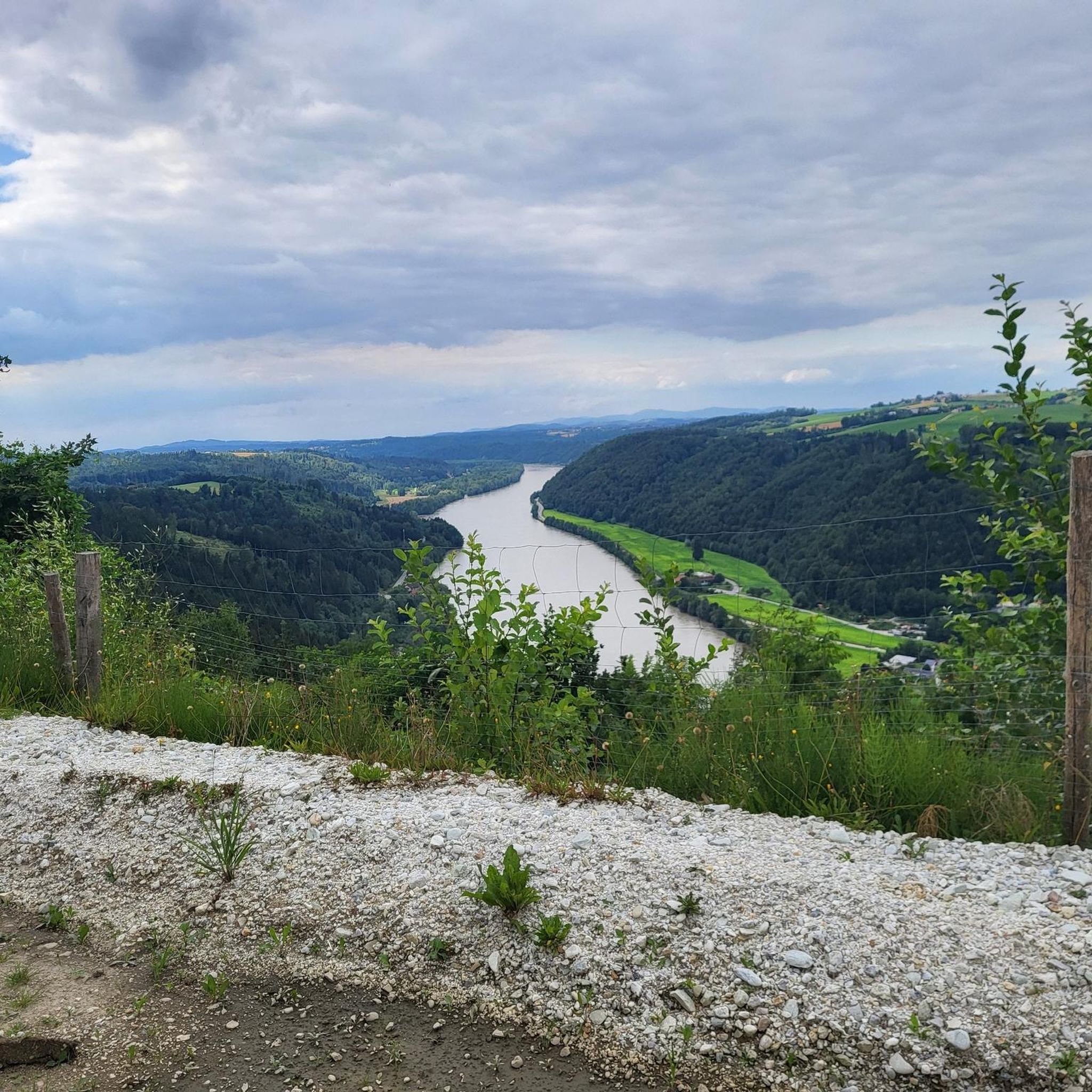
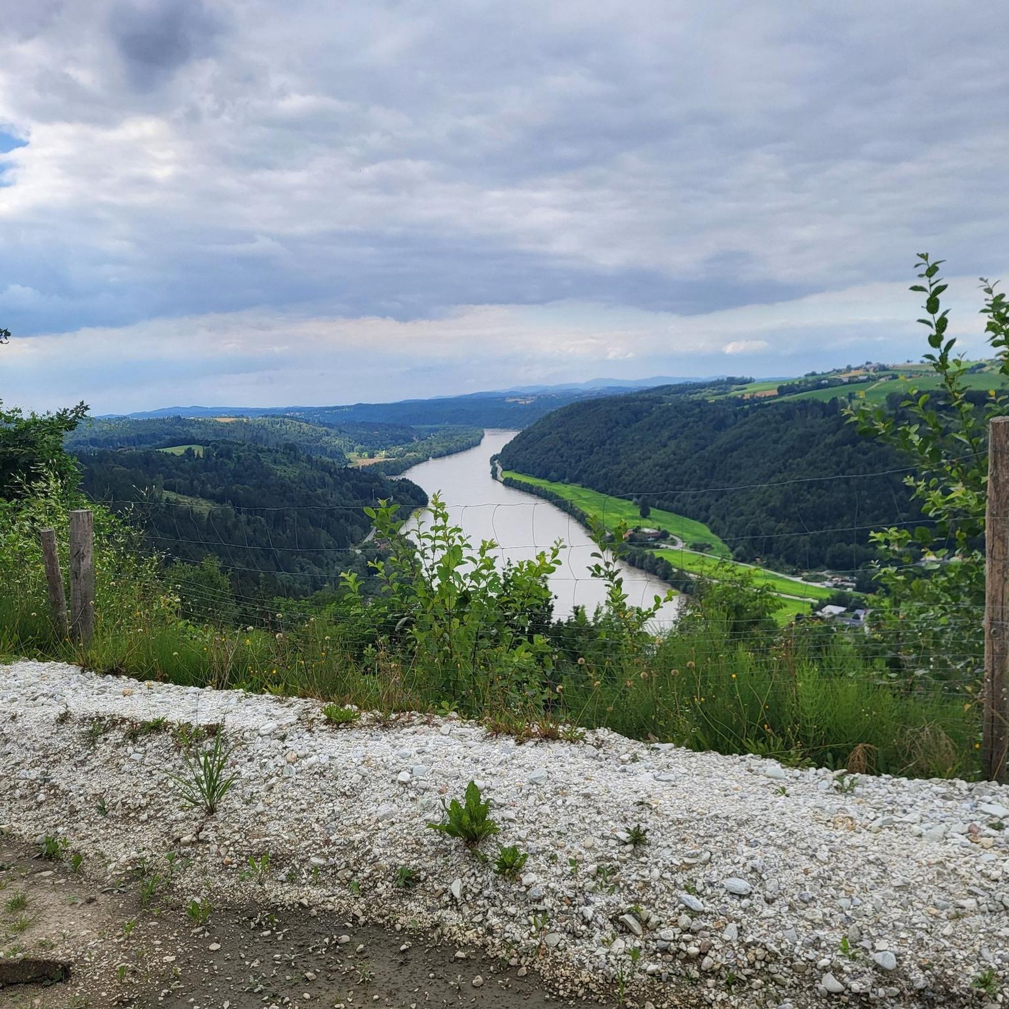
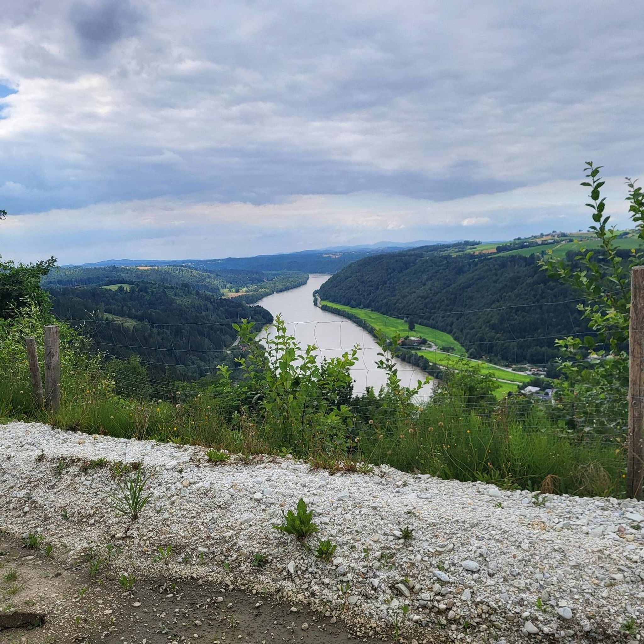
Penzenstein Viewpoint, Chapel and Summit Cross
Highlight • Viewpoint
Translated by Google •
Tip by

Sign up now to discover places like this
Get recommendations on the best single tracks, peaks, & plenty of other exciting outdoor places.
Sign up for free
View from Ebenstein Rock across the Danube Valley
Highlight • Viewpoint
Translated by Google •
Tip by

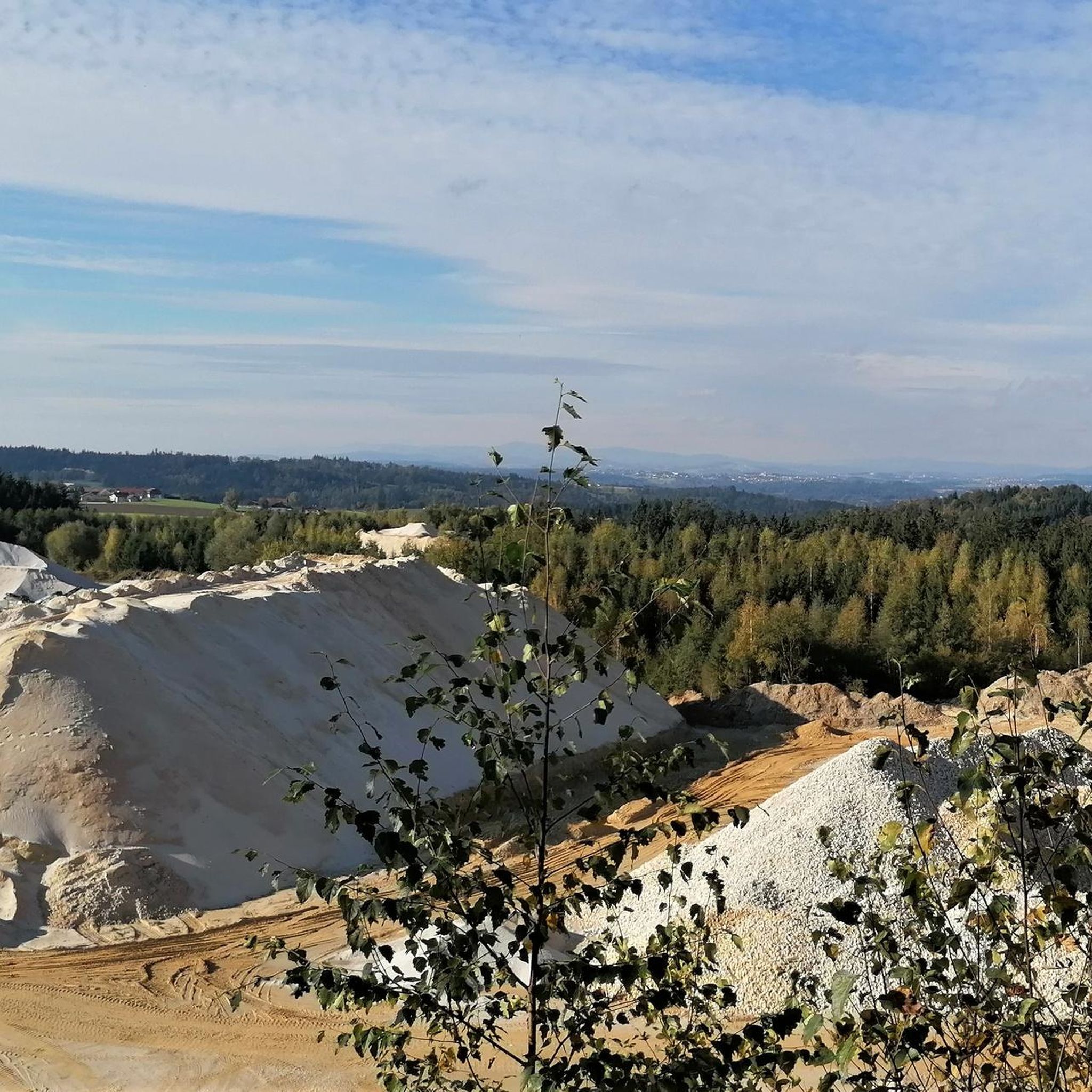
Ameisberg Summit (729 m)
Highlight • Summit
is called Hochholzstein by the local population and has been a popular excursion …
Translated by Google •
Tip by

Summit Cross on Höhenberg
Highlight • Summit
Translated by Google •
Tip by

Sign up for free to discover even more peaks around Esternberg.
Sign up for free
Already have an account?
Start today with a free account
Your next adventure awaits.
Login or Signup

Other adventures around Esternberg

Tips from the Community

The summit cross on Hohenberg was indeed blessed with a view stretching all the way to Untergriesbach.
0
0
a beautiful viewpoint
0
0

The Ebenstein is part of the geotope "Rock ensemble of Jochenstein on the Donauleite"! At the Donauleite, several rock ridges made of eye and pearl gneiss protrude from the slope, each ending in steep cliffs (10 to 15 m). A system of fissures that are almost at right angles to one another is responsible for the cuboid shape of the towers. The block flow between the ridges also consists of strikingly geometric gneiss blocks. The cliffs offer a fantastic view of the Danube's V-shaped valley and of Jochenstein (cliffs below the hiking trail; beware of falling!!!). Bavarian State Office for the Environment (LfU). More information: https://www.umweltatlas.bayern.de/standortauskunft/rest/reporting/sb_geotope/generate?additionallayerfieldvalue=275R010
1
0

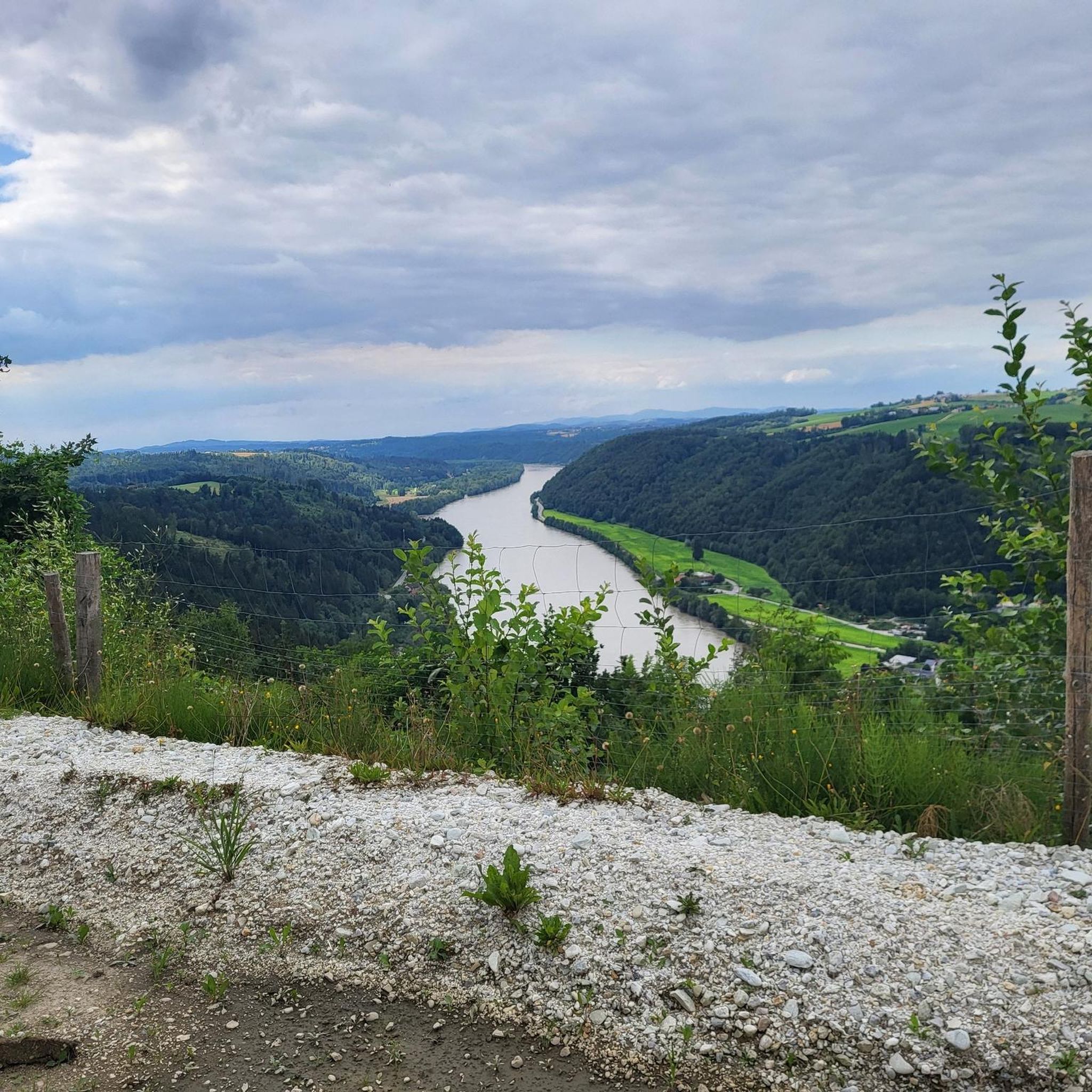
The Donaublick Penzenstein is a viewing point overlooking the Danube. Visitors here enjoy magnificent views of the Danube Valley, the Jochenstein Power Plant, and Engelhartszell. The most popular tourist destination in the municipality is a must-see. At Penzenstein there is also a small chapel, where mass is held during the summer months (every 13th of the month) and which is also a popular pilgrimage destination. There is also a rest area on the Donausteig trail. Source: https://www.urlaub-neustift.at/genussurlaub/sehenswuerdigkeiten/details/6-donaublick-penzenstein.html
2
0
The Donausteig long-distance hiking trail runs along both banks of the river for 450 km from Passau via Linz to Grein. Along the way, hikers encounter wondrous legendary figures, impressive landscapes and unique cultural treasures.
2
1
From the Ebenstein rock there is a magnificent view of the Danube valley with the Jochenstein Danube power station, Haus am Strom and Engelhartszell on the opposite side of the Danube. A special feature is the chapel that is located at this vantage point.
2
0
On the Penzenstein, a 568 m high rocky outcrop with an iron cross and views of the Danube Valley and Engelhartszell, the chapel, built in 1790, nestles against the rocks. Legend tells that "Seppenhans" from Kramesau saved a statue of "St. Nepomuk" from a flood. When a wooden chapel was built on the Penzenstein, he placed his Nepomuk there, but this brought terrible misfortune to the Kramesau. He brought the statue home, but the surrounding villages continued to be haunted. A farmer from Großmollsberg decided to put an end to the haunting and built a new chapel on the Penzenstein. Only then did peace return.
2
0

Great view, quiet and sheltered spot, enough space for a rest and snack
1
0
Frequently Asked Questions
What are some popular mountain peaks and viewpoints around Esternberg?
The region offers several notable elevated points. Among the most popular are Penzenstein Viewpoint, Chapel and Summit Cross, which provides panoramic views over the Danube valley, and the View from Ebenstein Rock across the Danube Valley, offering expansive views from a rocky plateau. Another favorite is Ameisberg Summit (729 m), known for its great views and as a popular excursion destination for locals.
Where can I find the best panoramic views in the Esternberg region?
For breathtaking panoramic views, consider visiting Penzenstein Viewpoint, which overlooks the Danube valley and the Jochenstein Danube power station. The View from Ebenstein Rock also offers stunning vistas of the Danube. Additionally, the Hoher Stein, mentioned in regional research, provides expansive views over the entire Innviertel region, extending all the way to the Alps.
What is the terrain like for hiking the peaks around Esternberg?
The terrain around Esternberg is characterized by rolling hills, forests, meadows, and pastures. While not alpine, some routes can be quite demanding. For example, an ascent to the Haugstein requires good endurance and sure-footedness, while paths to viewpoints like Hoher Stein lead through green meadows and flower fields, offering a more gentle experience.
Are there challenging mountain peaks for experienced hikers near Esternberg?
Yes, for experienced hikers seeking a challenge, the Haugstein Summit (895 m) is a notable option. It is the highest peak in the Sauwald region and an ascent provides impressive views, but it requires good endurance and sure-footedness.
What is the best time of year to visit the mountain peaks around Esternberg for hiking?
Spring and autumn are particularly recommended for hiking in Esternberg. During these seasons, temperatures are mild, and nature displays its full splendor with blossoming meadows in spring or colorful deciduous forests in autumn, enhancing the scenic beauty of the trails.
Are there family-friendly hiking options among the peaks near Esternberg?
Yes, the Esternberg region offers a variety of well-signposted hiking trails, many of which are family-friendly. While specific peaks might require more effort, the general area provides routes suitable for families, offering exciting adventures for children amidst its natural beauty.
What natural features can I expect to see when exploring the peaks?
You can expect to encounter diverse natural beauty, including dense forests, rolling hills, lush meadows, and pastures. Many elevated points offer views of the Inn River and the Danube valley. Highlights like Penzenstein and Ebenstein Rock are natural monuments, providing unique geological formations alongside the expansive views.
What outdoor activities can I do near these mountain peaks besides hiking?
Beyond hiking, the Esternberg area offers various outdoor activities. You can find numerous running trails, as well as extensive options for cycling and gravel biking. These routes often pass through the scenic landscapes surrounding the peaks and along the Inn and Danube rivers.
Are there specific trails for running or cycling that offer views of the peaks?
Yes, many of the running and cycling routes in the Esternberg region are designed to showcase the area's natural beauty, including views of the elevated points and the river valleys. For example, cycling routes like the 'View of Krämpelstein Castle – Nibelungen Danube Riverside Cycle Path loop' offer scenic perspectives of the landscape.
What do visitors enjoy most about the mountain peaks and viewpoints in Esternberg?
Visitors consistently praise the expansive and breathtaking panoramic views offered from various points, such as Penzenstein and Ebenstein Rock. The tranquility of the natural surroundings, the well-maintained trails, and the opportunity for peaceful relaxation at various resting places are also highly valued.
Is there a summit cross or chapel on any of the peaks?
Yes, the Penzenstein Viewpoint features both a small chapel and a summit cross, making it a popular destination. Additionally, the View from Ebenstein Rock also has a chapel situated on its rocky plateau. You can also find a Summit Cross on Höhenberg, offering beautiful views.
Are there any specific natural monuments among the peaks?
Yes, several peaks are recognized as natural monuments. The Haugstein Summit, Penzenstein Viewpoint, Ebenstein Rock, and Ameisberg Summit are all designated as natural monuments, highlighting their ecological or geological significance.
What is the highest point in the Sauwald region near Esternberg?
The highest point in the Sauwald region is the Haugstein Summit (895 m). It offers impressive views of the surrounding area, including the nearby Danube valley, and is considered a more challenging hike.
Most popular routes around Esternberg
Most popular attractions around Esternberg

Get inspired with the komoot mobile app


Explore more
See even more amazing summits around Esternberg with these guides:
