The 4 Most Amazing Peaks around Ronshausen
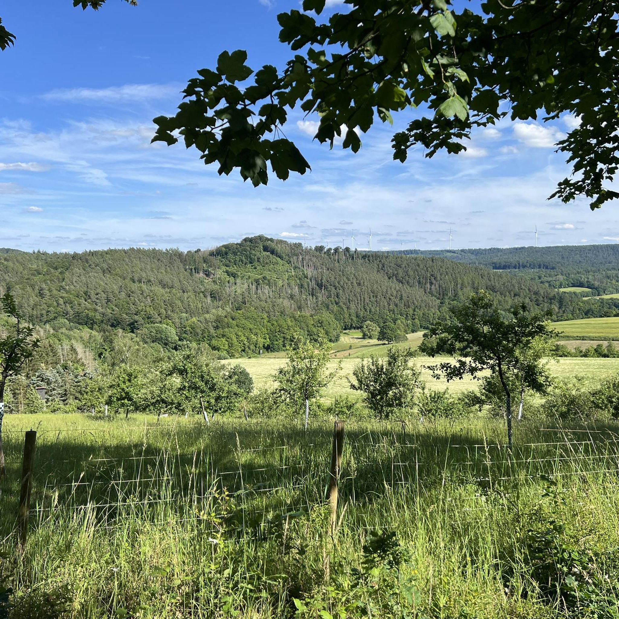
Mountain peaks around Ronshausen are situated in a region characterized by varied topography, nestled between the Thuringian Forest and the Rhön Mountains. This area offers a diverse landscape of gentle hills, dense forests, and river courses. The region provides options for outdoor enthusiasts, including hikers and bikers, with several prominent hills and peaks. These natural features contribute to the area's appeal for exploring the outdoors.
Best mountain peaks around Ronshausen
- The most popular mountain peaks is Hohe Buche Summit,…
Last updated: July 10, 2026
Rodenberg Castle Ruins
Highlight • Castle
Translated by Google •
Tip by

Summit Cross Arnsberg
Highlight • Summit
Translated by Google •
Tip by
Sign up now to discover places like this
Get recommendations on the best single tracks, peaks, & plenty of other exciting outdoor places.
Sign up for free
Summit Cross Ottilienberg
Highlight • Summit
Until about 400 years ago there was a small chapel on the northwest …
Translated by Google •
Tip by

Hohe Buche Summit
Highlight (Segment) • Summit
Road is great to drive in both directions.
Once at the top you have a great view of Meißner, Eisenberg and Rimberg 👍
Translated by Google •
Tip by

Giegenberg Trail Summit
Highlight (Segment) • Summit
Translated by Google •
Tip by

Sign up for free to discover even more peaks around Ronshausen.
Sign up for free
Already have an account?
Start today with a free account
Your next adventure awaits.
Login or Signup

Tips from the Community

First documented in 1170, only a few remnants of the keep, a foundation wall, and moat structures remain today. The legend of the Bornschisser (Bornschisser)—the nickname of the Rotenburgers—has a connection to the castle. The best way to access the castle by mountain bike is from the rear—from the breakfast beech tree.
1
0

It's a difficult path to get here, and some people walk past it.... The place is set back a little towards the south. There is a summit book and writing materials available here.
2
0

Unfortunately, the trail, the castle and the area around it are closed for the time being due to the danger of branches/trees breaking. 😕
5
0

Old monument high above the town of Rotenburg an der Fulda. Rodenberg Castle Ruins
1
0

Großer Arnsberg 647.7 m above sea level NN
0
0

Refuge with a summit cross on the Arnsberg👍🏻
0
0

The Rodenberg castle ruins, also known as Rotenburg on the Old Tower, are the ruins of a hilltop castle on the Alter Turm mountain (418.1 m above sea level), which is covered with deciduous forest, mostly beech trees, about 2 km north-northeast of the old town of Rotenburg an der Fulda in the Hersfeld-Rotenburg district in northern Hesse. The name of the town is probably derived from the former castle. The castle was first mentioned in documents in 1170, and in the years 1170, 1182 and 1197 the first Rotenburg castle guards, the ministerial family "von Rodenberc", are mentioned in connection with the castle. It is assumed that the Ludowingers, Landgraves of Thuringia, had the castle built after 1122, when the bailiwick of Hersfeld Abbey came into their possession from the Hessian Gisonen. However, it is possible that the Gisonen had already built the first fortified buildings on the mountain, which was built by Matthias Merian the Elder. Ä. Hausberg or Haußberg is still the name of the area today. After the death of the last Ludowinger, Heinrich Raspe IV, in 1247 and the Thuringian-Hessian War of Succession (1247-1264), the Hessian property and the Ludowinger's bailiwick rights there fell to Heinrich I, the first Landgrave of Hesse. This also affected the Rodenberg bailiwick castle, with which the gradual alienation of Hersfeld territory to the Landgraves of Thuringia and, as their successors, the Landgraves of Hesse began. The castle was subsequently a Hessian fief of the families of Trott, Baumbach, Reichenbach, Berlepsch, Vullekopf and Hattenbach, who lived there as castle guards or sub-bailiwicks. The castle was destroyed in the Sterner War, the armed conflict that broke out in 1372 between the Knights' League of the Sterne and the Landgrave Hermann II of Hesse. In a reconciliation document from 1389, it was stipulated that the castle should no longer be fortified. It then fell into disrepair, but was probably still at least partially habitable until the 16th century, when it was owned by the Lords of Trott zu Schwarzenhasel. Source: https://de.wikipedia.org/wiki/Burgruine_Rodenberg
6
1
Connecting path from Wehneberg, past the Zellersgrund make Friedlos to Giegenberg.
0
0
Frequently Asked Questions
Which mountain peaks offer the best views around Ronshausen?
For expansive scenic views, the Hohe Buche Summit is highly recommended, offering vistas of Meißner, Eisenberg, and Rimberg. The Hohe Meißner, though not a komoot highlight, is also a significant landmark at 753 meters, providing breathtaking views of the surrounding area. Additionally, the Weltschlüssel Viewpoint provides a beautiful panoramic view from a cozy bench.
Are there family-friendly mountain peaks or viewpoints in the Ronshausen region?
Yes, the Weltschlüssel Viewpoint is specifically noted as family-friendly, featuring a cozy bench with a panoramic view. Another family-friendly option is the View Over Wippershain Towards Soisberg, where you can see the pointed volcanic cone of the Soisberg.
What kind of outdoor activities can I do near the mountain peaks around Ronshausen?
The region around Ronshausen is excellent for both hiking and cycling. You can find various cycling routes, including options for touring bicycles and gravel biking, as well as easy hiking trails. For example, the Cycling around Ronshausen guide offers routes like the 'Sechs-Buchen – Fuldawiesen near Meckbach loop'. For hikers, the Easy hikes around Ronshausen guide includes trails such as the 'Keil's House loop'.
Are there challenging mountain bike trails in the Ronshausen area?
Yes, the Hohe Meißner is particularly known for its challenging mountain bike trails along its steep slopes, making it a popular spot for mountain biking throughout the year. The Stellberg and Himmelsberg are also mentioned as locations suitable for mountain biking.
What unique features can I find at the mountain peaks near Ronshausen?
At Summit Cross Arnsberg, visitors will find a summit book and writing materials available. The Summit Cross Ottilienberg is graced by a 3.60-meter high and 2.40-meter wide summit cross, erected in 2008, on a site that once held a chapel dedicated to Saint Odilia.
What is the best time to visit the mountain peaks around Ronshausen?
While specific seasonal recommendations for all peaks are not provided, a tour over the Ottilienberg is particularly worthwhile in spring during the wild garlic season. Generally, the diverse landscape with dense forests and river courses makes the area appealing for outdoor activities throughout much of the year.
Are there any specific trails or routes that incorporate these mountain peaks?
Yes, the section around Hohe Buche Summit is part of the 36 km long Glück-Auf-Radweg, a circular route in the old mining area of Richelsdorfer Gebirge. This route connects several towns and offers a great cycling experience.
What natural landmarks or features are prominent in the Ronshausen region?
The Ronshausen region is characterized by a varied topography, nestled between the Thuringian Forest and the Rhön Mountains. Key natural features include the prominent Hohe Meißner, known for its elevation and views, as well as the Stellberg and Himmelsberg. The landscape also features gentle hills, dense forests, and picturesque river courses.
What do visitors enjoy most about the mountain peaks around Ronshausen?
Visitors particularly appreciate the stunning panoramic views from various summits and viewpoints, such as the Hohe Buche Summit and Weltschlüssel Viewpoint. The challenging mountain bike trails on the Hohe Meißner are also a big draw for adventure enthusiasts. The overall diverse landscape provides a rich environment for outdoor exploration.
Are there any unique adventure experiences related to the mountain peaks?
Yes, the Hohe Meißner offers a treetop trail, providing an adventure course high in the trees with impressive vistas. This offers a unique perspective of the forest environment and a different way to experience the mountain.
What is the highest mountain peak mentioned near Ronshausen?
The Hohe Meißner is the most prominent mountain peak mentioned near Ronshausen, reaching an altitude of 753 meters. It is a significant landmark in the region.
Most popular routes around Ronshausen
Most popular attractions around Ronshausen

Get inspired with the komoot mobile app


Explore more
See even more amazing summits around Ronshausen with these guides:
