Top 20 Lakes around Rheinbreitbach
Best lakes around Rheinbreitbach are found in the surrounding regions, as Rheinbreitbach itself, situated on the Rhine and bordering the Siebengebirge, does not feature notable natural lakes within its municipal boundaries. The nearby Siebengebirge Nature Park and the Westerwald Lake District offer various bodies of water and recreational opportunities. These areas provide diverse landscapes, from former basalt quarries to artificial lake districts, suitable for exploration.
Best lakes around Rheinbreitbach
- The most popular lakes is Three-Lakes Viewpoint, a viewpoint where…
Last updated: July 10, 2026
Three-Lakes Viewpoint
Highlight • Viewpoint
Translated by Google •
Tip by

Weilberg Quarry
Highlight • Natural Monument
The highlight is on the tour "Weg der …
Translated by Google •
Tip by

Sign up now to discover places like this
Get recommendations on the best single tracks, peaks, & plenty of other exciting outdoor places.
Sign up for free
Waldschlößchen Pond
Highlight • Lake
Translated by Google •
Tip by

Basalt quarry pond and cliffs on Großer Ölberg
Highlight • Natural Monument
Translated by Google •
Tip by

Eulenbergsee Crater Lake
Highlight • Lake
In 2005, the NABU Rhein-Sieg acquired the land. Today, a well-maintained circular path leads around the lake and one or two views can be caught.
Translated by Google •
Tip by

Sign up for free to discover even more lakes around Rheinbreitbach.
Sign up for free
Already have an account?
Start today with a free account
Your next adventure awaits.
Login or Signup

Tips from the Community

Geologically interesting, enchanted, beautiful to look at.
0
0

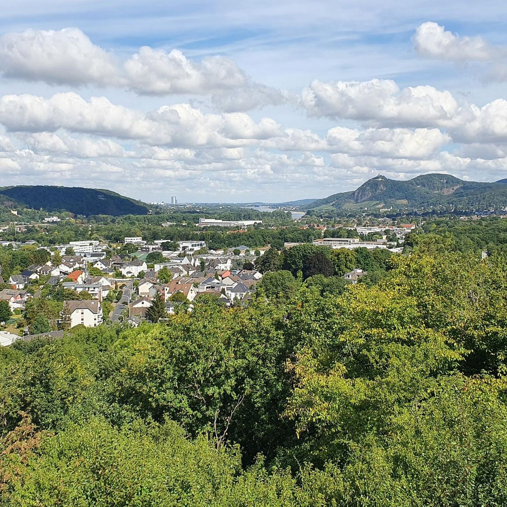
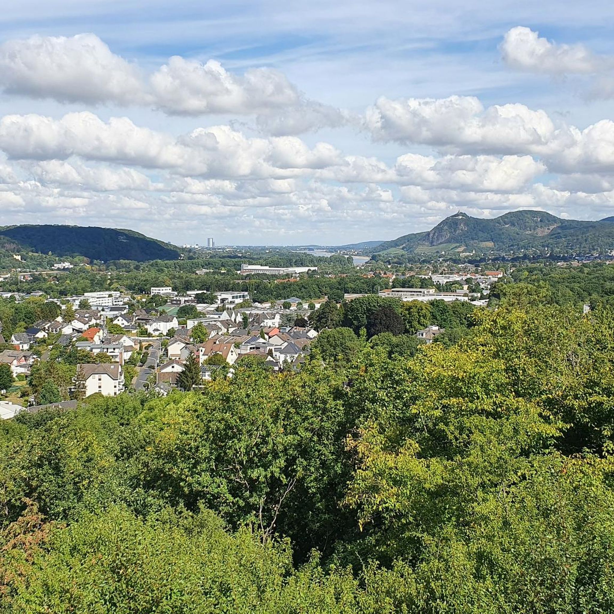
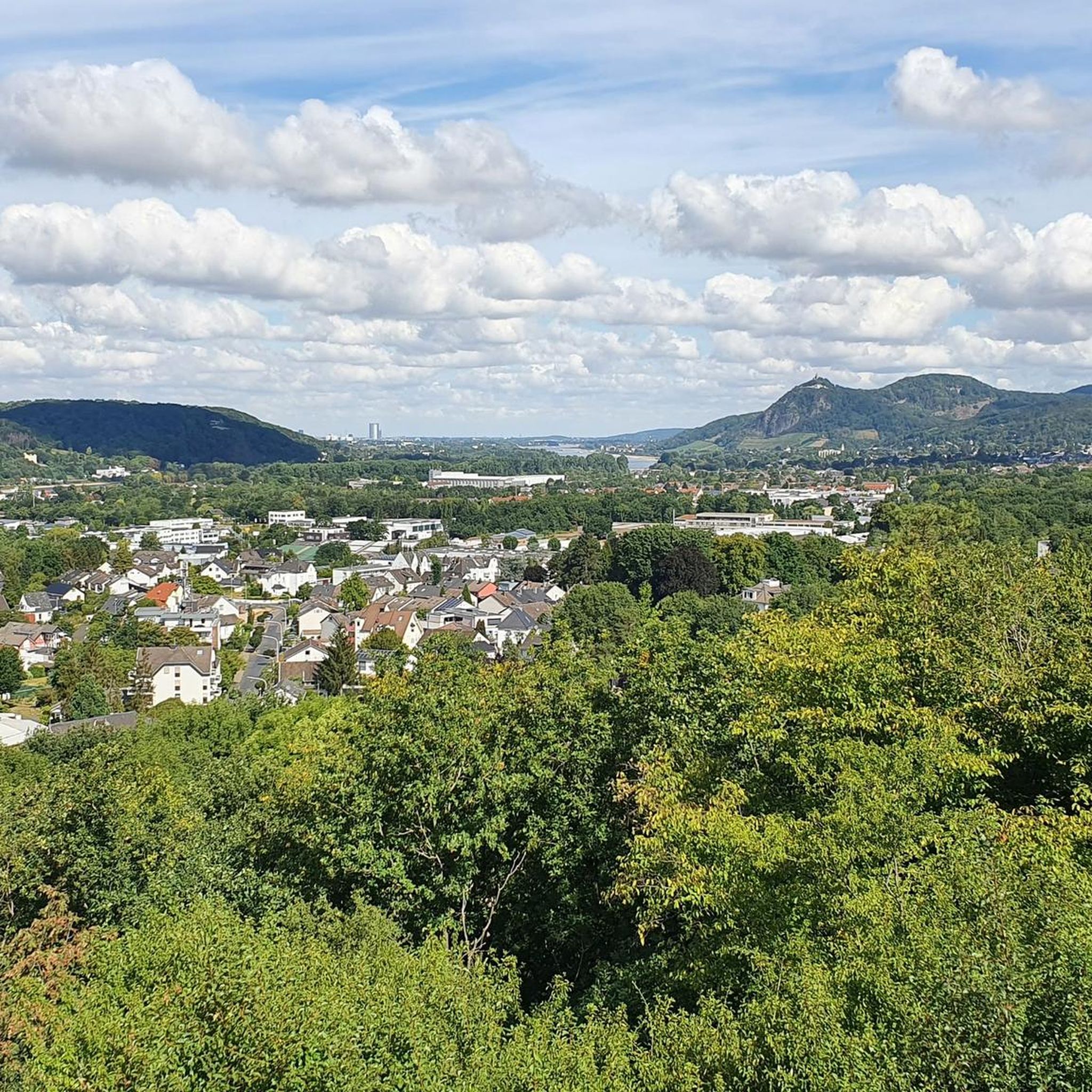
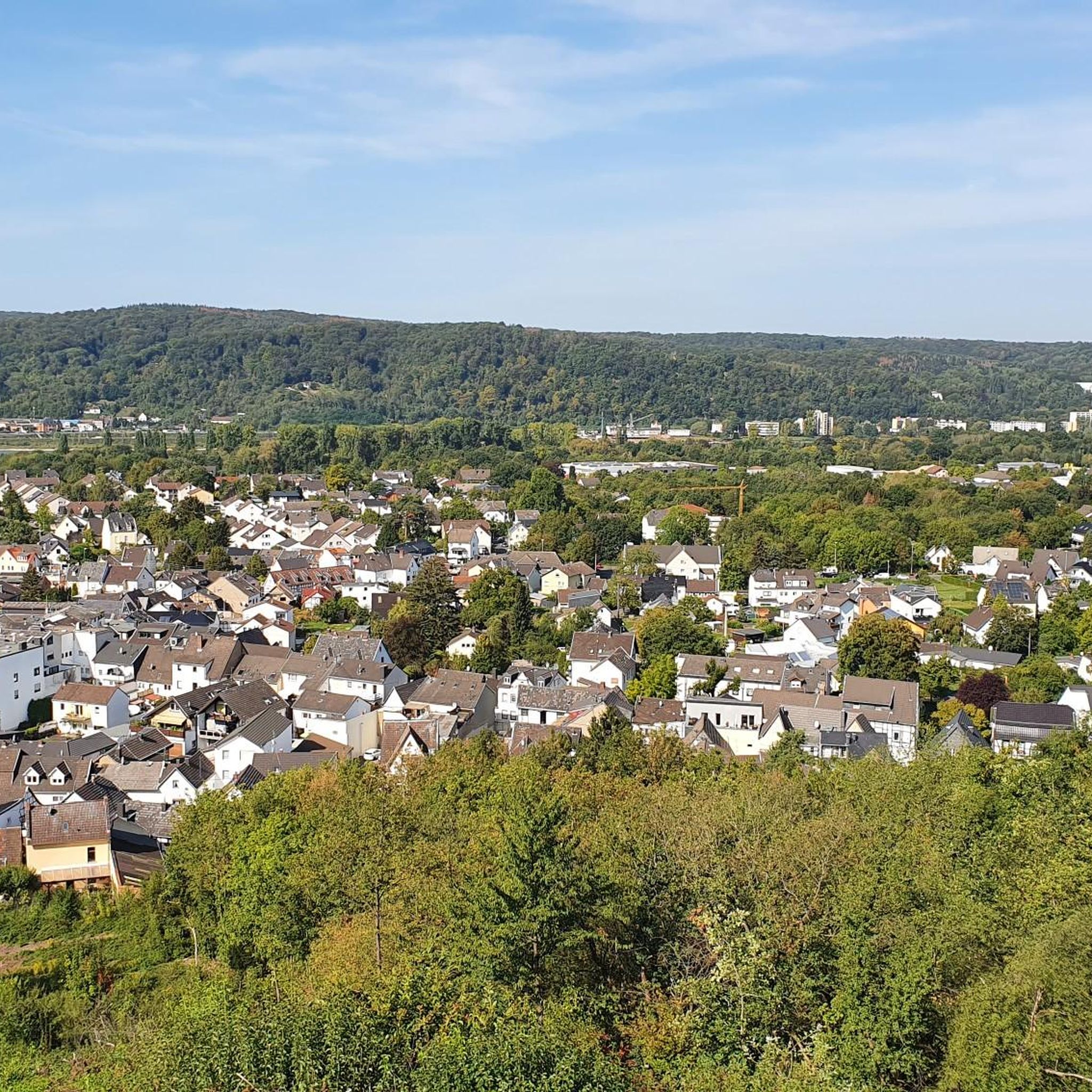
The name is once again misleading: Of course, the local hiker knows that there are by no means several lakes visible from this spot. Rather, it is the "good old Father Rhine," which can be seen several times, seen here from above.
9
0

Beautiful little lake in the middle of large basalt columns
0
0

The Weilberg is one of the many relics of the Siebengebirge from the time of the volcanoes that formed the landscape around 30 million years ago (Tertiary period). At that time, the volcanic activity began with a huge ash rain. Inside the earth was a huge magma focus that had created eruptions in various chimneys and crevices. Loose material was thrown explosively through these eruption sites to the earth's surface. This was deposited on the earth's surface and solidified into tuff. Lava penetrated the forming trachytuff layer and colored the tuff red at the contact zone. This can still be clearly seen today. The lava solidified into hexagonal basalt columns, often into slender columns. Later, liquid basalt penetrated the old tufa layer again in one passage and formed a "basalt tulip" at the upper end. Over the course of time, the destructive power of nature eroded the soft tuff layer through erosion, weathering and erosion. The hard layers of basalt resisted these forces and are therefore so close to the surface today that they were quarried. There are three large groups of volcanic rock in the Siebengebirge: 1. Trachyte (e.g. Drachenfels, Lohrberg) - used in the construction of Cologne Cathedral 2. Latite (e.g. Stenzelberg, Wolkenburg) - used for baroque building decoration 3. Basalts (e.g. Weilberg, Ölberg, Petersberg) - use e.g. B. for coastal reinforcement or as gravel for road and railway construction In the 19th and early 20th century, basalt was mined on the Weilberg, as in many other places in the Siebengebirge. The workers toiled for ten hours to extract the valuable stone by hand with hammers, crowbars, iron wedges or stone forks. It was particularly dangerous for the workers, who were lowered to the blast site on a rope. The extracted rock was transported to the nearby stone crushing plant. The workers loaded the mined rock into wagons and brought it down to the valley. From 1889, a narrow-gauge railway was built for transport, which led down into the Rhine Valley to the loading point on the ships. At weekends, she brought the day trippers to the Siebengebirge in passenger transport. Basalt was and is very popular for building roads, paths and railways, but also for bank and dike reinforcements (also in the Netherlands!). This quarry activity, which ended in 1942, offers the visitor a fantastic insight into times long past. Information boards give the visitor important information about the history of the origins of the volcanic landscape and the Weilberg, but also about the history of quarrying.
3
0

The Eulenberg served with interruptions until 1975 as a basalt quarry. In 2005, NABU Rhein-Sieg acquired the areas. Today, a well-kept circular path leads around the lake and you can catch a glimpse or two.
4
0
The Eulenberg served as a basalt quarry with interruptions until 1975. In 2005, the NABU Rhein-Sieg acquired the land. Today, a well-maintained circular path leads around the lake and one or two views can be caught.
4
0

This is the closed Weilberg basalt quarry.
4
0

A narrow path leads between partly steep slopes in the former crater to the shore. The atmosphere there is something special in every season. Everyday noises fall silent and the resulting stillness, the view of the partly rippled, elsewhere completely calm water surface and last but not least the imposing rock walls make this place (my) magical favorite place.
2
0
Frequently Asked Questions
Where can I find lakes near Rheinbreitbach?
While Rheinbreitbach itself does not have natural lakes, you can find various appealing bodies of water in the nearby Siebengebirge Nature Park and the Westerwald Lake District. These areas offer diverse landscapes and recreational opportunities.
Are there any viewpoints where I can see lakes or lake-like scenery?
Yes, the Three-Lakes Viewpoint in the Siebengebirge is a popular spot where sections of the Rhine river appear like three distinct lakes peeking out between the mountains. It also offers expansive views of Drachenfels, Bonn, Bad Godesberg, and even Cologne Cathedral. Another notable viewpoint is the View of Drachenfels, offering clear sightlines to the historic ruins.
Can I go swimming in any of the lakes near Rheinbreitbach?
In the Westerwald Lake District, Postweiher features a natural beach designated for swimming. However, swimming is prohibited at Dornheckensee in the Siebengebirge due to dangerous undercurrents and its status as a fauna-flora-habitat area.
What kind of outdoor activities can I do around these lakes?
The lakes offer various activities. In the Westerwald Lake District, Dreifelder Weiher is excellent for water sports like rowing, pedal boating, and stand-up paddleboarding. Postweiher also offers pedal boat rentals and cycling. For hiking, there are numerous trails, including a 6.4-kilometer walking trail around Haidenweiher for nature observation. You can also find many hiking, cycling, and MTB routes in the broader region. For more details on routes, check out the Hiking around Rheinbreitbach, Cycling around Rheinbreitbach, and MTB Trails around Rheinbreitbach guides.
Are there family-friendly lakes or activities available?
Yes, the Westerwald Lake District is generally family-friendly. Dreifelder Weiher offers water sports suitable for families, and the 20 km "Radrundweg Seenplatte" cycling path has gentle inclines. Waldschlößchen Pond is also considered family-friendly and offers a peaceful spot for a break.
What unique natural features can I observe around the lakes?
You can explore the Weilberg Quarry, a natural monument with an old basalt quarry and a small lake, showcasing the area's geological history. Dornheckensee, also a former basalt quarry, offers a beautiful panorama. In the Westerwald Lake District, the smaller ponds like Haidenweiher are protected natural biotopes, ideal for observing local flora and fauna, including marsh birds. Brinkenweiher is home to the endangered bitterling fish.
Is there camping available near any of the lakes?
Yes, in the Westerwald Lake District, you can find camping facilities. Dreifelder Weiher has a campsite called "Haus am See" directly on its northwestern shore, and camping is also available at Postweiher.
What do visitors enjoy most about the lakes around Rheinbreitbach?
Visitors appreciate the diverse landscapes, from the unique geological formations of the basalt quarries like Weilberg Quarry to the peaceful forest settings of places like Waldschlößchen Pond. The expansive views from spots like the Three-Lakes Viewpoint are also highly rated, offering stunning vistas of the Rhine and surrounding mountains.
Are there any challenging trails or less accessible lakes for experienced adventurers?
The Basalt quarry pond and cliffs on Großer Ölberg is noted for its challenging access, with steep and overgrown paths. It's described as an exciting, albeit potentially dangerous, area for those seeking a more adventurous exploration.
What is the best time to visit the lakes?
The lakes are generally enjoyable throughout the warmer months, from spring to autumn, when outdoor activities like hiking, cycling, and water sports are most pleasant. Spring and early summer offer lush greenery and blooming flora, while autumn provides beautiful foliage around the lakes.
Are there any lakes suitable for nature observation or bird watching?
Yes, the smaller ponds within the Westerwald Lake District, such as Hofmanns, Haiden, Brinken, and Wölflinger Ponds, are protected natural biotopes. Haidenweiher, in particular, is a bird sanctuary, and a 6.4-kilometer walking trail encircles it, offering excellent opportunities to spot marsh birds like egrets and lapwings.
How can I access the Westerwald Lake District from Rheinbreitbach?
The Westerwald Lake District is further afield but accessible by car. It's located on a plateau at an elevation of 400 meters, offering a diverse range of activities amidst nature. Public transport options might be limited, so driving is generally recommended for convenience.
Most popular routes around Rheinbreitbach
Most popular attractions around Rheinbreitbach

Get inspired with the komoot mobile app


Explore more
Still not found your perfect lake around Rheinbreitbach? Check out the guides of these regions to see even more beautiful places.
