The 5 Most Amazing Peaks around Ayl
Best mountain peaks around Ayl are situated in the Rheinland-Pfalz region, a landscape characterized by its low mountain ranges. Ayl itself is located at an altitude of 173 meters above sea-level, with nearby hills such as Hoste Berg and Scharz Berg. The region offers diverse natural landscapes, including forests, meadows, and river valleys. This area provides opportunities for exploring varied terrain and geological features.
Best mountain peaks around Ayl
- The most popular mountain peaks is Maunert Summit Cross (416 m)…
Last updated: June 27, 2026
Maunert Summit Cross (416 m)
Highlight • Summit
Translated by Google •
Tip by

Bockstein Summit
Highlight • Summit
Translated by Google •
Tip by

Sign up now to discover places like this
Get recommendations on the best single tracks, peaks, & plenty of other exciting outdoor places.
Sign up for free
Hostenturm (Highest Point on the Saargau)
Highlight • Viewpoint
Translated by Google •
Tip by

Bismarck Tower Schoden – View of the Saar Valley
Highlight • Monument
Translated by Google •
Tip by
Gipfelkopf (460 m) with summit logbook
Highlight • Summit
Translated by Google •
Tip by

Sign up for free to discover even more peaks around Ayl.
Sign up for free
Already have an account?
Start today with a free account
Your next adventure awaits.
Login or Signup

Tips from the Community

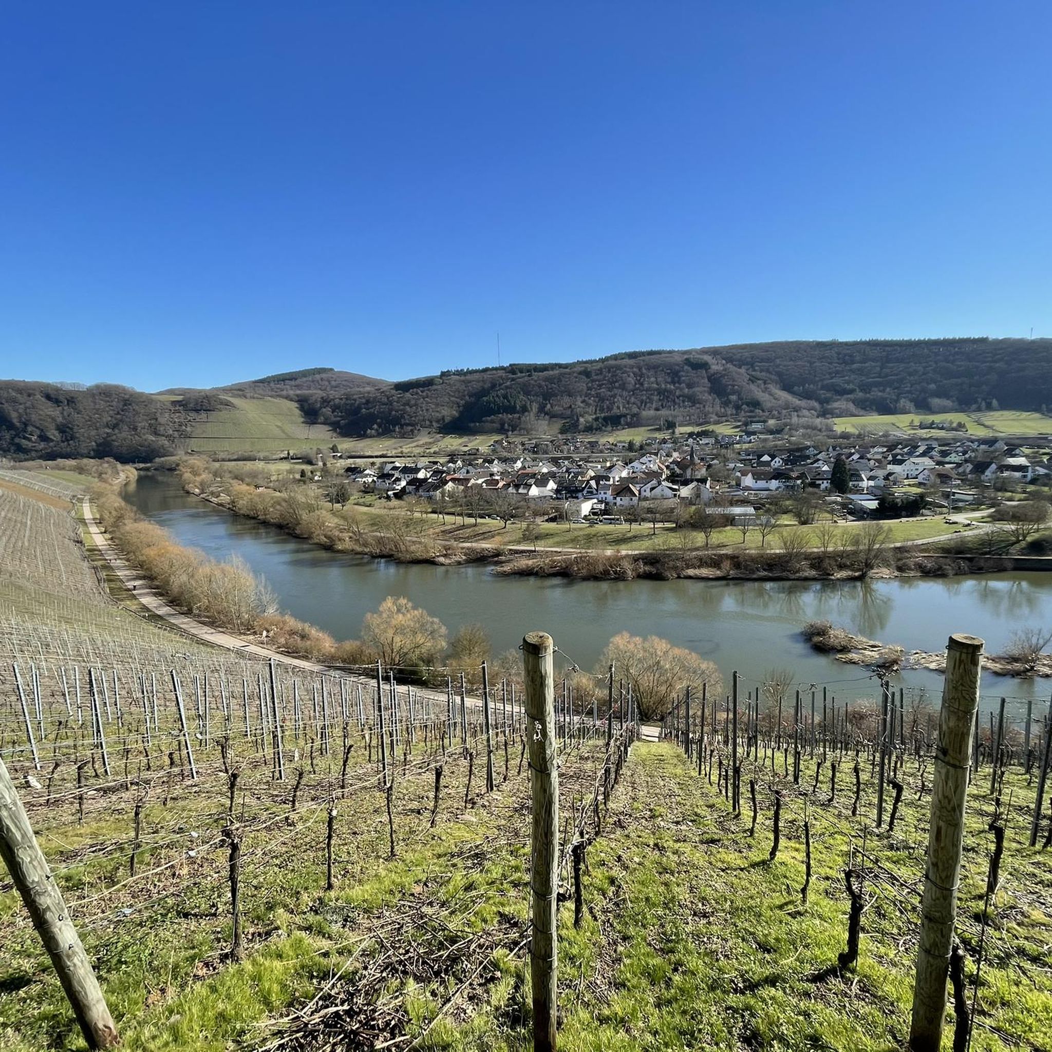
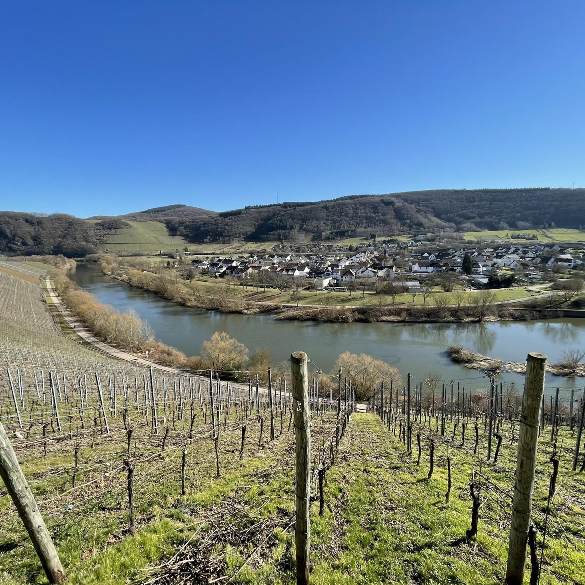
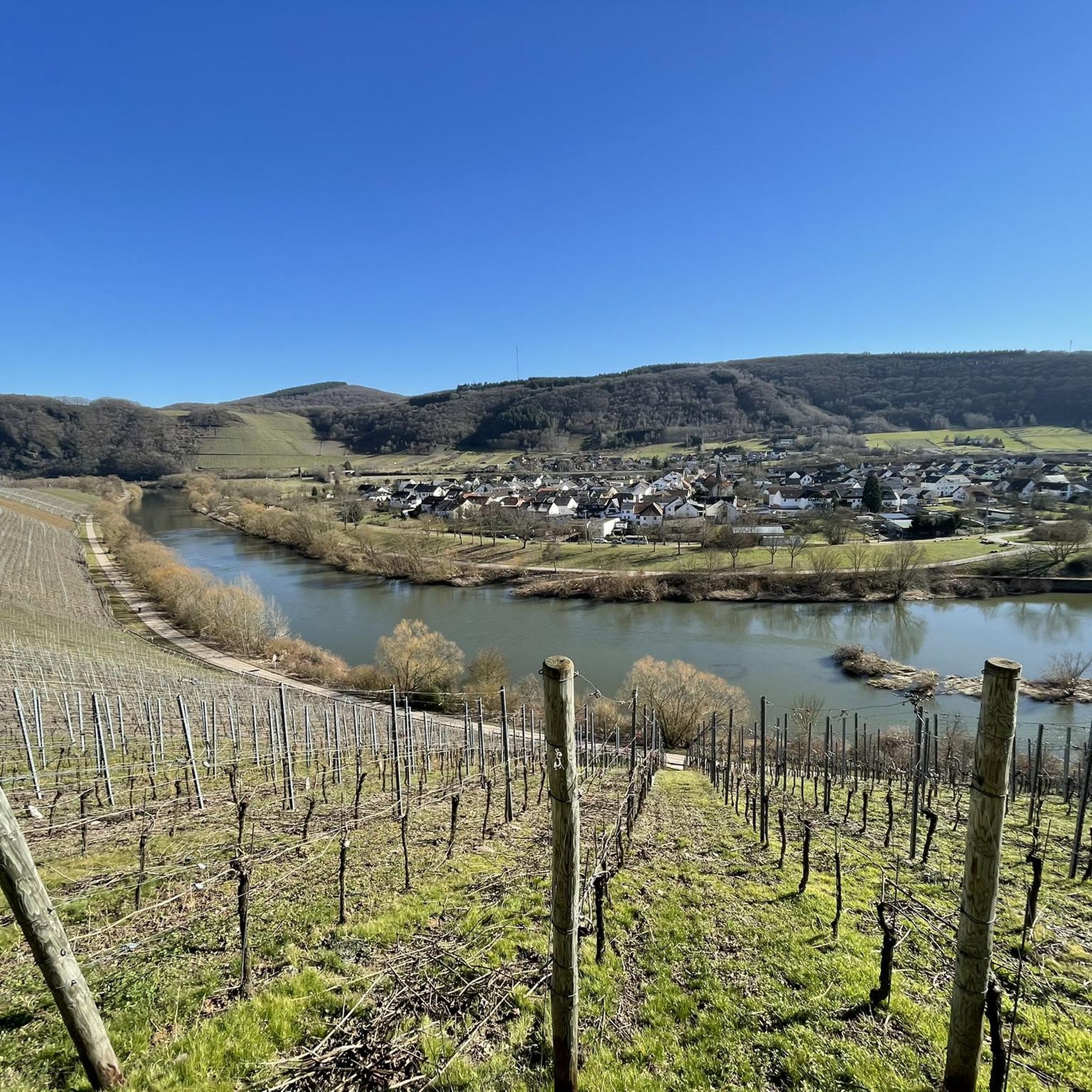
The Bismarck Tower is located on a steep slope between Schoden and Ockfen on the Moselsteig side path Saar-Riesling-Steig. From here you can enjoy a fantastic panoramic view of the Saar Valley, Schoden, Biebelhausen and the Ayler Kupp vineyard.
1
0

Great view of the beautiful Saar Valley
0
0
A great view of the beautiful Saar Valley
0
0

Ok, it's a bit funny to have a summit book on the hill ;-)
1
0

Nice view. Not clear how old the tower is, of what its function was. Very nice still
1
0

The Hosteturm was built in 1911-1912 as a water tank and observation tower on the highest elevation between the Saar and Moselle at 435 mm above sea level under District Administrator Karl Brügmann. The construction sealed the end of the village well for 40 communities, because since then the tower has secured the water supply of the Saargau. Construction of the elevated tank began on June 1, 1911. It was completed and connected to the grid in December of the same year. The construction costs amounted to 1,200,000 marks. On January 13, 1912, water was pumped to ten municipalities, including Kahren and Niederleuken. 2 years later, 41 communities up to today's Saarland were supplied. The water first came from the district waterworks near Wawern, but now it comes from the Mannebach valley via a 4.5 km long delivery line. Every year, 240,000 cubic meters of water flow through the elevated tank. The tower is now the property of the Saar - Obermosel water supply.
1
0

A nice idea. Unfortunately I had the wrong backpack with me, so I couldn't immortalize myself.
0
0

Here you can almost speak of climbing, great!!!
3
0
Frequently Asked Questions
What are some of the most scenic mountain peaks and viewpoints directly around Ayl?
Directly around Ayl, you can find several scenic spots. The Maunert Summit Cross (416 m) offers fantastic views towards Serrig or Taben-Rodt, with a ridge path that is easy to walk. Another popular spot is Bockstein Summit, which provides beautiful views and photo opportunities, especially along the Saar-Riesling-Steige. For extensive panoramic views, the Bismarck Tower Schoden – View of the Saar Valley provides a fantastic vista of the Saar Valley and surrounding mountains.
Are there any family-friendly mountain walks near Ayl?
Yes, several spots around Ayl are suitable for families. The path to the Maunert Summit Cross (416 m) is described as easy to walk, even for sure-footed children. The Bismarck Tower Schoden – View of the Saar Valley is also considered family-friendly, offering benches and tables for resting. Additionally, the Gipfelkopf (460 m) with summit logbook provides a nice, open field rest stop with good views, suitable for a family outing.
What kind of natural landscapes can I expect to see when visiting the peaks around Ayl?
The region around Ayl, situated in Rheinland-Pfalz, is characterized by diverse low mountain ranges. You'll encounter forests, meadows, and river valleys. The immediate vicinity features hills like Hoste Berg and Scharz Berg. Further afield, the Hunsrück offers picturesque landscapes with rustic forests and rich biodiversity, while the Eifel is known for its unique volcanic origins, including extinct cones, crater lakes (maars), and distinctive rock formations.
Beyond the immediate vicinity of Ayl, what larger mountain ranges are accessible for hiking?
For more significant mountainous terrain, the Hunsrück and Eifel low mountain ranges are easily accessible from Ayl. The Hunsrück, located to the east, is renowned for its diverse landscapes and trails like the Ausonius Trail and the Saar-Hunsrück-Steig. To the northwest, the Eifel offers a unique volcanic landscape with features like maars and trails such as the Eifelleiter.
What is the highest mountain in the broader Rheinland-Pfalz region, and what does it offer?
The highest mountain in Rheinland-Pfalz is Erbeskopf, standing at 816.32 meters within the Hunsrück mountains. It offers unforgettable views of the surrounding landscape and is a prime destination for nature enjoyment. The Hunsrück-Hochwald National Park encompasses parts of its high altitudes, promising an evolving 'primeval forest of tomorrow' with rustic forests and rich biodiversity.
Are there any historical or man-made monuments among the peaks near Ayl?
Yes, the region features several notable man-made monuments. The Bismarck Tower Schoden – View of the Saar Valley is a historical site offering fantastic views. Another significant structure is the Hostenturm (Highest Point on the Saargau), which serves as both a lookout point and a water supply tower, built in 1911/12 and offering kilometer-wide views towards Luxembourg or Hunsrück.
What outdoor activities can I do near these mountain peaks?
The area around Ayl offers a variety of outdoor activities. You can explore numerous hiking trails, including sections of the Saar-Riesling-Steige near Bockstein Summit. For cyclists, there are many Road Cycling Routes around Ayl, with options like the 'Saarburg Boat Dock – View of Weingut Van Volxem loop'. Mountain biking enthusiasts can find MTB Trails around Ayl, such as the 'View of the Old Saar – View of the Saar River loop'. There are also Running Trails around Ayl, including the 'Biotope Near Biebelhausen – Leuker Cross loop'.
What do visitors enjoy most about the mountain peaks around Ayl?
Visitors particularly enjoy the stunning panoramic views offered by many of the peaks and viewpoints. The Maunert Summit Cross (416 m) is praised for its fantastic views and peaceful rest areas. The Bockstein Summit is highlighted for its beautiful views and photo opportunities, especially along the Saar-Riesling-Steige. The combination of natural beauty, well-maintained trails, and historical elements like the Bismarck Tower makes for a diverse and rewarding experience.
Are there challenging mountain climbs or more difficult hikes available near Ayl?
While many local trails are accessible, some sections require sure-footedness. For instance, the path to the Maunert Summit Cross (416 m) includes a ridge section that, while easy for sure-footed individuals, has parts over stones that can feel like a climbing section. Similarly, reaching the Bockstein Summit also requires sure-footedness. For more challenging terrain, exploring the extensive trail networks in the nearby Hunsrück and Eifel low mountain ranges, which include longer and more strenuous routes, would be recommended.
When is the best time to hike the mountain peaks and trails around Ayl?
The region's diverse landscapes, including forests and river valleys, are enjoyable throughout much of the year. Spring and autumn generally offer pleasant temperatures and vibrant scenery, with blooming flowers or colorful foliage. Summer is also suitable, though it can be warmer. For specific conditions, especially in winter, it's always advisable to check local weather forecasts, as higher elevations in the Hunsrück and Eifel can experience snow and ice.
Are there options for dog-friendly hikes in the mountain areas near Ayl?
Many natural trails and paths in the low mountain ranges like the Hunsrück and Eifel are generally dog-friendly, allowing you to explore with your canine companion. When hiking around specific peaks near Ayl, it's always recommended to keep dogs on a leash, especially in nature reserves or areas with wildlife, and to be mindful of other hikers. Always carry water for your dog and clean up after them.
Where can I find information about parking or public transport for mountain trails near Ayl?
For local highlights like the Maunert Summit Cross (416 m), access points often include hiking car parks, such as one near Freudenburg. For the Bismarck Tower Schoden – View of the Saar Valley, an asphalt road from Ockfen leads directly to the site where benches and tables are available. For broader areas like the Hunsrück and Eifel, specific trailheads and visitor centers typically provide parking facilities. Public transport options may vary, so checking local bus or train schedules for access to trail starting points is advisable.
Most popular attractions around Ayl

Get inspired with the komoot mobile app


Explore more
See even more amazing summits around Ayl with these guides:
