Top 9 Gorges around Fontanelice
Best canyons around Fontanelice are characterized by significant geological features, primarily along the Santerno River. The area features impressive formations like the Riva dei Cavalli, a 150-meter-high sub-vertical escarpment showcasing ancient sea basin layers. The nearby Gypsum Vein Regional Park also contributes distinct geological formations, including karst landscapes and extensive cave systems. These natural features offer diverse opportunities for exploration and observation of unique terrain.
Best canyons around Fontanelice
- The most popular canyons is Quaderna Valley, a gorge with…
Last updated: June 29, 2026
Imolese Badlands and Trail to the Church of Sant'Andrea
Highlight (Segment) • Trail
After the first asphalted stretch …
Translated by Google •
Tip by

Quaderna Valley
Highlight (Segment) • Gorge
Translated by Google •
Tip by

Sign up now to discover places like this
Get recommendations on the best single tracks, peaks, & plenty of other exciting outdoor places.
Sign up for free
Singletrack descent on the Calanchi della Buferla
Highlight (Segment) • Trail
Translated by Google •
Tip by

View of the Calanchi
Highlight • Viewpoint
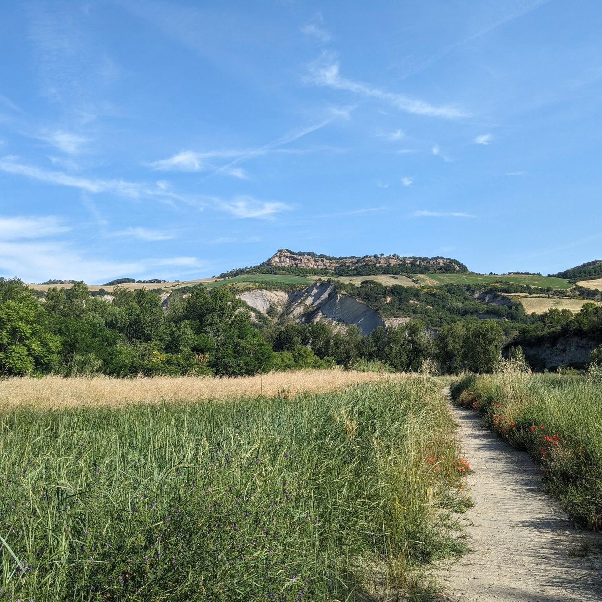
The gullies are unique geological formations characterized by deep gorges and stratified reliefs. This site is ideal for trekking …
Translated by Google •
Tip by

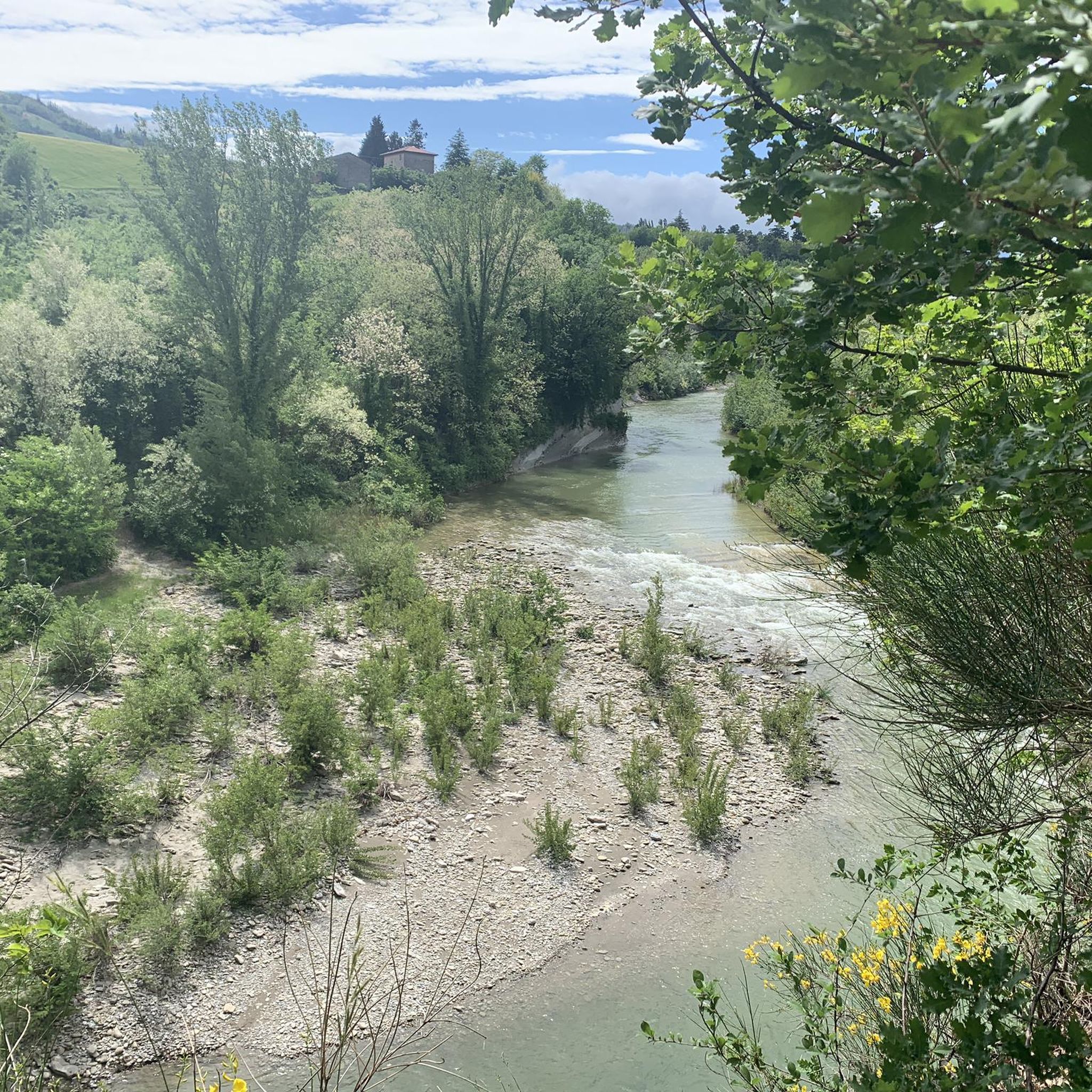
Scenic Section of the Santerno River
Highlight (Segment) • River
Translated by Google •
Tip by

Sign up for free to discover even more gorges around Fontanelice.
Sign up for free
Already have an account?
Start today with a free account
Your next adventure awaits.
Login or Signup

Other adventures around Fontanelice

Tips from the Community

on a nice dirt path, quite simple
0
0

Beautiful descent between the gullies. Pay attention to the deep cracks in the ground and in some sections the path has partially collapsed due to recent landslides.
1
0

A vantage point that offers a spectacular view of the calanques. The gullies are unique geological formations characterized by deep gorges and stratified reliefs. This site is ideal for trekking lovers, as it offers many paths that allow you to explore these fascinating natural formations up close.
1
0

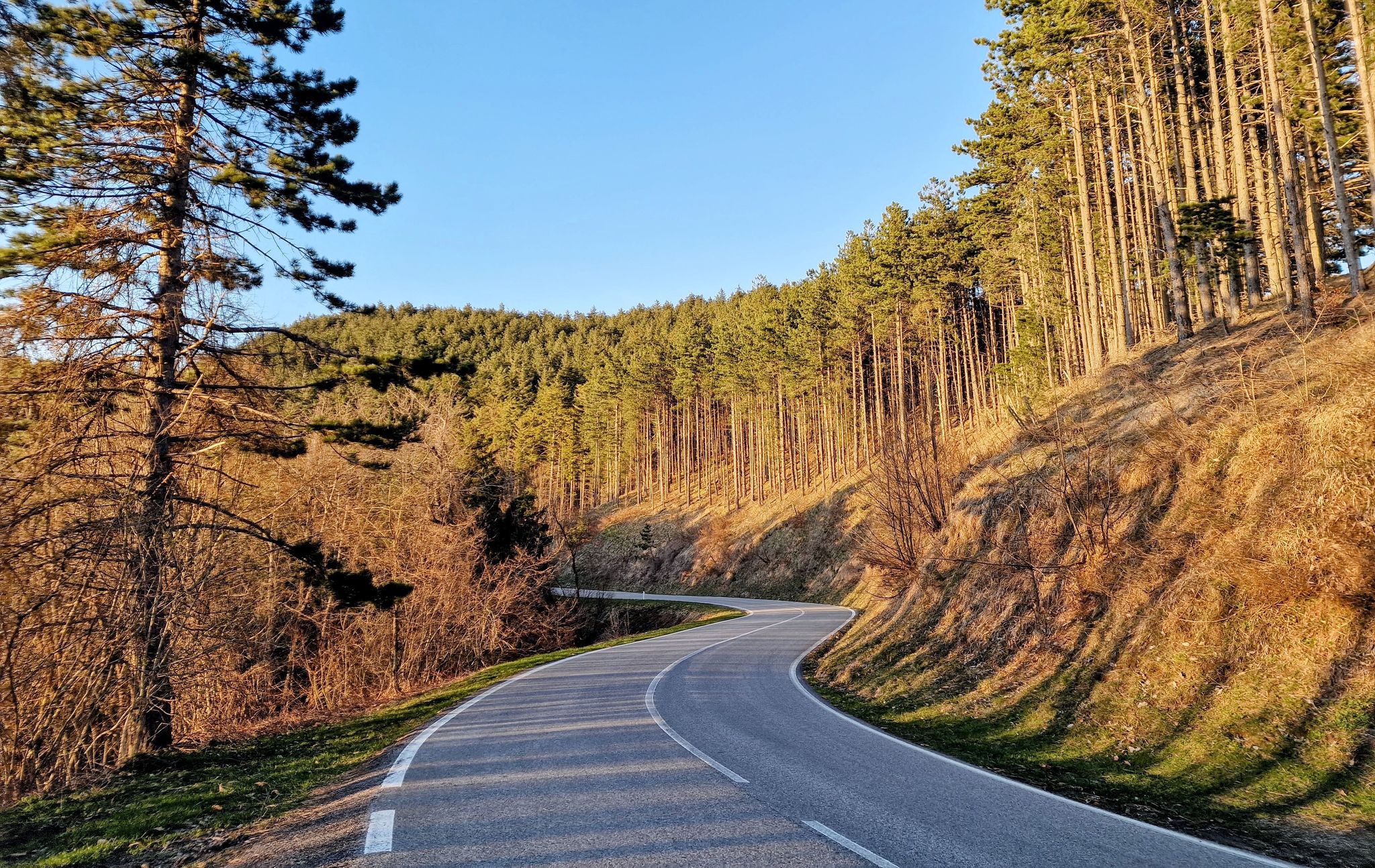
Highly recommended, little traffic and wide road and in excellent condition
0
0

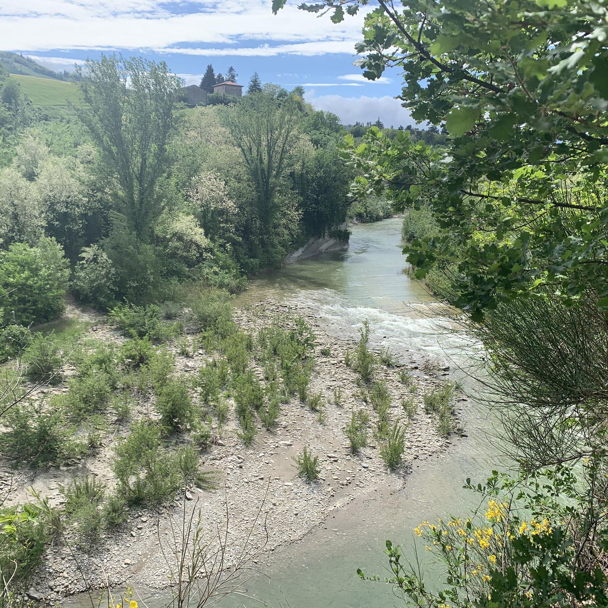
Further down the river there is another nice cycle path, here you often ride directly on the road, but since there is so little traffic you can admire the landscape. Limestone, mudstone, erosion, river courses, steep slopes. fantastic.
1
0

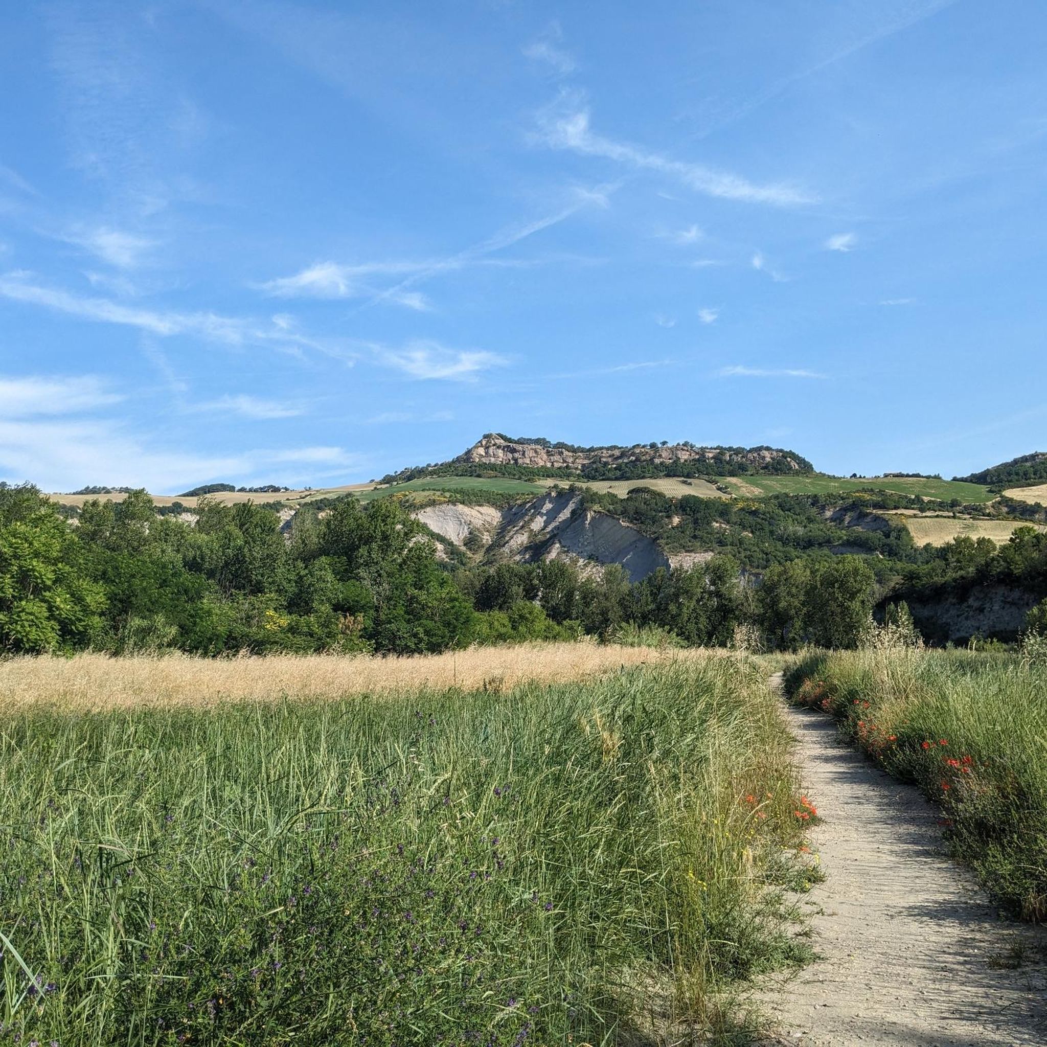
This stretch is definitely one of my favorites because it allows you to ride what are probably the most beautiful gullies in the Imola area. After the first asphalted stretch up to the already steep little church of Mezzocolle, continue on via Mezzocolle for a decidedly hard cemented stretch. Then the road follows the ridge, first gravel, then dirt, then cavedagne and gravel sections follow one another. The last stretch of via Murazze is in fact a single track that finally leads to the ridge of the Sellustra, right on the edge of the gully. On the contrary, it is necessary to be careful because, although not exposed, the path is right on the precipice.
0
0


Beautiful descent on the badlands of Buferla. Not difficult and super panoramic!
1
0
Frequently Asked Questions
What are the main geological features to explore around Fontanelice?
The Fontanelice area is characterized by significant geological features, primarily along the Santerno River. The most prominent is the Riva dei Cavalli (Horses' Cliff), an impressive 150-meter-high sub-vertical escarpment showcasing ancient layers of sandstone and marl. The nearby Gypsum Vein Regional Park also offers distinct geological formations, including karst landscapes, sinkholes, and extensive cave systems.
Are there opportunities for swimming in the canyons or rivers?
Yes, the Santerno River, which flows through Fontanelice, offers a delightful riverside oasis. This section of the river features a green riverside beach with shade and calm, clear waters suitable for swimming, especially during warmer months. It's a refreshing spot to enjoy the natural environment.
What are some popular trails or routes to explore the canyons and badlands?
You can explore various trails in the area. The Quaderna Valley offers wonderful landscapes with a mix of asphalt, gravel, and MTB trails. Another popular option is the Singletrack descent on the Calanchi della Buferla, which provides panoramic views through the badlands.
Are there any challenging trails for experienced hikers or bikers?
Yes, for those seeking a challenge, the Luca Ghini Trail is known for its breathtaking scenery but requires careful navigation, especially on dry ground. It features sections that are very steep and can be dangerous if wet, often requiring carrying your bike. Another challenging option is the Imolese Badlands and Trail to the Church of Sant'Andrea, which includes hard cemented and dirt stretches along a ridge.
Can I visit the Gypsum Vein Regional Park from Fontanelice?
Yes, the Gypsum Vein Regional Park (Vena del Gesso Romagnola) is located in the surrounding area and is a significant geological site. The Santerno River valley, where Fontanelice is situated, is part of this broader geological region. The park offers unique karst formations, deep abysses, and extensive cave systems, providing a different kind of 'canyon-like' experience. You can find more information about the park at visitromagna.it.
Are there family-friendly activities or trails in the Fontanelice canyon area?
While specific 'family-friendly' categories are not listed for all highlights, the riverside area near Fontanelice, particularly the Santerno River Oasis, provides a pleasant setting for families to enjoy long spring and summer days with its green beach and calm waters suitable for swimming. For trails, look for easier walks or sections of longer routes that are less strenuous.
What is the best time of year to visit the canyons around Fontanelice?
The warmer months, particularly spring and summer, are ideal for visiting the canyons and river areas around Fontanelice. This allows for enjoyment of the riverside oasis and swimming in the Santerno River. For hiking, especially on more challenging trails like the Luca Ghini Trail, it's recommended to go in summer with dry ground conditions for safety.
What kind of outdoor activities can I do near the canyons of Fontanelice?
Beyond exploring the canyons, the Fontanelice area offers diverse outdoor activities. You can find numerous hiking routes, including options like the Monte Battaglia loops. For mountain biking, trails such as the Pollo Trail or Monte Codronco Antennas loop are available. Cycling enthusiasts can enjoy routes like the Santerno Gorge loop. You can find more details on these activities in the hiking, MTB, and cycling guides for Fontanelice.
Where can I find scenic viewpoints of the canyons and badlands?
Many trails offer excellent viewpoints. The Singletrack descent on the Calanchi della Buferla is noted for its super panoramic views of the badlands. The Quaderna Valley also provides wonderful landscapes. Additionally, the Scenic Section of the Santerno River offers views of erosion and river courses amidst limestone and mudstone formations.
Are there any specific regulations or permits needed for hiking or canyoning in the area?
While general hiking is permitted, some trails, particularly those traversing sensitive geological areas or private land, might have specific recommendations or restrictions. For challenging routes like the Luca Ghini Trail, it's strongly advised to undertake it only in dry conditions and preferably not alone due to its dangerous nature. Always check local signage and conditions before embarking on a trail.
What makes the Riva dei Cavalli a significant natural landmark?
The Riva dei Cavalli is significant due to its impressive geological formation: an imposing sub-vertical escarpment, approximately 150 meters high, along the Santerno River. It showcases ancient layers of the Marnoso-Arenacea Formation, revealing an ancient submarine channel structure. Its dramatic rock face creates a spectacular 'amphitheater' shape, making it a recognized geosite of local interest and a stunning backdrop for riverside activities.
What do visitors enjoy most about the trails in the Fontanelice area?
Visitors frequently praise the breathtaking scenery and unique geological formations. Trails like the Imolese Badlands and Trail to the Church of Sant'Andrea are favorites for riding through beautiful gullies. The panoramic views from the Singletrack descent on the Calanchi della Buferla are also highly appreciated, as are the diverse landscapes of the Quaderna Valley.
Most popular routes around Fontanelice
Most popular attractions around Fontanelice

Get inspired with the komoot mobile app


Explore more
Already discovered everything in this region? See additional gorges around Fontanelice for your next adventure:
