The 9 Most Amazing Peaks around Llangreu/Langreo
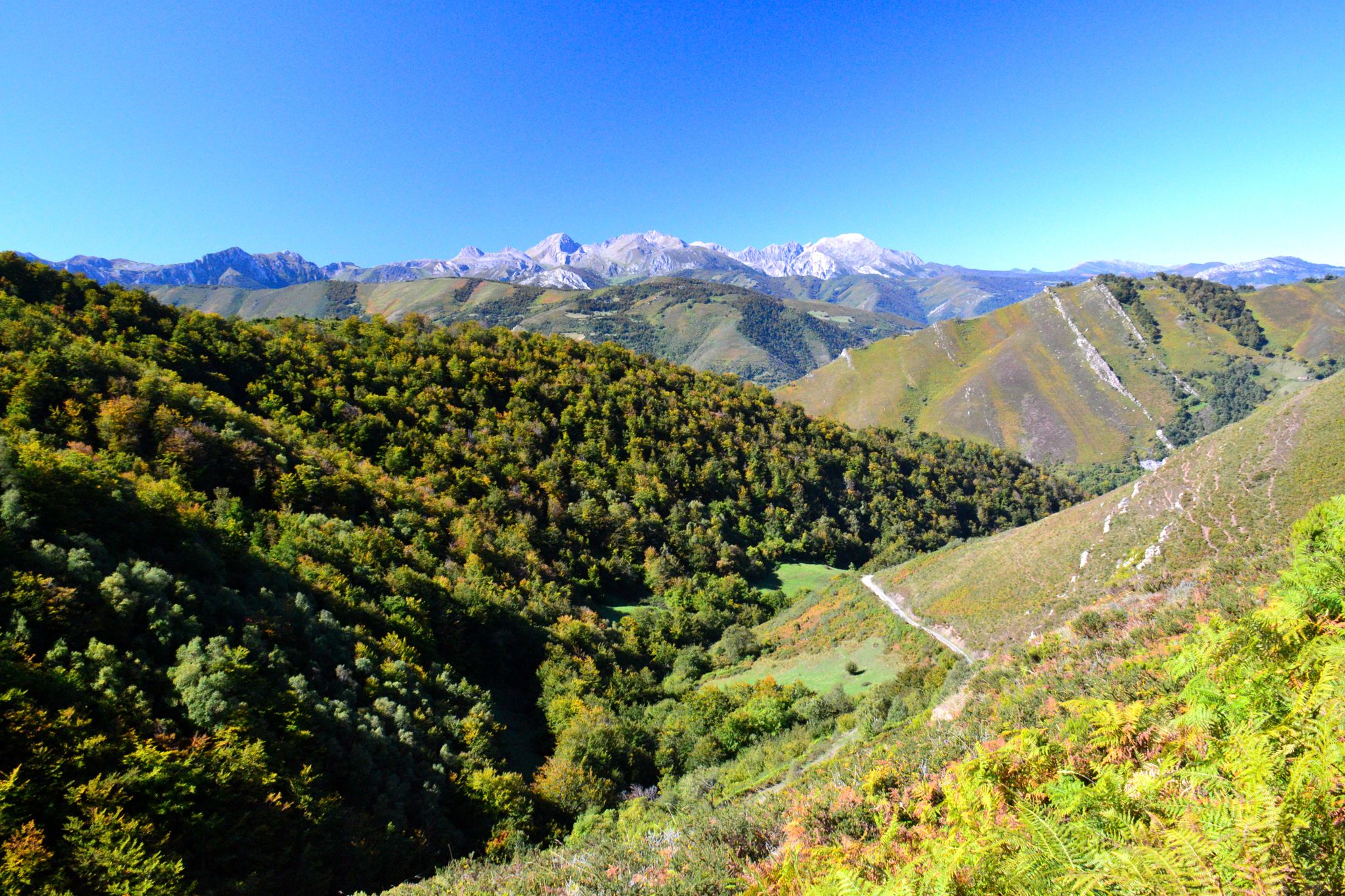
Best mountain peaks around Llangreu/Langreo offer diverse terrain and expansive views across Asturias. This municipality in Spain is characterized by its mountainous landscape, providing opportunities for challenging hikes and exploration of natural features. The region features peaks with varying elevations, from those offering panoramic vistas of central Asturias to others marking significant geographical points. These mountains are integral to the area's natural environment and provide access to broader ranges like the Sierra de Peñamayor.
Best mountain peaks around Llangreu/Langreo
- The…
Last updated: July 17, 2026
Les Praeres – Sierra de Peñamayor
Highlight • Summit
Translated by Google •
Tip by

Alto del Naranco
Highlight • Summit
Translated by Google •
Tip by

Sign up now to discover places like this
Get recommendations on the best single tracks, peaks, & plenty of other exciting outdoor places.
Sign up for free
Ascent to Monte Naranco and Sacred Heart of Jesus Monument from Oviedo
Highlight (Segment) • Climb
Translated by Google •
Tip by

La Camperona
Highlight • Settlement
Translated by Google •
Tip by

El Escobín (Picayu) Summit
Highlight • Summit
Translated by Google •
Tip by

Sign up for free to discover even more peaks around Llangreu/Langreo.
Sign up for free
Already have an account?
Start today with a free account
Your next adventure awaits.
Login or Signup

Other adventures around Llangreu/Langreo

Tips from the Community

A nice climb but some of the slopes are for gravel, not for road bikes.
0
0
Bring patches, the road that goes up through Resellon is very, very broken.
0
0

The Les Praeres pass, meaning "meadows" in Spanish, is a beautiful crossing point for the surrounding peaks. There's also a bar and restaurant with a mountain atmosphere. As if that weren't enough, there's a deer, rescued as a puppy by the bar's owner, who freely roams the area like a pet.
0
0
Several ways to go up and down, caution, some roads are dangerous
0
0

This is a short climb, almost seven kilometers long, with a total of 422 meters of elevation gain. It's popular with local cyclists, as it starts in the city of Oviedo itself. The road surface is good, and the views are magnificent.
0
0

Beautiful place, with impressive views and a bar where you can have a drink or something to eat.
0
0

great views from the monument to the sacred heart at the top
0
0
Frequently Asked Questions
What are some of the most notable mountain peaks in the Llangreu/Langreo area?
The Llangreu/Langreo region offers several significant peaks. Pico Cogollo, also known as San Justo, is the highest peak within the municipality at 1,017 meters. The Sierra de Peñamayor, bordering Langreo, includes prominent peaks like Pico el Triguero (1,293 meters) and Pico Peñamayor (1,149 meters). Other notable peaks include Pico La Xamoca (1,283 meters) within the Redes Natural Park, and Pico Tres Concejos (1,096 meters), known for its 360-degree views.
Which peaks offer the best panoramic views of Asturias?
For expansive views, Pico Tres Concejos is highly recommended, offering spectacular 360-degree panoramas that include Peña Mea, the Redes Natural Park, the Ubiñas massif, the Picos de Europa, and even the cities of Oviedo and Gijón. Pico Cogollo also provides extensive views of the surrounding Asturian landscape. Additionally, Pico Peñamayor and Pico La Rondiz offer remarkable views of Langreo and its surroundings.
Are there any challenging climbs for experienced hikers or cyclists in the area?
Yes, the region is known for challenging ascents. For cyclists, the climb to Les Praeres – Sierra de Peñamayor is particularly demanding, with a 490-meter drop over 3.8 km and an average slope of 12.89%. The ascent to Pico Cogollo is also considered challenging, especially the steep and potentially slippery last 10 meters to the summit. For road cyclists, the Ascent to Monte Naranco and Sacred Heart of Jesus Monument from Oviedo is a popular, challenging climb.
What kind of natural features can I expect to see on these mountain peaks?
The mountain peaks around Llangreu/Langreo are rich in natural beauty. The Sierra de Peñamayor features impressive landscapes, limestone formations, and diverse deciduous forests of oak, chestnut, and beech. You can also find diverse wildlife, including wild boar, deer, and vultures. Pico La Xamoca is characterized by dense beech forests on its northern slope and is located within the Redes Natural Park, a Biosphere Reserve.
Are there any family-friendly mountain walks or easier peaks to access?
Yes, Pico Tres Concejos is considered a relatively easy route, often starting from areas like Alto de la Colladiella, making it a good option for those seeking a less strenuous climb with rewarding views. While many peaks offer challenging sections, some routes to viewpoints like Urbiés Viewpoint can be more accessible depending on the starting point.
What is the typical elevation of mountain peaks near Langreo?
The mountain peaks near Langreo vary in elevation. Pico Cogollo stands at 1,017 meters. Within the Sierra de Peñamayor, Pico el Triguero reaches 1,293 meters, and Pico Peñamayor is 1,149 meters. Pico La Xamoca is 1,283 meters, and Pico Tres Concejos is 1,096 meters. Even lower peaks like Pico de La Rondiz, at 725 meters, offer significant panoramic views.
What outdoor activities can I do near these mountain peaks?
Beyond hiking, the area around Llangreu/Langreo offers various outdoor activities. You can find numerous road cycling routes, such as the 'La Felguera, Alto de la Mozqueta, and Mieres Loop' or the 'Alto de La Colladiella – Pozo Fortuna Memorial loop from Ciañu', which you can explore further in the Road Cycling Routes around Llangreu/Langreo guide. For mountain biking, there are trails like the 'Escobin – Pico Santo Medero loop from La Felguera - Nuevu Llangréu' and 'MTB Les Praeres loop from Sama-Los Llerones', detailed in the MTB Trails around Llangreu/Langreo guide. Running enthusiasts can also find challenging routes, including the 'Circular del Valle de Samuño desde Ciañu', available in the Running Trails around Llangreu/Langreo guide.
What is the best time of year to visit the mountain peaks in Llangreu/Langreo for hiking?
The best time to visit for hiking is generally during spring (April to June) and autumn (September to October) when the weather is milder and the landscapes are vibrant. Summer months can also be pleasant, especially at higher elevations, but be prepared for warmer temperatures. Winter can offer unique, snow-covered experiences, but trails may be more challenging and require appropriate gear.
Are there any historical or cultural landmarks near the mountain peaks?
Yes, the region has historical significance. On the route to Pico Tres Concejos, hikers can find monuments dedicated to miners and those who fell in the Spanish Civil War, reflecting the area's rich industrial and social history. The mountains themselves, like the Sierra de Peñamayor, hold geological interest due to their formation during the Hercynian orogeny, with numerous marine fossils found in its mountains.
What do visitors enjoy most about the mountain peaks around Llangreu/Langreo?
Visitors frequently praise the stunning panoramic views, especially from peaks like Pico Tres Concejos and Alto del Naranco, which offer vistas of Oviedo, Gijón, and the central Asturian area. The challenging yet rewarding climbs, such as the 'wall' of Les Praeres – Sierra de Peñamayor, are also a highlight for many. The diverse natural environments, from dense forests to limestone formations, and the opportunity to spot wildlife, add to the appeal.
Can I find places to eat or drink near the mountain trails?
Yes, some popular access points and trails have facilities. For instance, at Les Praeres – Sierra de Peñamayor, there is a bar and restaurant with a mountain atmosphere, offering a place to relax and refuel. While not every trailhead will have immediate services, nearby towns and villages in Llangreu/Langreo offer various cafes, pubs, and restaurants.
Is it possible to access these mountain peaks using public transport?
While specific public transport routes directly to all trailheads might be limited, the municipality of Llangreu/Langreo has public transport options that can get you close to some starting points. For more remote trails, a combination of public transport to a nearby town and then a short taxi ride or a longer walk might be necessary. Planning ahead and checking local bus schedules is recommended.
Most popular routes around Llangreu/Langreo
Most popular attractions around Llangreu/Langreo

Get inspired with the komoot mobile app


Explore more
See even more amazing summits around Llangreu/Langreo with these guides:
