Top 13 Gorges around Los Altos
Best canyons around Los Altos, California, feature significant ravines, creek-carved valleys, and dramatic elevation changes. These natural spaces provide opportunities for hiking, wildlife viewing, and scenic vistas. The area's geography includes rolling hillsides, steep canyons, and well-preserved creek environments, integral to the local ecosystem.
Best canyons around Los Altos
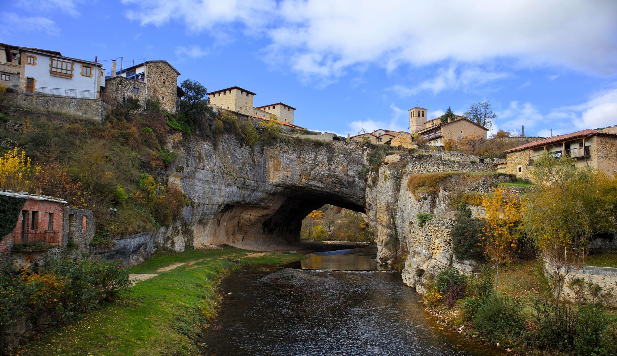
- The most popular canyons is Turquoise Pools and Waterfalls of Orbaneja del Castillo, a waterfall that emerges from the Cueva del Agua and falls into the Ebro River, creating a…
Last updated: October 20, 2026
Turquoise Pools and Waterfalls of Orbaneja del Castillo
Highlight • Waterfall
Translated by Google •
Tip by

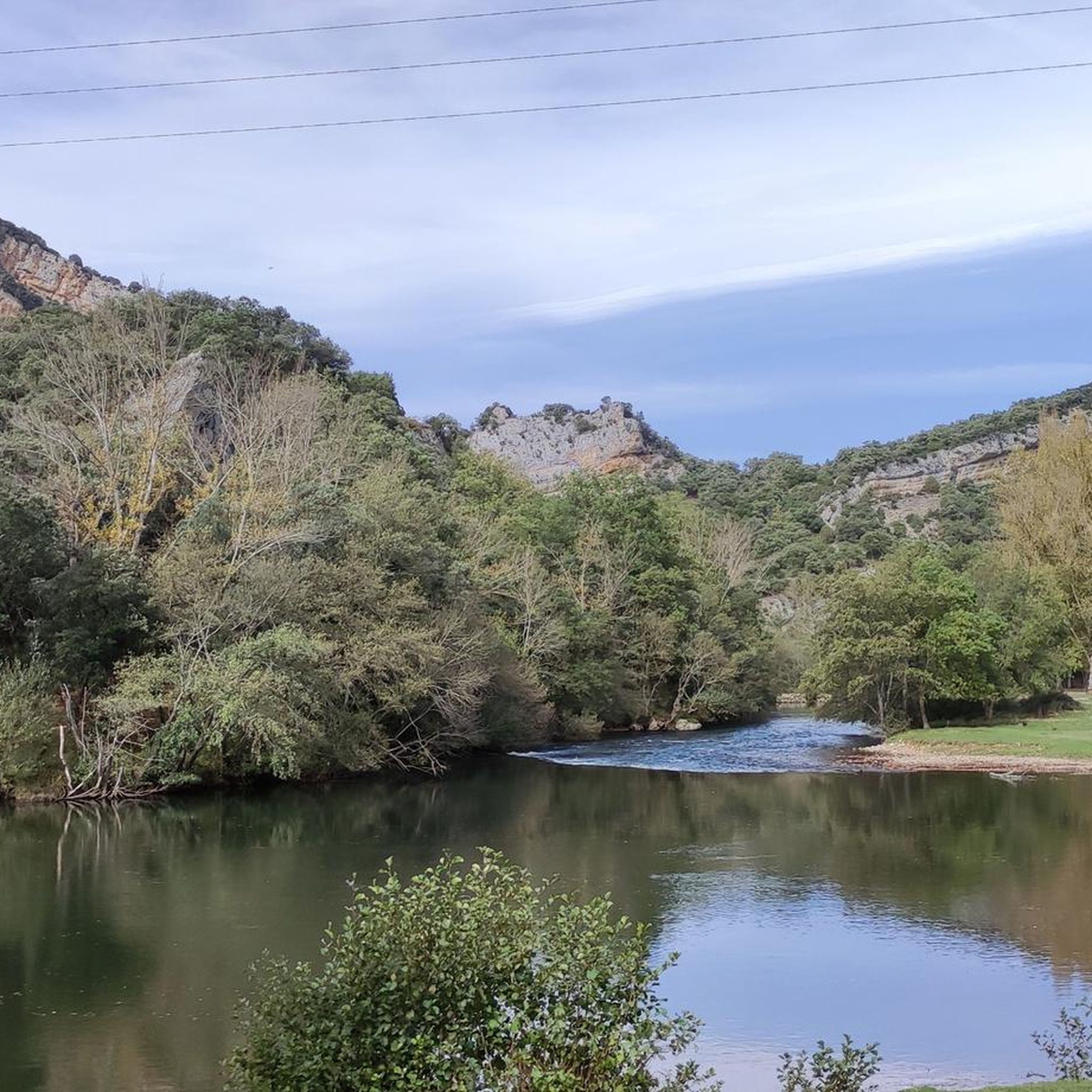
Ebro Trail
Highlight • Trail
Translated by Google •
Tip by

Sign up now to discover places like this
Get recommendations on the best single tracks, peaks, & plenty of other exciting outdoor places.
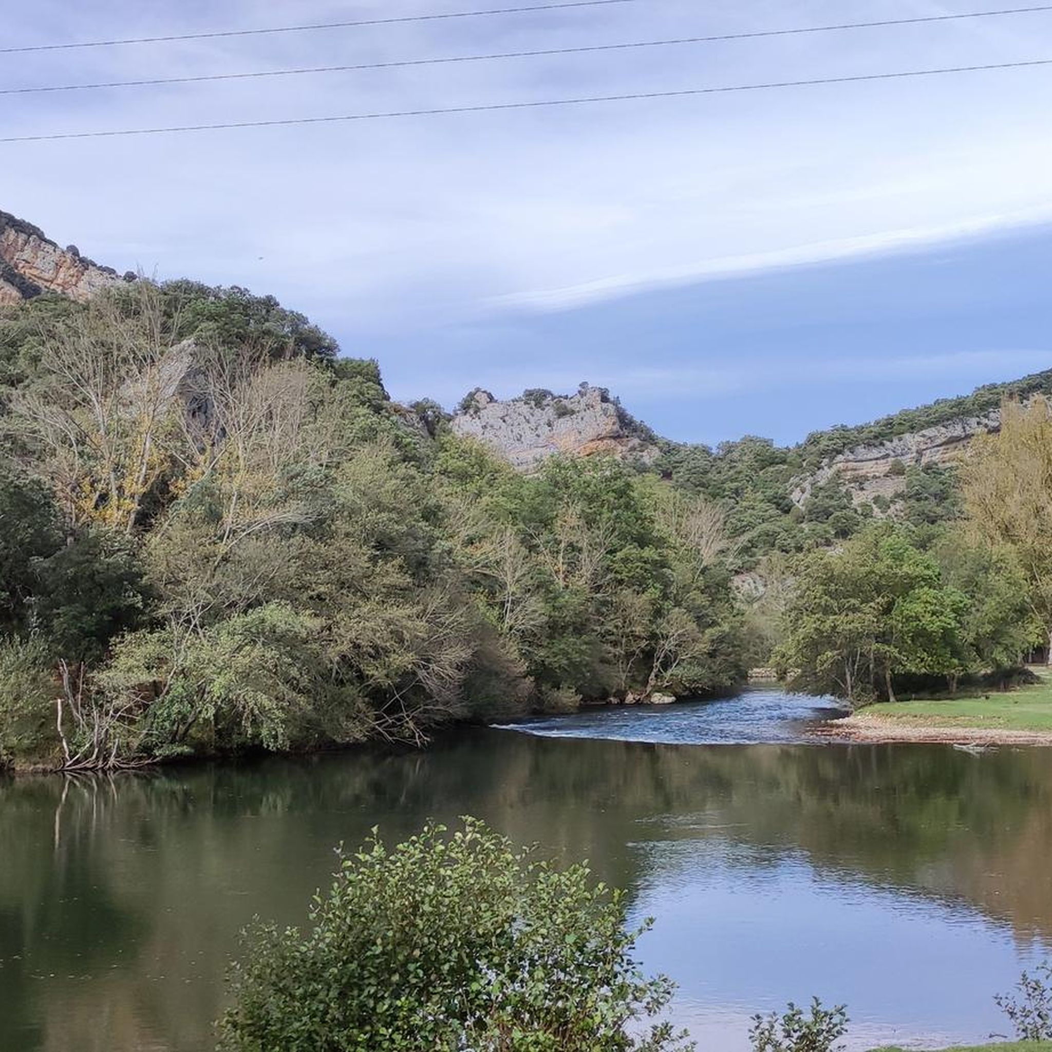
Ebro Valley in the Hoces del Alto Ebro y Rudrón Natural Park
Highlight • Gorge
Showing Translation
Tip by

Ebro Viewpoint
Highlight • Viewpoint
Showing Translation
Tip by

Hocinos Gorge (Garganta de los Hocinos)
Highlight (Segment) • Gorge
Translated by Google •
Tip by

Sign up for free to discover even more gorges around Los Altos.
Already have an account?
Start today with a free account
Your next adventure awaits.

Other adventures around Los Altos

Tips from the Community

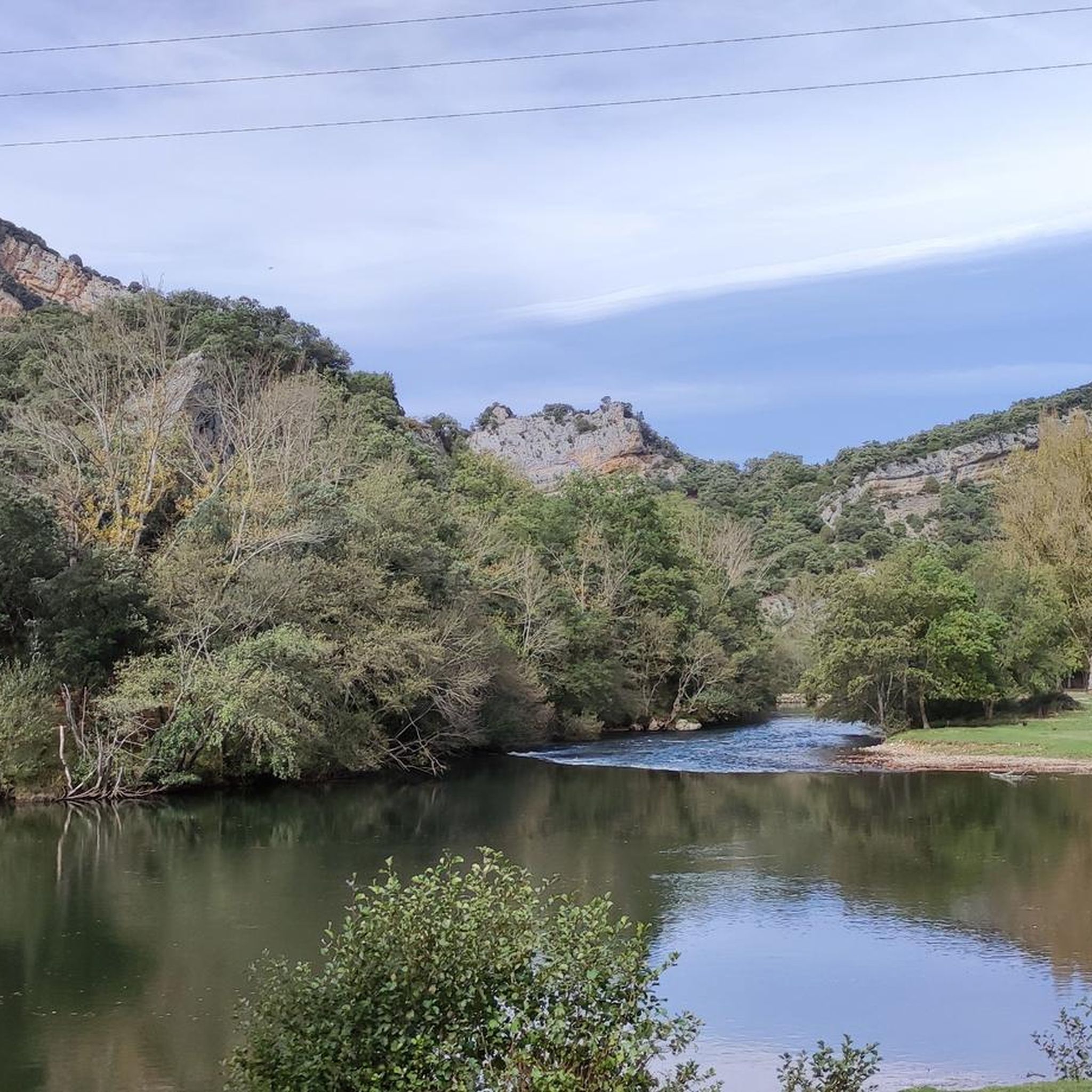
Here the Ebro has carved a beautiful canyon into the rocks. Especially here near Orbaneja, beautiful views of the spectacular rock faces on both sides open up again and again, while further towards Villaescuesa the path leads through a narrow but dense forest, which mostly obscures this view. It is definitely a beautiful path to hike.
0
0
A very beautiful path along the Ebro between Villaescusa and Orbaneja, where the Ebro has carved a beautiful canyon.
0
0
The waterfall looks magically beautiful, widening as it cascades over the limestone basins. From the bridge at the foot of the waterfall, you can look into the large lower basins, where the water has a turquoise-blue color. The scene could also fit well into a fantasy film, at the center of a valley of fairies or elves. Light was very good for taking photos in the late morning. If, however, you arrive only in the early evening, the sun is above the waterfall and is blinding - but then the large basins on the other side of the bridge at the foot of the waterfall are particularly beautiful.
0
0

Spectacular area for hiking routes
0
0

The waterfall springs from the Cueva del Agua from a height of over 20 meters, at the base of the rocky cirque that embraces the village, originating from an aquifer located in the subsoil of the Páramo de Bricia, and it leaps everywhere, dividing the village into two halves, the Villa and the Puebla, and descends among the stone houses, creating a most photogenic scene.
2
0

Beautiful route to do in good weather. The surrounding villages are worth visiting, on weekends it is best to book if you want to taste the local gastronomy.
0
0
A spectacular area for hiking trails
0
0

It is beautiful on its own, but if we add the depths of the town from which it arises... visit it!
8
0
Frequently Asked Questions
What kind of canyon experiences can I find around Los Altos?
Around Los Altos, you'll discover natural spaces with canyon-like features, including significant ravines, creek-carved valleys, and areas with dramatic elevation changes. These range from deep, wooded sections with fern-lined walls to steep creek-side paths and forested ravines, offering diverse terrain for exploration.
Which areas offer the best hiking trails through canyons near Los Altos?
Several parks provide excellent canyon hiking. Rancho San Antonio County Park and Open Space Preserve features the Wildcat Canyon Trail, known for its shaded, fern-walled sections. Stevens Creek County Park offers the Lower Canyon Trail, a steep, narrow dirt path along Stevens Creek. Additionally, Foothills Nature Preserve, part of the Adobe Creek watershed, has steep, forested ravines with miles of trails.
Are there any canyons with notable natural features or viewpoints?
Yes, several areas offer unique natural features and stunning views. In Rancho San Antonio County Park, the Wildcat Canyon Trail showcases vibrant orange maple leaves in autumn and a swollen creek in early spring. Upper Wildcat Canyon provides astounding views of Silicon Valley and the San Francisco Bay Area. Foothills Nature Preserve also offers spectacular Bay Area views from its rugged terrain.
What wildlife can I expect to see in the canyons around Los Altos?
The canyons and preserves around Los Altos are home to diverse wildlife. In Rancho San Antonio County Park, you might spot deer, turkeys, and various bird species. Stevens Creek is a vital wildlife corridor, providing habitat for native California species like raccoons, opossums, quail, hawks, and jays. Foothills Nature Preserve also offers opportunities to see deer and coyotes.
Are there family-friendly options for exploring canyons near Los Altos?
Many areas are suitable for families, offering a range of trail difficulties. Rancho San Antonio County Park has diverse hiking experiences, including moderate loops. Stevens Creek County Park provides shaded creekside paths that are generally accessible. Foothills Nature Preserve offers self-guided nature trails, perfect for a family outing.
What are the best times of year to visit the canyons in Los Altos?
The canyons around Los Altos offer beauty year-round. In spring, wildflowers bloom, and creekbeds fill with water. Autumn brings vibrant orange maple leaves to areas like Wildcat Canyon. Summer and fall feature golden grasses. While popular areas can be crowded on weekends, especially near Deer Hollow Farm in Rancho San Antonio, weekdays generally offer a quieter experience.
Can I find trails with significant elevation changes for a more challenging hike?
Absolutely. For challenging hikes, consider routes in Rancho San Antonio County Park, such as ascents to Black Mountain, which can be up to 14.6 miles. Within Stevens Creek County Park, a 4-mile Canyon Trail in the Montebello Open Space Preserve climbs 1300 feet of elevation. The Adobe Creek Trail in Monte Bello Open Space Preserve also involves descents to the creek followed by climbs through open fields.
Are there any historical or ecological points of interest in these canyon areas?
Yes, the region has both ecological and historical significance. Stevens Creek is considered one of the better-preserved creeks in the Bay Area, maintaining much of its natural channel. The Adobe Creek watershed historically hosted steelhead trout and holds archaeological significance related to the Ohlone people and early settlements.
What outdoor activities, besides hiking, can I do near the canyons?
Beyond hiking, the areas around Los Altos offer various outdoor activities. Stevens Creek County Park, with its 87-acre reservoir, provides opportunities for horseback riding, picnicking, and seasonal boating. For cycling enthusiasts, there are numerous routes nearby, such as those found in the Road Cycling Routes around Los Altos guide or the Cycling around Los Altos guide.
Where can I find running trails that incorporate canyon scenery?
Several running trails in the vicinity offer scenic canyon views. You can explore options like the 'Mirador del Cañón del Ebro' loop or the 'Hoz de Orbaneja del Castillo – Orbaneja del Castillo' loop. For more detailed routes, refer to the Running Trails around Los Altos guide.
What makes Stevens Creek Canyon unique?
Stevens Creek Canyon, within Stevens Creek County Park, is notable because Stevens Creek itself is considered one of the better-preserved streams in the Bay Area, retaining much of its natural channel. It serves as a vital wildlife corridor and offers diverse landscapes, from shaded creekside paths to trails with significant elevation changes, all centered around a relatively untouched creek environment.
Are there any specific trails that offer a 'narrow canyon experience'?
Yes, the Wildcat Canyon Trail within Rancho San Antonio County Park is particularly known for its deep, wooded sections, offering a cool, fern-lined, and narrow canyon experience. It plunges into the woods, providing a distinct sense of immersion in nature.
Most popular routes around Los Altos
Most popular attractions around Los Altos

Get inspired with the komoot mobile app


Explore more
Already discovered everything in this region? See additional gorges around Los Altos for your next adventure:
