The 8 Most Amazing Peaks around Bèlgida
Best mountain peaks around Bèlgida are situated on the northern slopes of the Sierra de Benicadell, a mountain range forming a natural border between the provinces of Valencia and Alicante. While Bèlgida itself has an average altitude of around 264-280 meters, its mountainous appeal comes from its proximity to the Sierra de Benicadell. The most notable peak in the vicinity is Benicadell, standing at 1,104 meters above sea level, emblematic of the entire range. This area offers diverse terrain, from dense forests to rocky crests.
Best mountain peaks around Bèlgida
- The most popular mountain peaks is Montcabrer Summit, a summit that offers panoramic views of the sierras and mountains of Alicante and southern Valencia. From its 1,390 meters above sea level, it is a prominent panoramic point of the Parc Natural Serra de Mariola.
- Another must-see spot is Summit of Pico Teix, a summit offering 360-degree views from its top at 1,265 meters above sea level. It can be reached via various paths and trails, including the forest path of l'Ombria.
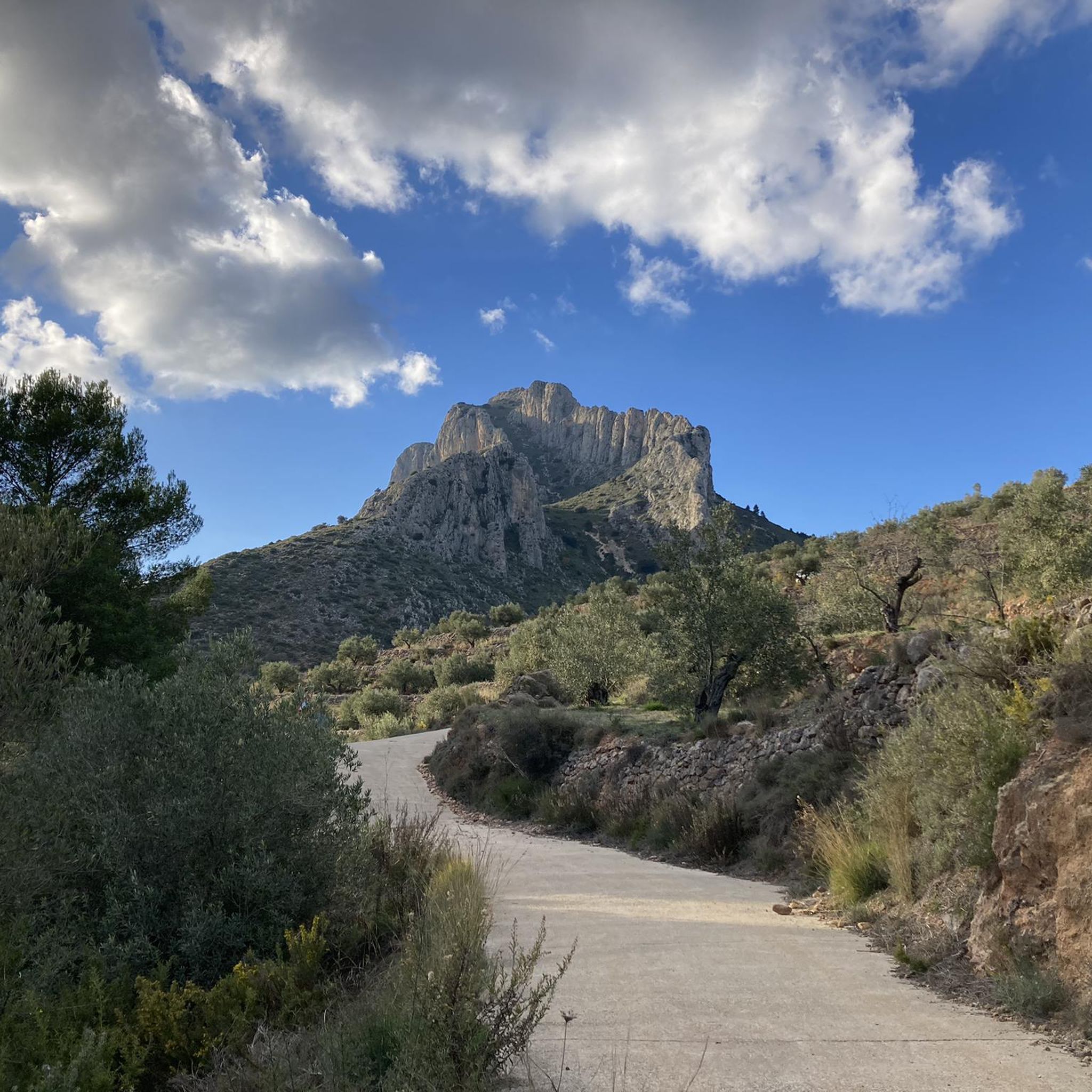
- Visitors also love View of Alt de Benicadell, a summit offering excellent views of the impressive Benicadell massif. This peak, at 1,105 meters, is a prominent feature of the Sierra de Benicadell, which forms a natural border between provinces.
- Bèlgida is known for summits, viewpoints, and natural monuments. The region offers a variety of mountain peaks to see and explore, with routes of varying difficulty.
- The mountain peaks around Bèlgida are appreciated by the komoot community, with more than 60 upvotes and 50 photos shared.
Last updated: July 4, 2026
Montcabrer Summit
Highlight • Summit
Translated by Google •
Tip by

View of Alt de Benicadell
Highlight • Summit
Translated by Google •
Tip by

Sign up now to discover places like this
Get recommendations on the best single tracks, peaks, & plenty of other exciting outdoor places.
Sign up for free
Summit of Pico Teix
Highlight • Summit
Translated by Google •
Tip by

Views of Benicadell
Highlight • Viewpoint
Translated by Google •
Tip by
Cruz de la Ollería
Highlight • Monument
This place offers a view of the Vall d'Albaida region and the Costera
Translated by Google •
Tip by

Sign up for free to discover even more peaks around Bèlgida.
Sign up for free
Already have an account?
Start today with a free account
Your next adventure awaits.
Login or Signup

Tips from the Community

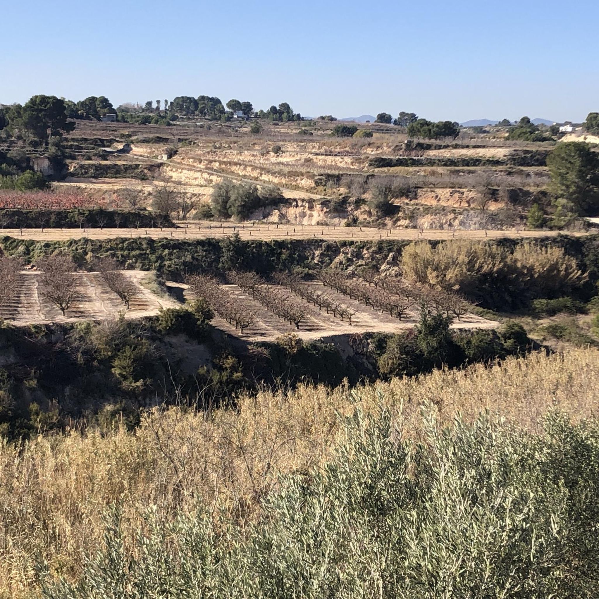
There are several points along this route from which you can admire the impressive silhouette of the Benicadell massif. The Alt de Benicadell, with a height of 1,105 metres, is a prominent peak in the Sierra de Benicadell, which forms a natural border between the provinces of Valencia and Alicante. The region around the Benicadell offers numerous opportunities for cycling tours that lead through varied landscapes with impressive views.
5
0

Place from which you have the most spectacular views of this incredible mountain.
1
0


The Benicadell accompanies the cyclist during the ascent and descent of the mountain pass between Castelló de Rugat and Beniarrés.
2
0

From its 1,390 meters above sea level, the top of Montcabrer is the panoramic point par excellence of the Parc Natural Serra de Mariola. From here you can see other peaks such as Aitana, Puig Campana and in the distance the summit of Montgó and Benicadell. You can reach the top by several alternative paths and trails of varying difficulty, it's all up to you!
2
0
The top of Pico Teix at 1265 meters above sea level offers amazing 360 views! It can be connected to several paths both from Cocentaina and from Agres through the forest path of l'Ombria in excellent condition. It deserves to visit it because the views are incredible!
2
0

In the Sierra de Mariola Natural Park. The road ends at the ruins of Mas de Llopis. From this point, a well-marked path takes us in about 45 minutes to the top of Montcabrer.
6
2

The summit of Montcabrer is an extraordinary panoramic point of the sierras and mountains of Alicante and southern Valencia. Among others, the Aitana massif, the Campana hill, the Montgó summit, the Benicadell mountain range, the walled silhouette of La Safor, and the distinguished Mondúver appear on the horizon. On clear and clear days it is possible to see the island of Ibiza floating in the Mediterranean.
4
1
Frequently Asked Questions
Which mountain peaks offer the most impressive panoramic views near Bèlgida?
For breathtaking panoramic views, consider visiting Montcabrer Summit, which provides an extraordinary 360-degree vista of the Alicante and southern Valencia sierras, including the Aitana massif and even Ibiza on clear days. Another excellent choice is the Summit of Pico Teix, offering amazing 360-degree views from its 1,265-meter peak. You can also find superb views of the iconic Benicadell massif from View of Alt de Benicadell.
Are there any challenging mountain peaks for experienced hikers in the Bèlgida area?
Yes, Pico Benicadell, the tallest peak in the Sierra de Benicadell at 1,104 meters, offers challenging ascents that can involve some scrambling, providing a rewarding experience for those with good fitness levels. The Beautiful views of Benicadell highlight is associated with this challenging peak.
What kind of natural features can I expect to see on the mountain peaks around Bèlgida?
The mountain peaks around Bèlgida, particularly in the Sierra de Benicadell, feature diverse Mediterranean ecosystems. You'll encounter pine forests, holm oak groves, and aromatic scrubland. The mountains are characterized by distinctive rocky ridges of limestone, such as those found on Pico Benicadell. The Ombria del Benicadell, on the northern face, is a protected landscape with country paths and recreational areas like Font Freda.
Are there family-friendly hiking options among the mountain peaks near Bèlgida?
While some peaks offer challenging routes, there are also easier trails in the broader Sierra de Benicadell area suitable for families. For instance, the 'View of Carrícola Castle – View of Castell de Cocentaina loop from Carrícola' is an easy hiking route of about 4 km. Look for routes with 'easy' difficulty grades in the Hiking around Bèlgida guide for suitable options.
What historical features can be found on the mountain trails in the Sierra de Benicadell?
As you hike the trails, particularly on Pico Benicadell, you might encounter historical features known as 'neveras' (snow wells). These structures were historically used to store ice, offering a glimpse into the region's past.
What is the best time of year to visit the mountain peaks around Bèlgida?
The region generally enjoys a Mediterranean climate. Spring and autumn are often ideal for hiking, offering pleasant temperatures and vibrant landscapes. Summers can be hot, so early morning or late afternoon hikes are recommended, and always be mindful of potential fire restrictions. Winter hiking is possible, but check weather conditions as higher elevations can experience colder temperatures.
What outdoor activities, besides hiking, can I do near the mountain peaks of Bèlgida?
Beyond hiking, the area around Bèlgida is excellent for cycling. You can explore various routes for touring bicycles and road cycling. Check out the Cycling around Bèlgida guide and the Road Cycling Routes around Bèlgida guide for detailed routes, including challenging loops like 'Pou Clar – View of Alt de Benicadell loop from Montaverner'.
Are there specific viewpoints to admire the Sierra de Benicadell from a distance?
Yes, there are several points from which to admire the Sierra de Benicadell. The Views of Benicadell highlight offers spectacular vistas of the mountain and a nearby reservoir. Additionally, when driving or cycling on the small mountain roads from Salem via Beniarrés to Gaianes, you'll find excellent perspectives of the impressive Benicadell massif and the surrounding valleys.
What are the elevations of the notable peaks within Bèlgida's municipality?
Within Bèlgida's municipal limits, as part of the Sierra de Benicadell, Pico Benicadell stands at 1,104 meters (3,622 feet). Other significant heights include Alto Redó at 994 meters (3,261 feet), Alto Quemado at 894 meters (2,933 feet), and Alto de la Fuenfría at 754 meters (2,474 feet).
Can I bring my dog on the mountain trails around Bèlgida?
Many outdoor trails in natural areas are dog-friendly, but it's always advisable to check local regulations for specific routes or protected areas within the Sierra de Benicadell. Generally, keeping your dog on a leash and cleaning up after them is expected.
Where can I find parking for hiking trails in the Bèlgida area?
While specific parking areas for each trail are not always explicitly listed, many trailheads, especially those leading to popular peaks like Montcabrer, often have designated parking spots or areas where it is safe to leave a vehicle. For Montcabrer Summit, the road ends at the ruins of Mas de Llopis, which serves as a starting point for the hike.
Most popular routes around Bèlgida
Most popular attractions around Bèlgida

Get inspired with the komoot mobile app


Explore more
See even more amazing summits around Bèlgida with these guides:
