The 1 Most Amazing Peaks around Méthamis
Best mountain peaks around Méthamis are centered around the iconic Mont Ventoux, a prominent feature in the landscape. Méthamis, a village situated at 380 meters altitude, is uniquely positioned at the foot of Mont Ventoux and overlooks the Gorges de la Nesque. The area is part of the broader Vaucluse Mountains, offering diverse terrain for outdoor activities. This region provides opportunities to explore significant peaks and dramatic natural formations.
Best mountain peaks around Méthamis
- The most popular mountain peaks is…
Last updated: August 16, 2026
Mont Ventoux Ascent from Sault
Highlight (Segment) • Climb
Translated by Google •
Tip by

Mont Ventoux Summit and Scenic Climb
Highlight (Segment) • Summit
Translated by Google •
Tip by

Sign up now to discover places like this
Get recommendations on the best single tracks, peaks, & plenty of other exciting outdoor places.
Sign up for free
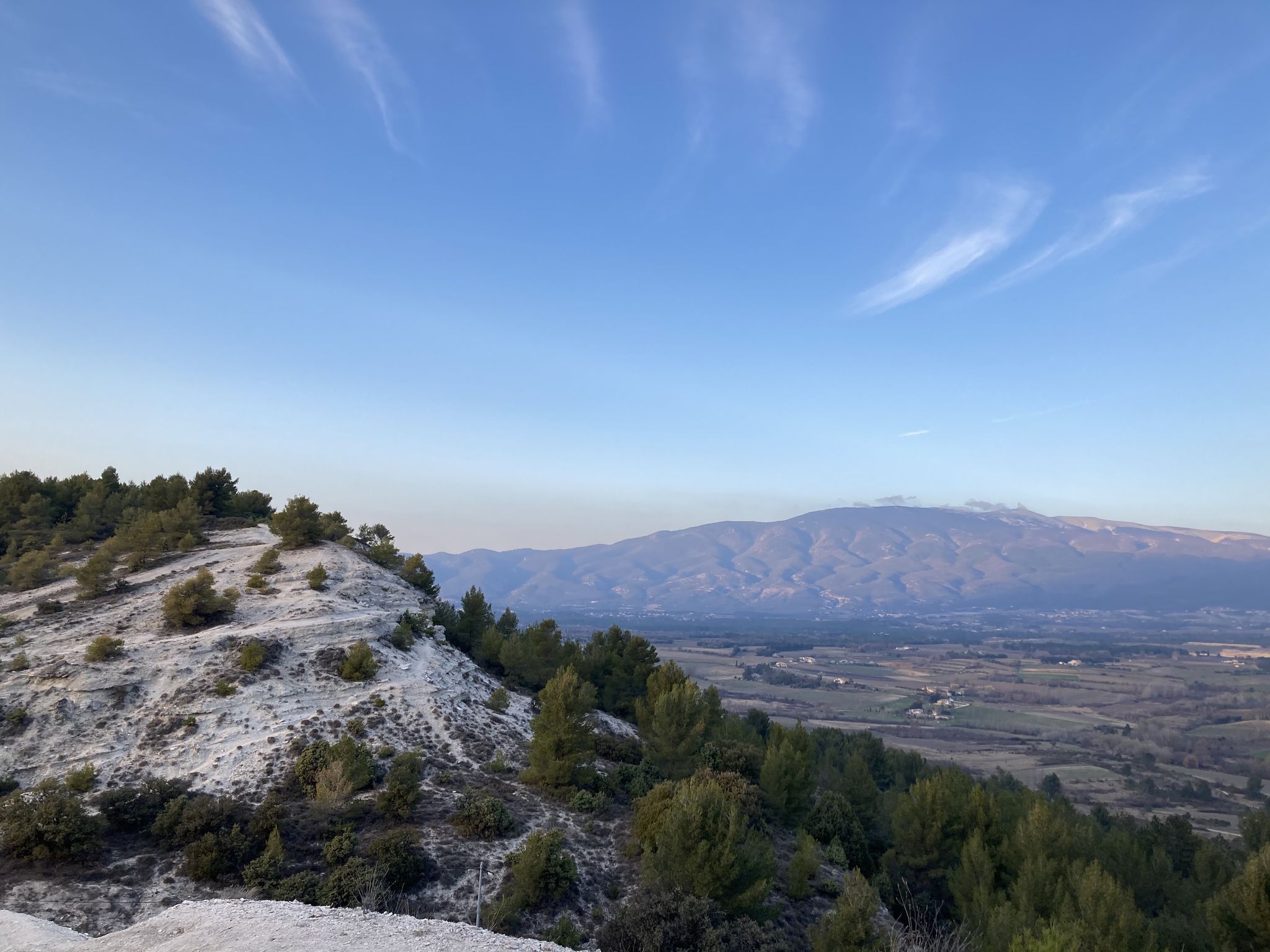
Stunning view of Mont Ventoux
Highlight • Summit
Translated by Google •
Tip by

Start today with a free account
Your next adventure awaits.
Login or Signup
Popular around Méthamis


Tips from the Community

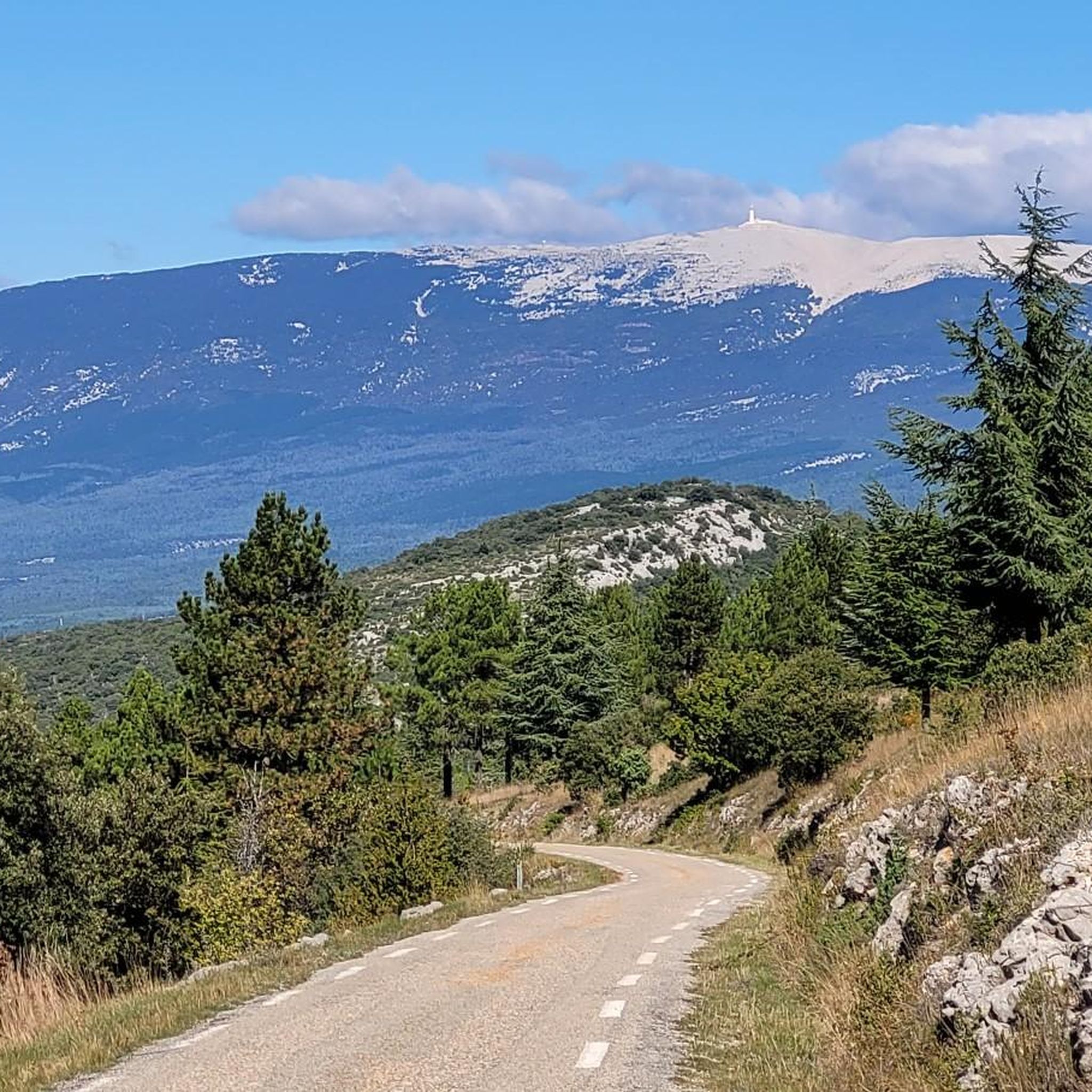
A superb climb on smooth asphalt, even if it's not the most popular climb. Therefore, traffic is very light, which I personally find more important. Up to Chalet Reynard, you're surrounded by trees. Views are rare. Overall, the climb is very pleasant and suitable for those who want to take it easy.
3
0

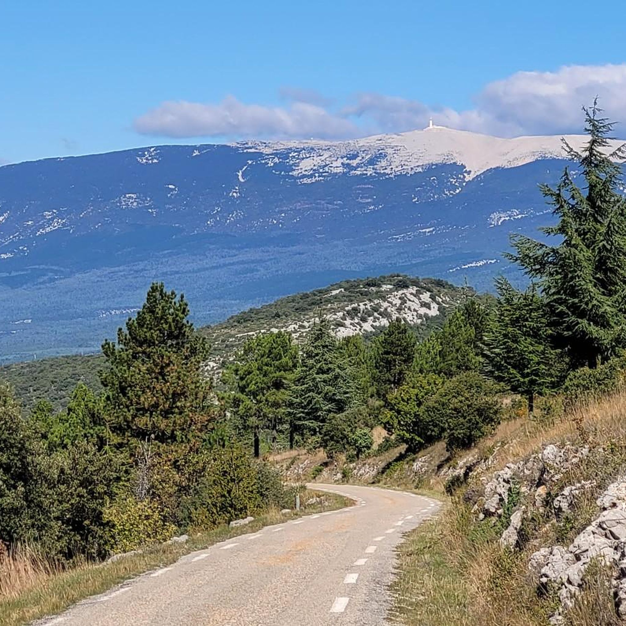
Ventoux is a unique peak, rising 1,909 metres high in the middle of a much less mountainous landscape. This means it can be admired from many places in the valley, such as this path near Mormoiron.
0
0

The gorges de la Nesque followed by the ascent of Mont Ventoux is beautiful but also a bit of a struggle.
0
0

Really nice route to drive
3
1

Mont Ventoux from Sault is the easiest of the three access points to the Reynard Chalet. To the summit, the climb is 25.50 kilometers with an elevation gain of 1,145 meters. The average gradient is 4.49%. From Sault to the Reynard Chalet, the climb is 17.4 kilometers with an elevation gain of 705 meters. The average gradient is 4%. If you're going to attempt to climb all three sides of Mont Ventoux in one day, then this is the slope to tackle last.
5
3
The easiest climb to Mont Ventoux, up to Chalet Renard, 21 km with an average 4% gradient. Asphalt is in very good condition. From Chalet Renard, same ascent as coming from Bedoin
2
0
Great route is worth it.
3
1
Frequently Asked Questions
What are the main mountain peaks and natural features to explore near Méthamis?
Méthamis is uniquely positioned at the foot of the iconic Mont Ventoux and overlooks the dramatic Gorges de la Nesque. The village is also part of the broader Vaucluse Mountains, whose highest point is Signal de Saint-Pierre. These areas offer a diverse range of landscapes, from the barren summit of Mont Ventoux to the limestone cliffs of the Gorges.
What makes Mont Ventoux a must-visit destination?
Mont Ventoux, often called the "Giant of Provence," is world-renowned, especially in the cycling community, as a legendary stage of the Tour de France. Rising 1,909 meters, it offers unparalleled challenges for cyclists and hikers, along with breathtaking panoramic views over the surrounding Provençal landscape from its summit. Its unique ecosystem transitions from vineyards at its base to a lunar-like landscape near the top.
What kind of experience do the Gorges de la Nesque offer?
The Gorges de la Nesque provide a dramatic natural spectacle with impressive limestone cliffs carved through the landscape. They are ideal for walking, cycling, and mountain biking, with marked trails that allow visitors to enjoy superb landscapes and well-preserved nature. Méthamis itself offers beautiful views overlooking the Gorges.
Are there other significant mountain areas near Méthamis besides Mont Ventoux?
Yes, Méthamis is situated within the Vaucluse Mountains, a range of the French Prealps. The highest peak in this range is Signal de Saint-Pierre, reaching 1,256 meters. Exploring the broader Vaucluse Mountains allows visitors to experience diverse landscapes, from dense forests to scenic plateaus, offering numerous opportunities for hiking and enjoying nature's tranquility. You can learn more about this range on Wikipedia.
What are the hiking and cycling options for Mont Ventoux?
Mont Ventoux offers several routes to its summit. The ascent from Bédoin is the most famous and challenging, featuring 21 kilometers of ascent with a 1,600-meter altitude difference and an average slope of 7.5%. For a slightly easier, yet still rewarding, experience, consider the ascent from Sault, which covers 25.50 kilometers with an elevation gain of 1,145 meters and an average gradient of 4.49%. Both routes offer incredible views, especially from the Mont Ventoux Summit.
What is the best time of year to visit the mountain peaks around Méthamis?
The best time to visit largely depends on your activity. Spring and autumn offer pleasant temperatures for hiking and cycling, avoiding the intense heat of summer and the potential snow and ice of winter, especially on higher elevations like Mont Ventoux. The Gorges de la Nesque are generally accessible year-round, but always check local weather conditions before heading out.
Are there family-friendly hiking options near Méthamis?
While Mont Ventoux offers challenging ascents, the broader area around Méthamis and the Gorges de la Nesque provides trails suitable for families. Look for shorter, less strenuous routes within the Vaucluse Mountains or along the Nesque. Many trails offer magnificent views without requiring extreme elevation gains. Always check the difficulty and length of a route before embarking with children.
What outdoor activities can I do near these mountain peaks?
Beyond hiking and cycling up Mont Ventoux, the region around Méthamis is excellent for various outdoor pursuits. You can explore numerous hiking trails, enjoy mountain biking, or try gravel biking. The Gorges de la Nesque also attract climbers with their dramatic limestone cliffs.
Where can I find stunning viewpoints of Mont Ventoux?
Mont Ventoux is visible from many locations due to its solitary nature. A particularly recommended spot for a clear view is near Mormoiron, where you can admire the "Giant of Provence" from a distance. The summit itself, accessible via routes like the Mont Ventoux Ascent from Bédoin, offers extensive panoramic views over the entire Provençal landscape.
Are there amenities like cafes or accommodation near the hiking trails around Méthamis?
Méthamis village itself offers amenities for visitors, including cafes and accommodation options. For those tackling Mont Ventoux, Chalet Reynard, located partway up the mountain, provides a stop for refreshments. The surrounding villages also offer various services to support hikers and cyclists exploring the region.
What are some challenging cycling routes in the area?
For cyclists seeking a challenge, the ascent of Mont Ventoux from Bédoin is legendary. It features 21 kilometers of climbing with a 1,600-meter altitude difference. Another challenging option is the "Terraced Fields of Mont Ventoux" cycling route, which starts from Méthamis and offers magnificent views over Mont Ventoux and the Comtat plains, combining scenic beauty with a good workout.
Can I find circular hiking routes around Méthamis?
Yes, the area around Méthamis offers several circular hiking routes. For instance, you can find moderate trails like the "Méthamis – Stone shelter loop from Méthamis" or the "Ausblick in die Schlucht – Stone shelter loop from Méthamis" which are part of the hiking guide for Méthamis. These routes allow you to experience the diverse landscapes and return to your starting point.
Most popular routes around Méthamis
Most popular attractions around Méthamis

Get inspired with the komoot mobile app


Explore more
See even more amazing summits around Méthamis with these guides:
