Top 7 Gorges in Malheur County
Canyons in Malheur County Oregon feature a rugged and diverse landscape, characterized by high desert, volcanic rock, and ancient geological formations. These areas offer unique hiking opportunities and showcase dramatic canyon walls. The region is known for its remote wilderness and distinct geological features. Malheur County provides a glimpse into a unique high desert ecosystem and geological wonders.
Best canyons in Malheur County
- The most popular canyons include Oregon Desert Trail along Owyhee River, a trail that winds along…
Last updated: August 20, 2026
Three Fingers Gulch
Highlight • Gorge
Tip by

Oregon Desert Trail along Owyhee River
Highlight • Trail
Tip by
Sign up now to discover places like this
Get recommendations on the best single tracks, peaks, & plenty of other exciting outdoor places.
Sign up for free
Honeycomb Wilderness Study Area
Highlight • Natural Monument
Tip by
Long Gulch
Highlight • Gorge
Tip by
Upper McCain Spring Road
Highlight • Trail
Tip by
Painted Canyon
Highlight • Canyon
Tip by
North Fork Owyhee River
Highlight • River
Tip by
Start today with a free account
Your next adventure awaits.
Login or Signup
Popular around Malheur County
Other adventures in Malheur County

Tips from the Community

A rocky, but easy to follow backcountry roads leads through Long Gulch with dramatic rock formations and nice flat terrain. A great spot for a break, to pitch your tent or just be amazed while hiking through this area.
2
0
The North Fork of the Owyhee River is a nicely flowing creek, at least during springtime. Since it can be deep in places, there is a bridge for you to cross it with dry feet. The gorge that was cut by the river is stunning.
1
0
This section of the Upper McCain Spring Road is part of the Oregon Desert Trail. It leads along some stunning rock formations that are a preview of the majestic formations that await you in the Honeycombs Wilderness.
3
0
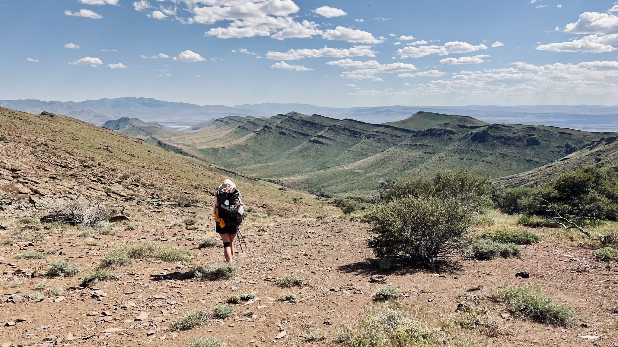
A backcountry road leads to this stunning gorge which is part of the Oregon Desert Trail. The gulch itself stretches between Three Fingers Rock and Owyhee River. If you are out of water, follow the canyon to the west to get to the river. The Oregon Desert Trail however will take you into the gorge which is overgrown in places. Look to your left and right to see some ruins of old corrals.
5
0
Painted Canyon is located in the magnificent Honeycombs Wilderness Study Area. Take a walk through the canyon following the dry creek bed and get stunned by nature’s art!
4
0
At this section of the Oregon Desert Trail, it winds its way along the Owyhee River. Depending on the water level, you can hike along a clearly visible dirt road. Otherwise you might have to opt for higher ground. The river is also your water source that has to be treated.
3
0
Strange, but beautiful rock formations will impress you when entering the Honeycomb Wilderness Study Area. Juniper Gulch leads you into the area that extends further to the north. Explore yourself, do a little cross country, if you are adventurous.
4
0
Frequently Asked Questions
What are some of the most unique natural features to see in Malheur County's canyons?
Malheur County's canyons are rich in geological wonders. You can explore the strange and beautiful rock formations within the Honeycomb Wilderness Study Area, especially through Juniper Gulch. Leslie Gulch is also renowned for its stunning, colorful rock formations and narrow canyons formed from volcanic ash. Along the Owyhee River, you'll find dramatic canyon walls and several natural hot springs like Three Forks, Echo, and Snively Hot Springs.
Are there opportunities for hiking along rivers in Malheur County's canyons?
Yes, the Owyhee River carves its way through rugged volcanic canyons, offering extensive hiking opportunities. The Oregon Desert Trail along Owyhee River is a prime example, winding along the river and potentially serving as a water source. The Malheur River Trail also traverses steep canyon walls before descending to the scenic banks of the Malheur Wild and Scenic River, offering rugged beauty and solitude.
What is the best time of year to visit the canyons in Malheur County?
Many of the canyons in Malheur County, such as Juniper Gulch within Leslie Gulch, can be accessed for much of the year. However, for areas with hot springs like Echo Hot Springs along the Owyhee River, visits are particularly recommended during cooler seasons or in the evening/night. Generally, spring and fall offer more moderate temperatures for hiking and exploration.
Are there any remote or less-discovered canyons in Malheur County worth exploring?
Yes, Whitehorse Creek Canyon, located within the remote Oregon Canyon Mountains, is described as one of Oregon's most incredible gorges. It remains largely undiscovered by many visitors due to its remote nature, offering a chance for solitude and a glimpse of the rare Whitehorse cutthroat trout.
What kind of wildlife can be spotted in the canyons of Malheur County?
The diverse ecosystems within Malheur County's canyons support various wildlife. Along the Malheur River Trail, you might spot eagles and ospreys. The remote Whitehorse Creek Canyon is home to the rare Whitehorse cutthroat trout. Additionally, areas like Burnt River Canyon, with its talus slopes, provide shelter for wildlife from extreme temperatures.
Are there any canyons in Malheur County that are part of the Oregon Desert Trail?
Yes, several canyons and areas are part of the Oregon Desert Trail. Three Fingers Gulch is a stunning gorge that is part of this trail, stretching between Three Fingers Rock and the Owyhee River. The Oregon Desert Trail along Owyhee River also winds through the Owyhee River canyons, and a section of the Upper McCain Spring Road is also part of the trail, leading along impressive rock formations.
What are the geological characteristics of the canyons in Malheur County?
The canyons in Malheur County are characterized by a rugged and diverse landscape, featuring high desert, volcanic rock, and ancient geological formations. Areas like Leslie Gulch are known for narrow canyons formed from volcanic ash, while the Owyhee River carves through rugged volcanic canyons. Even the Little Black Canyon area is noted for its volcanic, pyroclastic, and sedimentary rock formations of late Tertiary age.
Are there any canyons with dramatic rock formations suitable for photography?
Absolutely. The Honeycomb Wilderness Study Area, accessible via Juniper Gulch, offers strange and beautiful rock formations that are excellent for photography. Long Gulch also features dramatic rock formations along its backcountry road. The colorful rock formations of Leslie Gulch are particularly renowned for their photographic appeal, showcasing golden and reddish hues.
Can I find hot springs within the canyon areas of Malheur County?
Yes, the Owyhee River Canyons are known for several natural hot springs. These include Three Forks Hot Springs, Echo Hot Springs (nestled in vast canyonlands), and Snively Hot Springs, which are located right next to the Owyhee River, allowing for a mix of hot spring and cool river water.
What kind of plant life can be found in the canyons of Malheur County?
The canyons support diverse plant life. Whitehorse Creek Canyon features aspen forests along with curl-leaf mountain mahogany and other native plants. Burnt River Canyon is also a high desert area filled with curl-leaf mountain mahogany and is known for its diverse native plant life, especially after spring rains. The Malheur River canyon walls can also host forests of ponderosa pine, Douglas-fir, and larch trees.
Are there any canyons that offer viewpoints of the Owyhee River?
Yes, the North Fork Owyhee River is a notable viewpoint within the canyon system. Additionally, the Oregon Desert Trail along Owyhee River provides continuous views as it winds its way along the river.
Most popular attractions in Malheur County

Get inspired with the komoot mobile app


Explore more
Already discovered everything in this region? See additional gorges in Malheur County for your next adventure:
