Top 9 Waterfalls around Area A (Wells Gray Country)
Best waterfalls around Area A (Wells Gray Country) is a region known for its numerous waterfalls, often referred to as "Canada's Waterfall Park." This area, primarily within Wells Gray Provincial Park, features more than 40 named waterfalls shaped by volcanic and glacial activity. The landscape offers a diverse range of cascades, from towering plunges to wide, curtain-like flows. It provides a natural setting for exploring various waterfall types.
Best waterfalls around Area A (Wells Gray Country)
- The most popular waterfalls…
Last updated: September 30, 2026
Moul Falls
Highlight • Waterfall
Translated by Google •
Tip by

Spahats Creek Falls
Highlight • Waterfall
Tip by

Sign up now to discover places like this
Get recommendations on the best single tracks, peaks, & plenty of other exciting outdoor places.
Dawson Falls
Highlight • Waterfall
Tip by
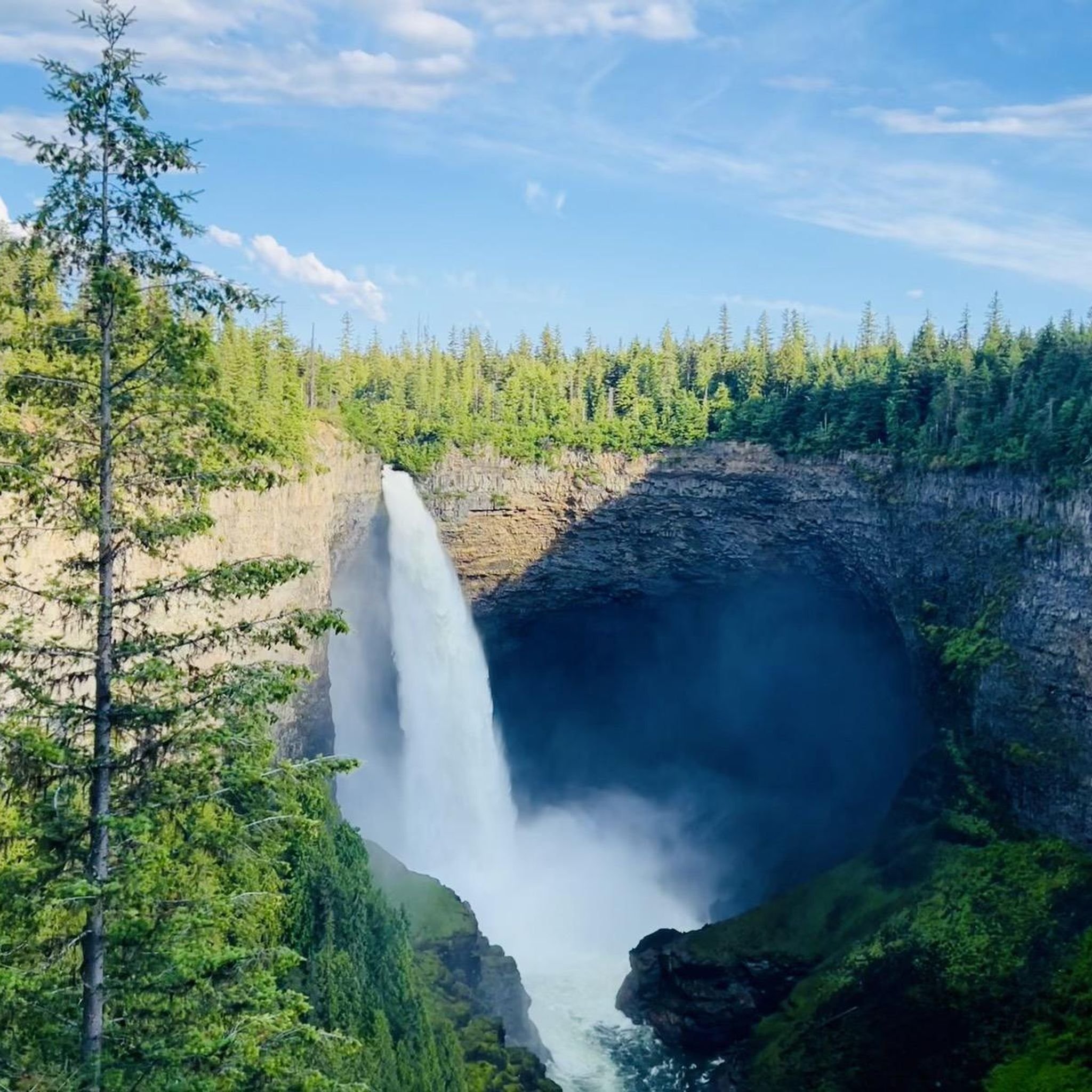
View of Helmcken Falls
Highlight • Waterfall
Showing Translation
Tip by

The Mushbowl
Highlight • Waterfall
Tip by
Sign up for free to discover even more waterfalls around Area A (Wells Gray Country).
Already have an account?
Start today with a free account
Your next adventure awaits.
Popular around Area A (Wells Gray Country)
Tips from the Community

At over 140 metres tall, it's easy to see why Helmcken Falls was one of the main reasons for the formation of Wells Gray Provincial Park. While the spectacular waterfall is a main draw during the busy summer season, the area is also popular with ice climbers during winter and the falls are known as the "Yosemite of ice climbing".
1
0

Here you can really disappear into nature.
3
0
A tough climb, but really cool.
3
0
So incredibly cool! You don't want to miss this.
3
0

It's definitely worth it, especially early in the morning when there aren't many people there yet.
1
0


From the Dawson Falls parking lot, a trail along the Murtle River takes you to the Falls in about 10 minutes. About two-thirds of the way, there is an excellent viewing point for the Falls. The water of the Murtle River plunges about 18 meters down a step at Dawson Falls. If you're lucky, you can see a rainbow below the Dawson Falls. Opposite is another observation point; it can be reached from the Pyramid Campground. In addition to Dawson Falls, there are six other waterfalls along the Murtle River in Wells Gray Park. (Visit June 3, 2018) https://www.worldwaterfalldatabase.com/waterfall/Dawson-Falls-2305 https://en.wikipedia.org/wiki/Dawson_Falls
2
0
Spahats Creek flows west from the Trophy Mountains, crossing the area's basalt formation. Upstream of Spahats Creek Falls, the creek has carved itself into a 23-meter-deep gorge and then plunges over the waterfall 61 meters into a massive canyon, emptying into the Clearwater River a few hundred meters later. The canyon is the result of glacial meltwater that flowed over the edge of the Clearwater Valley about 11,000 years ago. After the Ice Age, the stream receded into the comparatively small Spahats Creek. Spahats Creek was once known as Bear Creek. Spahats is a native word for bear. (Visit June 3, 2018) https://www.worldwaterfalldatabase.com/waterfall/Spahats-Creek-Falls-2293
3
0
Frequently Asked Questions
What is the best time of year to visit the waterfalls in Wells Gray Country?
The ideal time to experience the waterfalls in their full power is typically from late April to early July, when glacial melt and spring rains contribute to raging flows. During winter months, many falls transform into stunning frozen spectacles, offering a different kind of beauty.
Are there any family-friendly waterfalls with easy access in Wells Gray Country?
Yes, several waterfalls are easily accessible and great for families. Spahats Creek Falls is a prime example, located just 10 minutes from Clearwater with a short, easy walk to a fully accessible viewing platform. Dawson Falls also offers an easy 1.1-kilometer hiking route with multiple viewpoints, making it perfect for all ages.
Which waterfall offers a unique experience where I can go behind the cascade?
Moul Falls provides this unique adventure. After a moderate 3-kilometer hike, visitors can trek down behind the 35-meter cascade and feel the mist. This is particularly feasible in late summer when the water flow is less intense.
What kind of natural features can I expect to see around the waterfalls in Wells Gray Country?
Wells Gray Country is renowned for its volcanic and glacial history, which has shaped its diverse landscape. You'll encounter dramatic canyons, deep 'punchbowls' carved by powerful cascades, and ancient forests of cedar and hemlock, especially near waterfalls like Dawson Falls. The region's geology is a significant part of the experience.
Are there opportunities for hiking near the waterfalls?
Absolutely. Wells Gray Country offers numerous hiking trails that lead to or past its waterfalls. For example, you can explore routes like the Moul Falls loop or the Murtle River Bridge – Helmcken Falls loop. You can find more details on these and other trails in the Hiking around Area A (Wells Gray Country) guide.
Where can I see a waterfall that is known for its impressive width?
Dawson Falls, often called 'Little Niagara Falls,' is famous for its width rather than height. It cascades 90 meters across a ledge on the Murtle River, creating a broad, roaring flow that is quite spectacular.
Is there a waterfall that is particularly remote or offers a more adventurous experience?
For a more adventurous and rewarding experience, consider Silvertip Falls. At 168 meters, it's one of the tallest in the park, hidden beneath Trophy Mountain. Reaching its base requires a 2.1-kilometer return hike over challenging terrain, and access is via an active logging road.
What is The Mushbowl and why is it worth a quick stop?
The Mushbowl is a unique water feature consisting of two 4.5-meter cascades in a narrow canyon downstream from Dawson Falls. It's notable for exposing some of the oldest rocks in Wells Gray Provincial Park. It's an easy roadside stop, visible from the Clearwater Valley Road Bridge, offering a quick appreciation of the Murtle River's power.
Can I see salmon jumping near any of the waterfalls?
Yes, Bailey's Chute is a great spot to witness salmon jumping upstream, especially during the salmon run. It offers a fascinating glimpse into the region's wildlife and natural cycles.
Are there any waterfalls that are only accessible by boat?
Rainbow Falls is a remote and stunning waterfall located at the far end of Azure Lake. It is boat-accessible, allowing visitors to canoe, boat, or take a private tour to marvel at its beauty as it cascades into the lake, surrounded by ancient cedar trees.
What should I bring for a waterfall hike in Wells Gray Country?
For most waterfall hikes, especially those involving moderate trails like Moul Falls, sturdy hiking shoes are highly recommended. Depending on the season, layers of clothing, rain gear, water, and snacks are also advisable. For trails like Silvertip Falls, be prepared for roots, rocks, and streams.
Are there any less crowded waterfalls for a more tranquil experience?
While many falls are popular, McDiarmid Falls is a less-visited 10-meter waterfall found downstream from Moul Falls. Its quieter nature can offer a more tranquil experience away from the main crowds.
Most popular routes around Area A (Wells Gray Country)
Most popular attractions around Area A (Wells Gray Country)

Get inspired with the komoot mobile app


Explore more
Happy to travel a little further afield? Then browse these guides for the best waterfalls around Area A (Wells Gray Country):
