The 5 Most Amazing Peaks in Iztaccíhuatl-Popocatépetl
Best mountain peaks in Iztaccíhuatl-Popocatépetl are found within the Iztaccíhuatl-Popocatépetl National Park, a protected area spanning nearly 40,000 hectares. This region is home to Mexico's second and third-highest peaks, offering diverse experiences for outdoor enthusiasts. The landscape features volcanic mountains, pine-fir forests, and alpine grasslands. It is a significant area for both natural spectacle and cultural history.
Best mountain peaks in Iztaccíhuatl-Popocatépetl
- The most popular mountain peaks is Cerro Tláloc Summit and Archaeological Site, a summit that features an archaeological site at its broad summit, including an old Aztec pyramid. It is considered one of the highest-elevation shrines in the world and offers a blend of hiking and historical exploration.
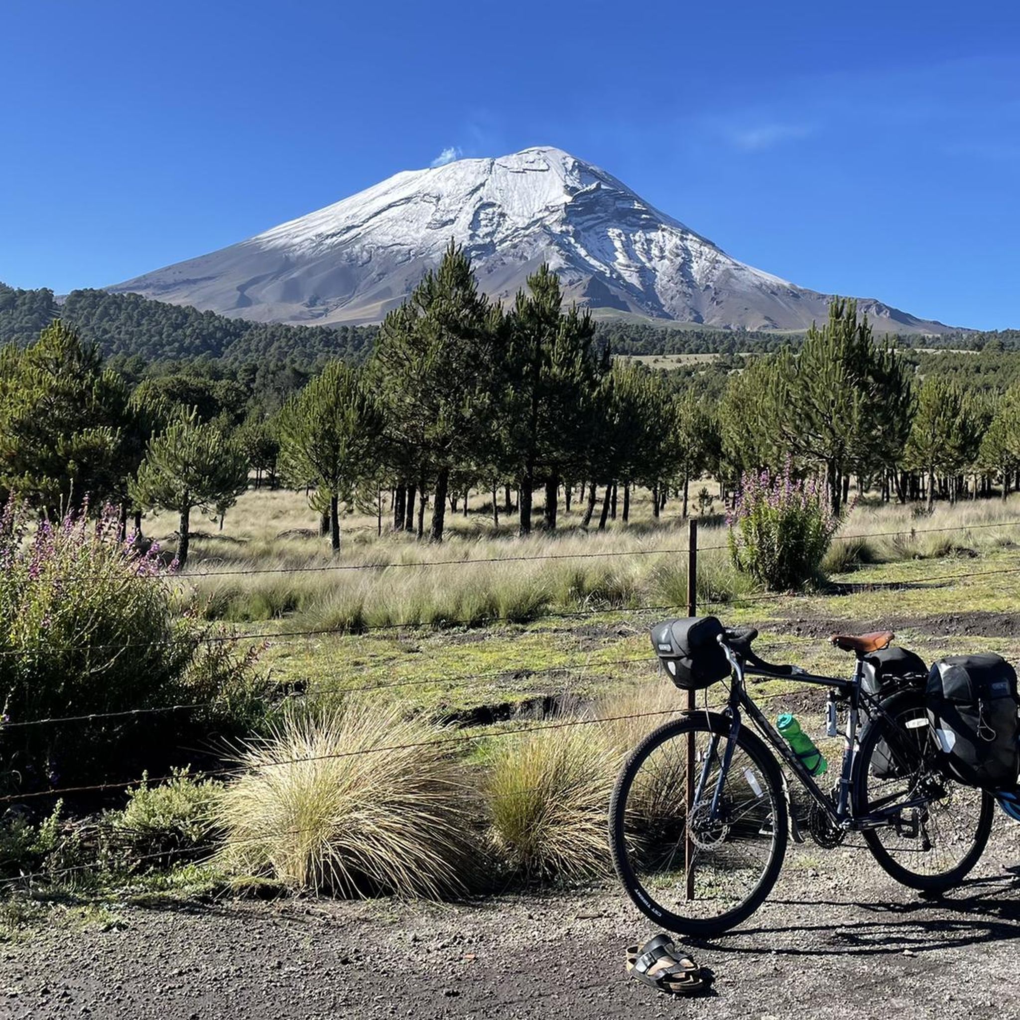
- Another must-see spot is Popocatépetl Volcano, an active volcano that frequently emits smoke. While summiting is forbidden due to its activity, its frequent emissions offer a dramatic spectacle from a safe distance.
- Visitors also love Iztaccíhuatl Summit, a dormant volcanic mountain and Mexico's third-highest peak. Its four snow-capped peaks resemble a sleeping female figure, and it is a popular destination for mountaineering with panoramic views.
- Iztaccíhuatl-Popocatépetl is known for volcanic peaks, summits with archaeological sites, and snow-capped mountains. The region offers diverse experiences, from challenging mountaineering routes to hikes with cultural significance.
- The mountain peaks in Iztaccíhuatl-Popocatépetl are appreciated by the komoot community. There are 24 photos and 13 upvotes from visitors who have explored these peaks.
Last updated: July 11, 2026
Cerro Tláloc Summit and Archaeological Site
Highlight • Summit
It's easy to find somewhere to park in the town and then just head roughly north west and find the trail that heads away from the glorious view of the 'Cabeza' (head) of nearby Ista.
The trail is a wide one and you can't miss it really as it lays on the outskirts of the town. If you have any difficulties just ask. The trail is in reality a rough road and is suitable for a four wheel vehicle and it meanders up through a lovely pine forest, which restricts your view but it is still pleasant.
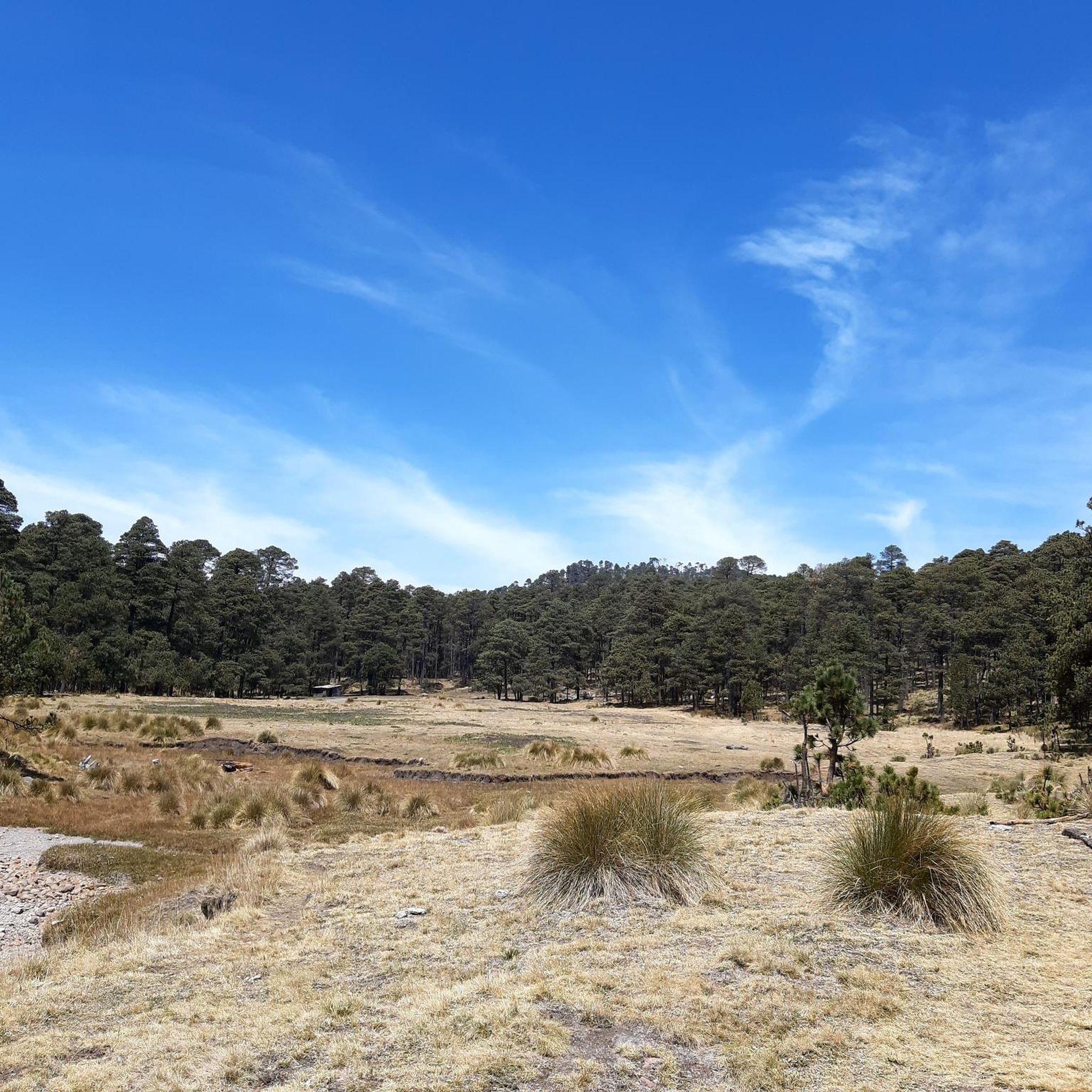
Just stick to the trail and after four k's you start to come out on a plateau. You are still on the big trail and it generally heads to the right. If you come to a junction just follow the yellow arrows. You have views from the plateau and to the left, about 2ks away is the summit of Telopan (4,060m). You will move away from this for another four k's until you come to a single track trail. Follow this until you come to the rock banded summit area of Tlaloc.
Now you go to the left of the rock bands, it's a bit of a bushman cross country trip but we managed to follow the trail up around to the left and had bit of a neat scramble until you come out above the bands. Another k and you come to the broad summit where you have the old Aztec pyramid.
It is time to head down now and this is a bit of bush trek too but the views are quite nice. You have great views of Ista's 'Cabeza' again and it is all very pleasant. Now I would return the same way as you came if you lack hiking competency and use a GPS if you can. We returned a different way heading down the rock band and ended up on a good off piste trip...all rather fun. After a jaunt back down the trail we ended back in Rio Frio. All in all this was a very good hiking day. Nice views, good trail, pine forest hike, easy scrambling and moderate route finding problems. No maps available to us but we got a gps track downloaded from wiki log. Take a gps if you can even if it's only to back track.
Tip by

Iztaccíhuatl Summit
Highlight • Summit
The name "Iztaccíhuatl" is Nahuatl for "White woman", reflecting the four individual snow-capped peaks which depict the head, chest, knees and feet of a sleeping female when seen from east or west. Iztaccíhuatl is to the north of its twin Popocatépetl, to which it is connected by the high altitude Paso de Cortés. Depending on atmospheric conditions Iztaccíhuatl is visible much of the year from Mexico City some 70 km (43 mi) to the northwest. The first recorded ascent was made in 1889, though archaeological evidence suggests the Aztecs and previous cultures climbed it previously. It is the lowest peak containing permanent snow and glaciers in Mexico.
Tip by
Sign up now to discover places like this
Get recommendations on the best single tracks, peaks, & plenty of other exciting outdoor places.
Sign up for free
Popocatépetl Volcano
Highlight • Volcano
Translated by Google •
Tip by

Summit of Popocatépetl
Highlight • Summit
Tip by

Amacuilecatl Summit (Feet of Iztaccíhuatl)
Highlight • Summit
Translated by Google •
Tip by

Start today with a free account
Your next adventure awaits.
Login or Signup
Popular around Iztaccíhuatl-Popocatépetl

Tips from the Community

Amacuilecatl ("Where the five winds dwell" or "Where the five waters dwell") the top of the foot of the volcanoes that make up the Iztaccíhuatl
0
0

The air is getting quite thin once you get closer to the top. Allow yourself enough time to get up there. We had to take a lot of breaks and needed around 4 to 5 hours to get there!
1
0

Route Information: Cerro Tlaloc, 4,157m. This was a nice surprise day for us, a group of four experienced guides and walkers setting out from Rio Frio, the small town at the base of this mountain. Basically we travelled to Rio Frio from Mexico City and started off at 9.30am. It's easy to find somewhere to park in the town and then just head roughly north west and find the trail that heads away from the glorious view of the 'Cabeza' (head) of nearby Ista. The trail is a wide one and you can't miss it really as it lays on the outskirts of the town. If you have any difficulties just ask. The trail is in reality a rough road and is suitable for a four wheel vehicle and it meanders up through a lovely pine forest, which restricts your view but it is still pleasant. Just stick to the trail and after four k's you start to come out on a plateau. You are still on the big trail and it generally heads to the right. If you come to a junction just follow the yellow arrows. You have views from the plateau and to the left, about 2ks away is the summit of Telopan (4,060m). You will move away from this for another four k's until you come to a single track trail. Follow this until you come to the rock banded summit area of Tlaloc. Now you go to the left of the rock bands, it's a bit of a bushman cross country trip but we managed to follow the trail up around to the left and had bit of a neat scramble until you come out above the bands. Another k and you come to the broad summit where you have the old Aztec pyramid. It is time to head down now and this is a bit of bush trek too but the views are quite nice. You have great views of Ista's 'Cabeza' again and it is all very pleasant. Now I would return the same way as you came if you lack hiking competency and use a GPS if you can. We returned a different way heading down the rock band and ended up on a good off piste trip...all rather fun. After a jaunt back down the trail we ended back in Rio Frio. All in all this was a very good hiking day. Nice views, good trail, pine forest hike, easy scrambling and moderate route finding problems. No maps available to us but we got a gps track downloaded from wiki log. Take a gps if you can even if it's only to back track.
5
0
Mount or Cerro Tlaloc (Spanish: Monte Tláloc, sometimes wrongly listed as Cerro el Mirador; Nahuatl: Tlālōcatepētl) is a mountain and archaeological site in central Mexico. It is located in the State of Mexico, in the municipalities of Ixtapaluca and Texcoco, close to the state border with Puebla. Formerly an active volcano, it has an official altitude of 4,120 metres (13,517 ft) above sea level, thus being the 9th tallest mountain of Mexico. The mountain was considered by the Nahuan peoples, foremost among them the Aztecs, to be specially sacred to the raingod Tlaloc. In fact, the mountain was believed to be one of his primary earthly dwelling places, called Tlalocan. Attribution of this and other mountains to the sacred presence of rain deities predates the Aztec era by centuries, even millennia. At the summit there are still remains of a shrine where high ceremonies would have been carried out. The rites of Tlaloc were otherwise performed at his temples, most famously that occupying one half of the Templo Mayor at the heart of the temple precinct of nearby Mexico-Tenochtitlan. The inherent analogy of temple pyramids to sacred mountains allows for the very likely possibility that the central temple of the Aztec capital, as such, was at least partly a symbolic representation of the actual Mount Tlaloc, and that the summit shrine of the temple was itself an analogue to that atop the mountain. The shrine atop is one of the highest-elevation shrines in the world. Together with Mount Telapón (4,060 metres (13,320 ft)) and some other, lower peaks, Mount Tlaloc forms the "Sierra de Río Frío", the northernmost tip of the Sierra Nevada. The mountain is easily accessible from Federal Highway 150 at the town of Río Frío de Juárez. The long, but easy and non-technical hike provides an elevation gain of over 1200 m.[2] More strenuous routes depart from San Pablo Ixayoc and from other towns outside Texcoco.
4
0
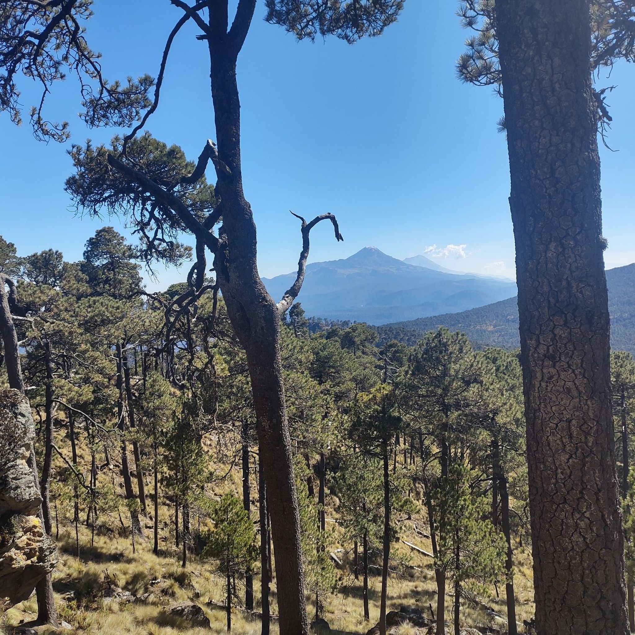
Carolina is absolutely right. Wen you are going up Izta and dawn breaks upon you the views across to the continually smoking Popo is amazing. Every time you turn back to take a picture you just have this marvellous volcano as a back drop. I simply love Mexico, its people and its mountains!
2
0
Iztaccíhuatl (alternative spellings include Ixtaccíhuatl, or either variant spelled without the accent) (Nahuatl pronunciation: [istakˈsiwat͡ɬ] (About this soundlisten) or, as spelled with the x, [iʃtakˈsiwat͡ɬ] (About this soundlisten)), is a 5,230 m (17,160 ft) dormant volcanic mountain in Mexico located on the border between the State of Mexico and Puebla within Izta-Popo Zoquiapan National Park. It is the nation's third highest, after Pico de Orizaba at 5,636 m (18,491 ft), and Popocatépetl at 5,426 m (17,802 ft). The name "Iztaccíhuatl" is Nahuatl for "White woman", reflecting the four individual snow-capped peaks which depict the head, chest, knees and feet of a sleeping female when seen from east or west. Iztaccíhuatl is to the north of its twin Popocatépetl, to which it is connected by the high altitude Paso de Cortés. Depending on atmospheric conditions Iztaccíhuatl is visible much of the year from Mexico City some 70 km (43 mi) to the northwest. The first recorded ascent was made in 1889, though archaeological evidence suggests the Aztecs and previous cultures climbed it previously. It is the lowest peak containing permanent snow and glaciers in Mexico.
4
0

The access to the Popo is closed due to its constant activity, but the view from the Izta is amazing.
2
0
Frequently Asked Questions
What are the most prominent mountain peaks in the Iztaccíhuatl-Popocatépetl region?
The region is home to Mexico's second and third-highest peaks. The most prominent include Iztaccíhuatl (5,230 meters), known as 'The Sleeping Woman', Popocatépetl (5,426 meters), an active volcano, and Mount Tláloc (4,120 meters), which features an archaeological site. Other notable peaks are Telapón (4,060 meters) and Papayo (3,600 meters).
Can I climb Popocatépetl?
No, summiting Popocatépetl Volcano is forbidden due to its continuous activity. However, its frequent emissions of smoke and occasional incandescent displays offer a dramatic and awe-inspiring view from a safe distance.
What makes Iztaccíhuatl a popular destination for mountaineers?
Iztaccíhuatl Summit, Mexico's third-highest peak, is a dormant volcanic mountain popular for mountaineering. Its four snow-capped peaks resemble a sleeping female figure, and the climb typically takes two days, offering panoramic views, especially of Popocatépetl from sections like 'Las Rodillas'.
Are there any mountain peaks with historical or cultural significance in the region?
Yes, Cerro Tláloc Summit and Archaeological Site is highly significant. It features an old Aztec pyramid at its broad summit, making it one of the highest-elevation shrines in the world. It was historically considered the abode of the Aztec rain god, Tláloc, offering a unique blend of hiking and historical exploration.
What kind of natural features can I expect to see around these peaks?
The Iztaccíhuatl-Popocatépetl National Park features diverse landscapes, including volcanic mountains, pine-fir forests at lower elevations, transitioning to pine forests and alpine grassland (Zacatonal) at higher altitudes. You'll also encounter snow-capped peaks and stunning viewpoints offering vistas of the surrounding volcanic terrain.
What are some hiking opportunities near these mountain peaks?
The region offers various hiking opportunities. For example, you can find routes like the 'Apatlaco River Waterfall – Paso de Cortés loop' or the 'Paso de Cortés loop from Paso de Cortés'. More challenging options include the 'Best located campsite – Alpinists' Cross loop'. You can explore more hiking trails in the region by visiting the Hiking in Iztaccíhuatl-Popocatépetl guide.
Are there any family-friendly options for exploring the Iztaccíhuatl-Popocatépetl region?
While many peaks offer challenging climbs, some areas provide more accessible trails through pine forests, such as those leading towards Telapón or the lower sections of Mount Tláloc. These offer pleasant walks with scenic views, suitable for families looking for less strenuous outdoor experiences.
What is the best time of year to visit the Iztaccíhuatl-Popocatépetl peaks?
The dry season, typically from November to May, is generally considered the best time to visit for clearer skies and more stable weather conditions, which are crucial for mountaineering and enjoying panoramic views. During this period, visibility is usually better, and there is less chance of rain.
What do visitors enjoy most about the mountain peaks in Iztaccíhuatl-Popocatépetl?
Visitors frequently highlight the dramatic natural spectacle of the active Popocatépetl volcano, the challenging yet rewarding climbs of Iztaccíhuatl with its panoramic views, and the unique blend of hiking and historical exploration offered by Mount Tláloc. The region's diverse volcanic landscape and rich cultural history are also highly appreciated.
Are there cycling routes available near the Iztaccíhuatl-Popocatépetl peaks?
Yes, there are cycling routes in the vicinity. Options range from moderate loops like the 'Summit of Popocatépetl – Paso de Cortés loop from Paso de Cortés' to more difficult routes such as the 'Route of the Volcanoes – Paso de Cortés loop'. For more details, refer to the Cycling in Iztaccíhuatl-Popocatépetl guide.
What should I pack for a climb on Iztaccíhuatl?
For a multi-day climb on Iztaccíhuatl, you should pack appropriate mountaineering gear, including warm layers, waterproof and windproof outer shells, sturdy hiking boots, a backpack, food, water, and navigation tools. Given the high altitude and potential for snow, specialized equipment like crampons and an ice axe might be necessary depending on conditions and the specific route.
Are there any hidden gem viewpoints in the Iztaccíhuatl-Popocatépetl region?
While the main peaks offer spectacular views, the ridges along the climb to Iztaccíhuatl, particularly after 'Las Rodillas', provide glorious vistas of Popocatépetl. Additionally, the trails leading to Telapón and Mount Tláloc offer excellent panoramic views of the volcanic landscape away from the most frequented spots.
Most popular routes in Iztaccíhuatl-Popocatépetl
Most popular attractions in Iztaccíhuatl-Popocatépetl

Get inspired with the komoot mobile app


Explore more
See even more amazing summits in Iztaccíhuatl-Popocatépetl with these guides:
