The 3 Most Amazing Peaks around Bavington
Best mountain peaks near Bavington are found within a landscape characterized by fells and moorland, offering distinct points of interest for outdoor enthusiasts. This area, located in Northumberland, England, features varied terrain with elevations reaching over 1,000 feet. The region provides opportunities to explore significant summits and viewpoints, many of which are marked by historic trig points. These locations offer insights into the area's geography and mapping history.
Best mountain peaks around Bavington
- The most popular mountain peaks is Shaftoe…
Last updated: October 7, 2026
Shaftoe Crags Trig Point
Highlight • Viewpoint
Tip by

Walwick Fell Trig Point
Highlight • Summit
(DoBIH Hill ID: 16017) [JNSA 15633]
TP4416 - Limestone Bank S6659
Northumberland National Park Definitive List summit.
County of Northumberland Definitive List summit.
Tip by

Sign up now to discover places like this
Get recommendations on the best single tracks, peaks, & plenty of other exciting outdoor places.
Whittington Fell Trig Point
Highlight • Summit
(DoBIH Hill ID: 5283) [JNSA 14881]
TP4822 - Military Road S6623
County of Northumberland Definitive List summit.
Tip by
(DoBIH Hill ID: 15971) [JNSA 11904]
#1826
County of Northumberland Definitive List summit.
TP3247 - Fourlaws Hill S6629
FB Height: 342.732m
#1055
County of Northumberland Trig Pillar List.
Tip by
Gunner’s Box — elevation 325.12 m (1,066 ft); prominence 22.23 m
Highlight • Summit
(DoBIH Hill ID: 15985) [JNSA 30072]
Northumberland National Park Definitive List summit.
County of Northumberland Definitive List summit.
Tip by
Sign up for free to discover even more peaks around Bavington.
Already have an account?
Start today with a free account
Your next adventure awaits.

Tips from the Community

Sappers’ Pike 342m P83 (1122ft) (DoBIH Hill ID: 15971) [JNSA 11904] #1826 County of Northumberland Definitive List summit. TP3247 - Fourlaws Hill S6629 FB Height: 342.732m #1055 County of Northumberland Trig Pillar List.
0
0
Gunner’s Box 325.12m P22.23 (1066ft) (DoBIH Hill ID: 15985) [JNSA 30072] Northumberland National Park Definitive List summit. County of Northumberland Definitive List summit.
0
0
Walwick Fell 250m P33 (820ft) (DoBIH Hill ID: 16017) [JNSA 15633] TP4416 - Limestone Bank S6659 Northumberland National Park Definitive List summit. County of Northumberland Definitive List summit.
0
0
Whittington Fell 268m P107 (879ft) (DoBIH Hill ID: 5283) [JNSA 14881] TP4822 - Military Road S6623 County of Northumberland Definitive List summit.
0
0

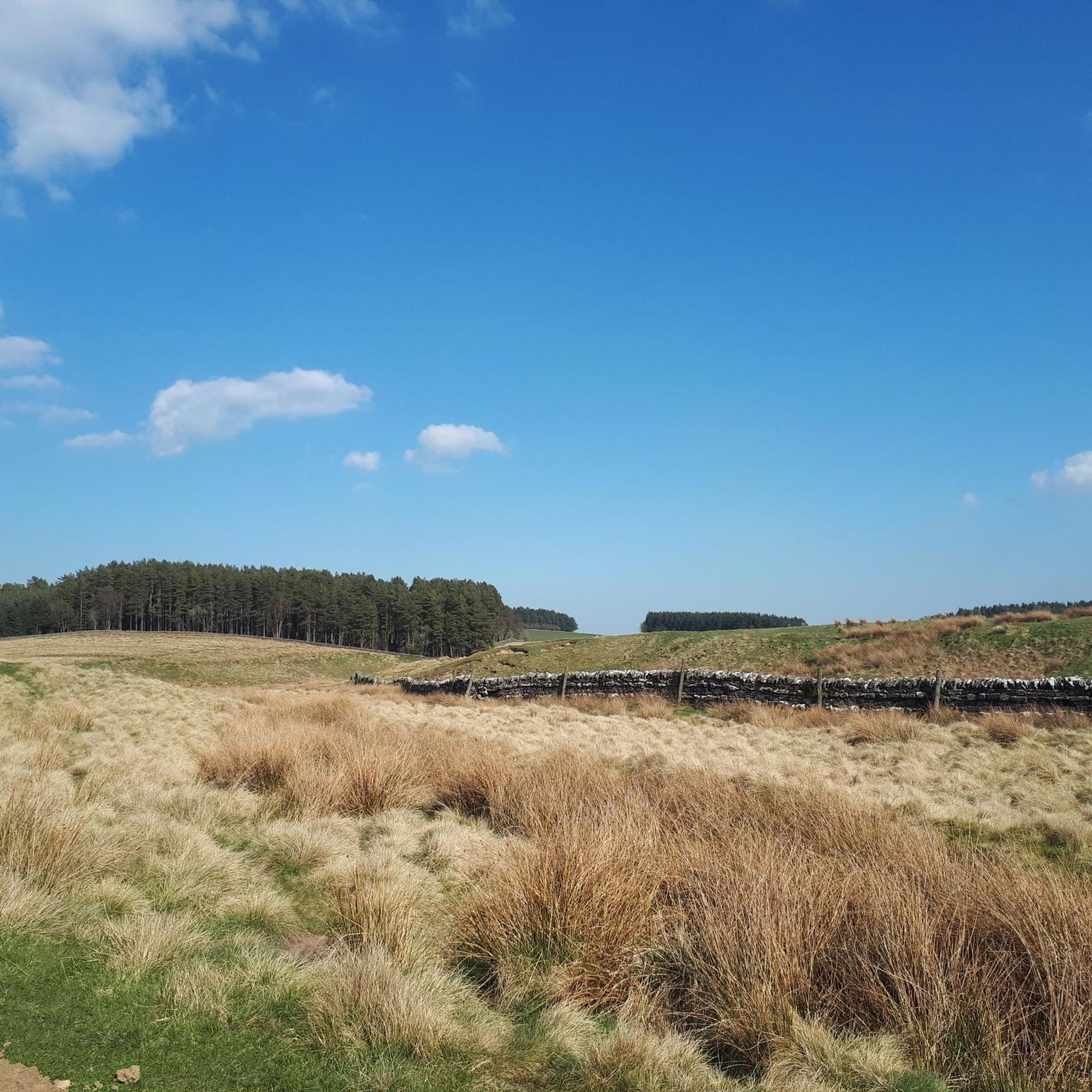
Elevated at 699 feet above sea level, the trig point, also known as a triangulation pillar, marks the highest point on the moorland. These pillars, introduced by the Ordnance Survey in 1936, serve as sturdy platforms for surveyors' theodolites, which were used to create accurate maps during the retriangulation Of Great Britain. They can be found scattered throughout the British countryside, offering important reference points for hikers and adventurers exploring the picturesque landscapes. This particular one was installed on 01/06/1947.
0
0
Frequently Asked Questions
What are the most notable peaks and viewpoints around Bavington?
While Bavington is known for its significant hills rather than towering mountains, you can find several notable summits and viewpoints. These include Shaftoe Crags Trig Point, which offers views from 699 feet above sea level, and Walwick Fell Trig Point at 820 feet. Other prominent points are Whittington Fell Trig Point (879 ft), Gunner’s Box (1,066 ft), and Corsenside Common Trig Point, the highest at 1,201 feet.
What kind of outdoor activities can I do near the peaks around Bavington?
The Bavington area, particularly within Hillman State Park, is a hub for outdoor activities. You can enjoy extensive mountain biking on nearly 30 miles of single-track trails, with options ranging from beginner-friendly routes like Pine Hollow Loop to advanced challenges like The Ridge Runner. The area is also popular for hiking, trail running, cross-country skiing, and equestrian activities. For more specific routes, explore the hiking trails around Bavington, gravel biking routes, or running trails.
Are there family-friendly hiking options around Bavington's peaks?
Yes, there are several family-friendly hiking options available. For example, the River Walk at Wallington and the Wallington Garden Pond loop are both rated as easy hikes, perfect for families. These trails offer gentle terrain and scenic beauty without excessive climbing, making them accessible for all ages.
What are the best trails for mountain biking in the Bavington area?
Bavington - Hillman State Park is renowned for its mountain biking. Popular trails include The Ridge Runner for advanced riders, Pine Hollow Loop for beginners, and Rocky Top Trail for intermediate challenges. The Five Points Trails network is also highly regarded for its moderate technical riding and good drainage after rain. Other favorites are Abby's Trail, TT 3, Switch Back Trail, TT1 & TT2, and Airport South Trail / Rollercoaster.
What unique historical features can be found on Bavington's peaks?
Many of the peaks around Bavington feature historic trig points, or triangulation pillars. These structures, like the one at Shaftoe Crags Trig Point (installed in 1947), were introduced by the Ordnance Survey to aid in accurate map-making. They serve as fascinating reminders of Britain's surveying history and offer sturdy platforms for modern-day adventurers.
What is the general terrain like for hiking and biking near Bavington?
The terrain around Bavington is characterized by rugged trails and scenic woodland paths. While not featuring towering peaks, the area offers significant hills with varied elevations. You'll encounter a mix of natural and man-made features, including rocky sections, tight switchbacks, and smooth flow trails, providing a dynamic experience for both hikers and riders.
Are there challenging climbs for experienced hikers or bikers in Bavington?
Yes, experienced hikers and mountain bikers will find challenging options. For mountain biking, The Ridge Runner trail is specifically recommended for advanced riders due to its steep climbs and thrilling descents. For hiking, routes like the Track Along the Reservoir from Well House CAMC CL are rated as difficult, offering a substantial challenge over longer distances.
What makes the Bavington area unique for outdoor enthusiasts?
The Bavington area stands out for its diverse and well-maintained trail system, particularly within Hillman State Park. It offers nearly 30 miles of single-track trails catering to various skill levels for mountain biking, alongside opportunities for hiking, trail running, and equestrian activities. The commitment to improving and clearing these trails, combined with the scenic woodland environment, creates a dynamic and engaging outdoor experience.
Where can I find easy hiking trails around Bavington?
For easy hiking, consider trails such as the River Walk at Wallington or the Wallington Garden Pond loop from Wallington Demesne. Another accessible option is the Hallington Reservoir loop from Colwell. These routes feature gentle elevation changes and are suitable for a relaxed outdoor experience.
What kind of wildlife might I spot around Bavington's peaks and trails?
While specific wildlife sightings are not guaranteed, the woodland paths and natural areas around Bavington's hills and trails provide habitats for various local wildlife. Keep an eye out for common woodland birds, small mammals, and other native species that thrive in the diverse terrain of the region.
Are there any trails that hold up well after rain in the Bavington area?
Yes, the Five Points Trails network within Hillman State Park is noted for holding up well after rain. This makes it a good option for mountain biking and hiking when other trails might be muddy, ensuring a more enjoyable experience even in damp conditions.
Most popular attractions around Bavington

Get inspired with the komoot mobile app


Explore more
See even more amazing summits around Bavington with these guides:
