The best cycling routes around Marthasville
5.0
(6)
75
riders
5
rides
Touring cycling routes around Marthasville are primarily defined by the Katy Trail, a 240-mile rail-to-trail path that traverses the region. The area features rolling hills and proximity to the Missouri River, offering views of river bluffs and surrounding vineyards. Marthasville is situated within Missouri's wine country, characterized by rich soil and varied topography.
Best touring cycling routes around Marthasville
- The most popular touring cycling route is Bums Cave – Missouri River loop from Dutzow, a 53.6 miles (86.3 km)…
Last updated: July 12, 2026
5.0
(3)
25
riders
53.0km
03:52
140m
140m
Moderate bike ride. Good fitness required. Mostly paved surfaces. Suitable for all skill levels.
13
riders
37.4km
03:05
70m
70m
Moderate bike ride. Good fitness required. Mostly paved surfaces. Suitable for all skill levels.

Sign up for free
5.0
(3)
17
riders
66.8km
05:24
170m
170m
Hard bike ride. Very good fitness required. Mostly paved surfaces. Suitable for all skill levels.
9
riders
39.1km
03:36
50m
50m
Moderate bike ride. Good fitness required. Mostly paved surfaces. Suitable for all skill levels.
11
riders
24.8km
02:17
30m
30m
Moderate bike ride. Good fitness required. Mostly paved surfaces. Suitable for all skill levels.
Our route recommendations are based on thousands of hikes, rides, and runs completed by other people on komoot.
Start today with a free account
Your next adventure awaits.
Login or Signup
Popular around Marthasville

Other adventures around Marthasville

Tips from the Community

Known locally as “Devil’s Boot Cave,” this natural overhang carved in sandstone resembles the shape of a boot and stretches roughly 25 feet deep and wide, near Marthasville. Once used as a pioneer shelter and noted by local schools for nature trips, the site offers a little geological curiosity beside the trail—a hands-on reminder of Missouri’s limestone landscape and early frontier life. Great for a quick stop and photo op!
0
0

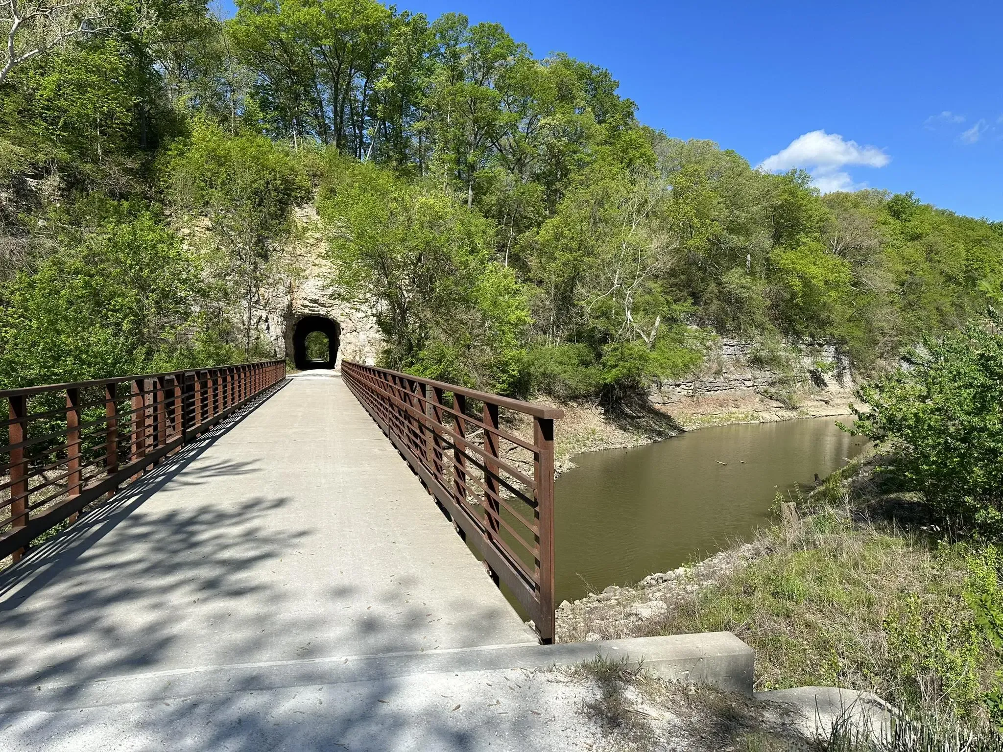
The Katy Trail from Matson to Augusta or vice versa offers mostly shaded paths, providing views of bluffs, wooden bridges, and glimpses of Klondike Park and the surrounding rural area along the way.
0
0

This scenic park on the banks of the Misouri River has about 4 miles of natural surface and paved trails. The MTB trails are mainly short but fun and challenging runs that can be ridden multiple times if you use the pavement and connector trails between them.
0
0
Klondike Park, nestled alongside the Missouri River near Katy Trail State Park, was a former silica sand quarry, now restored by St. Charles County Parks. Enjoy stunning views of the Missouri River from its bluffs. The park offers numerous camping sites and is known for its powdery white silica sand, once used for glass production. The Lewis and Clark Expedition also passed through this area.
0
0
The Katy Trail from Matson to Augusta offers mostly shaded paths, providing views of bluffs, wooden bridges, and glimpses of Klondike Park and the surrounding rural area along the way.
0
0
Augusta is a historic town nestled among rolling hills on the Missouri River bluffs. Incorporated in 1855, it proudly holds the distinction of being America's first designated wine region, recognized by the Federal Government in 1980—preceding even Napa and Sonoma! Known for its quaint charm and historic sites, Augusta stands as one of the most popular stops along the Katy Trail. Here, visitors can easily hop on or off the trail to discover wineries, a brewery, restaurants, a coffee shop, antiques, specialty stores, and relaxing B&Bs.
0
0
The Katy Trail from Matson to Augusta offers mostly shaded paths, providing views of bluffs, wooden bridges, and glimpses of Klondike Park and the surrounding rural area along the way.
0
0
A sight for sore eyes! Two local artists painted a mural on three abandoned 40-foot-tall silos that can be seen right off the trail. They capture the essence of Missouri's farmland and bright blue skies.
0
0
Frequently Asked Questions
How many touring cycling routes are available around Marthasville?
The komoot community has curated 4 touring cycling routes around Marthasville. These routes offer a mix of moderate and difficult options, with 3 routes rated as moderate and 1 as difficult.
What is the primary cycling attraction in Marthasville?
Marthasville is a key stop on the renowned Katy Trail State Park, a 240-mile rail-to-trail path that defines much of the region's cycling experience. The trail offers varied scenery, from majestic river bluffs to peaceful farmland.
Are there family-friendly cycling options in Marthasville?
The Katy Trail, which is central to cycling in Marthasville, is generally flat and well-maintained, making many sections suitable for family cycling. Its rail-to-trail nature means gentle gradients, ideal for riders of all ages.
What kind of landscapes can I expect to see while cycling near Marthasville?
Cyclists in Marthasville can expect picturesque views of the Missouri River and its dramatic bluffs, rolling hills, and scenic vineyards, as the area is part of the 'Missouri Weinstrasse' or 'Wine Road'. Routes like Bums Cave – Missouri River loop from Dutzow offer extensive river views.
Are there any circular touring cycling routes available?
Yes, there are several circular routes. For example, the Katy Trail – Klondike Park Quarry loop from Dutzow is a moderate 23.3-mile loop that incorporates sections of the Katy Trail and passes through Klondike Park. Another option is the Augusta – Bums Cave loop from Augusta, which is 24.3 miles long.
What are some notable places to explore along the cycling routes?
Along the routes, you can explore areas like Klondike Park, known for its views of the Missouri River and unique white silica sand. The region is also rich in wineries, such as Lake Creek Winery and Lost Creek Vineyard, which are often accessible from the Katy Trail. Historic sites like Boone Monument Village also offer interesting stops.
What do other touring cyclists enjoy most about cycling in Marthasville?
The touring cycling routes in Marthasville are highly rated by the komoot community, with an average score of 4.3 stars from over 5 reviews. Cyclists often praise the scenic beauty of the Missouri River bluffs, the well-maintained Katy Trail, and the charming wine country landscapes.
Is there parking available near the cycling routes?
Marthasville, being a hub on the Katy Trail, offers various services for cyclists, which typically include parking facilities. Community Club Park, for instance, caters to trail travelers and often provides amenities like camping with showers, suggesting convenient access for those arriving by car.
Can I find cafes or restaurants near the cycling routes?
Yes, Marthasville and nearby towns along the Katy Trail offer numerous services for cyclists, including restaurants and cafes. The town maintains a welcoming atmosphere with local businesses catering to trail users, and wineries in the 'Missouri Weinstrasse' also provide dining options.
What is the best time of year for touring cycling in Marthasville?
While specific best months aren't provided, the region's climate suggests spring and fall would be ideal for touring cycling. These seasons typically offer pleasant temperatures and vibrant scenery, avoiding the extreme heat of summer or the potential for winter conditions.
Are there any specific facilities for cyclists in Marthasville?
Marthasville is well-equipped for cyclists, offering services such as lodging, camping, and repair stations. Facilities like Happy Apples Bicycle Bunk House and Community Club Park specifically cater to trail travelers, providing amenities like camping with showers.
What is the elevation profile like for touring cycling routes in Marthasville?
The routes around Marthasville, particularly those incorporating the Katy Trail, generally feature gentle elevation changes due to their rail-to-trail nature. However, the region does have rolling hills, and some routes, like the Bums Cave – Missouri River loop from Dutzow, can accumulate over 135 meters of elevation gain, making them more challenging.
Most popular routes around Marthasville

Get inspired with the komoot mobile app


Explore more
Browse the best Cycling routes in other regions.
