The best running trails in Zec Louise-Gosford
5.0
(1)
37
runners
4
runs
Jogging routes in Zec Louise-Gosford traverse a mountainous landscape in Quebec's Eastern Townships, near the Canada-US border. The region is characterized by significant peaks, including Mont Gosford, which stands at 1,193 meters. Trails often lead through coniferous forests, especially at higher altitudes, and feature varied terrain with ridges and valleys. The area also includes natural features such as the River Araignées and borders Arnold Lake.
Best jogging routes in Zec Louise-Gosford
- The most popular jogging route is View from Mont Gosford loop from Camping de l'Accueil Gosford, a 10.5 miles (16.9 km) trail that takes 2 hours 24 minutes to complete. This difficult route offers challenging ascents towards Mont Gosford.
- Another top favourite among local runners is Sentier Frontalier SF1 – View from Mont Gosford loop from Camping de l'Accueil Gosford, a difficult 16.3 miles (26.2 km) path. This route winds through varied terrain, including ridges and valleys, showcasing diverse forests.
- Local runners also love the View from Mont Gosford loop from Camping de l'Accueil Gosford, a 11.5 miles (18.5 km) trail leading through mountainous terrain and coniferous forests, often completed in about 2 hours 45 minutes.
- Jogging in Zec Louise-Gosford is defined by mountainous terrain, challenging ascents, and extensive coniferous forests. The network primarily offers difficult routes, ideal for experienced trail runners.
- The routes in Zec Louise-Gosford are highly rated by the komoot community with an average score of 5.0 stars from over 1 review. More than 35 runners have used komoot to explore Zec Louise-Gosford's varied terrain.
Last updated: July 23, 2026
18
runners
Hard run. Very good fitness required. Mostly paved surfaces. Suitable for all skill levels.
5.0
(1)
8
runners
26.2km
03:49
1,060m
1,060m
Hard run. Very good fitness required. Mostly paved surfaces. Suitable for all skill levels.

Sign up for free
7
runners
8.38km
01:19
490m
490m
Hard run. Very good fitness required. Mostly paved surfaces. Suitable for all skill levels.
4
runners
35.2km
05:00
1,310m
1,310m
Hard run. Very good fitness required. Mostly paved surfaces. Suitable for all skill levels.
Our route recommendations are based on thousands of hikes, rides, and runs completed by other people on komoot.
Start today with a free account
Your next adventure awaits.
Login or Signup
Popular around Zec Louise-Gosford
Tips from the Community

Frontier Trail SF6 is a relatively short connector route that runs through hardwood forest. Leaving SF1, the route begins in a maple forest and gradually transitions to denser conifer stands and steeper terrain as you gain elevation. The trail feels quiet and secluded, with fewer viewpoints than the other trails, but a great feeling of backcountry isolation along the way.
0
0
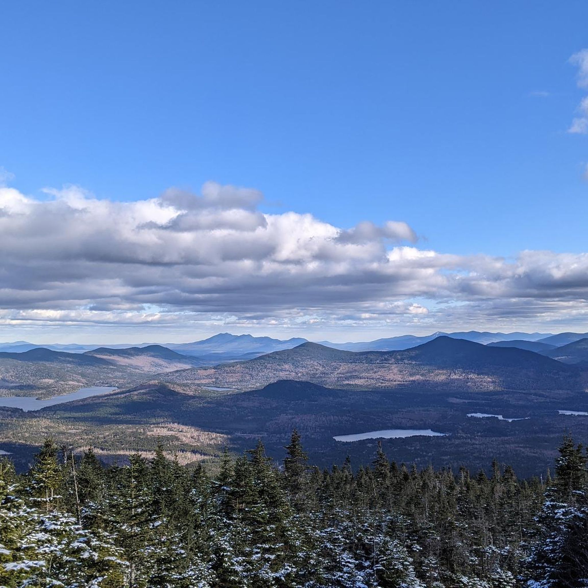
At 1,193 metres, Mont Gosford is the highest mountain in southern Québec and one of the province’s tallest peaks. It sits close to the Canada–United States border within the protected ZEC Louise-Gosford territory. There is a lookout tower at the summit with fantastic views that extend into Maine, New Hampshire, and the surrounding Appalachian ranges, especially on a clear day.
0
0
This is the main entry point for exploring Mont Gosford and the surrounding Sentiers Frontaliers network. Visitors are required to register before entering the area and must pay the access fees for hiking in the Gosford sector. The station offers trail information and manages access to this protected Appalachian landscape located near the Canada–United States border. For more information on fees and maps, visit: https://zeclouisegosford.reseauzec.com/activites/plein-air/.
0
0
Frequently Asked Questions
How many running routes are available in Zec Louise-Gosford?
There are 5 dedicated running routes available in Zec Louise-Gosford, all offering challenging and rewarding experiences through the region's diverse landscapes.
What is the typical difficulty level of jogging routes in Zec Louise-Gosford?
All the jogging routes in Zec Louise-Gosford are rated as difficult. They often involve significant elevation gains and cover mountainous terrain, making them ideal for experienced trail runners seeking a vigorous workout.
Are there any routes suitable for beginners or families?
The routes in Zec Louise-Gosford are generally considered difficult due to their elevation and length. While there isn't a specific 'easy' or 'beginner' category, families with older, experienced children who are accustomed to challenging hikes might enjoy shorter sections of trails, but full routes are demanding.
Can I bring my dog on the running trails?
Zec Louise-Gosford is generally dog-friendly, allowing leashed dogs on many trails. However, it's always best to check specific regulations with the ZEC administration or at the trailhead before heading out, as rules can vary.
What kind of views or natural attractions can I expect on these routes?
The routes offer breathtaking views, especially from Mont Gosford, which provides a 360-degree panoramic vista of the surrounding wilderness, including parts of Maine and New Hampshire. You'll also experience diverse forests, mountainous terrain, and an ecological reserve with unique geology and varied vegetation. The route View from Mont Gosford loop from Stationnement #1 is a great option for experiencing these views.
Are there any circular running routes?
Yes, all the featured running routes in Zec Louise-Gosford are circular. For example, the View from Mont Gosford loop from Camping de l'Accueil Gosford offers a challenging circular journey through the landscape.
What is the best time of year to go jogging in Zec Louise-Gosford?
The best time to go jogging is typically from late spring to early autumn. Autumn is particularly stunning with vibrant fall foliage. Winter running is possible but requires appropriate gear and caution due to snow and ice, as the area is popular for wilderness skiing and snowmobiling.
Where can I park when visiting the jogging trails?
Many routes, such as the View from Mont Gosford loop from Stationnement #1, start from designated parking areas like Stationnement #1 or Camping de l'Accueil Gosford. Specific parking information is usually available at the trailheads or through the ZEC's official resources.
What do other runners say about the trails in Zec Louise-Gosford?
The komoot community highly rates the running experiences in Zec Louise-Gosford, with an average score of 5.0 stars. Runners often praise the challenging ascents, the rewarding panoramic views from Mont Gosford, and the immersive wilderness experience.
What are some of the longer, more challenging running options?
For a significant challenge, consider the View from Mont Gosford – Sentier Frontalier SF1 loop from Camping de l'Accueil Gosford, which spans nearly 35 km with over 1300 meters of elevation gain. Another demanding option is the Sentier Frontalier SF1 – View from Mont Gosford loop from Camping de l'Accueil Gosford, covering over 26 km.
Are there any specific permits required for jogging in the ZEC?
As Zec Louise-Gosford is a controlled harvesting zone (ZEC), access typically requires a daily or annual permit. It's advisable to check the official ZEC website or contact them directly for current permit requirements and fees before your visit.
What are the elevation gains like on these running trails?
The running trails in Zec Louise-Gosford feature substantial elevation gains, reflecting the mountainous terrain. You can expect ascents ranging from approximately 480 meters on shorter loops to over 1300 meters on longer, more challenging routes like the View from Mont Gosford loop from Camping de l'Accueil Gosford.
Most popular routes in Zec Louise-Gosford

Get inspired with the komoot mobile app


Explore more
Browse the best Running Trails & Routes in other regions.
