Top 2 Mountain Passes around Meduno
Best mountain passes around Meduno are found in the Friuli Venezia Giulia region of Italy, offering diverse mountainous terrain. The area features elevated hiking routes and significant peaks like Monte Valinis, which provides panoramic views over the Friulian plain. Meduno also serves as a gateway to Val Tramontina, known for its natural beauty and the Meduna River. These routes provide opportunities for outdoor activities and exploration of the region's natural landscape.
Best mountain passes around Meduno
- The most popular mountain…
Last updated: June 28, 2026
Forcella Crous
Highlight • Mountain Pass
Translated by Google •
Tip by

Saddle between Tramonti and Palcoda
Highlight • Mountain Pass
Translated by Google •
Tip by
Sign up now to discover places like this
Get recommendations on the best single tracks, peaks, & plenty of other exciting outdoor places.
Sign up for free
Forcella Mostacins
Highlight • Mountain Pass
Here too, beautiful climbs, beautiful woods and moreover, the silence of Friuli between Travesio and Valeriano
Translated by Google •
Tip by

Col Taront gravel
Highlight (Segment) • Mountain Pass
Translated by Google •
Tip by

Ascent to Forca Sciara
Highlight • Mountain Pass
Showing Translation
Tip by
Sign up for free to discover even more mountain passes around Meduno.
Sign up for free
Already have an account?
Start today with a free account
Your next adventure awaits.
Login or Signup
Tips from the Community

The track leading from the Savoieit bivouac to Forca Sciara is poorly visible, and in particular, from the turn of the CAI track in the upper part of the itinerary, the track is practically non-existent. It is necessary to tackle this climb in conditions of good visibility to enter the correct gully. It is very easy to be misled by an inviting grassy gully. The correct gully is located above a scree slope. The trail markers and the track are found in the gully. It is preferable to tackle this climb in early spring or late autumn to avoid tall grass, heat, and ticks.
0
0

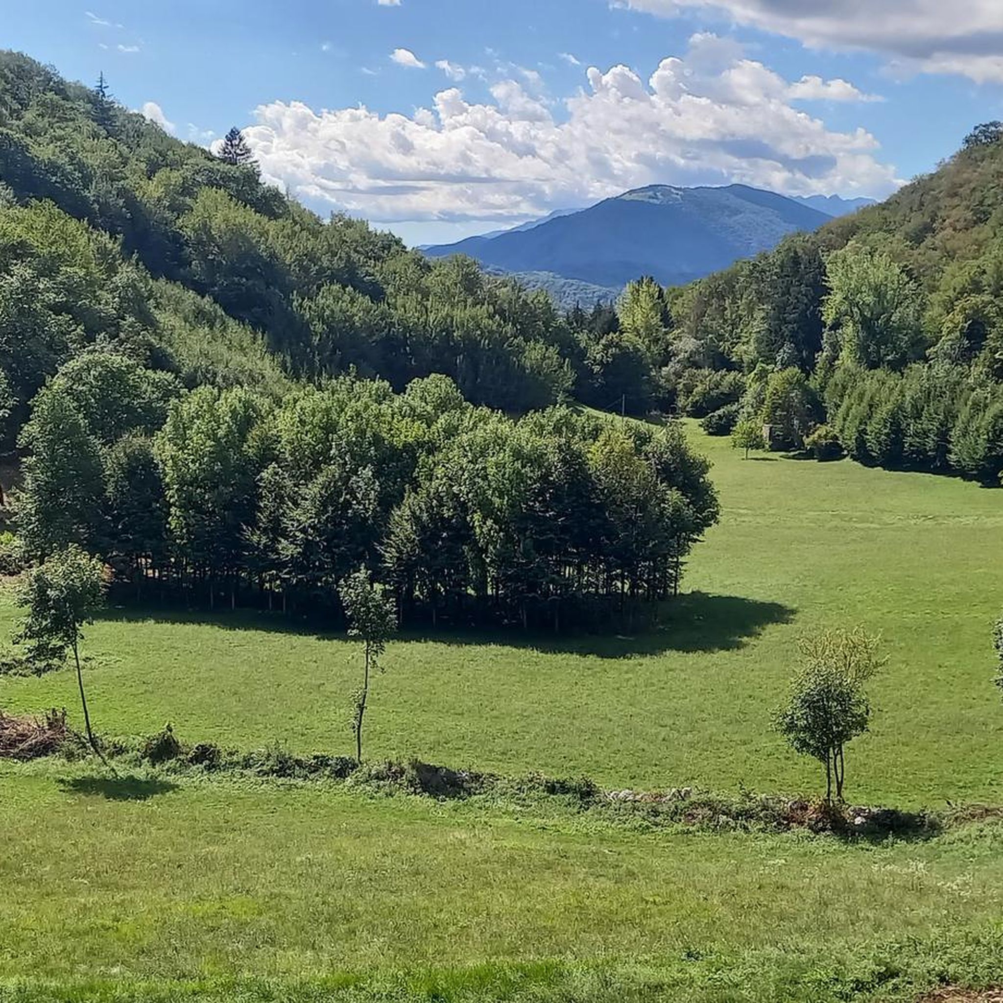
A suggestive and charming passage in the heart of the Carnic Prealps. This pass connects the wild Val Tramontina with the Palcoda area, offering an authentic and little-frequented atmosphere. The trail leading here crosses dense woods, rocky sections, and panoramic views that suddenly open up onto the valley. Perfect for those seeking an excursion immersed in the purest nature, far from crowded paths. On clear days, the view amply repays the effort of the climb. ⚠️ Some sections can be steep and require a surefootedness, especially in case of wet ground.
0
0
Photo of the unnamed fork that divides Tramonti from Palcoda.
0
0
Crucial crossing point between Valcellina and the plain.
0
0
For centuries, this pass was the only crossing point for people and herds, who used carts and sleds to barter and sell products from the Cellina Valley to those from the plain. On the trail of the Val Sant'Antonio, between the Ravedis Dam and the "La Crous" pass, you can still see the ruts in the rock where the sleds and carts once passed, along the still-intact stretches of mule track.
1
0

Beautiful climb immersed in Friulian nature
0
0

Even the Pordenone area, like the Treviso area, has its "fork" Mostacin(s). Here too, beautiful climbs, beautiful woods and moreover, the silence of Friuli between Travesio and Valeriano
0
0

The road that reaches Col Taront is more suitable for a mountain bike than for a gravel bike, not for the technical difficulties, but for the slopes and the sometimes stony terrain. I got there with the gravel doing some stretch on foot. Traveling often on an unexposed ridge, the panorama on the plain is remarkable. To return I chose the ring that from Col Taront takes you back to the asphalted road to Travesio.
0
0
Frequently Asked Questions
What are some notable mountain passes or elevated routes around Meduno?
Meduno features several elevated routes and passes that offer unique experiences. Key highlights include Forcella Crous, historically important as a crossing point, and Forcella Racli, which separates Mount Ortat from Mount Rodolino. Other passes like Forcella Mostacins and Forchia di Meduno also provide access to beautiful natural areas and connections between valleys.
What kind of views can I expect from the mountain passes in Meduno?
The mountain passes and elevated areas around Meduno, particularly Monte Valinis, offer spectacular 360-degree panoramic views. You can expect sweeping vistas over the entire Friulian plain and the surrounding mountains. Passes like Col Taront gravel also provide remarkable panoramas, especially along its unexposed ridge.
Are there historical sites or features on these passes?
Yes, Forcella Crous is particularly rich in history. For centuries, it served as the sole crossing point for people and herds, facilitating trade between the Cellina Valley and the plain. Along the Val Sant'Antonio trail, you can still observe ruts in the rock, left by carts and sleds, and intact stretches of the ancient mule track.
What is the best time of year to visit the mountain passes around Meduno?
The best time to visit the mountain passes around Meduno for hiking and outdoor activities is typically during the spring, summer, and early autumn months. During these seasons, the weather is generally milder and more stable, making for pleasant conditions to explore the trails and enjoy the panoramic views. Winter can offer different challenges and beauty, but some routes may be less accessible due to snow.
Are there family-friendly options for exploring the mountains near Meduno?
While some routes can be challenging, there are options for families. The Monte Valinis area offers trails of varying difficulty. For a moderate experience, consider the Malga Chiavoleit Shelter – Valinis Hut loop, which is about 6.7 km and takes around 3 hours and 30 minutes. Always check specific trail conditions and difficulty ratings before heading out with family.
Can I bring my dog on the trails around Meduno's mountain passes?
Generally, dogs are welcome on many outdoor trails in the Meduno area. However, it's always recommended to keep them on a leash, especially in areas with wildlife or livestock, and to follow local regulations regarding pet access. Ensure your dog is fit for the chosen trail's difficulty and carry enough water for both of you.
What other outdoor activities can I do near Meduno's mountain passes?
Beyond exploring the passes themselves, the Meduno region is a hub for various outdoor activities. You can find excellent opportunities for hiking, mountain biking, and road cycling. Monte Valinis is also an international launch point for paragliding and hang gliding, thanks to its ideal updrafts. The nearby Val Tramontina offers pristine natural beauty and opportunities for wild swimming in the Meduna River.
Are there specific hiking trails I can explore near Meduno's mountain passes?
Yes, the Monte Valinis area, accessible from Meduno, offers several popular hiking routes. These include the Monte Valinis — ring tour (approx. 9.7 km, moderate), the more challenging Monte Valinis Paragliding Trail from Meduno via CAI 819 (approx. 21.9 km, difficult), and the Malga Chiavoleit Shelter – Valinis Hut loop (approx. 6.7 km, moderate). You can find more hiking options in the Hiking around Meduno guide.
What about mountain biking opportunities around Meduno's passes?
Meduno is a great destination for mountain biking. Trails like the Monte Valinis Loop Trail (approx. 12.4 km, difficult) and the Forchia di Meduno – Mount Valinis loop (approx. 25.4 km, moderate) offer diverse terrain. You can also explore routes leading to the Pozze Smeraldine Waterfall or the Redona Dam. Discover more routes in the MTB Trails around Meduno guide.
Are there any unique natural features to discover, like wild swimming spots?
Absolutely. While exploring the mountainous areas, you can venture into Val Tramontina, known for its pristine natural beauty. This region, part of the Friulian Dolomites Nature Park, features emerald pools and offers opportunities for wild swimming in the Meduna River, providing a refreshing experience amidst nature.
How challenging are the trails associated with these passes?
The trails around Meduno's mountain passes vary in difficulty. For example, Forcella Racli is categorized as challenging, while Forcella Crous and Forcella Mostacins are intermediate. Monte Valinis offers a range from moderate to difficult, winding through wooded areas, arid slopes, and rocky sections. Always check the specific difficulty rating for your chosen route.
Where can I find accommodation or places to eat near the mountain passes?
Meduno itself offers various options for accommodation, cafes, pubs, and restaurants. While there might not be direct facilities on every pass, the town serves as a convenient base. For specific trails like those on Monte Valinis, you might find shelters such as Casera Valinis, a well-maintained emergency bivouac just below the summit, or Malga Chiavoleit, which can be a small detour.
Is there a pass that connects different valleys or regions?
Yes, several passes serve as important connections. Forcella Crous historically connected the Cellina Valley with the plain. Similarly, Forchia di Meduno is a secondary pass that links Meduno with Campone, the Arzino Valley, and the Tramontina Valley, also serving as a crossroads for paths to Mount Cereis and Mount Valinis.
Most popular attractions around Meduno

Get inspired with the komoot mobile app


Explore more
See even more epic mountain passes by checking out these guides around Meduno:
