Top 20 Natural Monuments around Colwall
Best natural monuments around Colwall are found at the foot of the Malvern Hills, offering diverse outdoor experiences. This region is characterized by its prominent hills, which provide extensive views and numerous walking opportunities. The landscape features significant natural heritage, including several notable peaks and historical sites. Visitors can explore a variety of natural features and enjoy the area's scenic beauty.
Best natural monuments around Colwall
- The most popular natural monuments is Worcestershire Beacon Summit and Toposcope, a natural…
Last updated: July 1, 2026
Worcestershire Beacon Summit and Toposcope
Highlight • Natural Monument
Tip by

Herefordshire Beacon (British Camp)
Highlight • Summit
Tip by

Sign up now to discover places like this
Get recommendations on the best single tracks, peaks, & plenty of other exciting outdoor places.
Sign up for free
Midsummer Hill Iron Age Hillfort
Highlight • Historical Site
Tip by
Summer Hill
Highlight • Lake
Tip by

North Hill Summit
Highlight • Natural Monument
Tip by

Sign up for free to discover even more natural monuments around Colwall.
Sign up for free
Already have an account?
Start today with a free account
Your next adventure awaits.
Login or Signup

Tips from the Community

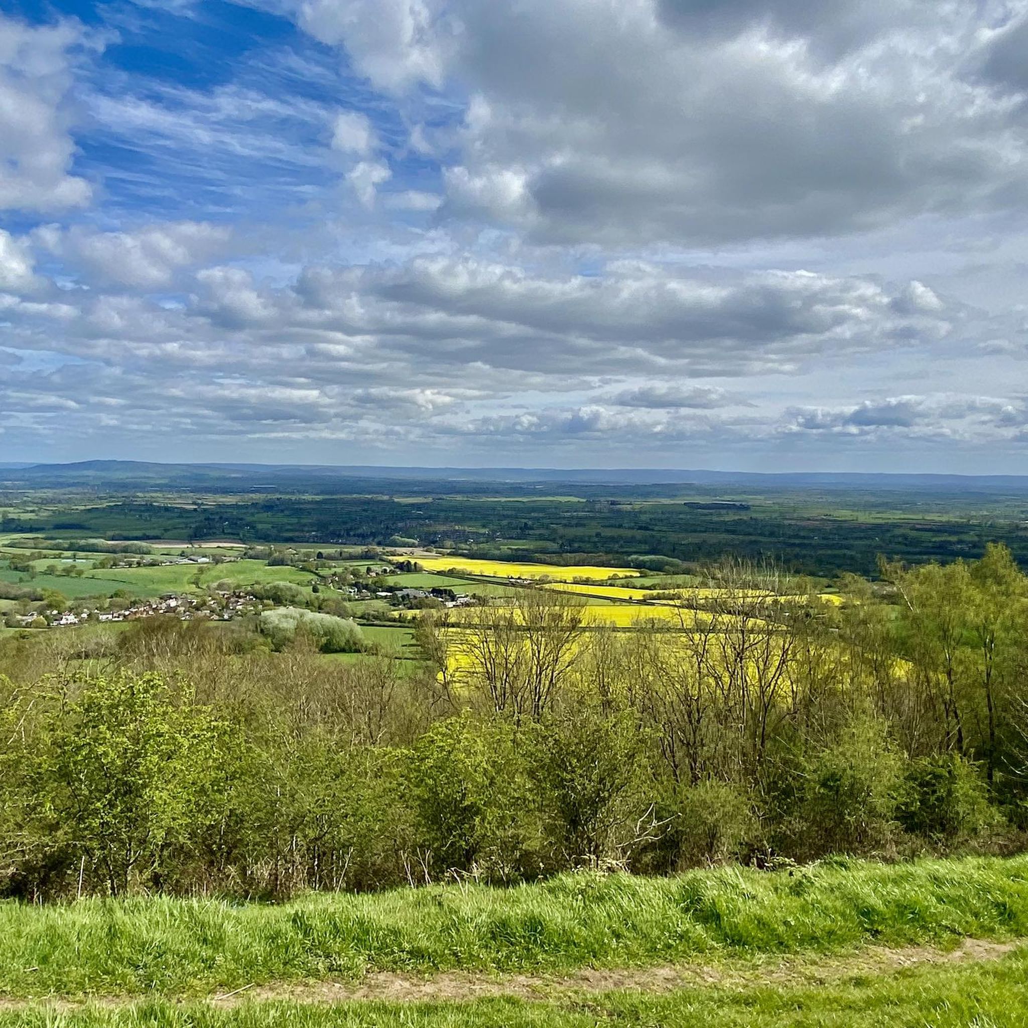
One of the finest hills in the Malverns with it's Iron Age Hillfort (yes another one on the Malverns!), and superb views west across Eastnor Park. It used to be heavily wooded on the Eastern Side, but Ash Die-back disease has caused a huge number of large mature Ash trees to be felled in recent times. This is still a hill to be savoured and you will not see too many people here either.
0
0
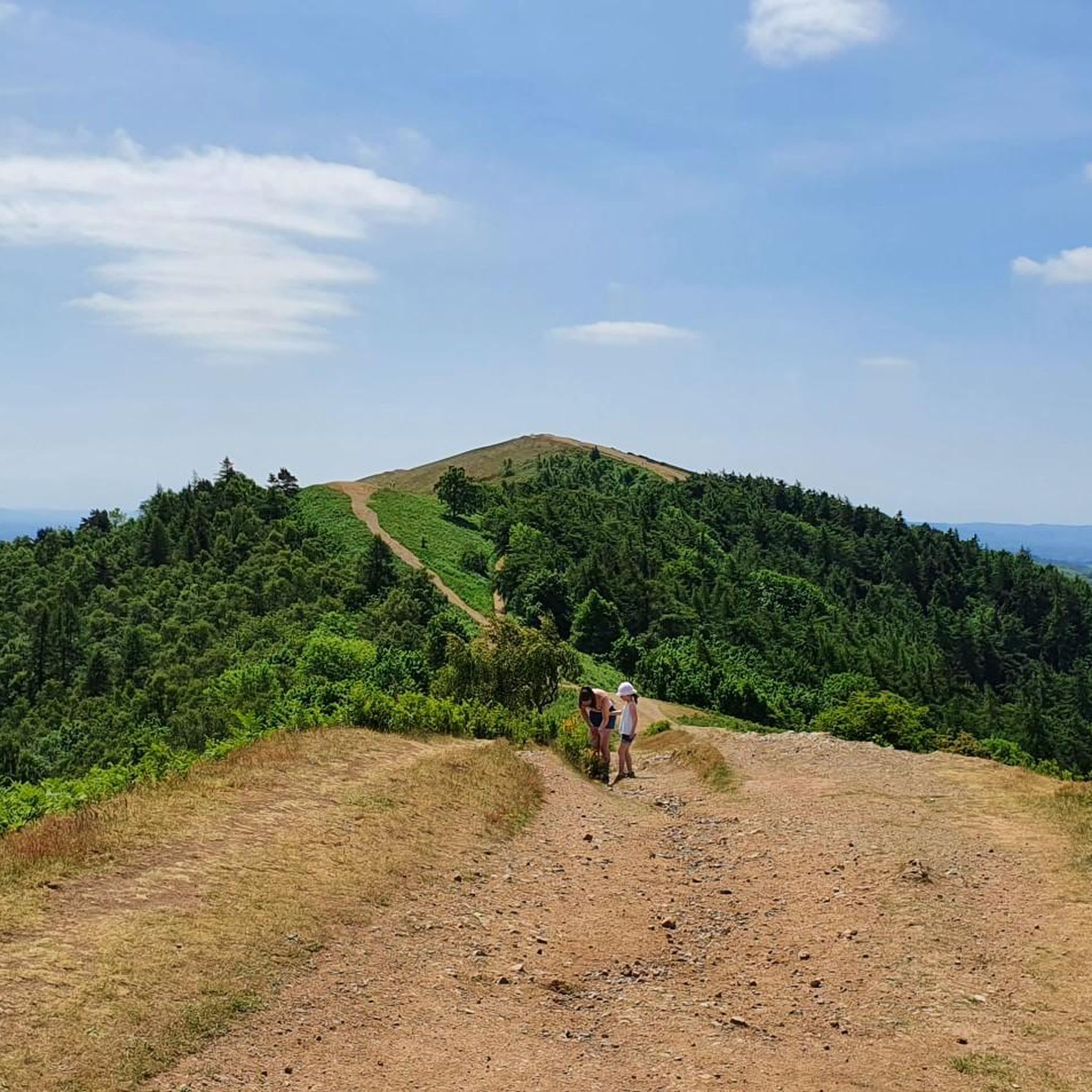
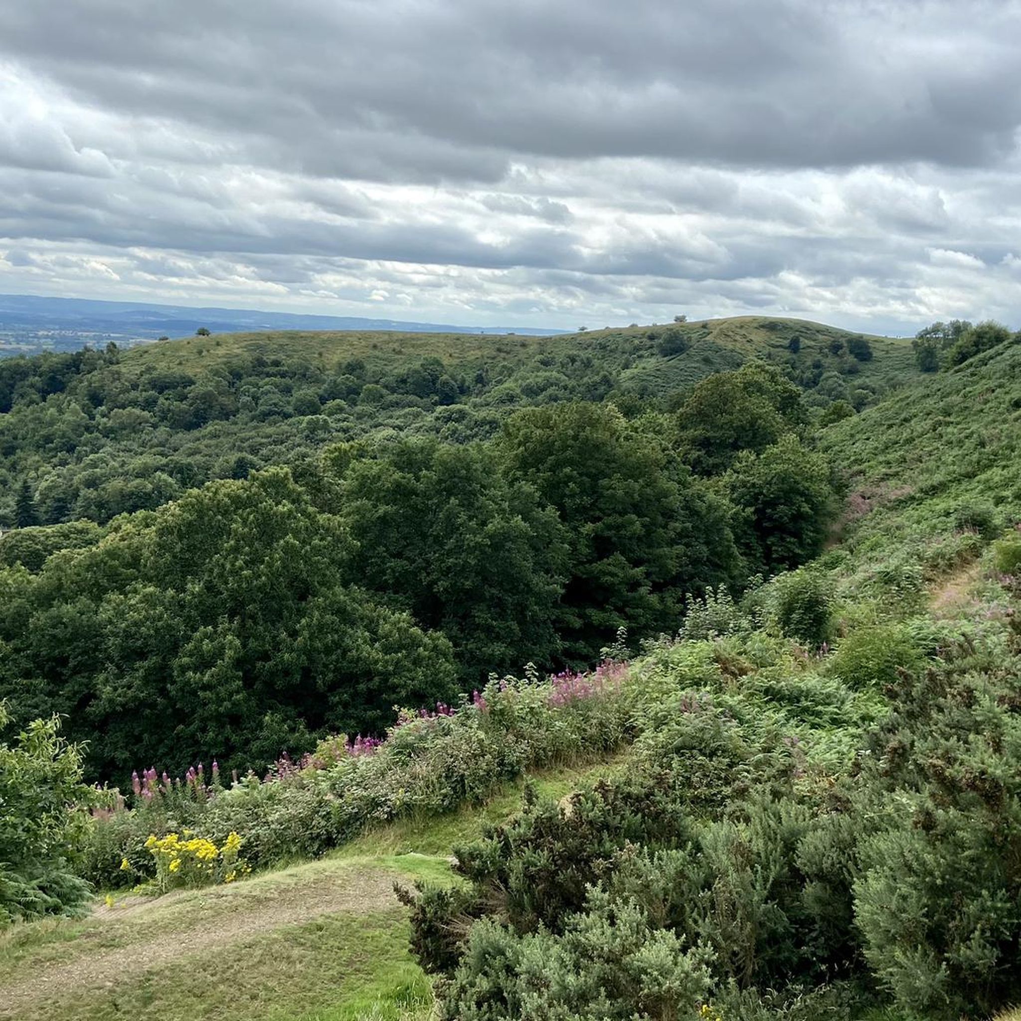
North Hill is a very good viewpoint - but this image was taken on the way up to Table Hill, which is next to North HIll.
0
0
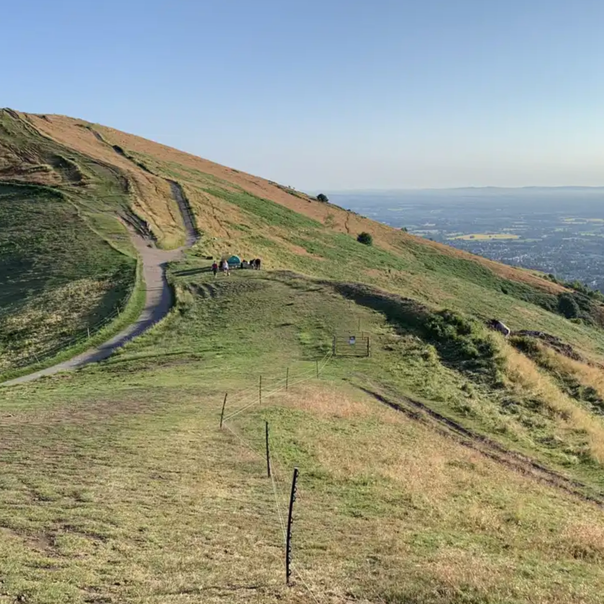
Summer Hill is a bit of a bump in between the Beacon and the Wyche Cutting, however it's steep southern aspect does afford some of the best views along the Malvern Hills ridge, particularly when there is an Inversion happening.
0
0

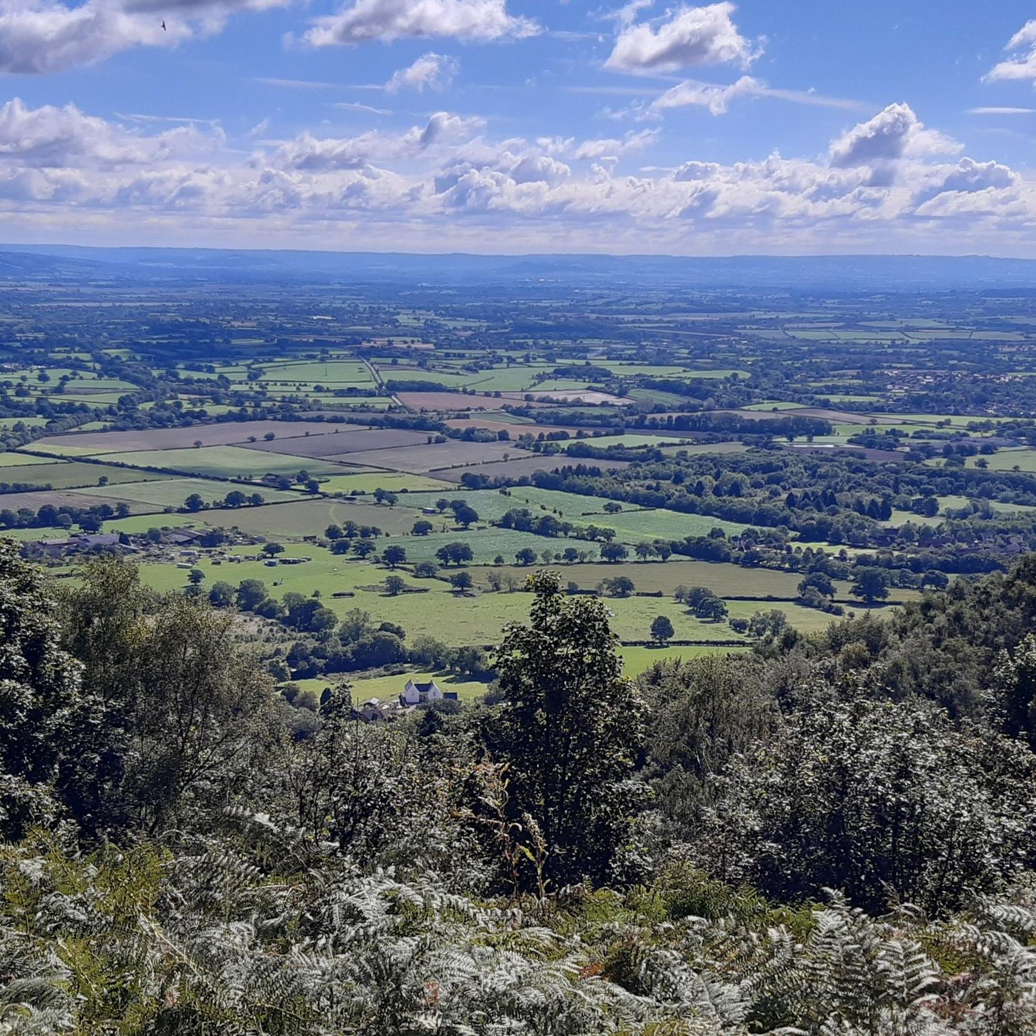
Midsummer Hill rises in the southern part of the Malvern Hills and is a very worthy objective. Site of a former hillfort, along with neighbouring Hollybush Hill, it provides extensive views, with the impressive Eastnor Castle visible in the Herefordshire countryside. A hike to the top could be combined with Herefordshire Beacon to the north, or a longer outing traversing the entire Malvern ridge.
0
0

North Hill is the second highest point of the range of Malvern Hills that runs about 13 kilometres (8.1 mi) north-south along the Herefordshire-Worcestershire border, although North Hill lies entirely within Worcestershire. It has an elevation of 397 metres (1,302 ft), making it the highest point of the Worcestershire Way. The eastern flank of the hill lies directly behind Worcester road in Great Malvern from where its summit is a brisk 15 – 20 minutes steep walk from the town centre via St Ann's road and Happy Valley. A path from the car park in North Malvern follows the lower contour of North Hill to Happy Valley and St. Ann's Well. Although the flint route from North Wales to Wessex lay to the north of Malvern, there is some evidence to suggest that traders passed over the Malvern Hills. Parts of an arrowhead, scraper and flint flakes have been discovered between the North Hill and Table Hill. A 19th-century guide book describes both a collapsed burial mound on North Hill named the Giant's Grave and a tump on Table Hill. These tumuli may have been connected to the Dobunni settlement in Mathon. A track that runs along North Hill was known as the "Pyx Path" and was used by the priest from Worcestershire when bringing Sacrament to the hermits that lived in Malvern in the 11th Century. It was also referred to as the "Pixie Path", as it was believed to be used by fairies. The Lodge spring can be found at the foot of North Hill, off Worcester road. The ornamental fountain has a small spout and basin that is similar in design to those at St Ann's Well.
1
0
The hill lies to the south of the Worcestershire Beacon, which is Worcestershire's (and the Malvern Hills') highest hill, and Summer Hill's summit, though often overlooked given the grandeur of its neighbour, is a most respectable 1,253 feet above sea level. Source: Wikishire
0
0
The Herefordshire Beacon is one of the highest peaks of the Malvern Hills. It is surrounded by a British Iron Age hill fort earthwork known as British Camp. The fort subsequently had a ringwork and bailey castle built inside its boundary and there is evidence of 120 huts in the area. British Camp has been a scheduled monument since 1923. On the eastern slope of Herefordshire Beacon, there is a disused reservoir, British Camp Reservoir, which holds approximately 213,000 cubic metres (7,500,000 cu ft) of water. Herefordshire Beacon represents one of the Malvern Hills, 1,109 feet (338 m) high, and is the second highest summit in the hills. It is within the county of Herefordshire, but is directly adjacent to the border with Worcestershire to the east. Atop Herefordshire Beacon, there is an Iron Age hill fort, known as British Camp, and would have held a settlement between 4th century BCE and 1st century CE. A ringwork and bailey castle was built within the site of the hill fort, and there is evidence of 120 huts having been built within the boundaries of the fort. The hill fort received scheduled monument status on 10 August 1923. Nearby to British Camp, on the eastern slope of Herefordshire Beacon, there is a reservoir called British Camp Reservoir. It has a capacity of 213,000 cubic metres (7,500,000 cu ft), although it has not been used for many years. In 2017, Severn Trent proposed to dismantle the treatment plant associated with the reservoir and drain it, leaving an 8,000 cubic metres (280,000 cu ft) pond. source: Wikipedia
0
0
Midsummer Hill is situated in the range of Malvern Hills that runs approximately 13 kilometres (8 mi) north-south along the Herefordshire-Worcestershire border. It lies to the south of Herefordshire Beacon with views to Eastnor Castle. It has an elevation of 284 metres (932 ft). To the north is Swinyard Hill. It is the site of an Iron Age hill fort which spans Midsummer Hill and Hollybush Hill. The hillfort is protected as a Scheduled Ancient Monument and is owned by Natural England. It can be accessed via a footpath which leads south from the car park at British Camp on the A449 or a footpath which heads north from the car park in Hollybush on the A438. The hillfort is very unusual in that the ramparts enclose two hills and the intervening valley. Bowden speculates that the spring within the valley "enhance[s] the position of the hillfort as a site of symbolic value". Source: Wikipedia
0
1
Frequently Asked Questions
What are the best viewpoints among the natural monuments around Colwall?
For expansive panoramic views, the Worcestershire Beacon Summit and Toposcope is the highest point in the county, offering sights as far as the Black Mountains and Shropshire Hills on a clear day. Another excellent spot is Herefordshire Beacon (British Camp), an Iron Age hill fort with splendid views. The iconic Colwall Stone also provides sweeping vistas across the rolling countryside.
Are there any historical natural monuments to explore near Colwall?
Yes, several natural monuments in the area also boast significant historical importance. Both Herefordshire Beacon (British Camp) and Midsummer Hill Iron Age Hillfort are sites of former Iron Age hill forts, offering a glimpse into ancient British heritage alongside their natural beauty. North Hill also has historical connections, with evidence of traders and ancient burial mounds.
What kind of outdoor activities can I do near the natural monuments in Colwall?
The area around Colwall's natural monuments is ideal for various outdoor activities. You can enjoy hiking, with options ranging from easy strolls to more challenging climbs. There are also numerous routes for road cycling and mountain biking. For detailed routes, you can explore guides like Easy hikes around Colwall, Road Cycling Routes around Colwall, and MTB Trails around Colwall.
Are there easy walking trails suitable for beginners around Colwall's natural monuments?
Yes, there are several easy walking trails. For instance, the Colwall Stone loop is an easy 4.6 km walk. The Malvern Hills offer a mix of terrain, and while some climbs are steep, many paths provide gentler strolls. You can find more options in the Easy hikes around Colwall guide, which includes routes like the British Camp, Herefordshire Beacon & Swinyard Hill loop.
Can I find family-friendly walks among the natural monuments near Colwall?
Many of the natural monuments offer paths suitable for families, especially those looking for gentler strolls rather than challenging hikes. The Colwall Stone area provides leisurely walks with stunning views. While some summits require a climb, the overall Malvern Hills area has a variety of trails that can be adapted for different fitness levels, making it possible to find family-friendly options.
Are the natural monuments around Colwall dog-friendly?
The Malvern Hills, including many of the natural monuments, are generally dog-friendly, offering plenty of open spaces for walks. However, it's always advisable to keep dogs under control, especially around livestock or in areas with ground-nesting birds. Always check local signage for specific restrictions or requirements.
What is the best time of year to visit the natural monuments around Colwall?
The natural monuments around Colwall can be enjoyed year-round. Spring brings blooming wildflowers and fresh greenery, while autumn offers spectacular foliage. Summer provides longer daylight hours for extended walks. Even in winter, clear days can offer crisp air and stunning, far-reaching views, though paths can be muddy or icy. Always check weather conditions before heading out.
Where can I find parking for the natural monuments near Colwall?
Parking is available at various points around the Malvern Hills. For instance, there is parking near the Colwall Stone, and at Earnslaw Quarry car park for accessing Summer Hill. For Herefordshire Beacon (British Camp), there's a car park nearby, though the climb from there is steep. Many popular trailheads offer designated parking areas.
What wildlife can I expect to see at the natural monuments in Colwall?
The diverse habitats around Colwall support a variety of wildlife. In the traditional orchards managed by the Colwall Orchard Group, you might spot species like the Noble Chafer beetle, otters, and kingfishers near streams, and a range of birds and insects in the wildflower meadows. The wider Malvern Hills area is home to various bird species and small mammals.
Are there any natural monuments around Colwall that offer a different kind of natural heritage experience?
Beyond the prominent hills, the traditional orchards managed by the Colwall Orchard Group, such as Lugg's Mill Orchard and Colwall Village Garden, offer a unique natural heritage experience. These sites focus on biodiversity, featuring extensive plantings of traditional fruit trees, native hedges, and wildlife corridors like streams and ponds. They provide a peaceful environment to observe flora and fauna and learn about traditional English countryside management.
How long does it typically take to hike to the summits of the Malvern Hills natural monuments?
Hiking times vary depending on your starting point and fitness level. For example, a brisk walk to North Hill Summit from Great Malvern town centre can take 15-20 minutes. Reaching Worcestershire Beacon or Herefordshire Beacon can take anywhere from 30 minutes to an hour or more from nearby car parks, depending on the route's steepness. Longer treks along the Malvern ridge, combining multiple summits, can take several hours.
Are there any natural monuments around Colwall that are wheelchair accessible?
While the Malvern Hills are generally rugged with steep ascents and uneven paths, making them challenging for wheelchairs, some lower-level paths or specific viewpoints might offer limited accessibility. For the most part, the natural monuments themselves, being summits and hill forts, are not wheelchair accessible due to their natural terrain. It's best to research specific paths if accessibility is a primary concern.
Most popular routes around Colwall
Most popular attractions around Colwall

Get inspired with the komoot mobile app


Explore more
Extend your search for the best caves by checking out these guides of the top ones around Colwall:
