Top 12 Natural Monuments around Gil García
Natural monuments around Gil García offer diverse landscapes within the Ávila province. This region serves as a gateway to natural attractions, including parts of the Sierra de Gredos. The area features a variety of geological formations and water features. Visitors can explore mountain ranges, glacial lakes, and canyons.
Best natural monuments around Gil García
- The most popular natural monuments is Charco del Trabuquete, a waterfall that is a natural pool with a waterfall on the Garganta de Jaranda river.…
Last updated: July 15, 2026
Charco del Trabuquete
Highlight • Waterfall
Translated by Google •
Tip by

Garganta de la Nava
Highlight (Segment) • Gorge
Translated by Google •
Tip by

Sign up now to discover places like this
Get recommendations on the best single tracks, peaks, & plenty of other exciting outdoor places.
Sign up for free
Laguna de la Nava
Highlight • Lake
Translated by Google •
Tip by
Laguna de los Caballeros
Highlight • Lake
Translated by Google •
Tip by

Viewpoint of the Puerto de Tornavacas
Highlight • Viewpoint
Translated by Google •
Tip by

Sign up for free to discover even more natural monuments around Gil García.
Sign up for free
Already have an account?
Start today with a free account
Your next adventure awaits.
Login or Signup


Tips from the Community

the water is super cold even in summer!!!
0
0

Located in the charming and quiet town of Guijo de Santa Bárbara, Charco del Trabuquete is a simple, although somewhat demanding, route that runs through the Jaranda Gorge. A route dotted with cliffs and cliffs through which streams and river gorges with crystal-clear waters flow. It is undoubtedly a natural environment of great beauty nestled between the Sierra de Gredos and the Sierra de Tormantos.
0
0

This is one of the best-known mountain passes in the Sierra de Gredos area and is also important as it separates the two most important basins in the Iberian Peninsula, the Duero and the Tagus.
0
0
This lagoon is curious with respect to the rest since normally, glacial cirques tend to take a direction perpendicular to the ridge of the mountain, that is to say they descend in a north or south direction. This one, however, does it in an east direction, with the Covacha del Losar as the highest part!
0
1

Located at 1,275 meters above sea level, it is recognized as a historic mountain pass in the Sierra de Gredos and represents the physical division point of the Duero and Tagus basins. This site has been the passage of several civilizations. over the centuries and represents a site of great historical importance for the area.
1
1
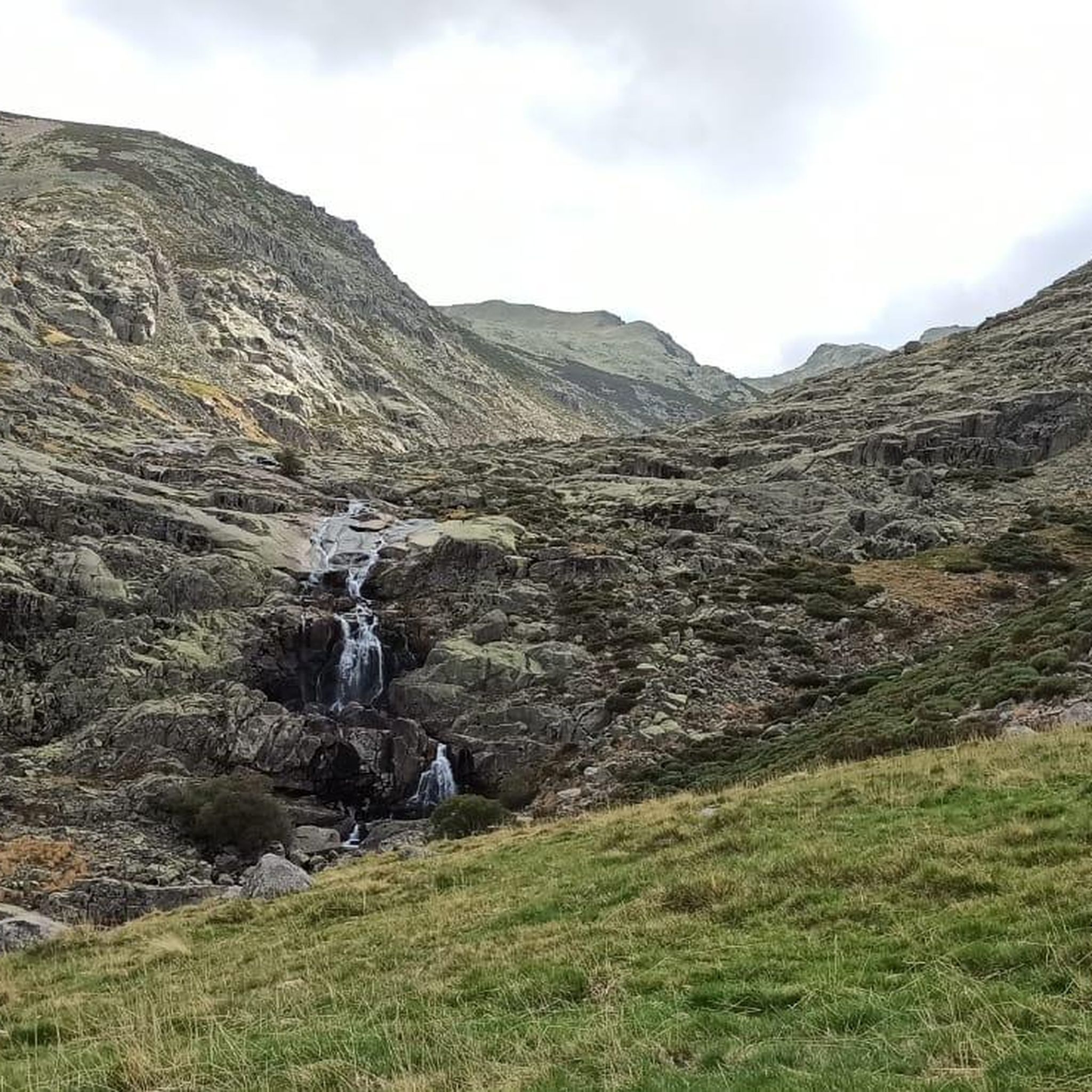
Following the well-known Route of the Trabuquete you will find this wonderful pool with a natural waterfall on the river Garganta de Jaranda. Undoubtedly the highlight of the route, not only for its turquoise waters but also for the beautiful landscape that surrounds it.
1
1

This impressive granite canyon offers incredible views of the rock formations along the course of the river. There are several waterfalls that fall at different heights and form pools of crystal clear water. This section is, for the most part, an adapted stone walkway that zigzags along the gorge. However, there are also parts of loose stones.
3
0

The Laguna de los Caballeros is a lagoon of glacial origin located in the upper part of the gorge of the same name, in the western sector of the Sierra de Gredos, in the municipality of Navalonguilla, (Ávila, Castilla y León, Spain). The lagoon is located at an altitude of about 2,000 meters above sea level in an extensive glacial valley (one of the three located on the north face of La Covacha).1 La Covacha, with a height of 2,399 meters above sea level, constitutes the highest point in the western sector. of the Sierra de Gredos.2n. 1 Unlike the rest of the lagoons in the region, the Caballeros lagoon has not been artificially dammed.
1
0
Frequently Asked Questions
What are some of the most popular natural monuments to visit near Gil García?
Visitors frequently enjoy the Charco del Trabuquete, a beautiful natural pool with a waterfall on the Garganta de Jaranda river, accessible via a pleasant 3 km walk. Another favorite is the Garganta de la Nava, an impressive granite canyon featuring multiple waterfalls and crystal-clear pools.
Are there any glacial lakes around Gil García?
Yes, the region boasts stunning glacial lakes. You can visit Laguna de la Nava, situated at nearly 2,000 meters above sea level, offering reflections of the surrounding peaks. Another impressive glacial lake is Laguna de los Caballeros, nestled in a beautiful glacial cirque within the Sierra de Gredos.
What kind of natural features can I expect to see in the area?
The natural monuments around Gil García are characterized by diverse landscapes. You'll find majestic mountain ranges, deep gorges with impressive rock formations, numerous waterfalls, and serene glacial lakes. The area is part of the rich natural heritage of the Ávila province, offering varied geological formations and water features.
What outdoor activities can I do near these natural monuments?
The area around Gil García is excellent for outdoor activities. You can explore various hiking routes, including challenging trails to glacial lakes like the Laguna del Duque Trail. For cyclists, there are numerous cycling routes, and mountain biking enthusiasts can find exciting MTB trails that traverse the diverse terrain.
Are there any viewpoints offering panoramic scenery?
Absolutely. The Viewpoint of the Puerto de Tornavacas is a notable spot. Located at 1,275 meters above sea level, it offers stunning vistas and is recognized as a historic mountain pass in the Sierra de Gredos, dividing the Duero and Tagus basins.
What is the Sierra de Gredos Regional Park, and how close is it to Gil García?
The Sierra de Gredos Regional Park is a majestic mountain range that serves as a prominent natural feature near Gil García. It's an ideal destination for hiking, mountaineering, and wildlife observation, featuring glacial cirques, mountain lakes, and diverse ecosystems. Gil García acts as a gateway to this significant natural area.
Are there any unique geological sites or caves in the vicinity?
While not directly in Gil García, the nearby province of Ávila is home to the fascinating El Águila Caves (Cuevas del Águila) in Ramacastañas. These caves are a significant geological heritage site, featuring a 1,000-meter walkable route showcasing remarkable stalactite and stalagmite formations. They offer a unique subterranean experience and insight into geological history.
What kind of wildlife can I expect to see in the natural monuments around Gil García?
The Sierra de Gredos Regional Park, which is easily accessible from Gil García, is known for its diverse ecosystems and is home to a variety of flora and fauna. Most notably, you might spot the iconic Iberian ibex, especially in the higher mountain areas. The region's varied habitats support a range of other wildlife as well.
What do visitors enjoy most about the natural monuments in this region?
Visitors particularly appreciate the pristine natural beauty and the opportunities for exploration. Many highlight the turquoise waters of natural pools like Charco del Trabuquete and the spectacular rocky landscapes along rivers and gorges. The tranquility and the chance to connect with nature in diverse settings, from waterfalls to high-altitude glacial lakes, are frequently praised.
Are there any easy trails or accessible natural monuments for families or those seeking less strenuous options?
While many trails in the Sierra de Gredos can be challenging, some natural monuments offer more accessible experiences. For instance, the walk to Charco del Trabuquete is a manageable 3 km. The Garganta de la Nava also features an adapted stone walkway in parts, making it easier to navigate some sections of the gorge.
How long should I plan for a visit to the natural monuments around Gil García?
The duration of your visit depends on the specific natural monument and the activities you plan. For a single site like Charco del Trabuquete, a few hours for the walk and enjoying the pool might suffice. Exploring a glacial lake like Laguna de la Nava or hiking through a gorge could take half a day to a full day, especially if you combine it with other nearby attractions or longer trails.
Is it possible to find circular walks among the natural monuments?
Yes, the region offers several circular routes that allow you to experience different natural monuments. For example, within the Sierra de Gredos, there are circular trails that connect various points of interest, such as the 'Laguna de la Nava y Laguna del Barco — circular desde Nava del Barco por PR-AV 39' route, which is a more challenging option for experienced hikers.
Most popular attractions around Gil García

Get inspired with the komoot mobile app


Explore more
Extend your search for the best caves by checking out these guides of the top ones around Gil García:
