Top 5 Mountain Passes around Navadijos
Mountain passes around Navadijos, a village in the Sierra de Gredos mountains, offer access to a region characterized by rugged terrain and diverse landscapes. The area features deep valleys, glacial formations, and significant natural features. This region provides opportunities for exploring various mountain routes and viewpoints. The Sierra de Gredos is also recognized as a UNESCO Biosphere Reserve, supporting a rich biodiversity.
Best mountain passes around Navadijos
- The most popular mountain passes is View of the Sierra de Gredos,…
Last updated: July 1, 2026
Chía Pass (1,663 m)
Highlight (Segment) • Mountain Pass
Translated by Google •
Tip by

View of the Sierra de Gredos
Highlight • Viewpoint
Translated by Google •
Tip by

Sign up now to discover places like this
Get recommendations on the best single tracks, peaks, & plenty of other exciting outdoor places.
Sign up for free
Puerto de la Cañada del Horno
Highlight • Mountain Pass
Translated by Google •
Tip by
Trail between mountains
Highlight • Trail
Translated by Google •
Tip by

Collado de la Honda
Highlight • Mountain Pass
Translated by Google •
Tip by
Start today with a free account
Your next adventure awaits.
Login or Signup



Tips from the Community

The Navarredonda de Gredos Stargazing Viewpoint is one of the most outstanding spots for astronomical observation in the Sierra de Gredos mountain range, within the Starlight Reserve, which guarantees dark skies free from light pollution. It is located in Navarredonda de Gredos (Ávila), at an altitude of approximately 1,600 meters, ensuring clear, unobstructed skies. It forms part of the network of stargazing viewpoints in the Gredos Regional Park, designed for astrotourism and night photography. It is near the Parador de Gredos hotel and the Navarredonda Children's Park, with easy access by car and a parking area.
1
0

Small tack between Navarreonda de Gredos and San Martín De la Vega del Alberche of just 4 km, being harder in the northern area than in the southern area. It is also known by the name of Alto de Barajas. Like all secondary roads in the Gredos area, the asphalt is irregular and rough, of acceptable width, without a shoulder and with very little traffic. Despite the little traffic, it is highly recommended to have your rear light because locals usually travel quickly and hardly expect to encounter cyclists. This small limit can be used on many routes in the northern area of Gredos.
0
0
This slope is gentler than the northern slope and much shorter, with just 4 km and 2 of them hard, with some considerable ramps in the pair of horseshoe curves that there are. The road is inhospitable and therefore with very little traffic. The asphalt is uneven and rough, which adds hardness to the climb. Most of the secondary roads in this area are like this, which gives it a lot of charm. The landscape in summer is dry land, very typical of the northern area of Gredos and the northern plateau in general. I climbed the pass one early morning in August and I really enjoyed the solitude and silence of nature.
0
0

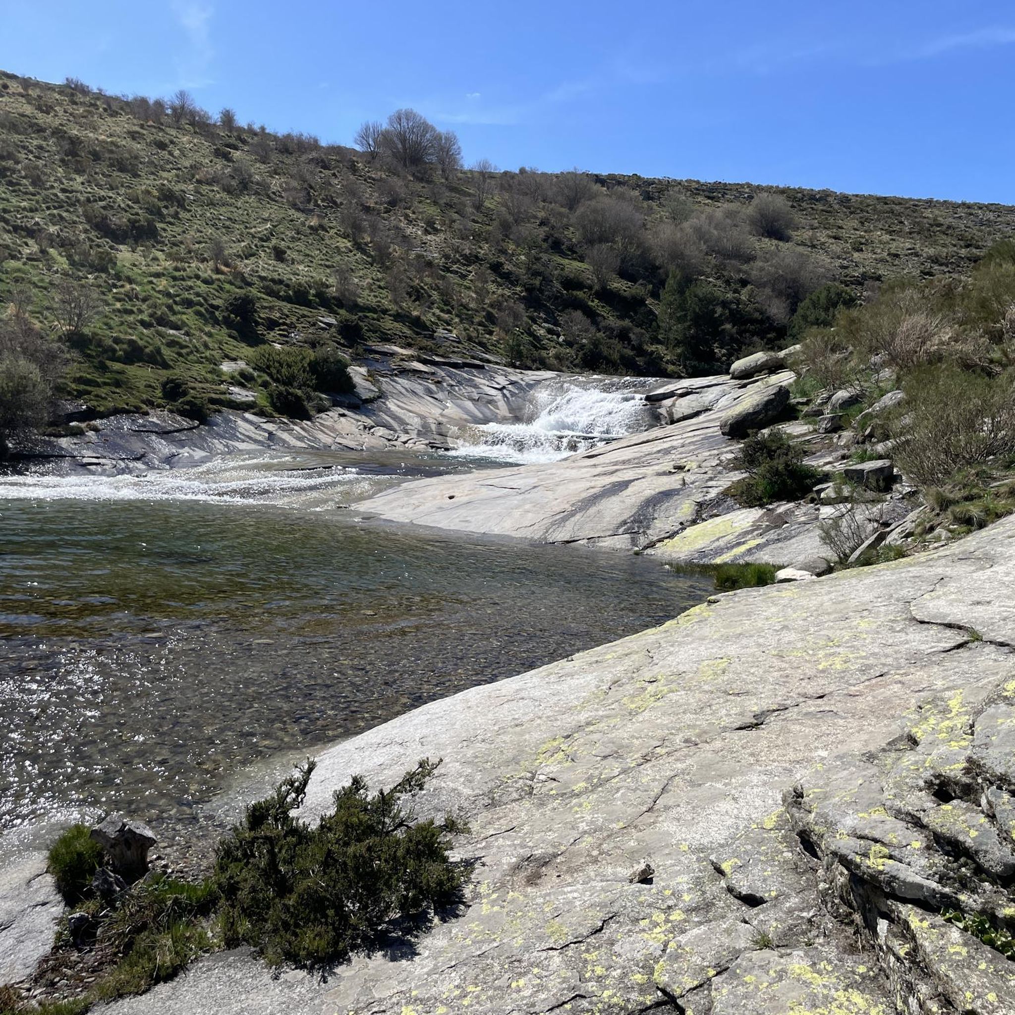
The Collado de la Honda is the final part of an old glacier that ends at this point. The glacier is the result of ancient times when the glacial movements were more southern and this is an example of how in this area of the middle of the Meseta there were.
1
0

This track communicates with the Pico pass and passes through a beautiful pine forest and other mountain vegetation.
2
0
It is 1,663 meters above sea level and connects the Corneja Valley (Valdecorneja) with the Alto Valle del Alberche through a local road that connects the towns of Navacepedilla de Corneja and San Martín de la Vega del Alberche. It separates the Sierra de Villafranca and the massif of La Serrota.
0
0
It is 1,767 meters above sea level and connects the Alto Alberche valley with that of Alto Tormes, through a local road that connects the towns of San Martín de la Vega del Alberche and Barajas, annexed to Navarredonda de Gredos, in whose municipal area it is located. located the coronation of the same.
0
0

The mountain range is located on the Iberian Peninsula on the territory of the provinces of Ávila, Cáceres, Toledo and the autonomous community of Madrid. The highest point is the 2592 m high Pico Almanzor. The Sierra de Gredos is the headwaters of the Tormes, Alberche and Tiétar rivers; it forms the watershed between the water systems of the Duero to the north and the Tajo to the south. Parador of the Gredos Between crystalline waters, rugged rocks and the green pine forests of the Sierra de Gredos, the Parador de Gredos, the first of all Paradores, has been entrenched behind stately stone walls since 1928. In the interior, the rustic furnishings ensure comfort and a stately ambience at the same time. Here, on the ridge of the Alto del Risquillo, the majestic building offers impressive panoramas over the Valle de Tormes, the Sierrau de Piedrahita and Béjar mountain ranges and the Gredos massif.
4
0
Frequently Asked Questions
What are some of the most notable mountain passes and viewpoints around Navadijos?
The Sierra de Gredos region, where Navadijos is located, offers several remarkable passes and viewpoints. Among them are the View of the Sierra de Gredos, which provides expansive panoramas across multiple provinces, and Chía Pass (1,663 m), known for connecting the Corneja Valley with the Alto Valle del Alberche. Other significant passes include Serranillos Pass, famous for its picturesque landscapes and cycling history, and Puerto del Pico, a key starting point for exploring the Sierra de Gredos Regional Park.
What kind of natural features can I expect to see in the mountain passes near Navadijos?
The Sierra de Gredos is characterized by rugged mountains, deep valleys, and glacial formations. You'll encounter diverse landscapes, from pine forests and mountain vegetation along routes like the Trail between mountains, to high-altitude grasslands at passes like Puerto de Tornavacas. The region is also a UNESCO Biosphere Reserve, rich in biodiversity, including Spanish ibex and golden eagles.
Are there any historically significant mountain passes in the area?
Yes, Serranillos Pass holds historical significance, particularly in the world of cycling. It has been a notable stage in the Vuelta a España, a major cycling race, famously featuring in Hinault's legendary stage in 1983. This adds a layer of sporting history to its already stunning natural beauty.
What outdoor activities can I do near these mountain passes?
The mountain passes around Navadijos are ideal for various outdoor activities. You can find numerous hiking trails, such as those leading to glacial cirques and mountain lakes from Puerto del Pico. Cycling is also very popular, with passes like Serranillos offering challenging routes. For more specific routes, you can explore hiking trails, cycling routes, and running trails around Navadijos.
What is the best time of year to visit the mountain passes around Navadijos?
The best time to visit generally depends on your planned activities. While the region is beautiful year-round, conditions can be problematic from October to May due to bad weather, especially in winter. For hiking and cycling, late spring, summer, and early autumn offer more favorable conditions. During these months, you can fully enjoy the landscapes and outdoor activities without the challenges of snow and ice.
Are there family-friendly options for exploring the mountain passes near Navadijos?
While many passes involve challenging terrain, the broader Sierra de Gredos region offers diverse trails. For family-friendly options, look for trails with easier difficulty grades. The area around Navarredonda de Gredos, near the View of the Sierra de Gredos, has amenities like the Navarredonda Children's Park, suggesting some accessible areas. Always check specific trail details for suitability.
Can I bring my dog on the trails around the mountain passes?
The Sierra de Gredos is generally dog-friendly, especially on many of its natural trails. However, it's always advisable to check specific regulations for the Sierra de Gredos Regional Park or any protected areas you plan to visit, as rules can vary. Ensure your dog is on a leash and you clean up after them to preserve the natural environment.
What are the difficulty levels of hiking trails near the mountain passes?
The trails in the Sierra de Gredos range from moderate to difficult. For example, the Chía Pass (1,663 m) is categorized as intermediate, while other routes like the Ascent to La Serrota can be difficult. The terrain often features rugged mountains and uneven asphalt on secondary roads, which can add to the challenge for cyclists and hikers alike. Always check the difficulty grade of a specific route before embarking.
Where can I find accommodation or places to eat near the mountain passes?
Navadijos and nearby villages within the Sierra de Gredos offer various amenities. For instance, the Parador de Gredos, located on the ridge of the Alto del Risquillo, provides accommodation with impressive panoramas. You'll find cafes, pubs, and other accommodation options in towns like Navarredonda de Gredos and Hoyos del Espino, which serve as popular bases for exploring the passes.
Are there any permits required for hiking in the Sierra de Gredos Natural Park?
While many areas are freely accessible, some specific activities or zones within the Sierra de Gredos Regional Park, especially those related to sensitive ecosystems or high-altitude mountaineering, might require permits or advance registration. It's recommended to check with the park authorities or local information centers for the most current regulations regarding permits for hiking or other activities.
What makes the <a href="https://www.komoot.com/highlight/5437098" target="_blank" rel="noopener">Puerto de la Cañada del Horno</a> unique?
The Puerto de la Cañada del Horno, also known as Alto de Barajas, connects the Alto Alberche valley with that of Alto Tormes at 1,767 meters above sea level. It's a smaller pass, about 4 km long, known for its irregular and rough asphalt, typical of secondary roads in the Gredos area. This makes it a challenging but rewarding route for cyclists seeking less traffic and a more authentic mountain experience.
What is the significance of <a href="https://www.komoot.com/highlight/5758478" target="_blank" rel="noopener">Collado de la Honda</a>?
The Collado de la Honda is a fascinating natural monument as it represents the final part of an ancient glacier. It serves as a tangible example of how glacial movements extended further south in this area of the Meseta during ancient times, offering a glimpse into the region's geological past.
Most popular attractions around Navadijos

Get inspired with the komoot mobile app


Explore more
See even more epic mountain passes by checking out these guides around Navadijos:
