Top 3 Natural Monuments around Nogueruelas
Best natural monuments around Nogueruelas, a municipality in Teruel, Spain, showcase the region's diverse geology, water features, and panoramic views. The area is characterized by its dramatic landscapes, including canyons carved by rivers and elevated viewpoints. These sites offer opportunities for exploring the natural heritage and engaging in outdoor activities.
Best natural monuments around Nogueruelas
- The most popular natural monument is The Gorge, a gorge that features abrupt canyons carved by the Estrecho River and offers views of the…
Last updated: July 15, 2026
The Gorge
Highlight • Gorge
Translated by Google •
Tip by

Peñarroya Summit and Observation Tower
Highlight • Summit
Translated by Google •
Tip by

Sign up now to discover places like this
Get recommendations on the best single tracks, peaks, & plenty of other exciting outdoor places.
Sign up for free
Small Dam Hoz del Mijares
Highlight • Structure
Translated by Google •
Tip by
Peña Ojerada Rock Formation
Highlight • Natural Monument
Translated by Google •
Tip by
Start today with a free account
Your next adventure awaits.
Login or Signup

Tips from the Community

The small dam on the Mijares River Gorge, in the municipality of San Agustín (Teruel), is part of a natural setting of great scenic and geological value. Although it is not a large dam, it plays an important role in regulating water flow and in local hydroelectric power generation.
2
0
The Hoz del Río Mijares in San Agustín (Teruel) is a stunning natural setting located in the Gúdar-Javalambre region, ideal for lovers of hiking, geology, and spectacular landscapes.
2
0
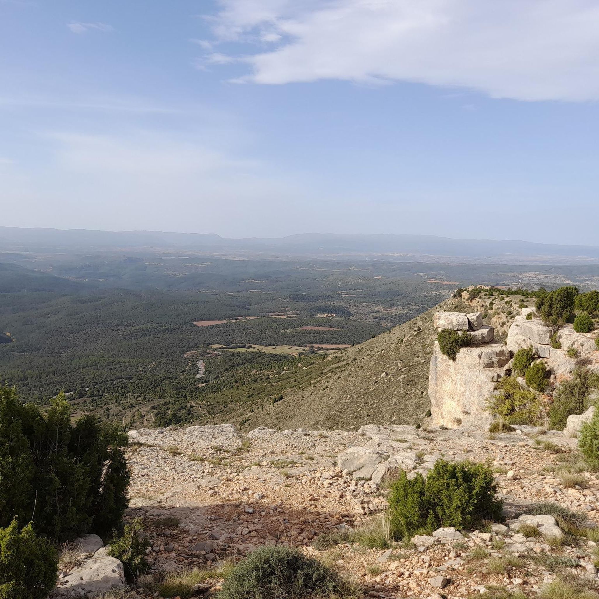
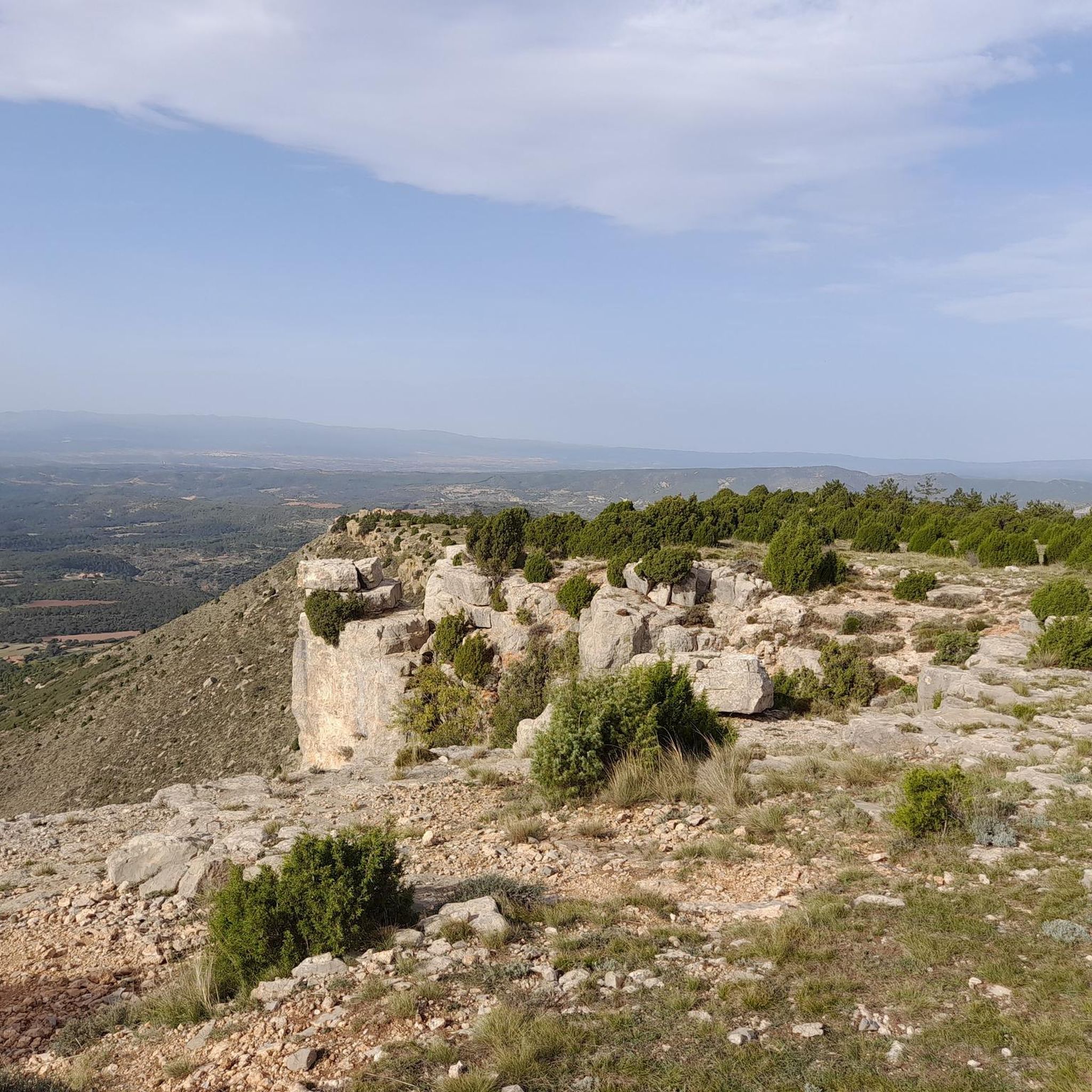
The Peña Ojerada in Alcalá de la Selva is a popular destination for hiking enthusiasts. One of the most recommended routes is the Circular Route of the Viewpoints, which includes the Peña Ojerada and Monte Pinar.
7
0

The geodesic vertex called Peñarroya points 2028.228 m with respect to the base of the observation pillar, but it sits on two bodies of stone masonry. Altitude of the bodies of the order of 10 or 11 meters in total. LIDAR data confirm a ground level elevation of 2017 m. Peñarroya is a chromotoponym that refers to the color of the rocks that make up the mountain. The spelling in the Spanish language is Peñarroya and in the Aragonese language Penyarroya or Peñarroya depending on the spelling chosen for the palatal nasal. The origin of the toponym is quite clear. It combines the common noun peña, from the Latin PĭNNAM, 'battlement', with the adjective RŭBEŭS, -A, -UM 'blond'. The toponym reflects the reddish hue of the terrain. The spelling Penya (in addition to others such as Penna or Peña) is included in many medieval texts in Aragon. For example, in 1448 to designate the summit of the mountain range (of Peña) that rises above Sos del Rey Católico on the border, then, with the kingdom of Navarra.
1
0
There is a hiking route called “Las Hoces del Mijares” that you can explore. It is approximately 10.24 km long and offers stunning views.
9
0

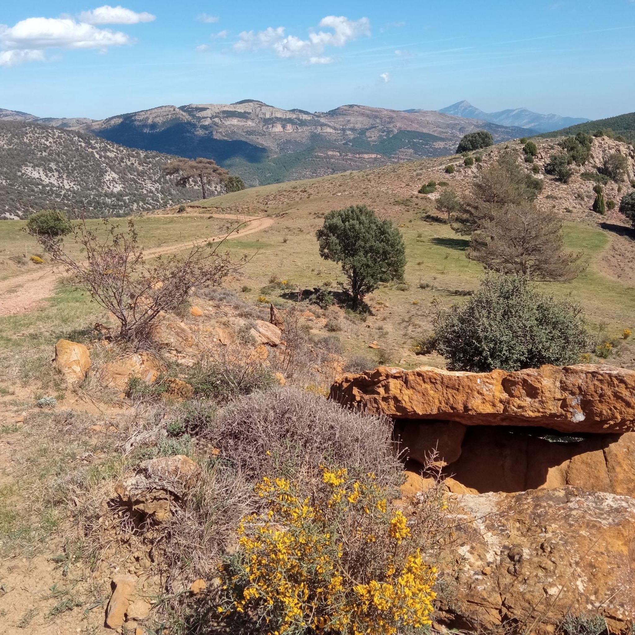
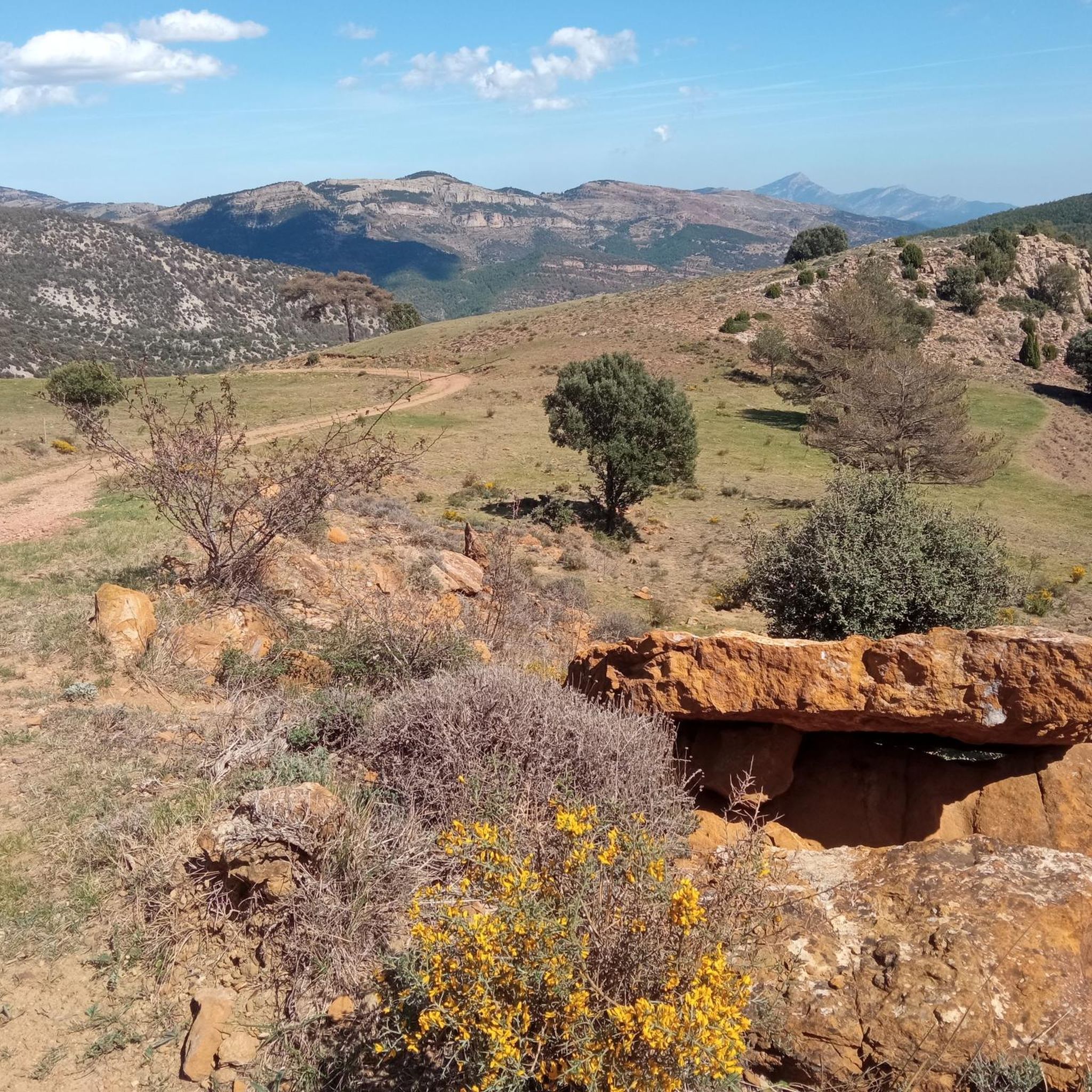
A few kilometers from the Valdelinares ski resort is this panoramic point with very beautiful views of the entire valley and the interior of Teruel. The built turret allows you to climb above the 2028 masl of the top and to be able to have 360 degree panoramic views without obstacles ahead.
1
0
In this corner of the trail there is a small dam that restricts access but it is a nice and quiet place to enjoy this wonderful place.
1
0
Wonderful place at the foot of the Mijares River where you can appreciate the environment of the Hoz (or canyon) formed by thousands of years of water erosion. An amazing and very quiet place where you can take a refreshing bath in summer.
1
1
Frequently Asked Questions
What are some popular natural features to explore in Nogueruelas?
Nogueruelas is rich in diverse natural features. You can explore dramatic geological formations like The Gorge, which features abrupt canyons carved by the Estrecho River. The region also boasts numerous natural springs, such as Fuente de la Salud, known for its pure, fresh water in a charming wooded setting. Additionally, you'll find spectacular water pools in areas like Paraje de los Amanaderos de Val de Azoo, and interesting rock formations like Peña Ojerada Rock Formation.
Where can I find panoramic views of the Nogueruelas region?
For breathtaking panoramic views, head to Peñarroya Summit and Observation Tower. Situated at an elevation of 2028 meters, it offers 360-degree vistas of the valley and the interior of Teruel. Other excellent viewpoints include Mirador natural de La Hoya (1,307 meters) and Mirador natural del Cabezo de las Cruces (1,710 meters), both providing expansive natural vistas.
Are there family-friendly natural monuments or activities in Nogueruelas?
Yes, several natural spots are suitable for families. Fuente de la Salud is part of a highly accessible circular hiking route, ideal for all fitness levels and known for its tranquil, wooded setting. The Paraje de los Amanaderos de Val de Azoo, with its spectacular water pools, also offers a scenic and relaxing environment for a family outing.
What kind of outdoor activities can I do near the natural monuments?
The natural monuments in Nogueruelas are excellent starting points for various outdoor activities. You can enjoy hiking, mountain biking, and gravel biking. For hiking, explore routes like the “Las Hoces del Mijares” trail near The Gorge. For more options, check out the Hiking around Nogueruelas guide, the MTB Trails around Nogueruelas guide, or the Gravel biking around Nogueruelas guide.
When is the best time to visit the natural monuments in Nogueruelas?
The best time to visit Nogueruelas' natural monuments generally depends on your preferred activity. Spring and autumn offer pleasant temperatures for hiking and exploring. During the rainy season, typically in spring or late autumn, areas like Rocha de las Fuentes become particularly notable for their abundant water, offering a dynamic natural spectacle. Summers can be warm, ideal for enjoying water features like the spectacular pools at Paraje de los Amanaderos de Val de Azoo.
Are there any historical or traditional water sources to visit?
Yes, Nogueruelas is distinctive for its numerous fountains, many with historical significance. The Ruta de las Fuentes connects many of these, including the traditional Fuente de San Simón, located in a secluded spot, and Fuente de la Caba, known for its stalactite-like formations. Fuente de la Salud is also a cherished natural spring, valued for its purity and freshness.
What kind of geological formations can I see in the area?
The region is characterized by interesting geological formations, particularly evident in areas like The Gorge (Barranco de los Berros), where you can observe abrupt canyons carved by the Estrecho River, embankments, and even a waterfall. The powerful forces of nature have created dramatic landscapes, including the river embedded between rocks near Fuente de la Salud.
What do visitors enjoy most about the natural monuments around Nogueruelas?
Visitors particularly appreciate the scenic beauty, geological interest, and the opportunities for hiking and exploration. The tranquility of spots like Fuente de la Salud, the dramatic landscapes of The Gorge, and the expansive views from Peñarroya Summit are frequently highlighted. The purity of the water sources and the connection to local heritage also add to the appeal.
Are there any specific trails or routes that incorporate multiple natural monuments?
Yes, the “Las Hoces del Mijares” hiking route, approximately 10.24 km long, offers stunning views and includes The Gorge. Additionally, the Ruta de las Fuentes is a unique way to explore many of the area's natural water sources, connecting several of Nogueruelas' registered fountains. Fuente de la Salud is also part of an accessible circular hiking route.
What is the difficulty level of hiking trails around Nogueruelas' natural monuments?
Hiking trails around Nogueruelas vary in difficulty. For instance, the “Las Hoces del Mijares” route near The Gorge is considered intermediate. However, there are also highly accessible circular routes, such as the one leading to Fuente de la Salud, which are suitable for all fitness levels. You can find a range of options from easy to difficult in the Hiking around Nogueruelas guide.
Can I bring my dog to the natural monuments in Nogueruelas?
While specific regulations for each natural monument may vary, many outdoor areas and trails in Nogueruelas are generally dog-friendly, especially if your dog is well-behaved and kept on a leash. It's always advisable to check local signage or specific highlight details for any restrictions. Enjoy exploring the natural beauty with your canine companion!
Are there any natural swimming spots in Nogueruelas?
Yes, the Paraje de los Amanaderos de Val de Azoo is particularly noted for its "espectaculares pozas de agua" (spectacular water pools), making it a highlight for visitors seeking tranquil natural swimming spots or simply a scenic walk amidst captivating water features.
Most popular routes around Nogueruelas
Most popular attractions around Nogueruelas

Get inspired with the komoot mobile app


Explore more
Extend your search for the best caves by checking out these guides of the top ones around Nogueruelas:
