Top 16 Natural Monuments around Talamantes
Best natural monuments around Talamantes are primarily situated within the Moncayo Natural Park, a region dominated by the Moncayo Massif. This area features diverse landscapes, from high mountain peaks and extensive forests to impressive ravines and unique geological formations. The natural features provide varied experiences for outdoor enthusiasts, showcasing the ecological and geological significance of the Sistema Ibérico.
Best natural monuments around Talamantes
- The most popular natural monuments is Cueva de los Pilares, a cave with spectacular rock formations…
Last updated: July 15, 2026
Cueva de los Pilares
Highlight • Cave
Translated by Google •
Tip by

Cabezo de la Mata
Highlight • Viewpoint
Translated by Google •
Tip by

Sign up now to discover places like this
Get recommendations on the best single tracks, peaks, & plenty of other exciting outdoor places.
Sign up for free
Valcongosto Gorge
Highlight • Gorge
Translated by Google •
Tip by
Cerro Morrón Summit
Highlight • Summit
Translated by Google •
Tip by
Views of the Peñas de Herrera
Highlight • Viewpoint
Translated by Google •
Tip by
Sign up for free to discover even more natural monuments around Talamantes.
Sign up for free
Already have an account?
Start today with a free account
Your next adventure awaits.
Login or Signup

Other adventures around Talamantes

Tips from the Community

Cabezo de la Mata is a peak located in the Sierra del Moncayo, in Aragon, Spain. With an altitude of 1,437 metres, it is one of the most accessible peaks in the area. One of the most popular routes to ascend Cabezo de la Mata begins at Fuente de los Frailes. This circular route offers spectacular views of the northeastern slope of the Sierra del Moncayo and the plain of the Ebro Valley. The route includes sections through beech and pine forests, and is suitable for all year round.
5
0

You need to be in shape, it is a climb that requires some climbing skill.
0
0

At the Collado de la Atalaya you have to head northeast along the slope of the mountain range following a level path marked with stone markers. The path crosses the Las Hoyas de los Portillos valley and climbs halfway through the pine forest towards the wall of the Muela del Cerro Morrón. In the pine forest you have to keep climbing towards the east and at the base of the walls connect with the path coming from the north face of the mountain. The landmarks are clear between the pine trees and the mole wall, they jump a couple of small slopes near other cavities and lead to the spectacular Cueva de los Pilares, a fantastic natural rock sanctuary with arches, vaults and giant columns. The climb to the summit of the mole leaves from the cave through the canal located to the west, it is a clear and obvious climb, it has stone markers and although it seems that there is no exit with good visibility, it is a simple section along some aerial ledges without too many complications, unless the rock is wet, it cannot even be classified as a climbing step, rather technical mountain hiking. The milestones enter the large inclined molar plain and take the direction of the summit through the center of the mountain.
0
1
At Cerro Morrón (1,730 m) there is a trig point and good views of the Moncayo massif. The visible summit is Lobera (2,226 m) and behind it the distant San Miguel peak (2,315 m), simply showing the silhouette of the summit. And below the pedestal of the great mountain covered by endless forests of pines, oaks and beech trees. Towards the north the enormous plain of the Ebro valley and around it the rest of the reliefs of the eastern Iberian region.
0
0

The Herrera rocks are formations that break the smooth crest of the mountain and resemble castles. From this point you can see its peaks, to the southeast.
0
0

Beautiful views from the Cabezo de la Mata to the NE slope of the Sierra del Moncayo and the plain that extends towards the Ebro Valley. Easily accessible from the Central de la Morca car park, from Fuente de los Frailes or the hostel
1
1
From this point we will have spectacular views of the Peñas de Herrera that will accompany us for a good part of the way if we go to Cerro Morrón or to the Peñas de Herrera themselves, both located in the Sierra del Moncayo
1
1
Located at an altitude of 1,731 meters, is the top of Cerro Morrón, located in the Sierra de la Muela and within the Moncayo Natural Park with impressive views. Let's not forget to visit the Cueva de los Pilares that are close to us!
1
0
Frequently Asked Questions
What natural features can I expect to see around Talamantes?
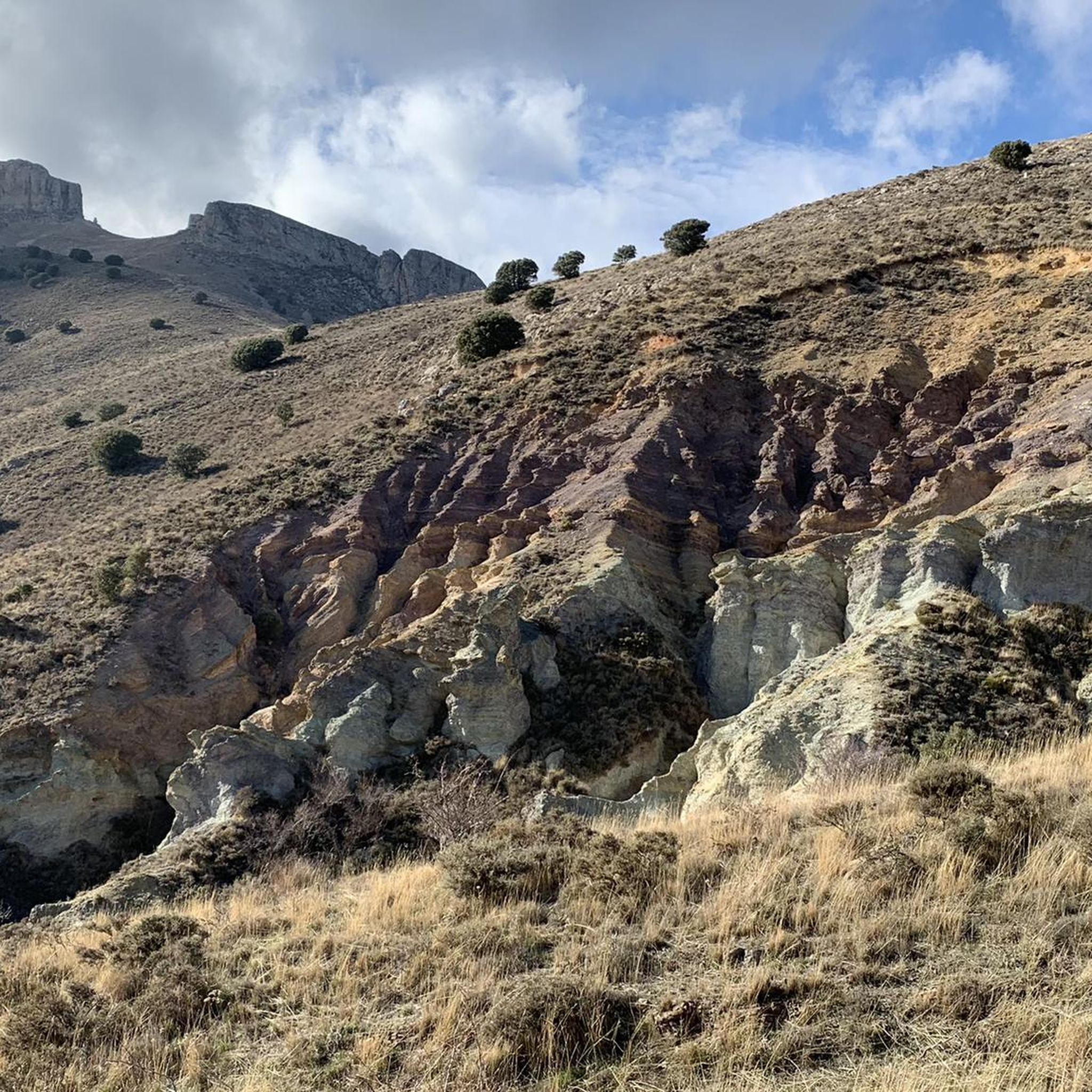
The region around Talamantes, primarily within the Moncayo Natural Park, offers a diverse range of natural features. You can explore the majestic Moncayo Massif with its high peaks and extensive forests, impressive ravines like the Barrancos de Talamantes featuring colorful badlands, and unique geological formations such as the Cueva de los Pilares and the Pozo de los Aines sinkhole.
Are there any unique geological formations to explore near Talamantes?
Yes, Talamantes is home to several unique geological formations. The Cueva de los Pilares is a natural rock sanctuary with spectacular arches, vaults, and giant columns. You can also visit the Pozo de los Aines, a striking doline or sinkhole formed by collapsed limestone, and the Barrancos de Talamantes, known for its visually striking 'cárcavas de arenas de colores' (colorful badlands).
Where can I find the best panoramic views of the Moncayo region?
For breathtaking panoramic views, consider ascending the Moncayo Massif itself, particularly Pico San Miguel, which offers vistas extending to the Pyrenees on clear days. Other excellent viewpoints include Cabezo de la Mata, offering views of the northeastern slope of the Sierra del Moncayo and the Ebro Valley, and Cerro Morrón Summit, which provides impressive views of the Moncayo massif and the surrounding forests.
What outdoor activities can I do near these natural monuments?
The area around Talamantes is ideal for various outdoor activities. Hiking is very popular, with trails leading through forests, ravines, and to summits. You can find routes like the circular trail through the Barrancos de Talamantes or the Peñas de Herrera - circular from Talamantes. Cycling is also a great option, with numerous routes for both road and touring bikes, such as the Moncayo Climbs Loop or Moncayo — gravel circular from Monasterio de Veruela.
Are there family-friendly natural monuments or activities around Talamantes?
While many trails in the Moncayo Natural Park can be challenging, there are options suitable for families. The walk to the Pozo de los Aines is short and easy, passing through an olive grove. Some sections of the Barrancos de Talamantes circular route are manageable, and the Cabezo de la Mata is considered one of the more accessible peaks in the area, with routes suitable for all year round.
Can I spot any wildlife in the natural monuments of Talamantes?
Yes, the natural monuments around Talamantes are home to diverse wildlife. The Cuevas de Añón, though not generally open for interior access, are a crucial habitat for various bat species, which use the caves for breeding and hibernation. The extensive forests of the Moncayo Natural Park also support a variety of birds and other forest animals.
What is the best time of year to visit the natural monuments around Talamantes?
The best time to visit largely depends on your preferred activities. The lower slopes of the Moncayo Massif are covered in forests of pines, oaks, and beeches, making them pleasant for hiking in spring and autumn. Between October and May, the higher peaks can be snow-covered, offering opportunities for winter walks or more challenging mountaineering. Summer provides warmer conditions for exploring, but always be prepared for varying mountain weather.
Are there any natural monuments that are particularly good for hiking?
Absolutely. The Moncayo Massif offers routes of varying difficulty for mountain climbing and hiking. The Barrancos de Talamantes features a circular hiking route (Sendero circular S-4) of about 15 kilometers. Trails around the Peñas de Herrera also provide rewarding hiking experiences with fantastic views. For a challenging hike, consider the Cueva de los Pilares and Cerro Morrón Loop.
What kind of forests can be found within the Moncayo Natural Park?
The Moncayo Natural Park is characterized by its rich forest ecosystems. The lower slopes of the Moncayo Massif are covered in extensive forests primarily composed of pines, oaks, and beeches. These diverse woodlands provide beautiful scenery and important habitats for local wildlife, offering varied experiences throughout the seasons.
Are there any historical or cultural sites near the natural monuments?
While the focus is on natural monuments, the region does have historical connections. The Pozo de los Aines, for instance, has historical and legendary associations, with archaeological remains from Roman and Muslim eras found nearby. Additionally, the wider Moncayo region has a rich history, including the Monasterio de Veruela, which can be incorporated into cycling routes like the Monastery of Santa María de Veruela y Ambel — circular from Talamantes.
What do visitors enjoy most about the natural monuments around Talamantes?
Visitors frequently appreciate the stunning panoramic views, especially from the summits like Moncayo and Cabezo de la Mata. The unique geological formations, such as the spectacular rock formations in the Cueva de los Pilares and the striking Pozo de los Aines, are also highly valued. The diverse hiking opportunities through varied landscapes, from dense forests to impressive ravines, are a major draw for outdoor enthusiasts.
Most popular attractions around Talamantes

Get inspired with the komoot mobile app


Explore more
Extend your search for the best caves by checking out these guides of the top ones around Talamantes:
