Top 8 Natural Monuments around Arenthon
Best natural monuments around Arenthon are found in the Haute-Savoie region of France, offering diverse natural landscapes. The area features various geological formations, including mountain summits and tranquil lakes. Visitors can explore these natural features, which provide opportunities to experience the alpine environment. This region is characterized by its natural beauty and varied terrain.
Best natural monuments around Arenthon
- The most popular natural monument is Le Môle summit cross, a summit that offers exceptional views, including Mont Blanc. It…
Last updated: October 5, 2026
Pointe des Brasses
Highlight • Summit
Les Brasses …
Translated by Google •
Tip by

La Gouille aux Morts
Highlight • Lake
Gouille aux Morts: What an ugly name for this charming little pond. Beavers, mallards, herons, and especially frogs …
Translated by Google •
Tip by
Sign up now to discover places like this
Get recommendations on the best single tracks, peaks, & plenty of other exciting outdoor places.
Pointe d'Andey
Highlight • Summit
Translated by Google •
Tip by

Rochers de Faverges
Highlight • Natural Monument
Translated by Google •
Tip by

Fairies' Stone
Highlight • Natural Monument
fr.wikipedia.org/wiki/Pierre-aux-F%C3%A9es_(Reignier)
Translated by Google •
Tip by

Sign up for free to discover even more natural monuments around Arenthon.
Already have an account?
Start today with a free account
Your next adventure awaits.

Tips from the Community

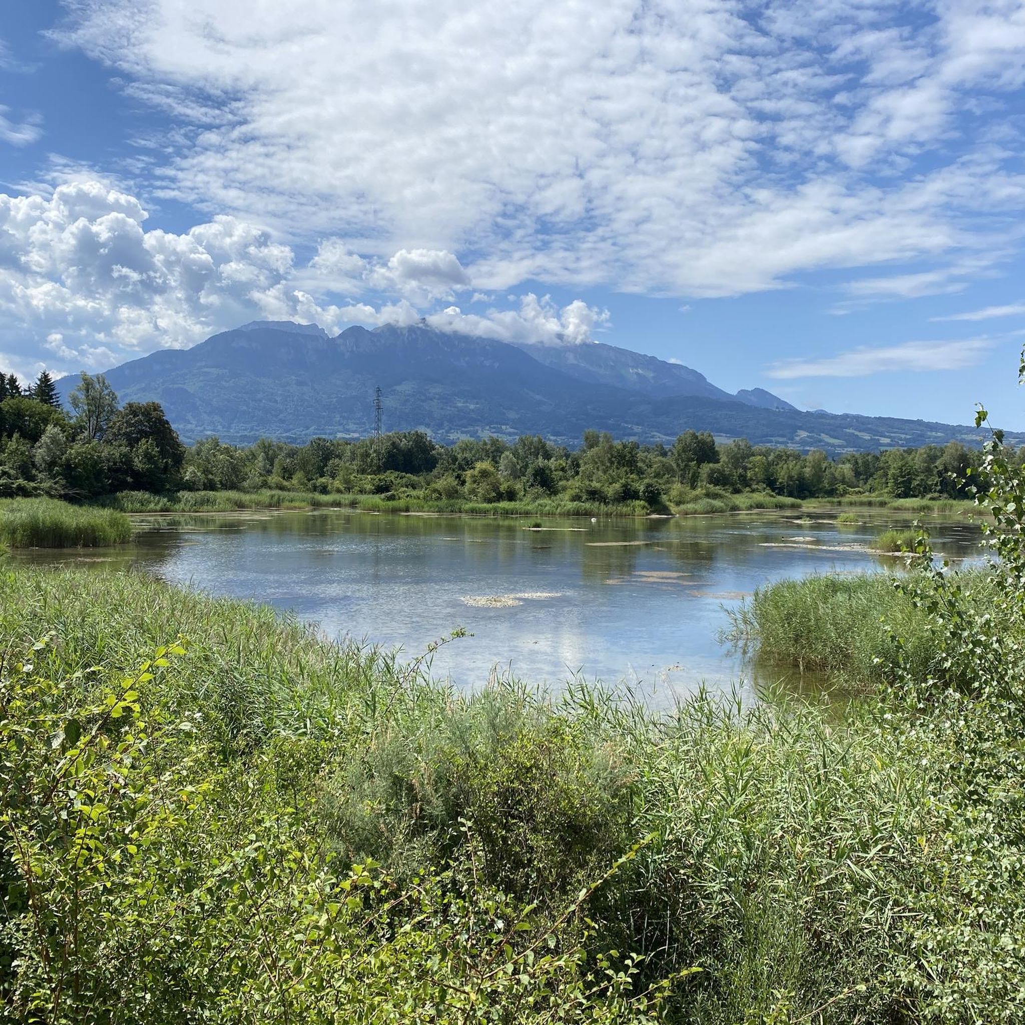
Intersection Point: La Gouille aux Morts (Pond of the Dead) Altitude 650m Gouille aux Morts: What an ugly name for this charming little pond. Beavers, mallards, herons, and especially frogs take shelter in its tall grass and breed there. The place is calm and peaceful, far from the road to the Vallée Verte (Green Valley), although you can still hear the sounds of traffic. Above it, the Molière à Vachat stream is mirrored in its waters. Its reflection blends with the water lilies scattered there, creating perfect harmony. A delight for the eye of the walker. It's impossible not to think of Monet's "Water Lilies." It is said that, long ago, two stonemasons working at the "Molière," located about fifty meters above, fell to their deaths there on a Sunday (yes, a Sunday...the Lord's Day). See: H. Savoie: Les Molières du Mont Vouan. Or perhaps the pond got its name because a peasant was swallowed up there with his cart...
1
0


To be done on snowshoes or in sneakers, from the solaison plateau for walkers or from Bonneville for hikers; )
0
0
It can blow hard up there! I recommend the path that goes down to La Tour from the east
0
1

The cross means summit of the Brasse mountain
1
0
Pointe des Brasses is a summit of Haute-Savoie located in the Chablais massif, straddling the municipalities of Saint-Jeoire and Viuz-en-Sallaz, and culminating at 1,503 meters above sea level. Les Brasses is a toponym from a mountain pasture located above Viuz-en-Sallaz2. It could derive from the German Brache, which designates fallow or fallow land2,3, or from the Old German braka meaning “clearing”3. It is possible that it also derives from the Latin bracchium3 (“arm”), referring to the arms of the river, three of which have their source in Brasses: the Menoge, the Entreverges and Airets streams. In June 2013, a cross made by students from the Viuz-en-Sallaz Catholic Automobile School was erected on its summit. Six meters high, it is made up of 33 metal cubes measuring 30 centimeters on each side, assembled on site and arranged in a spiral by the students themselves. She was blessed on July 7, 2013 by Mgr Boivineau, Bishop of Annecy.
1
0

Easy family walk starting with a nice climb a little exposed to the wind. Less wind at the summit and during the descent via the pass.
0
0
Frequently Asked Questions
What are some of the most impressive natural features to explore near Arenthon?
The region around Arenthon boasts diverse natural features. You can explore the dramatic canyon of the Gorges du Fier, known for its suspended footbridge and 'Giants' Kettles'. Another awe-inspiring site is the Cirque du Fer-à-Cheval, a colossal horseshoe-shaped amphitheater with numerous waterfalls during spring. For unique geological formations, the Désert de Platé offers a lunar landscape of 'lapiaz' formations and panoramic views of Mont Blanc.
Are there any natural monuments near Arenthon that offer panoramic views?
Yes, several natural monuments provide stunning panoramic views. Le Môle summit cross offers exceptional 360-degree vistas, including the Jura mountains, Lake Geneva, and Mont Blanc. The Désert de Platé also provides breathtaking views of the Mont Blanc massif. Additionally, Pointe d'Andey is a summit known for its scenic outlooks.
Which natural monuments are suitable for families with children?
The Gorges du Fier is an excellent choice for families, offering an accessible suspended footbridge and educational insights into geology. La Gouille aux Morts, a tranquil pond, is also family-friendly, providing a peaceful spot for wildlife observation. The Fairies' Stone, a historical dolmen, offers an interesting and accessible visit for all ages.
Where can I go to observe local wildlife near Arenthon?
For wildlife spotting, La Gouille aux Morts is a tranquil pond teeming with beavers, ducks, herons, and frogs. The vast Cirque du Fer-à-Cheval is also rich in diverse wildlife, including golden eagles, bearded vultures, ibex, and marmots, making it an ideal location for nature enthusiasts.
Are there any historical natural monuments in the Arenthon area?
Yes, the region has natural monuments with historical significance. The Fairies' Stone is a listed dolmen dating back to 3200-2800 BC. The Rochers de Faverges are geological formations where iron oxide veins were exploited in Roman times, giving the rocks their name from the Latin 'fabrica'.
What kind of hiking opportunities are available near these natural monuments?
The area offers a variety of hiking opportunities. The Cirque du Fer-à-Cheval is ideal for hiking, with routes ranging from gentle riverside strolls to more challenging treks. The Désert de Platé provides an exceptional hiking experience through its unique mineral landscape. For mountain hikes, you can explore routes like the 'Petit Môle – Le Môle loop' or 'Montagne de Sous-Dîne loop'. You can find more details on these and other mountain hikes around Arenthon on our guide page: Mountain Hikes around Arenthon.
Can I go cycling near the natural monuments around Arenthon?
Yes, there are several cycling routes in the vicinity. For example, you can find routes like the 'Footbridge over the Arve – Ponds on the banks of the Arve loop' or the 'Cohendier Park Pond – Route des gorges de la borne loop'. For more cycling options, including road cycling, refer to our guides: Cycling around Arenthon and Road Cycling Routes around Arenthon.
What is the best time of year to visit the natural monuments near Arenthon?
The spring and summer months are generally ideal for visiting, especially if you wish to see the numerous waterfalls at Cirque du Fer-à-Cheval, which are most spectacular during the spring snowmelt. These seasons also offer pleasant weather for hiking and exploring the diverse landscapes.
Is there a beautiful waterfall to visit near Arenthon?
Yes, the Cascade de la Diomaz is a beautiful waterfall located approximately 16 km from Arenthon. It features multiple cascades flowing into natural basins carved into the rock, offering a refreshing and picturesque walk. At its foot, you can also see the ancient 'Croix des Chartreux' etched into the stone.
What makes Le Môle mountain a significant natural monument?
Le Môle is a distinctive mountain rising to 1,863 meters, separating the Arve and Giffre valleys. Its unique, almost volcanic shape and its role as the southern entrance to the Geneva region give it geographical importance. It's also historically significant as the location from which Mont Blanc was first measured in 1775, and offers excellent 360-degree panoramic views from its summit.
Are there any unique geological formations to see?
Absolutely. The Gorges du Fier showcases impressive erosion work, including 'Giants' Kettles' and intricate rock formations carved by the river. The Désert de Platé is renowned for one of Europe's largest 'lapiaz' formations, a maze of grooves and ridges carved into limestone by millennia of erosion, creating an almost lunar landscape.
Most popular routes around Arenthon
Most popular attractions around Arenthon

Get inspired with the komoot mobile app


Explore more
Extend your search for the best caves by checking out these guides of the top ones around Arenthon:
