Top 11 Natural Monuments around Vaudricourt
Best natural monuments around Vaudricourt offer a diverse range of landscapes in the Hauts-de-France region. Vaudricourt serves as a base for exploring natural sites, including reclaimed industrial heritage and coastal features. The area provides opportunities to observe geological formations and historical natural sites.
Best natural monuments around Vaudricourt
- The most popular natural monument is La Cise Cliff, a natural monument featuring white chalk cliffs. It is composed of chalk from the Upper Cretaceous, strewn with flint nodules.
- Another must-see…
Last updated: July 5, 2026
Ault Chalk Cliffs
Highlight • Natural Monument
Translated by Google •
Tip by

Cape Hornu
Highlight • Beach
The name Cap Hornu comes from the Picard word “hornu”, which means “horned” …
Tip by
Sign up now to discover places like this
Get recommendations on the best single tracks, peaks, & plenty of other exciting outdoor places.
Sign up for free
La Cise Cliff
Highlight • Natural Monument
Translated by Google •
Tip by

Bois de Cise
Highlight • Forest
Translated by Google •
Tip by

Cliffs of Ault
Highlight • Natural Monument
Even if the city has lost its splendor, the site is impressive, because to the north, the plain of …
Translated by Google •
Tip by

Sign up for free to discover even more natural monuments around Vaudricourt.
Sign up for free
Already have an account?
Start today with a free account
Your next adventure awaits.
Login or Signup

Tips from the Community


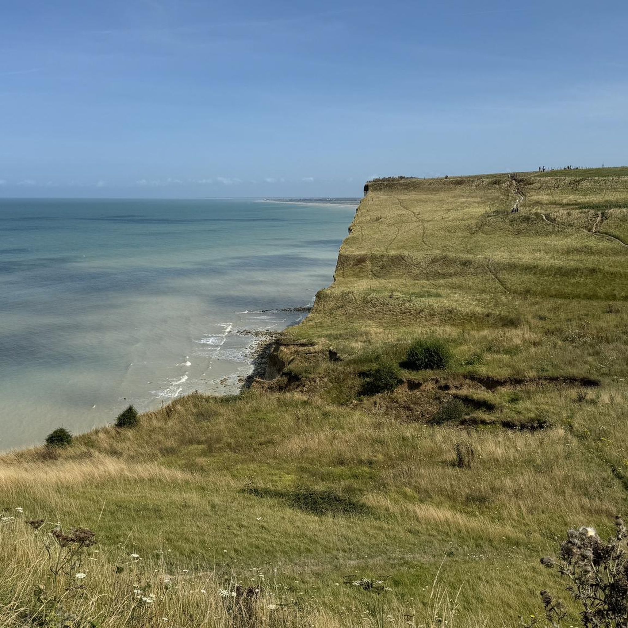
The cliffs are made of chalk and are impressive to look at.
3
0
Here in Ault begin the chalk cliffs, which stretch all the way to Normandy and repeatedly appear as enormous cliffs.
4
0


The cliffs around the beach of Ault are composed of chalk from the Upper Cretaceous, more precisely from the Turonian and Coniacian (around 83 million years ago to 90 million years ago). They are strewn with flint nodules which highlight the subhorizontal stratification planes (the formation of flint has already been discussed in Discovery of the geology of the cliffs of Étretat, presentation of an excursion from the beach of Tilleul (Antifer) to the Porte d'Amont (Étretat Nord)). The relative proportion of chalk and flint is around 90-95% chalk to 5-10% flint. Flint horizons are stratigraphic markers. On the cliffs of Ault, the regular flint band called Seven Sisters is recognizable and characterizes the boundary between the Middle Coniacian and the Upper Coniacian (around 87 million years ago). The boundary between the lower and middle Coniacian is marked by the Shoreham 2 marl level, which is more difficult to identify. These lithostratigraphic markings allow in particular the correlation of distant deposits, such as between the Normandy and Picardy coasts, or between the French and English coasts.
3
0
A green setting in the heart of the cliffs, classified as a picturesque area since 1959. The Bois de Cise is an exceptional natural area, a small natural forest, originally wild and abandoned, which became a famous seaside resort during the Belle Époque under the leadership of a visionary who stopped at nothing. This coastal forest was originally a wild forest and a hunting ground in the Middle Ages. At the end of the 19th century, the Bois de Cise was sold off in lots on the initiative of a property developer and became a famous seaside resort of the Belle Époque. Today, it is a charming holiday and walking area that is best explored on foot via the narrow paths and wooden steps that crisscross the area. Very beautiful villas bear witness to the prosperous years before the First World War. Don't forget to go to the panorama, like Victor Hugo in his time, a fantastic viewpoint from which you can see the mouth of the Bay of Somme.
0
0
The cliffs around the beach of Ault are composed of chalk from the Upper Cretaceous, more precisely from the Turonian and Coniacian (around 83 million years ago to 90 million years ago). They are strewn with flint nodules which highlight the subhorizontal stratification planes (the formation of flint has already been discussed in Discovery of the geology of the cliffs of Étretat, presentation of an excursion from the beach of Tilleul (Antifer) to the Porte d'Amont (Étretat Nord)). The relative proportion of chalk and flint is around 90-95% chalk to 5-10% flint. Flint horizons are stratigraphic markers. On the cliffs of Ault, the regular flint band called Seven Sisters is recognizable and characterizes the boundary between the Middle Coniacian and the Upper Coniacian (around 87 million years ago). The boundary between the lower and middle Coniacian is marked by the Shoreham 2 marl level, which is more difficult to identify. These lithostratigraphic markings allow in particular the correlation of distant deposits, such as between the Normandy and Picardy coasts, or between the French and English coasts.
2
0
Frequently Asked Questions
What types of natural monuments can I explore around Vaudricourt?
The area around Vaudricourt offers a diverse range of natural monuments, including impressive white chalk cliffs along the coast, re-naturalized former slag heaps showcasing industrial heritage, ancient megalithic sites, and serene lakes. You'll find a mix of coastal formations, unique geological features, and sites where nature has reclaimed industrial landscapes.
Which natural monuments are most popular with visitors?
Among the most popular natural monuments are the La Cise Cliff, known for its white chalk cliffs, and the Ault Chalk Cliffs, which mark the beginning of the Normandy Alabaster Coast. Visitors also highly appreciate Cape Hornu, a beach and natural monument near Saint-Valery-sur-Somme, offering panoramic views of the bay and its wildlife.
Are there any natural monuments with historical significance?
Yes, the Cape Hornu near Saint-Valery-sur-Somme has a rich history, with tips mentioning its strategic importance and medieval past. Additionally, the Passage dolmen: The Fairy Table is a megalithic complex over 4000 years old, offering a glimpse into prehistoric times and early human construction in the region.
Where can I find panoramic views of the region's landscape?
For breathtaking panoramic views, visit Cape Hornu, which overlooks the Bay of Somme. Another excellent spot is Le Belvédère du Parc d'Olhain, the highest point in Pas-de-Calais, offering expansive views of the Artois hills, the mining basin, and the mountains of Flanders.
What outdoor activities can I do near these natural monuments?
The area provides numerous opportunities for outdoor activities. You can find various hiking trails, including routes around the Ault Chalk Cliffs. There are also running trails and gravel biking routes that allow you to explore the coastal areas and natural reserves.
Are there family-friendly natural monuments around Vaudricourt?
Yes, Cape Hornu is categorized as family-friendly, offering a beach and wildlife viewing opportunities. Lac de Beugin provides a peaceful spot to relax by the water, and Vallée Carreau Park, with its gravel paths, is suitable for walking or cycling with the family.
Can I observe wildlife at these natural sites?
Absolutely. Cape Hornu offers views of the bay's wildlife. The Hâble d'Ault Route, a land of lowlands isolated from the sea by pebbles, is home to various waterfowl, seabirds, and other wildlife. The Parc Naturel Régional de la Baie de Somme Picardie maritime is particularly known for observing seals at low tide.
Are there any natural monuments that showcase the region's industrial heritage?
Yes, the region uniquely blends natural beauty with its industrial past. Terril numéro 5 de Lapugnoy and Terril de Fouquereuil are former slag heaps that have been reclaimed by nature, offering scenic walks and views. Vallée Carreau Park also highlights the mining heritage with its redeveloped paths and a 'terriloscope' to visualize the original height of the slag heaps.
Where can I find a peaceful natural spot for relaxation or fishing?
Lac de Beugin, an old quarry transformed into a lake, is a peaceful spot ideal for relaxation and fishing. It's popular for carp, trout, and pike, offering a tranquil setting to enjoy the view.
What is unique about the coastal natural monuments?
The coastal natural monuments, such as La Cise Cliff and Ault Chalk Cliffs, are composed of chalk from the Upper Cretaceous, strewn with flint nodules. These impressive white cliffs offer dramatic scenery and are part of the Normandy Alabaster Coast, providing a unique geological perspective.
Are there any natural monuments suitable for longer walks or cycling?
Vallée Carreau Park features gravel paths ideal for walking or cycling. For longer routes, consider the gravel biking routes that explore the coastal areas, or the hiking trails, some of which are over 10 km, offering extended exploration of the natural landscapes.
Most popular routes around Vaudricourt
Most popular attractions around Vaudricourt

Get inspired with the komoot mobile app


Explore more
Extend your search for the best caves by checking out these guides of the top ones around Vaudricourt:
