Top 7 Mountain Passes around Wittnau, Switzerland
Best mountain passes around Wittnau, Switzerland, are situated within the Aargau region, part of the Jura mountains. This area features several notable mountain passes that are integral to popular hiking routes. The Jura Crest Trail, a long-distance hiking route, connects many of these passes and passes near Wittnau. The terrain offers a mix of elevations and natural features, providing diverse outdoor experiences.
Best mountain passes around Wittnau, Switzerland
- The most popular mountain passes is Benkerjoch Pass, a mountain pass…
Last updated: July 10, 2026
Saalhöhe Pass
Highlight • Mountain Pass
Translated by Google •
Tip by

Benkerjoch Pass
Highlight • Mountain Pass
Translated by Google •
Tip by

Sign up now to discover places like this
Get recommendations on the best single tracks, peaks, & plenty of other exciting outdoor places.
Sign up for free
Benkerjoch
Highlight • Mountain Pass
Translated by Google •
Tip by

Staffelegg Pass (621 m)
Highlight (Segment) • Mountain Pass
Tip by

Salhöhe-Hard-Wasserflue-Salhöhe (SO) Hike (Easy)
Highlight • Trail
Translated by Google •
Tip by

Sign up for free to discover even more mountain passes around Wittnau, Switzerland.
Sign up for free
Already have an account?
Start today with a free account
Your next adventure awaits.
Login or Signup
Popular around Wittnau, Switzerland
Other adventures around Wittnau, Switzerland

Tips from the Community

Starting point for many beautiful Jura hikes
5
0

Starting point for many beautiful tours
1
0


From the barbecue area south of the car park, a cool S1 trail leads down towards Fischbach/Küttigen. Via Gipsi... Can also be easily ridden uphill (with an e-bike). You then don't have to ride all the way up the pass road... From Küttigen, follow the dirt road to the right at the Fischbach bus stop. After the Gipsi there is a sharp left turn, then after 100m turn right up the trail... Have fun!
1
0

An extremely suitable starting point (free parking and public transport) for wonderful hikes to the highest point in Aargau, Geissfluegrat, even with a summit book, or in the other direction to Wasserflue with a fantastic view. You can cross three cantons here with little effort. If you can, you should avoid weekends and public holidays. There are a lot of people on the road and the motorcyclists are a particular nuisance, racing up and down the road at extremely high speeds and with a noise like that at the Nürburgring. "Safety first" is literally a foreign word for some people.
4
0
Free, very large car park at Salhöhe (or Saalhöhe). You can also arrive by bus. Restaurant on site with a fun-decorated garden. Particular caution is required on public holidays due to (speeding) motorbike riders (including in the car park).
1
0

This pass in the canton of Aargau connects Aarau and Frick. Thanks to the parallel Staffelegg, which takes most of the traffic, this pass has relatively little traffic. Located just below the Wasserflue mountain (866 m), there are many hiking opportunities.
2
0

A very nice easy hike. Hiking poles are an advantage. Sure-footedness is essential. There are very beautiful viewpoints and fantastic views of the Alps. Especially at the height of the Wasserflue, the view of the Alps is a dream. There is also a very large bench where you can take a break at the same time. There are a few barbecue areas along the way where you can relax and grill something. The Salhöhe is a pass in the Swiss Jura at an altitude of 787 m above sea level. M. and a maximum gradient of 10.5%. It connects the towns of Kienberg and Erlinsbach. The Salhöhe forms the cantonal border between the cantons of Aargau and Solothurn. At the starting point there is the well-known Saalhöhe Restaurant where you can go for something to eat or drink. I found the following highlights of the hike: - Always great viewpoints of the Alps - If you go early in the morning you can enjoy nature even more and take it easy. Important: This hike starts directly from the public parking lot. (Toll-free) FYI: Moderately difficult hike Difficulty level: T1 (hiking)
1
0
Frequently Asked Questions
What makes the mountain passes around Wittnau, Switzerland, unique?
The mountain passes around Wittnau, Switzerland, are situated in the Aargau region, part of the Jura mountains. They are integral to popular hiking routes, including sections of the Jura Crest Trail. This area offers a diverse landscape with picturesque scenery, historical significance, and a mix of elevations and natural features.
Are there any historical sites or landmarks near these passes?
Yes, several passes have historical significance. For instance, the Bänkerjoch Pass once served as a border with Austria, and the Salhöhe Pass marked the border between the Old Swiss Confederacy and Habsburg territories after 1415. The Unterer Hauenstein Pass has Roman artifacts and was an important transit route in Roman times. You can also find medieval fortifications like Schenkenberg Castle ruins and Habsburg Castle near the Staffelegg Pass.
What kind of views can I expect from the mountain passes?
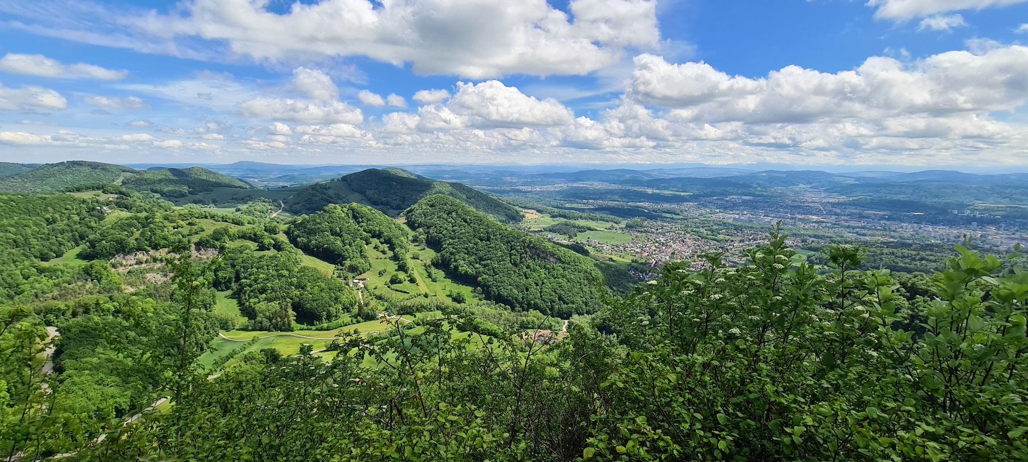
Many passes offer expansive and panoramic views. From Staffelegg Pass Summit, you can see the Jura mountains and the city of Aarau. The Saalhöhe Pass provides views of the Aargau Jura hills, and on clear days, distant Alps can be seen from a hike towards Aarau. The Benkerjoch also offers wonderful views of the Jura mountains.
Are there family-friendly options among the mountain passes?
Yes, some mountain passes are considered family-friendly. For example, Benkerjoch Pass is listed as family-friendly in the komoot community. The region generally offers diverse outdoor experiences suitable for various skill levels.
Can I bring my dog on trails around the mountain passes?
Yes, some areas are dog-friendly. Staffelegg Pass Summit is specifically noted as dog-friendly, making it a good starting point for walks with your canine companion.
What outdoor activities can I do near these mountain passes?
The region around Wittnau offers a variety of outdoor activities. Besides hiking, you can enjoy gravel biking and mountain biking. For gravel biking, routes like the 'Aare River Path' or 'Quiet upper Möhlintal' are available. Road cycling routes include 'Benkerjoch Pass – Kasteln Castle loop' and 'Saalhöhe – Climb Towards Rohr loop'. Mountain biking trails like 'Old Rhine Bridge, Rheinfelden' or 'Benkerjoch – Schafmatt Mountain Lodge loop' are also popular. You can find more details on these activities in the Gravel biking around Wittnau, Switzerland, Road Cycling Routes around Wittnau, Switzerland, and MTB Trails around Wittnau, Switzerland guides.
Are there restaurants or cafes available at the mountain passes?
Yes, several passes offer dining options. The Staffelegg Pass features a restaurant at its summit. The Saalhöhe Pass also has a restaurant, the Chalet restaurant, and is a good spot for a stop after a hike. The Schafmatt Pass is another popular excursion destination with a restaurant.
What is the best time to visit the mountain passes around Wittnau?
The Jura mountains region is generally pleasant for hiking and cycling from spring through autumn. The Staffelegg Pass is also suitable for winter walking, suggesting year-round accessibility for some activities, though conditions should always be checked for winter visits.
Is parking available at the mountain passes?
Yes, parking is generally available. Staffelegg Pass Summit has a large parking lot on both sides of the street. The Saalhöhe Pass also offers a free, very large public parking lot. It's advisable to arrive early on nice weather days as parking can become occupied.
How can I reach the mountain passes using public transport?
Public transport options are available for some passes. For instance, from Frick, a postbus goes to Aarau (and back) via the Benkerjoch Pass, where it makes a stop. The Saalhöhe Pass can also be reached by bus.
What do visitors enjoy most about the mountain passes around Wittnau?
Visitors appreciate the diverse hiking opportunities, the wonderful views of the Jura mountains, and the historical significance of the passes. The komoot community has contributed over 100 photos and more than 350 upvotes, highlighting the scenic beauty and enjoyable outdoor experiences, including trails suitable for intermediate hikers.
Are there any specific long-distance trails that connect these passes?
Yes, the Jura Crest Trail, a classic long-distance hiking route in Switzerland, connects many of these passes. The Staffelegg Pass is the endpoint for Stage 2 and the starting point for Stage 3, while the Bänkerjoch, Salhöhe, Schafmatt, and Unterer Hauenstein passes are all part of Stage 3 of this trail.
Most popular routes around Wittnau, Switzerland
Most popular attractions around Wittnau, Switzerland

Get inspired with the komoot mobile app


Explore more
See even more epic mountain passes by checking out these guides around Wittnau, Switzerland:
