Top 5 Mountain Passes in Lima
Mountain passes in Lima, Peru, provide access to the high Andes from the Pacific coast. The region features significant elevations and diverse mountain landscapes. Ticlio Pass, also known as Abra Anticona, is a notable mountain pass accessible from Lima, reaching an elevation of 4,818 meters. This area is characterized by its dramatic Andean scenery and impressive engineering feats like the Central Highway and the historic Ferrocarril Central Andino railway.
Best mountain passes in Lima
- The most popular mountain passes is…
Last updated: July 15, 2026
Jurau Pass Descent
Highlight • Mountain Pass
Translated by Google •
Tip by

Trapecio Pass
Highlight • Mountain Pass
Translated by Google •
Tip by

Sign up now to discover places like this
Get recommendations on the best single tracks, peaks, & plenty of other exciting outdoor places.
Sign up for free
Tapush Pass
Highlight • Mountain Pass
Translated by Google •
Tip by
Jatunchacua Pass
Highlight • Mountain Pass
Translated by Google •
Tip by

Ascent to Paso Tapush
Highlight (Segment) • Mountain Pass
Translated by Google •
Tip by
Ascent to Paso San Antonio
Highlight (Segment) • Mountain Pass
Translated by Google •
Tip by
Start today with a free account
Your next adventure awaits.
Login or Signup
Other adventures in Lima

Tips from the Community

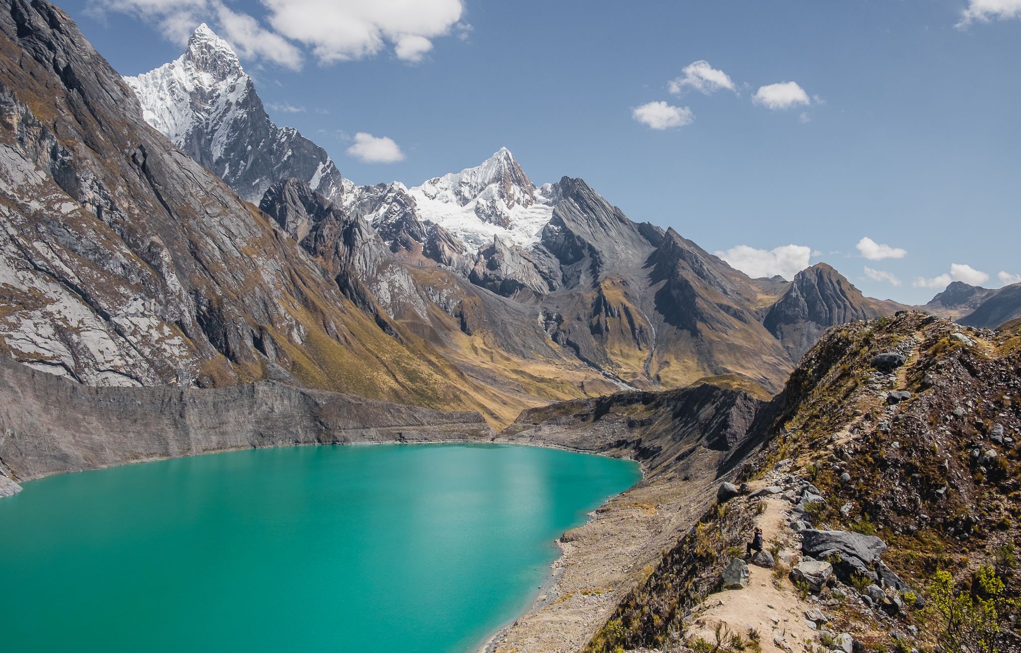
A pass at 4,825m that takes you through beautiful valleys, along the lagoon, and between high peaks. The trail to Oyon is not in very good condition. It's best done downhill with a mountain bike (we did it with a 26x2.15 tandem mountain bike). The trail to Cochamarca is in excellent condition and is almost flat. It's worth the trip!
0
0

Hello Mia, I'm a little confused by your comment. The Jurau Pass is not considered easy but it is a much easier and less steep alternative to the San Antonio and Santa Rosa Pass. I haven't done the tour yet (plan is next year) but I found quite a lot of information about it. I would therefore be very happy to hear back from you as to whether it is actually that demanding or whether you perhaps meant the San Antonio. Best wishes Piet
0
0

The descent from the Jurau Pass to Juraucocha is completely pathless and very steep. There are a few cairns, but not enough to orient yourself in the scree desert. The GPX track here is very imprecise. There are countless steep cliffs that must be avoided. It is possible to descend to Juraucocha, but it is very challenging. Going uphill is a lost cause without a guide.
0
0

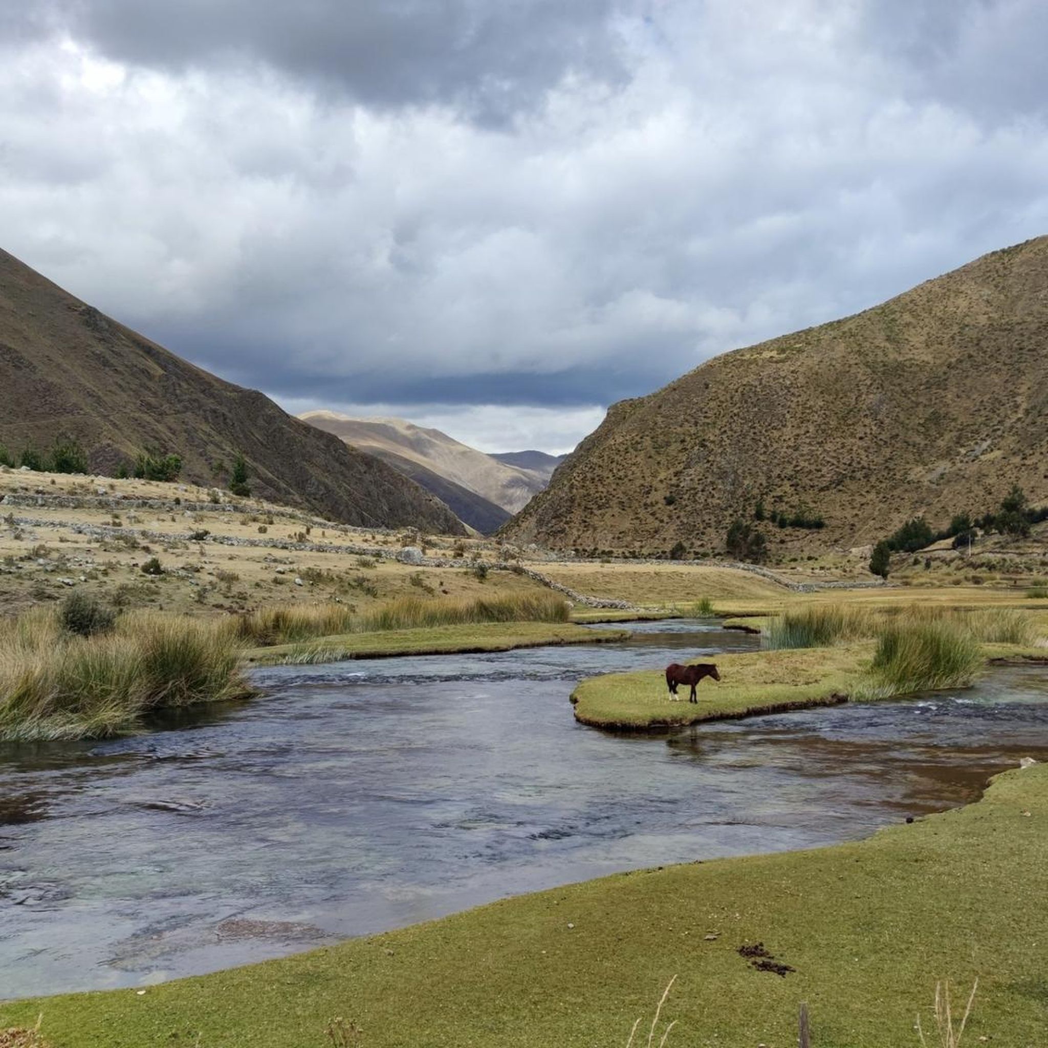
On the way you always had great views of the surrounding mountains and you passed small shepherds' huts.
1
0
The climb from Huayllapa to the top of the pass takes a long time, but at the top you are rewarded with a great view.
0
0
The steep and strenuous climb up to Paso San Antonio (5,020 meters) is worth it. With every step the panorama gets better.
1
0
Breathtaking views await you on this 5,040 meter high mountain pass. There are bright blue lakes in the valley and a mighty glacier rises opposite.
0
0
Frequently Asked Questions
What are some of the most notable mountain passes near Lima?
One of the most notable and accessible mountain passes from Lima is Ticlio Pass (Abra Anticona), located about 150 kilometers northeast of the city. It reaches an elevation of 4,818 meters. Another impressive pass is Trapecio Pass, which climbs to 5,040 meters and offers views of bright blue lakes and a glacier.
What is the highest mountain pass in the Lima region?
According to available data, Trapecio Pass is one of the highest, reaching an elevation of 5,040 meters. Ticlio Pass (Abra Anticona) is also exceptionally high at 4,818 meters.
What kind of natural features can I expect to see at these mountain passes?
The mountain passes in the Lima region offer breathtaking Andean landscapes. At passes like Trapecio Pass, you can find bright blue lakes and glaciers. Many passes, including Tapush Pass and Ascent to Paso Tapush, provide expansive panoramic views of the surrounding mountains and valleys. You might also encounter lagoons and high peaks, such as those near Jatunchacua Pass.
Are there any historically significant mountain passes or landmarks?
Yes, Ticlio Pass (Abra Anticona) is historically significant as it was once the highest railway junction in the world, part of the Ferrocarril Central Andino. At its summit, there's a monument dedicated to Ernest Malinowski, the engineer who designed this impressive railway. The pass also marks the Continental Divide of South America.
What are the typical weather conditions and temperatures at high-altitude passes like Ticlio?
At high-altitude passes such as Ticlio, temperatures can vary significantly, ranging between 8°C and -5°C. Visitors should be prepared for cold weather, especially at higher elevations, and be aware of the significantly lower atmospheric pressure, which is approximately 50% lower than at sea level.
What outdoor activities can I do near the mountain passes in Lima?
The region around Lima's mountain passes offers various outdoor activities. You can find numerous hiking trails, including challenging routes like the Pampa Elefante Campsite – San Antonio Pass loop or the Ascent to Paso del Trapecio – Trapecio Pass loop. There are also options for cycling and mountain biking in the broader Lima region.
What should I know about altitude sickness when visiting high mountain passes?
When visiting high mountain passes like Ticlio (4,818m), there is a risk of altitude sickness (soroche) due to the significantly lower atmospheric pressure. It's advisable to acclimatize gradually, stay hydrated, and consult a doctor if you have concerns. Be prepared for symptoms like headaches, nausea, and dizziness.
Are there any particularly challenging mountain passes for experienced hikers?
Yes, several passes offer challenging experiences. The Jurau Pass Descent is described as completely pathless and very steep, with numerous cliffs to avoid, making it very challenging. The Ascent to Paso San Antonio is also noted as a challenging route.
What is the best time of year to visit the mountain passes in Lima?
While specific data for all passes isn't provided, the dry season (typically May to October) is generally considered the best time to visit the Peruvian Andes. During this period, you can expect clearer skies and more stable weather conditions, which are ideal for high-altitude travel and outdoor activities. However, temperatures at high passes can still be very cold.
What can I expect on the climb to Tapush Pass?
The climb from Huayllapa to the top of Tapush Pass can take a long time, but visitors are rewarded with expansive views from the summit. On the way to Paso Tapush, you'll also enjoy great views of the surrounding mountains and pass small shepherds' huts, offering a glimpse into local life.
Is Pasamayo Pass recommended for tourism?
Pasamayo Pass is primarily known for its extreme danger due to its 'Serpentín' section and 'Curva del Diablo,' which has a high number of fatal accidents. It features 52 turns, extreme drop-offs, and is prone to dense fog and slippery conditions. For these reasons, it is not recommended for tourism, and access for passenger transport vehicles on the original route is restricted.
What kind of views does Jatunchacua Pass offer?
Jatunchacua Pass, at 4,825 meters, takes you through beautiful valleys, alongside lagoons, and between high peaks. It offers stunning scenery, though the trail to Oyon is not always in the best condition, while the trail to Cochamarca is excellent and almost flat.
Most popular routes in Lima
Most popular attractions in Lima

Get inspired with the komoot mobile app


Didn’t find what you were looking for?
Find even more amazing mountain passes in Lima organized by region:
Explore more
See even more epic mountain passes by checking out these guides in Lima:
