Top 9 Natural Monuments in Paisagem Protegida Da Serra De Montejunto
Best natural monuments in Paisagem Protegida Da Serra De Montejunto are found within a significant natural area in Portugal's Western region. This protected landscape is characterized by diverse geological formations, rich biodiversity, and extensive panoramic views. Reaching an altitude of 666 meters, it is the highest natural viewpoint in Estremadura, offering vistas between the Atlantic coast and the Tagus valley. The area is particularly noted for its karstic formations, including numerous caves and sinkholes, which have been shaped by water…
Last updated: October 22, 2026
Serra de Montejunto Watchtower
Highlight • Viewpoint
Translated by Google •
Tip by

Gravel Bend
Highlight • Natural Monument
Translated by Google •
Tip by

Sign up now to discover places like this
Get recommendations on the best single tracks, peaks, & plenty of other exciting outdoor places.
Windmills of Serra de Montejunto
Highlight • Monument
The trail has small sections with very steep slopes, so the easiest way to do it is …
Translated by Google •
Tip by
Montejunto - Squirrel Trail
Highlight (Segment) • Trail
Translated by Google •
Tip by
Fontainhas Cave
Highlight • Cave
Translated by Google •
Tip by

Sign up for free to discover even more natural monuments in Paisagem Protegida Da Serra De Montejunto.
Already have an account?
Start today with a free account
Your next adventure awaits.
Popular around Paisagem Protegida Da Serra De Montejunto

Tips from the Community

Known as Buracos Mineiros, this is one of the many caves where a variety of prehistoric remains have been found, showing signs of human settlement in the Montejunto region. During the archaeological exploration of the cave, a staircase with a handrail was installed to allow easy access to it.
1
0

Access is via a solid staircase.
2
0

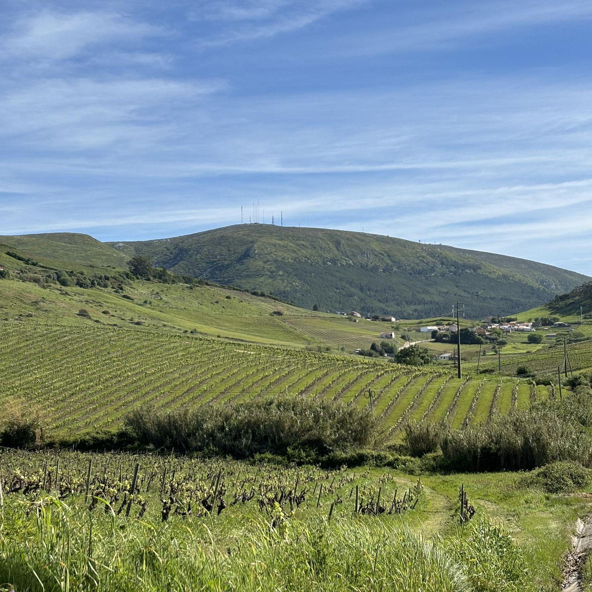
The Serra de Montejunto Forest Watch Station can be accessed via a pastoral trail from the picnic park. It offers a beautiful panorama of the region north of the Serra.
3
0
I mentioned that on my previous suggestion for this place. There is an alternative to the blackberry vines: a little before you start to find them, turn left to a little footpath that goes between the trees, it is sloping and can be slippery in winter.
2
0

This trail was great fun, but unfortunately blackberry vines have joined the ferns near the end and made the passing a bit complicated.
3
0
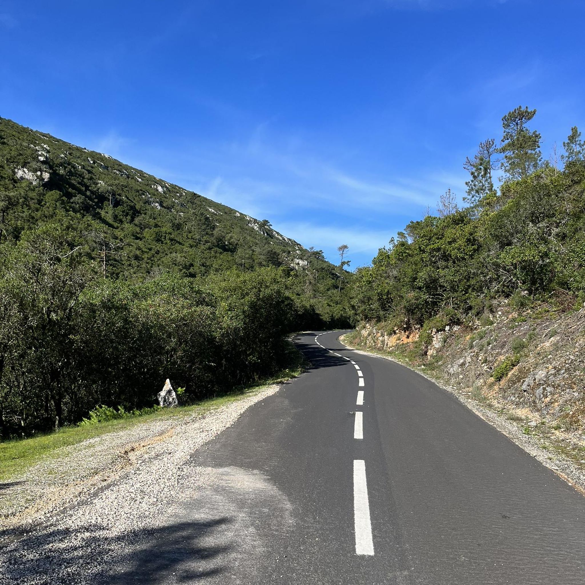
The karst landscape of Montejunto constitutes the extreme southwest of the Estremenho Limestone Massif. Deep valleys, lakes, gravel pits and lapiás are some of the formations found here, testimonies of various geological eras. Water has been the protagonist in erosion phenomena over time. Several deposits of gravel pits result from the cracking of the outcrops caused by the expansion of the water which, when freezing, breaks the rock into small parts. Source: https://montejunto.pt/natureza/paisagens/
3
0
Small trail that goes through the stunning vegetation that surrounds it. At the end, the trail seems to have no way out, carefully pass between the ferns that are probably taller than you and that block visibility. Visit and respect and Nature.
3
0
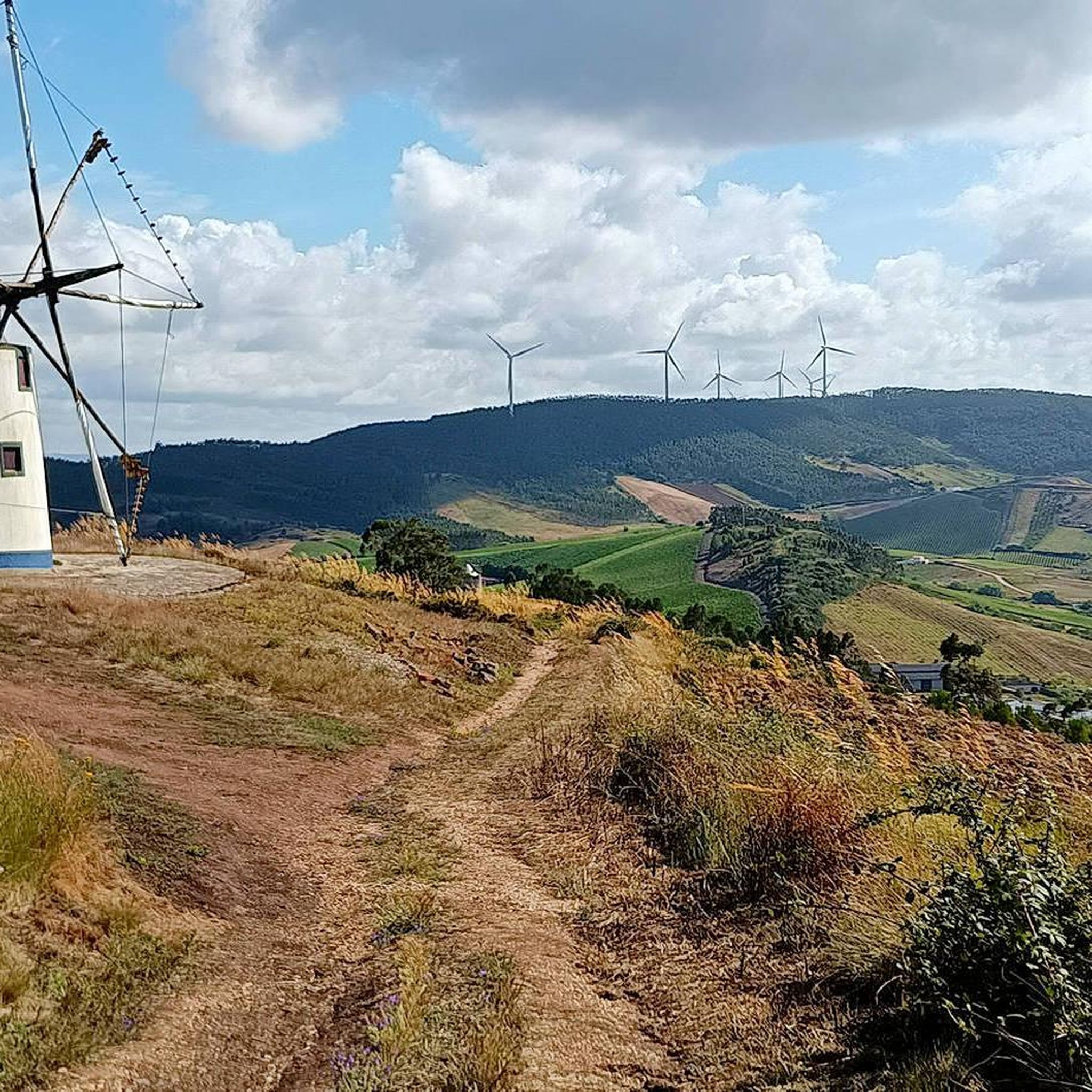
Interesting trail, which passes right next to several windmills, some of them recovered. The trail has small sections with very steep slopes, so the easiest way to do it is downhill, that is, towards Serra de Montejunto, Vila Verde dos Francos. For those who are in Vila Verde dos Francos, it is preferable to go up the Estrada de Montejunto (N-115) to the sign that says Caminho dos Moinhos, and then turn right.
1
0
Frequently Asked Questions
What unique geological features can I explore in Paisagem Protegida Da Serra De Montejunto?
The region is renowned for its diverse geological formations, particularly its karstic features. You can observe numerous caves and sinkholes, which are part of the Estremenho Limestone Massif. These formations, like the Gravel Bend, showcase millions of years of water erosion and geological processes, revealing features such as gravel pits, lapiás, columns, stalactites, and stalagmites.
Where can I find the best panoramic views in the Serra de Montejunto?
As the highest natural viewpoint in Estremadura, Serra de Montejunto offers exceptional panoramic views. The Serra de Montejunto Watchtower provides a strategic overview of the region north of the Serra. Another excellent spot is the Salvé Rainha Viewpoint - Salvé Rainha Cross Viewpoint, often called the "balcony of Estremadura," from where you can appreciate the geological structure of the mountain and vast landscapes stretching between the Atlantic coast and the Tagus valley.
Are there any historical or cultural sites among the natural monuments?
Yes, beyond its natural beauty, the area has historical significance. You can visit the Windmills of Serra de Montejunto, where you'll find several recovered windmills, combining natural scenery with cultural interest. The region also has archaeological remains, including necropolis caves and fortified settlements, indicating ancient human occupation.
What kind of wildlife can be observed in Paisagem Protegida Da Serra De Montejunto?
The Protected Landscape is a significant biodiversity hotspot. It hosts over 400 identified plant species, including endemic ones. The fauna is also diverse, with about 75 bird species, ten of which are endangered, such as Bonelli's eagle and the Eurasian eagle-owl. Additionally, a cave in Cadaval serves as an important national bat roost during winter.
Are there family-friendly trails or natural monuments suitable for children?
While specific 'family-friendly' categories aren't listed for individual monuments, the general area offers various easy hiking options. For instance, you can explore easy hikes like the "View of Serra de Montejunto – Penha do Meio-Dia loop" or the "Serra Montejunto Bar loop." These routes are generally suitable for families looking to enjoy nature. You can find more details on easy hikes in the region here.
What are the options for hiking near the natural monuments?
The region offers a variety of hiking trails. You can find easy hikes such as the "Ota Karstic Canyon Trail" or more challenging routes depending on your preference. Many trails pass by the natural monuments, allowing you to combine sightseeing with physical activity. For a comprehensive list of hiking options, refer to the easy hikes guide for the area.
Can I find trails for mountain biking or road cycling in the area?
Yes, Paisagem Protegida Da Serra De Montejunto is suitable for both mountain biking and road cycling. For mountain bikers, there are routes like the "Meia Encosta Trail – Gravel Bend loop." Road cyclists can enjoy scenic routes such as the "View of Serra de Montejunto – Montejunto Monument loop." You can explore more MTB trails here and road cycling routes here.
What is the best time of year to visit the natural monuments in Serra de Montejunto?
The Serra de Montejunto offers beauty year-round, but spring and autumn are often ideal for visiting. During these seasons, the weather is typically milder, making hiking and exploring the geological formations and viewpoints more comfortable. The lush vegetation in spring and the changing colors in autumn add to the scenic beauty.
What do visitors typically enjoy most about the natural monuments here?
Visitors frequently appreciate the stunning panoramic views, especially from the highest points like the Salvé Rainha Viewpoint. The unique karst landscape, with its deep valleys and geological formations at spots like Gravel Bend, also captivates many. The combination of natural beauty, geological significance, and the opportunity for outdoor activities like hiking through diverse vegetation, as seen on the Montejunto - Squirrel Trail, makes for a rewarding experience.
Are there any specific tips for exploring the trails around the natural monuments?
When exploring trails like the Montejunto - Squirrel Trail, be aware that some sections might have dense vegetation or steep slopes. It's advisable to wear appropriate footwear and clothing. For trails passing by the Windmills of Serra de Montejunto, some parts can be very steep, so doing them downhill towards Vila Verde dos Francos might be easier. Always respect nature and be prepared for varying terrain.
Is there parking available near the natural monuments?
While specific parking locations for each monument are not detailed, the region is generally accessible by car. Visitors often find parking near popular starting points for trails or viewpoints, such as those leading to the Serra de Montejunto Watchtower or the picnic park areas. It's recommended to check local signage upon arrival.
Most popular routes in Paisagem Protegida Da Serra De Montejunto
Most popular attractions in Paisagem Protegida Da Serra De Montejunto

Get inspired with the komoot mobile app


Explore more
Extend your search for the best caves by checking out these guides of the top ones in Paisagem Protegida Da Serra De Montejunto:
