Top 20 Natural Monuments around Niederkappel
Natural monuments around Niederkappel are primarily shaped by the dramatic landscapes of the Danube River in the southwestern Mühlviertel region of Austria. The area features spectacular river meanders and elevated viewpoints offering panoramic vistas. Its diverse terrain includes river views and forested sections, providing varied outdoor experiences. This region is well-regarded for its scenic beauty and opportunities for hiking and cycling.
Best natural monuments around Niederkappel
- The most popular natural monument is Schlögen Loop, a river feature that represents the largest forced meander in Europe. Reaching its viewpoint involves a steep, rocky path, but offers a panoramic outlook over the Danube.
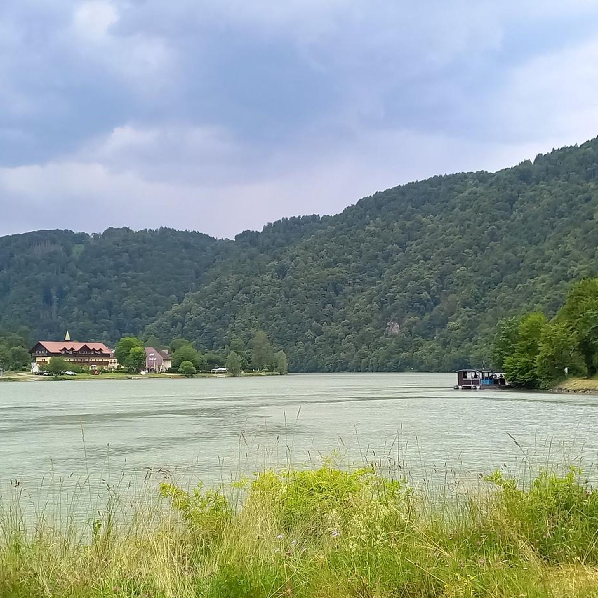
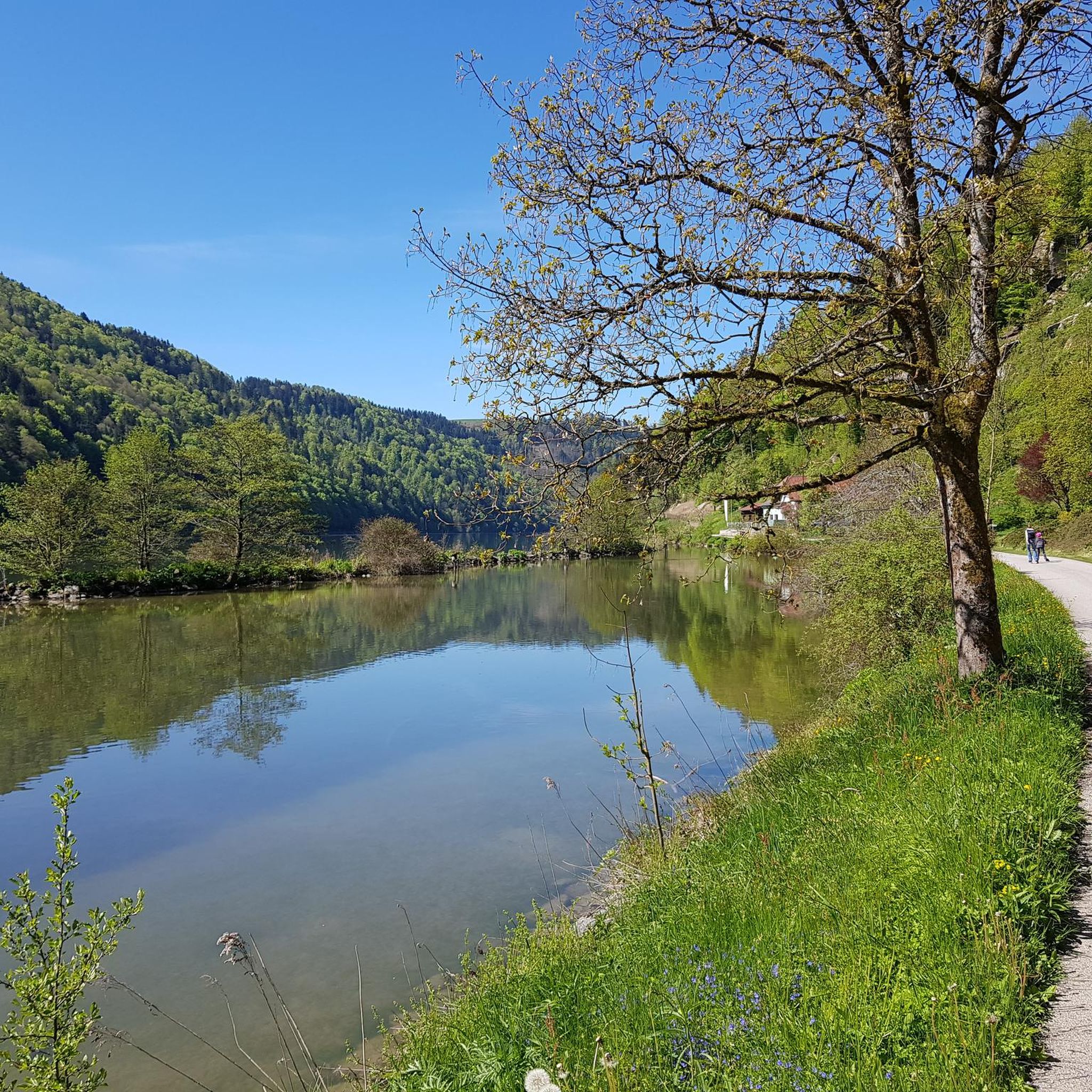
- Another must-see spot is Steinerberg Danube Loop 🏞️, a river and natural monument. This area highlights where the EuroVelo 6 Danube Cycle Path closely follows the river around its horseshoe bend, providing continuous views from the trail.
- Visitors also love Mayrhofberg Observation Tower, a viewpoint and man-made monument. Located at 655 m, it is the highest elevation in the Eferding district, offering extensive views into the surrounding country.
- Niederkappel is known for its impressive river meanders, significant viewpoints, and observation towers. The region offers a variety of natural monuments to see and explore, from river formations to elevated scenic spots.
- The natural monuments around Niederkappel are appreciated by the komoot community, with more than 1700 upvotes and over 690 photos shared.
Last updated: July 8, 2026
Schlögen Loop
Highlight (Segment) • River
Translated by Google •
Tip by

Steinerberg Danube Loop 🏞️
Highlight • River
Tip by

Sign up now to discover places like this
Get recommendations on the best single tracks, peaks, & plenty of other exciting outdoor places.
Sign up for free
Schlögen Loop
Highlight • River
Translated by Google •
Tip by

View of the Schlögener Schlinge
Highlight • Viewpoint
On the way there is a lot to see: So flows in the middle part of the way along a stream. After a 30 minute hike you have made the 1.6 kilometers and even the most tired hikers a smile is written in the face. The view is breathtaking, in addition one must say that it is not crowded. Well, that's probably the way owed! ;-) Up here you can also take a break.
Translated by Google •
Tip by

Mayrhofberg Observation Tower
Highlight • Viewpoint
Translated by Google •
Tip by

Sign up for free to discover even more natural monuments around Niederkappel.
Sign up for free
Already have an account?
Start today with a free account
Your next adventure awaits.
Login or Signup

Tips from the Community

The Schlögener Loop is an impressive natural wonder on the Danube, ideal for exploring by bike. The Danube Cycle Path leads through one of Austria's most beautiful river landscapes, offering breathtaking views of the famous Danube Bend.
6
0

The Mayrhofberg is adorned with a tower and a summit cross with some benches.
2
0

Well, the hike went okay. The observation tower is nice with a nice view, but the trail is very poorly signposted.
2
0
From the "Schlögener Blick" viewpoint you have a spectacular panoramic view of the loop. You can reach the viewpoint via hiking trails and it is particularly worthwhile at sunset or in the golden hour because the landscape is particularly impressive then.
5
0

Where the Danube turns twice Even nature does not always reach its destination by taking a straight path. An impressive example of this is the Danube loop near Schlögen. The river, squeezed between the banks of the "Donauleiten" that are characteristic of the Upper Danube Valley, gives way to the granite of the Bohemian Massif at this point. It changes direction twice, forming two intertwined headlands. This natural wonder is really visible from above. From the Schlögen viewpoint, which romantic landscape lovers can reach in a short hike from Schlögen. The ships that sail through the double bend look like toys from here. The pale blue ribbon of the river winds like a ribbon through the green, wooded ridges. A place to linger and enjoy.
5
0

Very nice view and area. Recommended.
0
0

A great excursion destination... observation tower and summit cross in one go👍😉
3
0

Please bring time to experience this wonderful nature
6
1
Frequently Asked Questions
What are the most impressive natural features to see around Niederkappel?
The region is dominated by the dramatic landscapes of the Danube River. The most impressive features are the spectacular river meanders, particularly the Schlögen Loop, which is the largest forced meander in Europe. You can also find numerous elevated viewpoints offering panoramic vistas over the river and surrounding forested sections.
Are there any family-friendly natural monuments or viewpoints in the area?
Yes, several natural monuments and viewpoints are suitable for families. The Steinerberg Danube Loop 🏞️ and the Danube Bend Near Haibach are both categorized as family-friendly. The View of the Schlögener Schlinge also offers accessible viewpoints and trails for all ages.
What kind of outdoor activities can I do near these natural monuments?
The area around Niederkappel is excellent for various outdoor activities. You can enjoy cycling along the Danube Cycle Path, which closely follows the river around its bends, offering continuous views. Hiking is also very popular, with trails ranging from easy walks to more challenging routes through diverse terrain. For more detailed route information, explore the Cycling around Niederkappel, Gravel biking around Niederkappel, and Mountain Hikes around Niederkappel guides.
What should I know before visiting the Schlögen Loop viewpoint?
The viewpoint for the Schlögen Loop offers unparalleled panoramic views, but reaching it involves a steep and rocky path that takes approximately 20 to 30 minutes. Sturdy footwear and secure footing are absolutely necessary due to the partly loose scree. The reward, however, is a perfect outlook over the Danube's horseshoe bend.
Are there any observation towers offering extensive views of the region?
Yes, the Mayrhofberg Observation Tower is a notable man-made monument. Located at 655 meters, it is the highest elevation in the Eferding district and offers extensive views into the surrounding country, including parts of the neighboring Grieskirchen district.
What makes the Steinerberg Danube Loop special for cyclists?
The Steinerberg Danube Loop 🏞️ is particularly special for cyclists because the EuroVelo 6 Danube Cycle Path closely follows the river around its horseshoe bend here. It offers an excellent, car-free, and tranquil cycling route with continuous views of the unique river formation from various vantage points, even from the trail itself.
What is the best time of year to visit the natural monuments around Niederkappel?
The region's natural beauty, especially the river landscapes and forested areas, can be enjoyed throughout much of the year. Spring and autumn offer pleasant temperatures for hiking and cycling, with vibrant foliage in autumn. Summer is ideal for water sports and longer days. While winter hiking is possible, be prepared for colder weather and potentially icy conditions, especially on steeper paths.
Are there any historical aspects associated with the natural monuments in this area?
Yes, the Danube River and its meanders, such as the Danube Bend Near Haibach and the View of the Schlögener Schlinge, have historical significance dating back to Roman times. The Romans established naval bases in the area, underscoring the strategic importance of the Donauschlinge for shipping and trade throughout history.
What do visitors generally appreciate most about the natural monuments near Niederkappel?
Visitors consistently praise the breathtaking views, especially from the elevated viewpoints overlooking the Danube's meanders. The tranquility of the car-free cycle paths and the diverse hiking opportunities through scenic landscapes are also highly valued. The unique geological formation of the Schlögen Loop is often cited as a major highlight.
Are there opportunities for water sports near the Danube's natural monuments?
Yes, the Danube River invites visitors to enjoy various water sports. Near the Danube Bend Near Haibach, for instance, you can engage in activities like kayaking and stand-up paddleboarding. Boat trips on the Danube are also a popular way to experience the scenic beauty of the river and its unique formations.
Are there any circular hiking routes that include natural monuments?
Many hiking trails in the region are designed as circular routes, allowing you to experience the natural monuments from different perspectives. For example, the Mountain Hikes around Niederkappel guide includes routes like the 'Schlögen Loop – Schlögen Loop loop from Schlögen' which is a moderate 11.8 km hike, and the 'View of the Schlögener Loop loop from Schlögen', an easy 3.3 km option.
Most popular routes around Niederkappel
Most popular attractions around Niederkappel

Get inspired with the komoot mobile app


Explore more
Extend your search for the best caves by checking out these guides of the top ones around Niederkappel:
