Top 20 Natural Monuments around Schlammersdorf
Natural monuments around Schlammersdorf offer access to diverse natural features. The region is characterized by its varied landscapes, including volcanic formations and wetlands. A prominent feature is the Rauher Kulm, a protected volcanic cone with historical significance. The area provides opportunities for hiking and exploring unique geological formations and rich biodiversity, making it a destination for those interested in Wandern Naturdenkmäler Schlammersdorf.
Best natural monuments around Schlammersdorf
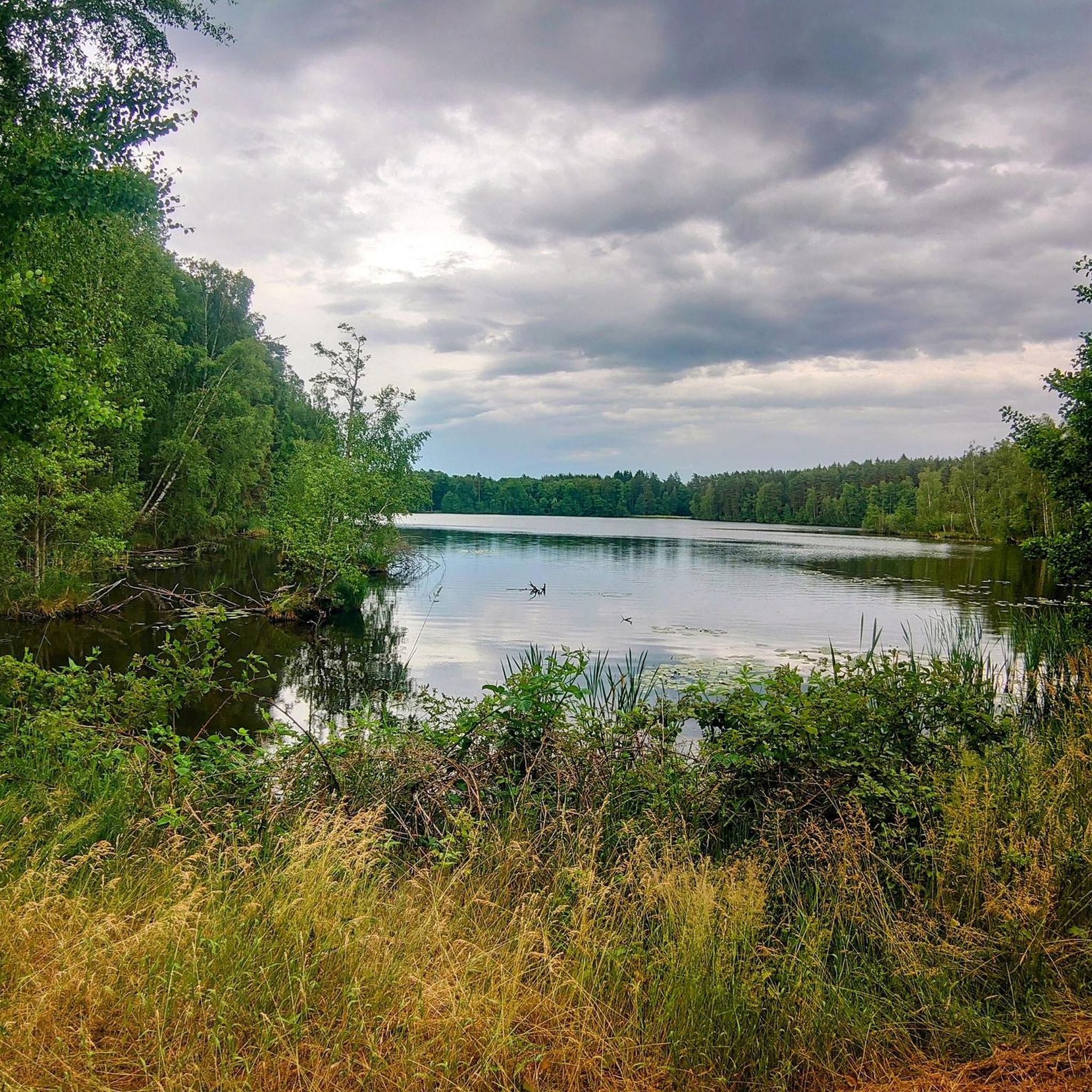
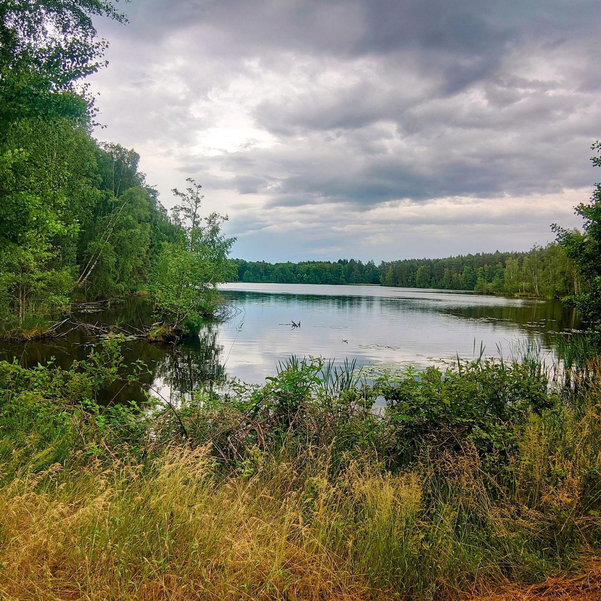
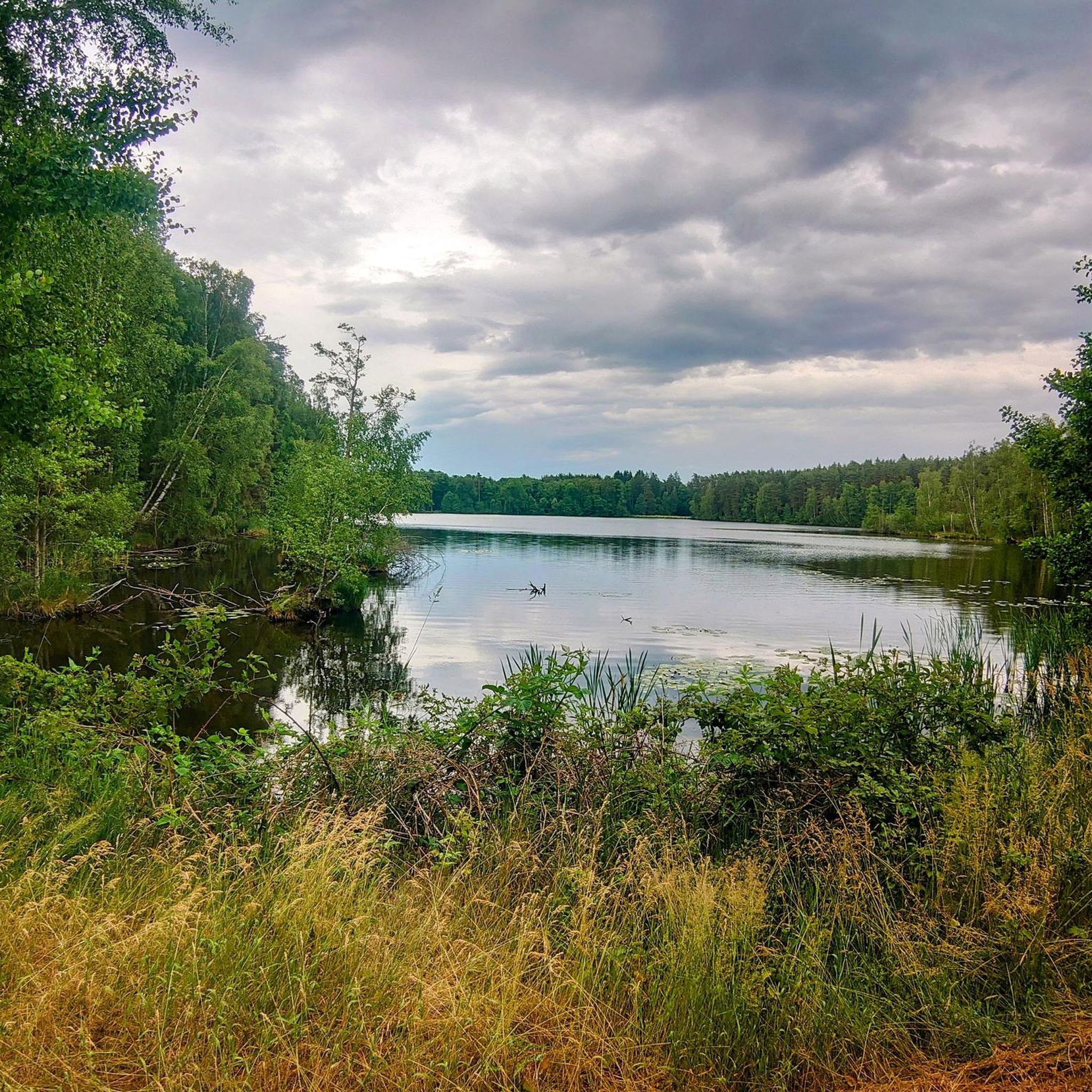
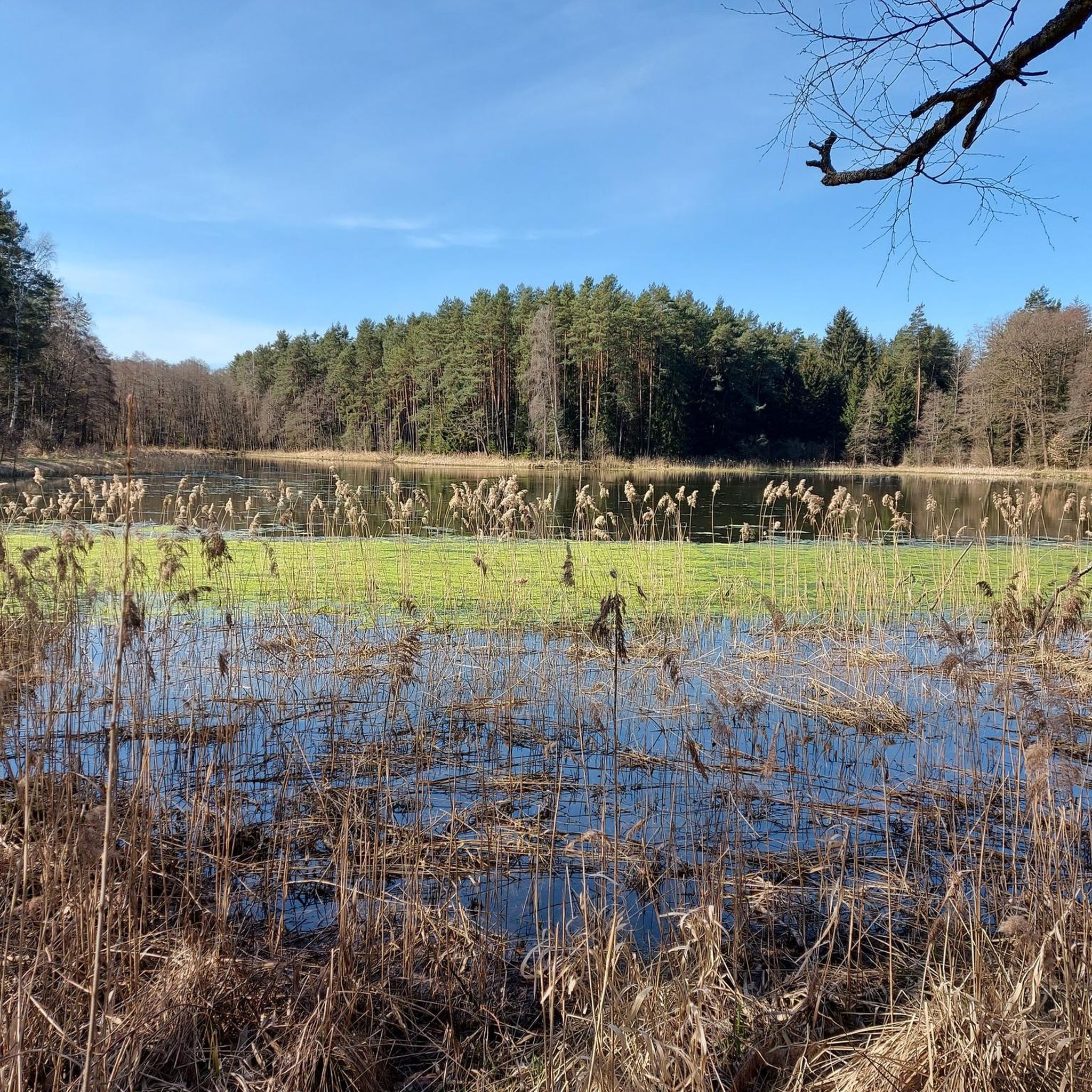
- The most popular natural monuments is Between Großer Rußweiher and Rußloheweiher, a…
Last updated: September 28, 2026
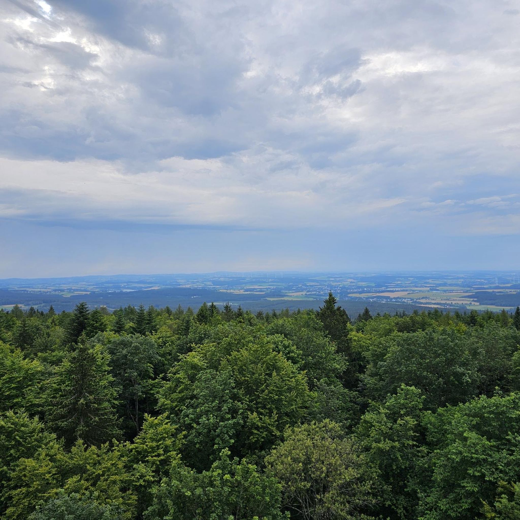
Rauher Kulm Lookout Tower
Highlight • Viewpoint
Nicolaus Apel built a wooden observation tower as early as 1807. There was a movable gold-plated sun above …
Translated by Google •
Tip by

Circular rampart at Rauher Kulm
Highlight • Historical Site
Translated by Google •
Tip by

Sign up now to discover places like this
Get recommendations on the best single tracks, peaks, & plenty of other exciting outdoor places.
Osprey and White-tailed Eagle Observation Point, Großer Rußweiher
Highlight • Viewpoint
Translated by Google •
Tip by

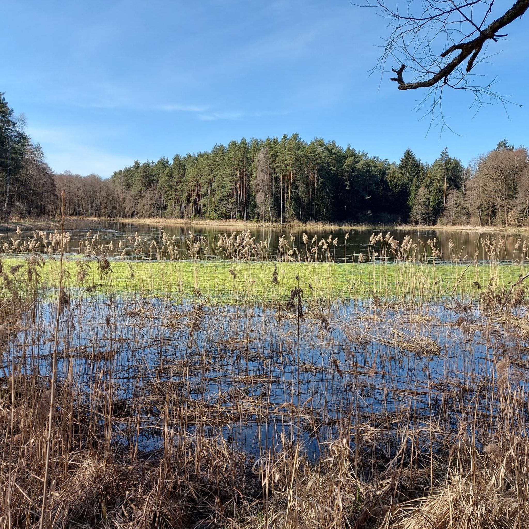
Between Großer Rußweiher and Rußloheweiher
Highlight • Lake
Translated by Google •
Tip by
Barbaraberg Pilgrimage Site and Ruins of St. Barbara Church
Highlight • Religious Site
Translated by Google •
Tip by

Sign up for free to discover even more natural monuments around Schlammersdorf.
Already have an account?
Start today with a free account
Your next adventure awaits.
Tips from the Community

Burgstall Rauhenkulm There are no reliable sources regarding the origin of the high medieval castle. Although the deed of foundation of the Benedictine monastery Michelfeld from 1119 states that Bucco de Culmen of Leuchtenberg had a residence on one of the two Kulms. He would thus be the first scientifically documented lord of the castle. However, it is unclear whether Rauhe Kulm or Kleine Kulm is meant. It is conceivable, but unlikely, that it was a building in the village of Kulmain. Excavations have brought shards, arrowheads, crosses, and coins from this period to light. According to Losert, the construction of the Rauher Kulm rampart was part of Emperor Otto I the Great's strategy to contain the impending danger from the Hungarians. Sandstone, timber framing, and bricks were used in the construction of the castle around 950. In addition to military use, the castle was also inhabited by women and children, as evidenced by various finds, including several spindle whorls, a weaving sword, and a large iron knife. Burgrave Friedrich III of Nuremberg acquired the castle, including the associated places, from the Landgraves of Leuchtenberg in 1281. The former tower was part of the margravial signaling system. During the Second Margravial War under Margrave Albrecht Alcibiades, the castle, as well as the Schlechtenkulm castle on Kleine Kulm, was destroyed in 1554. Before the destruction, both castles were besieged for about a year by troops from the imperial cities of Nuremberg, Bamberg, Würzburg, and Bavaria under the command of the electoral district administrator Hans Umseher von Waldeck, and the inhabitants were starved. The fortress commander von Heydenab surrendered the fortress on Rauhen Kulm on June 28, 1554. Afterwards, it was blown up with screws, the triple walls were razed and destroyed. Stones from the medieval ramparts of both castle sites were later used in part to reinforce the city walls of Neustadt. Today, only traces of the terrain are visible of the Burgstall Rauhenkulm. Remains of the surrounding rampart and the location of the tower in close proximity to the current observation tower are recognizable. The cartographer Johann Christoph Stierlein created the first very accurate topographical map of the mountain with the ruin. Source: www.wikipedia.de
5
0
Pilgrimage Church of St. Barbara Traces of prehistoric settlements can be found on the Barbaraberg. In pre-Christian times, a Slavic cemetery with 161 documented graves, discovered in 1972 during excavations, was located here. Archaeologically secured is a Romanesque hall church from around the year 1000. It is reported that pilgrimages to the "Church of St. Barbara" and to the wooden carved image of St. Barbara took place as early as the end of the 14th century. During the Reformation, these pilgrimages were forbidden, which led to decay. In 1661, at the instigation of the Kemnath parish priest Balthasar Grosch, the chapel was rebuilt and adorned with the miraculous image that had been found buried in a stable. Under Abbot Dominikus I. von Lieblein, a church in the Rococo style was built here between 1741 and 1756 in honor of St. Barbara. The church building was cruciform and had five altars. The vaults of the nave were decorated with images from the life of St. Barbara. Pilgrimages to the Barbaraberg were resumed. In the course of secularization, the Barbara Church was also closed and sold in 1803. The miraculous image and the relics of St. Barbara remained on site, while the rest of the furnishings were sold to other parishes. The church space was converted into a barn. Due to damage to the roof, the crossing dome and the interior were demolished in 1888. In 1914, the church was partially incinerated by a lightning strike. The Barbara statue in the gable of the facade, which has been headless ever since, still commemorates this. In 1919, the Munich cathedral chapter canon Michael Hartig acquired the remains and had a small chapel built, which was consecrated in 1921. Originally, he wanted to establish a recreational home for the diocesan priests of Munich here. However, the association founded for this purpose was dissolved in 1929. He then donated the buildings to the Speinshart Monastery, in whose possession they remain to this day. In 1976/77, an external renovation took place, followed by interior restoration from 1992 to 1994. What remains of the church is the still magnificent facade, flanked by buildings that formerly served for the accommodation of monastery members and later for agricultural purposes. Sparse remains of the walls of the former church are still preserved. Source: Excerpts from www.wikipedia.de
5
0

It's best combined with a tour of Speinshart Monastery. The Stations of the Cross and Barbaraberg Church are well worth seeing.
1
0


Dam that separates the large and small Rußweiher - beautiful view of both ponds
2
0

The rampart on the Rauher Kulm is a fortification at the foot of the Rauher Kulm. Gate area of the rampart Area disturbed by quarrying The Rauher Kulm, as a basalt mountain in the otherwise flat surroundings, was already visited by people in prehistoric times. The rampart made of basalt blocks runs around the foot of the mountain. Finds point to the Bronze Age, the Celts, the time of the Carolingians and the Slavic settlement chambers. Fighting took place during the time of the Hungarian invasions. Even if the rampart has been disturbed by later interventions, including the creation of an English garden across the entire mountain or the mining of the basalt in quarries, the course can be recognized from the basalt boulders. There is a lower main rampart with at least two gate areas and another fortified area at medium height. The hilltop castle is, however, classified as largely late medieval. Several burial mounds are also known. It is assumed that the settlement was located within the protective wall, so that it was not just a refuge. The predominantly stone remains were reinforced by wooden structures, among other things. There is evidence of post-and-slot walls, kennel-shaped walls and additionally secured gate areas. The cartographer Johann Christoph Stierlein made a drawing of the Rauher Kulm and recorded both the rampart and the hilltop castle.[1] The rampart was researched at the beginning of the 20th century by Adalbert Neischl on behalf of the Nuremberg Natural History Society and Hugo Obermaier, who completed Neischl's work. Hans Losert has been carrying out excavations for over ten years and is responsible for the scientific analysis.
1
0

The ring wall itself dates back to the time of the Celts and probably served as a refuge or place of worship. The remains of the ramparts are still clearly visible and make for an exciting exploration tour. The climb to the summit is a bit strenuous, but the view and the historic atmosphere definitely make the effort worthwhile.
4
0

Around the cone, hikers will find a well-developed network of paths through varied mixed forest and old beech forest stands. The newly marked paths mostly lead along well-paved forest paths, but also along natural hiking trails. The exposed basalt slopes are a valuable habitat for numerous animals and rare plants. Around 90 different lichens and mosses grow and thrive on the heat-storing basalt boulders. The Rauhe Kulm has been protected as a natural monument since 1909 and has been a nature reserve in accordance with European standards (FFH) for several years. In 2013, the Rauhe Kulm was voted Germany's most beautiful natural wonder.
8
1
Frequently Asked Questions
What unique natural features can I explore around Schlammersdorf?
The region offers diverse natural features, including volcanic formations and wetlands. A prominent example is the Rauher Kulm, a striking volcanic cone with exposed basalt slopes that provide a habitat for numerous animals and rare plant species, including around 90 types of lichens and mosses. You can also find significant wetlands like the Großer Rußweiher area.
Are there family-friendly natural monuments to visit near Schlammersdorf?
Yes, several natural monuments are suitable for families. The Osprey and White-tailed Eagle Observation Point, Großer Rußweiher, is a great spot where information boards provide details on resident ospreys and other bird species. The area Between Großer Rußweiher and Rußloheweiher is also recognized as a valuable nature reserve and bird sanctuary, offering gentle trails for all ages.
What kind of wildlife can I observe at the natural monuments?
The wetlands, particularly around the Großer Rußweiher, are known for their rich birdlife. The Osprey and White-tailed Eagle Observation Point is specifically designed for birdwatching, where you can spot ospreys and other rare bird species. The basalt slopes of the Rauher Kulm also host a variety of unique lichens, mosses, and other flora and fauna.
Are there historical sites among the natural monuments?
Absolutely. The Circular rampart at Rauher Kulm is a significant historical site, believed to be a former Celtic ringfort. The remains of the ramparts are still visible, offering an exciting exploration alongside its natural beauty. Additionally, the Barbaraberg Pilgrimage Site and Ruins of St. Barbara Church combines natural views with historical and religious significance.
What hiking opportunities are available near the natural monuments?
The natural monuments are surrounded by a network of hiking trails. For example, the Rauher Kulm features well-established paths through mixed forests and ancient beech stands. You can find various hiking routes, from easy to moderate, in the area. For more detailed options, explore the Hiking around Schlammersdorf guide, which includes routes like the 'View of the Stockweiher – Haark Chapel loop'.
Can I find viewpoints offering scenic panoramas?
Yes, several natural monuments double as excellent viewpoints. The Circular rampart at Rauher Kulm offers impressive views from its summit. The Barbaraberg Pilgrimage Site also provides great views extending far into the surrounding landscape, revealing the beauty of the baroque cultural landscape.
What other outdoor activities can I do in the vicinity of these natural monuments?
Beyond hiking, the region offers opportunities for other outdoor sports. You can find numerous running trails, such as the 'Rohrweiher loop from Vorbach', by checking the Running Trails around Schlammersdorf guide. For mountain biking enthusiasts, the MTB Trails around Schlammersdorf guide lists routes like the 'Kalvarienberg Chapel – Kalvarienberg lookout tower loop'.
Is there parking available near the natural monuments?
While specific parking details for every natural monument are not provided, popular sites like the Rauher Kulm and the Großer Rußweiher area typically have designated parking facilities nearby to accommodate visitors exploring the trails and observation points.
What is the best time of year to visit the natural monuments around Schlammersdorf?
The natural monuments can be enjoyed throughout the year, each season offering a different experience. Spring and autumn are ideal for hiking due to pleasant temperatures and vibrant foliage. Summer allows for longer days and full enjoyment of the wetlands and viewpoints. Even winter can offer serene, picturesque landscapes, especially around the Rauher Kulm's forests.
Are the trails around the natural monuments suitable for beginners?
Many areas offer trails suitable for various fitness levels. For instance, the paths around the Großer Rußweiher are generally easy and family-friendly. While the climb to the summit of the Rauher Kulm can be a bit strenuous, there are also well-paved forest paths and natural hiking trails that are less demanding. Always check route descriptions for difficulty levels.
What makes the basalt blockfields at Rauher Kulm special?
The Basalt blockfields at Rauher Kulm are a unique geological feature. These exposed basalt slopes are a valuable habitat for numerous animals and rare plants. Around 90 different lichens and mosses thrive on the heat-storing basalt boulders, creating unique microclimatic conditions and a distinct ecosystem. The Rauhe Kulm itself was formed by volcanic activity millions of years ago.
Most popular routes around Schlammersdorf
Most popular attractions around Schlammersdorf

Get inspired with the komoot mobile app


Explore more
Extend your search for the best caves by checking out these guides of the top ones around Schlammersdorf:
