The best traffic-free bike rides around Farndale East
4.5
(46)
1,742
riders
94
rides
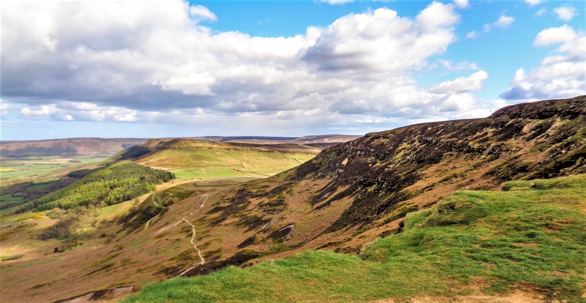
No traffic road cycling routes around Farndale East traverse a landscape characterized by extensive moorlands and prominent ridges such as Blakey Ridge and Rudland Rigg. The region features diverse terrain, including country roads and mostly paved surfaces, with elevation changes that cater to various fitness levels. The River Dove meanders through the valley, contributing to the area's natural features. Farndale East offers a network of routes suitable for road cyclists seeking quiet paths away from busy traffic.
Best no traffic…
Last updated: September 26, 2026
16
riders
75.0km
03:49
1,110m
1,110m
Hard road ride. Very good fitness required. Mostly well-paved surfaces and easy to ride.
12
riders
82.3km
04:37
1,560m
1,560m
Hard road ride. Very good fitness required. Mostly well-paved surfaces and easy to ride.

10
riders
26.7km
01:19
390m
390m
Moderate road ride. Good fitness required. Mostly well-paved surfaces and easy to ride.
5.0
(1)
2
riders
20.8km
01:10
460m
460m
Moderate road ride. Good fitness required. Mostly well-paved surfaces and easy to ride.
Get access to more routes and recommendations from other explorers.
Already have an account?
Our route recommendations are based on thousands of hikes, rides, and runs completed by other people on komoot.
Start today with a free account
Your next adventure awaits.
Other adventures around Farndale East

Tips from the Community

Each of the sacred monuments that you repeatedly encounter – despite all the differences in their external design – has a common concern: The cross that rises here not only wants to attract the viewer's gaze, but – and this is primarily – to make him think of God. Not only in theological books, but even in secular literature, God's voice is often represented, and this is even often the case in crime novels. For example, Ellis Peters set the series of novels about the Benedictine 'Brother Cadfael', which is set in 12th-century England, in the surroundings of a monastery. In "The Virgin in the Ice" it says: "And yet life, clinging to faith, the tenacious struggle with fate had to go on, the land had to be cultivated year in, year out. Plough and harrow must not rest, and one had to take care of sowing and harvesting the fruits of the earth as much as here, in the monastery and church, of sowing and harvesting souls." I wish the viewer here in front of the cross a good thought for his soul.
0
0

Whitby Harbour is a historic and bustling port at the mouth of the River Esk in North Yorkshire, offering a various attractions, shops, and dining places.
0
0

Head on out to either of the 2 main piers and experience an epic sunrise or sunset!
0
0

Nice spot to fuel up with a view. Cakes simple sandwiches and drinks. Friendly staff
0
0

The monument includes a standing cross, Listed Grade II, used as a boundary marker and known as Fat Betty or the White Cross. It stands on Danby Moor at the junction of three parishes whose boundaries were fixed during the medieval period. It is on the north side of a minor road to Rosedale 510m to the east of the cross known as Young Ralph. On the north side of the base is the date 1919 cut in the stone. On the west side is an inscription BS IB 1953. Neither inscription bears on a date for this monument. There is also an OS benchmark on the west face. The cross has been repeatedly whitewashed over the years in accordance with the practice of the Downe Estate on which it stands. The cross has been set up on Danby Moor to mark the meeting of the old parishes of Danby, Westerdale and Rosedale. It also marks the side of an old road down to Rosedale from the cross called Young Ralph. The road is mentioned in a 13th century charter from Guisborough.
1
0
Wayside crosses are one of several types of Christian cross erected during the medieval period, mostly from the 9th to 15th centuries AD. In addition to serving the function of reiterating and reinforcing the Christian faith amongst those who passed the cross and of reassuring the traveller, wayside crosses often fulfilled a role as waymarkers, especially in difficult and otherwise unmarked terrain. The crosses might be on regularly used routes linking ordinary settlements or on routes having a more specifically religious function, including those providing access to religious sites for parishioners and funeral processions, or marking long-distance routes frequented on pilgrimages. Over 350 wayside crosses are known nationally, concentrated in south west England throughout Cornwall and on Dartmoor where they form the commonest type of stone cross. A small group also occurs on the North York Moors. The wayside cross and boundary marker known as Young Ralph survive complete even though previously broken and repaired. The cross marks the highest point on the old road from Keldholme in the south of the moors to Castleton in the north. It also marks the boundary of the Wapentake of Pickering Lyth. It has been adopted as the symbol of the North York Moors National Park and has been a listed monument since 1938.
2
0

Free e-bike charging and repari station.
0
0
Great stop at Coopers coffee house in Whitby for a drink and snack.
0
0
Frequently Asked Questions
How many no traffic road cycling routes are available in Farndale East?
There are nearly 100 dedicated no traffic road cycling routes around Farndale East, offering a wide range of options for different skill levels. You'll find routes from easy to difficult, ensuring a peaceful ride away from busy roads.
What kind of terrain can I expect on no traffic road cycling routes in Farndale East?
Farndale East offers diverse terrain for road cyclists, primarily featuring country roads and some sections that might include disused railway lines, which are known for their minimal gradient and smooth surfaces. While many routes are mostly paved, some segments will involve elevation changes, especially as you explore the surrounding moorlands and ridges like Blakey Ridge.
Are there any easy no traffic road cycling routes suitable for beginners in Farndale East?
Yes, Farndale East has 22 easy no traffic road cycling routes perfect for beginners or those seeking a relaxed ride. An example is the Blakey Bank Summit – View from Blakey Junction loop from Farndale East, which covers about 15 km with moderate elevation changes.
What are some notable landmarks or natural features to see along the no traffic road cycling routes?
You'll encounter stunning natural beauty and historical sites. Keep an eye out for the distinctive The Wainstones on Hasty Banks, offering fantastic views. The area is also known for the River Dove, especially during spring when wild daffodils carpet its banks. You might also pass by historic sites like the Bank Top Iron Kilns, remnants of the Victorian ironstone industry.
When is the best time of year to go no traffic road cycling in Farndale East?
The spring, particularly between mid-March and mid-April, is a magical time to visit Farndale East. This is when the valley is famous for its spectacular display of wild daffodils along the River Dove. The weather is generally milder, making for pleasant cycling conditions, though the moorlands can be exposed.
What do other road cyclists enjoy most about no traffic road cycling in Farndale East?
The area is highly rated by the komoot community, with an average score of 4.6 stars. Reviewers often praise the peaceful, car-free nature of the routes, the breathtaking views across the wild moorlands, and the unique charm of the traditional Yorkshire landscape, especially during the daffodil season.
Are there any challenging no traffic road cycling routes for experienced riders?
Absolutely. For experienced riders, there are 24 difficult no traffic road cycling routes. Consider the Beggar's Bridge – Hutton-le-Hole village loop from Farndale East, an 83 km route with significant elevation gain, or the Blakey Bank Summit – Whitby Harbour loop from The Lion Inn, which is 75 km and also offers a demanding ride.
Can I find circular no traffic road cycling routes in Farndale East?
Yes, many of the no traffic road cycling routes in Farndale East are circular, allowing you to start and end at the same point. This is convenient for exploring the diverse landscapes without needing to retrace your steps. For example, the Blakey Bank Summit – Castleton Village loop from The Lion Inn is a moderate 26 km circular option.
Are there any places to eat or drink near the no traffic road cycling routes?
Yes, you'll find options for refreshments. The historic Lion Inn on Blakey Ridge is a notable landmark and offers views overlooking Church Houses, making it a good stop for cyclists. Hutton-le-Hole Village, often considered one of the prettiest in the North York Moors, also has amenities.
What is the highest point I might reach on a no traffic road cycling route in Farndale East?
While cycling, you'll be in the vicinity of some of the highest points in the North York Moors. Urra Moor, the highest point of the North York Moors, is nearby. You might pass highlights like Urra Moor – Highest Point of the North York Moors or Round Hill Summit (Highest Point of Urra Moor), offering expansive views across the wild moorland.
Are there any specific considerations for cycling in winter in Farndale East?
Winter cycling in Farndale East can be challenging due to the exposed moorland terrain. While the routes are generally traffic-free, weather conditions can be harsh, with potential for ice, snow, and strong winds. It's advisable to check local weather forecasts, dress in warm, layered clothing, and ensure your bike is equipped for colder conditions.
Most popular routes around Farndale East
Most popular attractions around Farndale East

Get inspired with the komoot mobile app


Explore more
Browse the best Road cycling routes in other regions.
