The best hikes from bus stations in Yoho National Park
4.7
(2643)
25,300
hikers
11
hikes
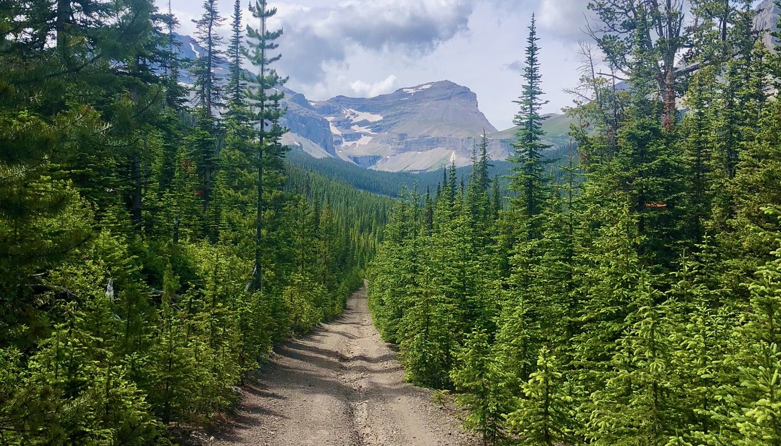
Bus station hiking trails in Yoho National Park traverse a landscape shaped by glacial activity, featuring towering peaks, deep valleys, and numerous waterfalls. The park is characterized by its rugged alpine environment, with 28 mountains exceeding 3,000 meters and several prominent glaciers. Lush forests and vividly colored glacial lakes, such as Emerald Lake and Lake O'Hara, are common features along the routes. The Kicking Horse River also carves through the park, creating notable geological formations.
Best bus station hiking trails in Yoho National Park
- The most popular bus station hiking route is Lake O'Hara Shoreline Trail loop, an easy 1.8 miles (2.8 km) trail that takes about 45 minutes to complete. This route offers views of the serene Lake O'Hara.
- Another top favourite among local hikers is Little Beehive via Lake Agnes Trail, a moderate 5.7 miles (9.2 km) path. This trail ascends through forests to a viewpoint overlooking Lake Louise and the surrounding mountains.
- Local hikers also love the The Teahouses loop via Lake Agnes and Plain Of Six Glaciers Trails — Banff National Park, an 8.8 miles (14.1 km) trail leading through high alpine terrain and past glacial features, often completed in about 5 hours 20 minutes.
- Hiking in Yoho National Park is defined by glacial lakes, powerful waterfalls, and rugged mountain peaks. The network offers options for various ability levels, from easy lakeside strolls to challenging high-elevation routes.
- The routes in Yoho National Park are highly rated by the komoot community with an average score of 4.7 stars from over 2,200 reviews. More than 22,000 hikers have used komoot to explore Yoho National Park's varied terrain.
Last updated: October 13, 2026
5.0
(1)
15
hikers
7.34km
03:34
520m
520m
Hard hike. Good fitness required. Sure-footedness, sturdy shoes and alpine experience required.
5.0
(1)
18
hikers
2.84km
00:45
30m
30m
Easy hike. Great for any fitness level. Easily-accessible paths. Suitable for all skill levels.

5.0
(4)
13
hikers
6.04km
02:03
270m
270m
Hard hike. Good fitness required. Sure-footedness, sturdy shoes and alpine experience required.
5.0
(2)
10
hikers
5.94km
01:58
240m
240m
Hard hike. Great for any fitness level. Sure-footedness, sturdy shoes and alpine experience required.
8
hikers
11.2km
03:44
480m
480m
Hard hike. Good fitness required. Sure-footedness, sturdy shoes and alpine experience required.
Get access to more routes and recommendations from other explorers.
Already have an account?
Our route recommendations are based on thousands of hikes, rides, and runs completed by other people on komoot.
Start today with a free account
Your next adventure awaits.
Popular around Yoho National Park


Tips from the Community

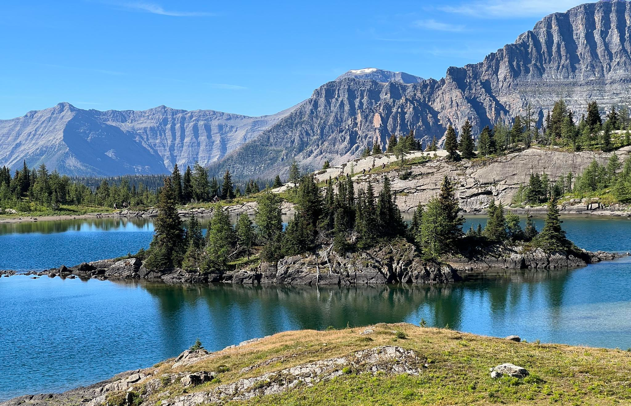
Opabin Prospect is renowned as one of the most breathtaking and iconic panoramic views in the entire region. Hikers stand on a cliff band getting a vertical perspective of the vibrant blue waters of Lake O'Hara and Mary Lake, framed by massive peaks like Cathedral Mountain. The shortest route to the lookout is a 5.3-kilometre out-and-back on the West Opabin Trail, but if you have more time, consider a longer hike or look hike all the way around Lake O'Hara. Access to the area is strictly limited to 200 visitors per day via a competitive Parks Canada shuttle lottery, so if you can get the opportunity to hike, pack your lunch, layers and camera and enjoy the area for as long as you can.
0
0
Cascade Lakes are a series of three alpine lakes just south uphill from Lake O'Hara. They are breathtaking lakes full of bright turquoise water, and a great spot to have lunch at on a hike, since they can only be reached on foot. There are large, flat boulders to sit on at the water's edge, great for laying out on, and in fall the larch trees around the lake display a golden show of changing needles.
0
0
Seven Veils Falls is a brief out and back spur trail from the Lake O'Hara Circuit Trail along the turquoise-coloured Lake O'Hara shore. The falls get their name from the way the water cascades down a series of wide, terraced rock steps, divided into seven delicate veils of water. Hikers can hear the water rushing as far back as the Lake O'Hara Lodge area. The best place to view the falls is from the official viewing platforms, as the Lake O'Hara Trails Club recently constructed stone viewing and photography platforms for the best photos and to protect the fragile ecosystem around the falls.
0
0

The views around Lake O'Hara are stunning no matter where you are, but the reflection on the water you get from here is truly special. However, this isn't somewhere you go to on a whim. Reservations are required to take the bus out to the lake, otherwise it's a long hike (22 km, round trip) in on the access road.
0
0
Most hikers reach this point via the steep trail up from Lake O'Hara. From here you can head up to the summit of East Wiwaxy Peak or follow the ridgeline down to Lake Oesa. You'll be treated to phenomenal views no matter where you choose to head next!
0
0
Access to Lake O'Hara is strictly controlled to preserve the delicate ecosystem and to offer a better experience for those who do visit the lake. The lottery controlled shuttle bus drops off at the campground and near the Le Relais Shelter for those lucky enough to win a reservation.
0
0
This section of trail gives you excellent views of Mary Lake in the foreground and the surrounding mountains in the distance.
0
0
This shallow alpine lake gets it name from Hungabee Mountain that towers in the background. The name for the mountain is derived from the Stoney/Nakoda language and means chieftan and was chosen because the mountain that bears the name is higher than the surrounding peaks.
0
0
Frequently Asked Questions
How many bus-accessible hiking trails are available in Yoho National Park?
There are over 20 bus-accessible hiking trails in Yoho National Park, offering a wide range of experiences from easy strolls to challenging alpine adventures. These routes allow you to explore the park's stunning landscapes conveniently.
What makes hiking from bus stations in Yoho National Park unique?
Hiking from bus stations in Yoho National Park provides convenient access to some of the park's most iconic and beautiful areas without the need for a personal vehicle. This allows you to immerse yourself in the dramatic landscapes of towering peaks, vivid glacial lakes, and powerful waterfalls, often leading to trailheads that might otherwise be difficult to reach.
Are there easy bus-accessible hiking trails suitable for beginners in Yoho National Park?
Yes, Yoho National Park offers several easy bus-accessible trails perfect for beginners or those looking for a relaxed walk. For instance, the Lake O'Hara Shoreline Trail loop is an excellent option, providing stunning views with minimal elevation gain.
Can I find challenging hikes accessible by bus in Yoho National Park?
Absolutely. For experienced hikers seeking a challenge, there are several difficult bus-accessible routes. The Teahouses loop via Lake Agnes and Plain Of Six Glaciers Trails, though partially in Banff, is a prime example of a demanding trail offering significant elevation gain and spectacular alpine scenery.
What natural landmarks can I see along bus-accessible hiking trails in Yoho National Park?
Many bus-accessible trails lead to or pass by Yoho's incredible natural landmarks. You can experience the awe-inspiring Takakkaw Falls, Canada's second-tallest waterfall, or the stunning turquoise waters of Emerald Lake. The powerful Wapta Falls and the unique Natural Bridge on the Kicking Horse River are also accessible, showcasing the park's diverse geological features.
Are there any family-friendly bus-accessible hiking options in Yoho National Park?
Yes, Yoho National Park offers several family-friendly bus-accessible trails. The easy routes, such as the Lake O'Hara Shoreline Trail loop, are generally suitable for families with children, providing beautiful scenery without overly strenuous climbs. Always check the specific trail details for distance and elevation to ensure it matches your family's capabilities.
What is the best time of year to hike from bus stations in Yoho National Park?
The best time to hike from bus stations in Yoho National Park is typically from late June to early October. During this period, most trails are free of snow, and the weather is generally favorable. Early summer brings wildflowers, while fall offers vibrant larch colors, though some higher elevation trails may see early snow in September.
Are there any loop trails accessible from bus stations in Yoho National Park?
Yes, several bus-accessible trails in Yoho National Park offer loop options, which are great for experiencing varied scenery without retracing your steps. The Lake Agnes – Big Beehive Lookout loop, starting from Lake Louise (a common bus stop), is a popular moderate loop that provides stunning views.
What do other hikers enjoy most about bus-accessible trails in Yoho National Park?
The komoot community highly rates the bus-accessible trails in Yoho National Park, with an average score of 4.7 stars. Reviewers often praise the incredible natural beauty, including the vibrant glacial lakes and powerful waterfalls, as well as the convenience of accessing these stunning areas via public transport, making for a car-free and immersive experience.
Are there any bus-accessible trails that lead to waterfalls in Yoho National Park?
Yoho National Park is famous for its waterfalls, and several bus-accessible trails lead directly to them. You can hike to the base of the majestic Takakkaw Falls or explore the area around Laughing Falls, both offering spectacular views of cascading water.
Are permits or fees required for hiking bus-accessible trails in Yoho National Park?
Yes, a valid Parks Canada Discovery Pass or a daily park pass is required for entry into Yoho National Park, regardless of how you arrive. These passes can be purchased at park gates or online. Specific trails, particularly in the Lake O'Hara area, may also require additional reservations or permits for bus access or overnight stays.
Most popular attractions in Yoho National Park

Get inspired with the komoot mobile app


Explore more
Browse the best Hikes in other regions.
