The best traffic-free bike rides in Calero County Park
5.0
(8)
103
riders
10
rides
If you've ever tried to plan gravel biking in Calero County Park, you know how quickly the options can feel overwhelming. With so many trails crisscrossing the landscape, it’s tough to figure out which routes are genuinely worth your time and effort, and which are just filler. We get it – you want the highlights, not the guesswork.
That's where we come in. Our komoot community has ridden, reviewed, and mapped these routes, so we've done the legwork to bring…
Last updated: May 30, 2026
6
riders
Hard gravel ride. Very good fitness required. Mostly paved surfaces.
4.0
(1)
12
riders
37.9km
03:15
1,080m
1,080m
Hard gravel ride. Very good fitness required. Mostly paved surfaces.

2
riders
43.9km
03:58
1,140m
1,140m
Hard gravel ride. Very good fitness required. Mostly paved surfaces.
5.0
(1)
9
riders
52.5km
03:54
820m
820m
Hard gravel ride. Very good fitness required. Mostly paved surfaces.
4.7
(3)
37
riders
45.0km
03:25
430m
430m
Moderate gravel ride. Good fitness required. Mostly paved surfaces.
Get access to more routes and recommendations from other explorers.
Already have an account?
Our route recommendations are based on thousands of hikes, rides, and runs completed by other people on komoot.
Start today with a free account
Your next adventure awaits.


Other adventures in Calero County Park

Tips from the Community

This is a tough climb. It gains 2200 in 5 miles of which 1.1 miles are flat or downhills! There are 3-4 short segments with 15% gradient. The road is exposed so riding when temperature is below 75 is recommended. On summer weekends expect caravans of motorcycles with their fumes and noise. It is a super special experience. Be patient on climb and cautious on the descent. There are restroom facilities but no potable water. This climb is addictive! You will be back! There are locals who climb this road 100+ times annually!
0
0

This is not a very exciting trail to hike. It’s pretty much a trail surrounded by thick walls of vegetation, with almost no opportunity to view your surroundings. The trail is 70% rocks/gravel, and 30% hard packed clay, so avoid wearing snickers
0
0

If you make the summit a fantastic view awaits. Be aware the road goes down then up to the road about then up again to the summit!…
0
0

Still one of the highest points in the Santa Cruz Mountains, even though the military graded and flattened the actual summit to create an Air Force base. The summit was cleaned of hazardous material in 2009, then carefully restored after a lot of community input. It's a lovely place to visit now!
0
0

Climbing Mount Umunhum is a tough but rewarding challenge. The road is steep, with sections reaching up to 18% grades, so pace yourself. The views from the top are spectacular, making the hard work worth it. Start early to avoid traffic and the heat, and be prepared for a long, demanding ascent.
1
0

Located right by the parking area you can find some additional info before heading out on your ride.
0
0
Nice gravel trail that winds its way through the park. Some sections follow long the water giving you some great views.
0
0
If you like hairpin switchbacks, this is the grueling climb (or adrenaline-pumping downhill) for you! You can bike almost all the way to the peak. The very last .2-mile of the trail is closed to bikes, but at that point you can switch to the road, instead, and use that to read the summit.
0
0
Frequently Asked Questions
How many no-traffic gravel bike trails are available in Calero County Park?
Calero County Park offers 10 dedicated no-traffic gravel bike trails, ranging from moderate to difficult. This extensive network ensures a diverse experience for gravel bikers looking to explore the park's natural beauty away from vehicular traffic.
What kind of terrain can I expect on the gravel bike trails in Calero County Park?
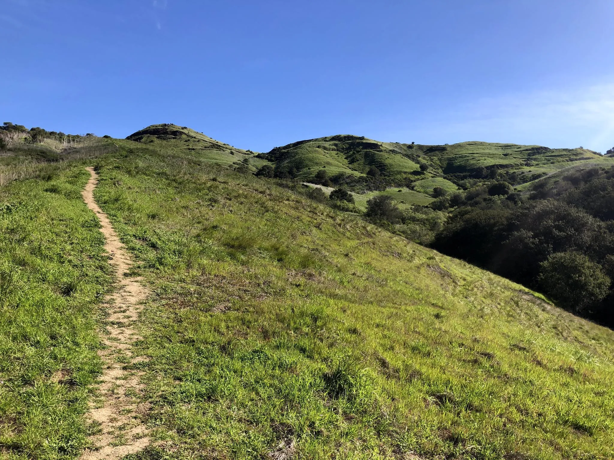
The trails primarily feature fine gray gravel or smooth dirt, making them ideal for gravel bikes. You'll traverse rolling grassland hills, California Oak woodlands, and chaparral. While largely non-technical, some sections may include short, rocky stretches, offering a good mix for developing skills.
Are there any challenging gravel bike routes for experienced riders?
Yes, Calero County Park has several challenging routes with significant elevation gain. For instance, the Mount Umunhum – Mount Umunhum loop from Almaden Quicksilver County Park is a difficult 37.9 km ride with over 1000 meters of ascent. Another demanding option is the Mine Hill Trailhead – Mount Umunhum Road loop from Almaden Valley, covering 43.8 km with similar elevation.
What scenic viewpoints or natural features can I see along the trails?
You'll find breathtaking vistas of southern Santa Clara County and the Santa Cruz Mountain Range from the park's ridges. A notable viewpoint is Lisa Killough Trail, which offers consistent views of Calero Reservoir. From March to May, the park's backcountry, especially in areas like Rancho San Vicente, bursts with vibrant wildflowers, including native poppies.
Are there any family-friendly no-traffic gravel biking options?
While many routes in Calero County Park are rated difficult, the park's extensive network does offer sections suitable for families. The Lisa Killough Trail is known for its gradual gravel inclines, which can be more manageable for families looking for a less strenuous ride. Always check the specific route details for distance and elevation to ensure it matches your family's skill level.
What is the best time of year to go gravel biking in Calero County Park?
The spring months, particularly March to May, are highly recommended. During this time, the park's backcountry is alive with wildflowers, offering a spectacular visual experience. The weather is generally pleasant, though it's always wise to check local forecasts for current conditions.
Where can I park when visiting Calero County Park for gravel biking?
Parking is available at various trailheads and entrances to Calero County Park. Popular starting points include the Rancho San Vicente Entrance and areas near Almaden Quicksilver County Park, which connects to Calero's trail system. Always check official park information for specific parking lot locations and any potential fees.
What wildlife might I encounter while gravel biking?
Calero County Park is a haven for wildlife. Keep an eye out for burrowing owls, coyotes, ground squirrels, ducks, geese, and cormorants. The park is also known for nesting bald eagles, offering a chance for unique sightings during your ride.
Are there any loop routes available for gravel biking?
Yes, many of the gravel biking routes in Calero County Park are designed as loops. For example, the Lisa Killough Trail – Lisa Killough Trail Viewpoint loop from Rancho San Vicente Entrance is a popular 25.9 km loop. Another option is the Mine Hill Trailhead – Mine Hill Trail loop from Almaden Quicksilver County Park, which offers a 24.7 km circular ride.
What do other gravel bikers enjoy most about Calero County Park?
The komoot community rates the trails in Calero County Park highly, with an average score of 4.5 stars. Reviewers frequently praise the park's extensive network of fine gravel and dirt trails, the stunning panoramic views of the Santa Cruz Mountains, and the feeling of being immersed in nature away from traffic. The diverse landscapes, from rolling grasslands to oak woodlands, are also a highlight.
Can I connect to other parks from Calero County Park's gravel trails?
Yes, Calero County Park's trail system connects to nearby parks, significantly expanding your riding possibilities. You can access trails that lead into Almaden Quicksilver County Park, allowing for longer and more varied adventures. The Serpentine Loop Trail also connects to the Longwall Canyon Trail in the adjacent Cañada del Oro Open Space Preserve.
Most popular routes in Calero County Park
Most popular attractions in Calero County Park

Get inspired with the komoot mobile app


Explore more
Browse the best Gravel rides in other regions.
